Asher & Adams was a New York publishing firm known for their atlases. Notably, their maps were some of the first to prominently exhibit railroad lines, even if this meant a slight reduction in topographical detail. They specialized especially in state and county maps of the United States.
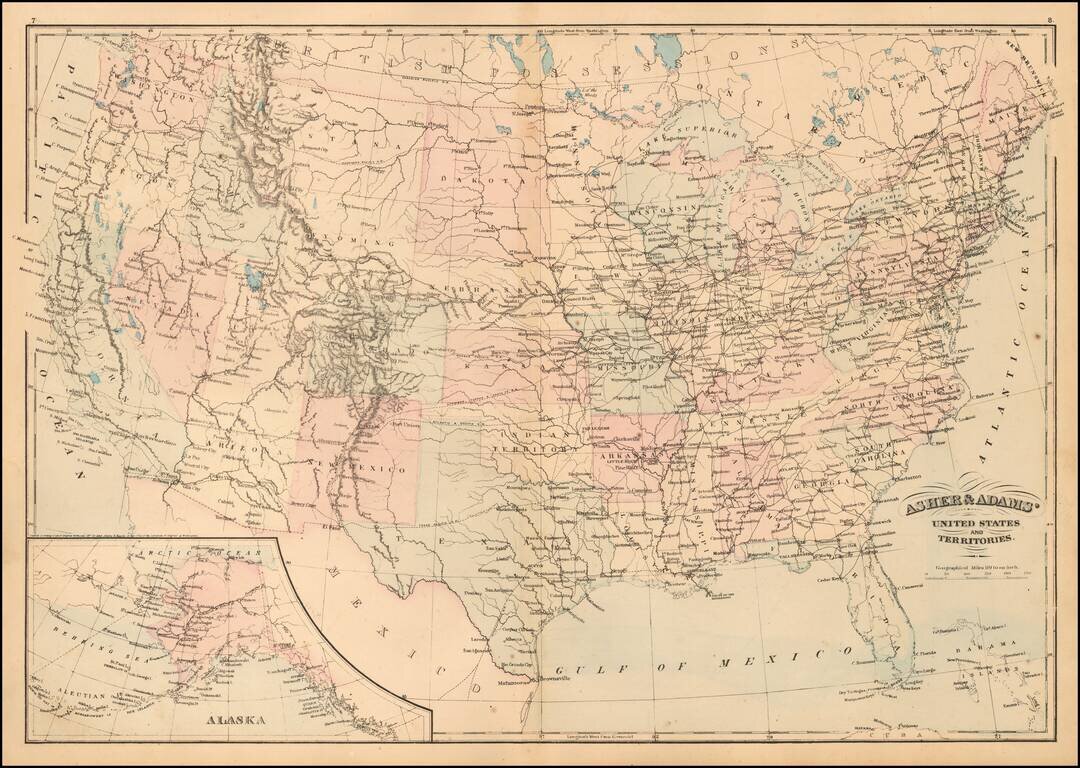
Detailed map of the United States, published by Asher & Adams. The map focuses on railroad routes and proposed railroad routes in the United States. One Dakota is shown as is Indian Territory.
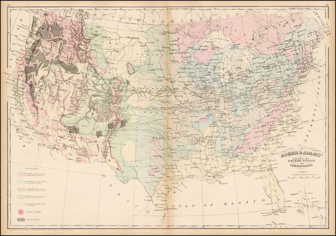
Striking geological map of the United States exhibiting geological regions including Eozoic, Paleozoic, Carboniferous, Mesozoic, Cenozoic, and volcanic regions.
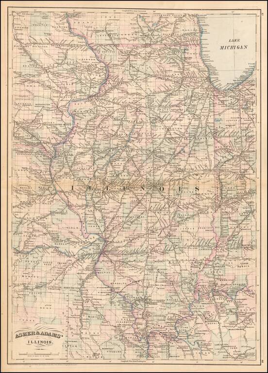
Gorgeous large format railroad map, hand colored by counties. Shows railroads, towns, rivers, lakes, mountains, township surveys, etc. Asher & Adams Atlas was conceived as a Railroad Atlas.
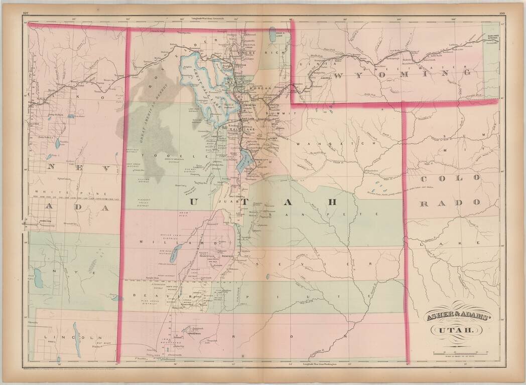
One of the earliest obtainable maps of Utah Territory. Asher & Adams map of Utah is among the earliest map of Utah Territory in its modern configuration to appear in a commercial atlas. The focus of the map is the railroad and related detail...
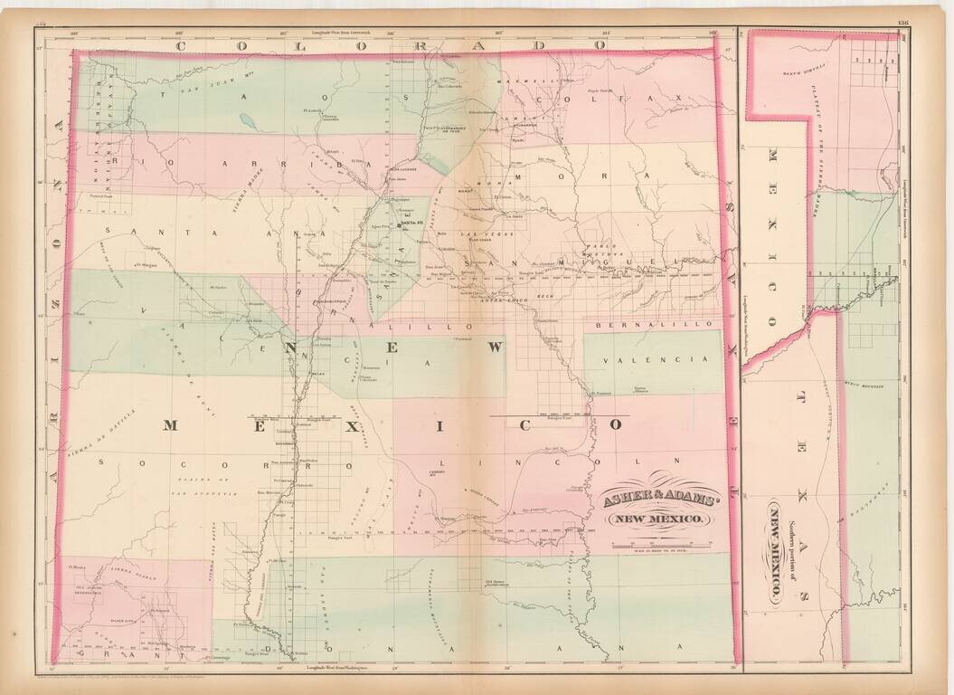
Remarkable large format railroad map of New Mexico Territory. The earliest separately issued map of New Mexico Territory in its modern configuration to appear in a commercial atlas . The map illustrates the early railroads, settlements, mining...