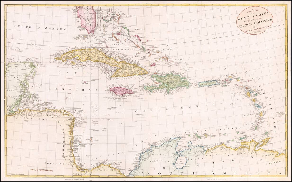
Fine large map of the South Florida and the Caribbean, published shortly after the American Revolution. The map extends from South Florida and the Florida (Gulf) Stream and the Bahamas in the north to the Yucatan, Mosquito Coast, Windward Islands and...
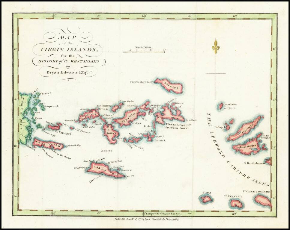
18th Century Map of the Virgin Islands Detailed map of the Virgin Islands, published in London by Brian Edwards. Extends from the east coast of Puerto Rico to St. Barts, centered on Tortola, St. Johns, Saint Croix and Virgin Gorda. There are very...