
![[Siege of Vicksburg -- Manuscript Battle Map / Field Sketch]](/map/small/62795.jpg)
Hand Drawn During The Siege of Vicksburg Detailed hand drawn map / field sketch showing troop positions during the siege of Vicksburg, during the American Civil War. The map locates troop positions, Rebel Works, topographical features, bridges and...

Decorative and unusual trading card map from this famous series. Map is surrounded by decorative vignette, showing Paddlewheeler, sweet potatoes and cotton. Includes population statistics.
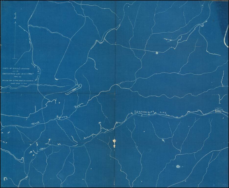
Detailed blueprint map illustrating the location of "Steel's Division" during the Siege of Vicksburg. "Steel" is Frederick Steele (1819 – 1868), a career military officer in the United States Army, who served as a major general in the Union Army...
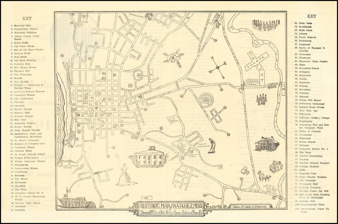
Scarce Pictorial map of the Natchez, Mississippi area, illustrating historical sites, extending frrom the Mississippi River to Sharpe Airport. On the verso, a key with points illustrating on the map is given.