

Scarce vintage pictorial map of Kentucky, celebrating the state's agricultural industries, produced by Karl Smith, one of the 1930s' prominent makers of state pictorial maps. The map features an exhaustive list of Kentucky's 120 counties at the time,...
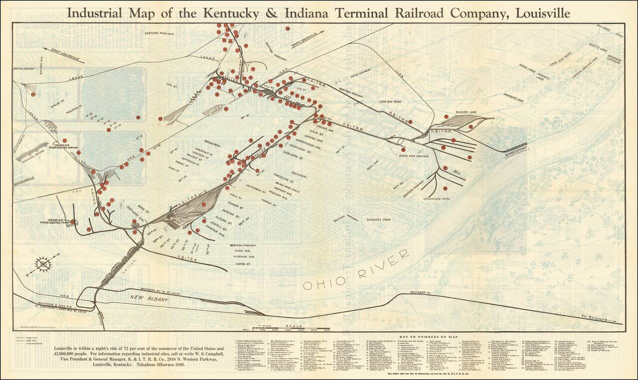
Louisville is within a night's ride of 72 per cent of the commerce of the United States and 42,000,000 People Interesting map of Louisville, Kentucky, highlighting the location of the railroad lines, major manufacturers, and freight houses in...
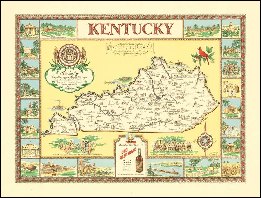
"The Dark and Bloody Ground" Rare pictorial map of the Kentucky, one of a number of different pictorial maps of Kentucky by the prolific illustrator Karl Smith. The map illustraes landmarks and historical events in the decorative panels which make up...