
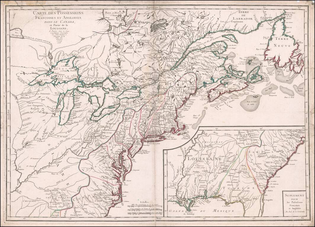
Rare, Detailed First Edition of Longchamps’ Map of the North American Colonies—Proof State! Fine example of the first edition of Longchamps’ map of the colonies—Spanish, French, and British—in North America east of the Mississippi River,...
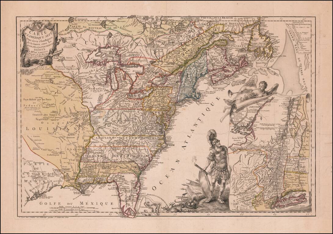
Mars, the God of War, Witnessing Fame's Proclamation of the Birth of the United States Fine example of Beaurain's important map of The 13 Colonies and the contiguous part of French Louisiana and Florida, one of the earliest maps published in Europe to...
Nice example of J. B. Eliot's map of the United States, generally regarded as the earliest map to include the title "United States'' on a printed map. Eliot's map, which is drawn from American sources not previously utilized on any printed map, is...
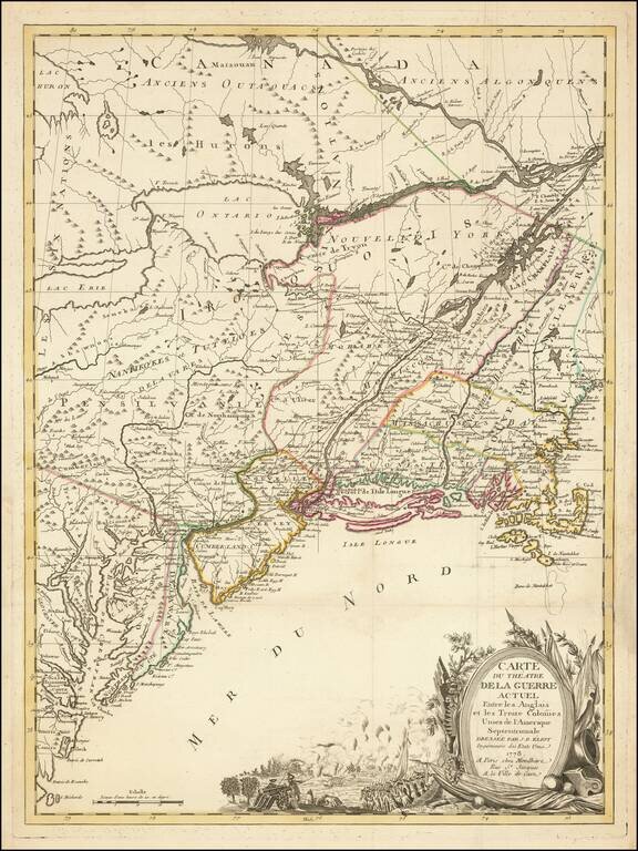
Fine map of the British Colonies, illustrating General Burgoyne's march from Saratoga, New York, to Charlottesville, Virginia, which appeared in the French edition of Thomas Anburey's Voyages dans les parties interieurs de l'Amerique by Thomas Anburey,...
![[Franklinia] A Map of the States of Virginia, North Carolina, South Carolina and Georgia; Comprehending the Spanish Provinces of East and West Florida: Exhibiting the Boundaries as fixed by the late Treaty of Peace . . .](/map/small/67980.jpg)
One of the Earliest Appearances of the State of Franklin (Franklinia) Nice example of Purcell's map of the Southern States (and Midwest), which includes an early reference to the New State of Franklin in the center part of North Carolina. This map...
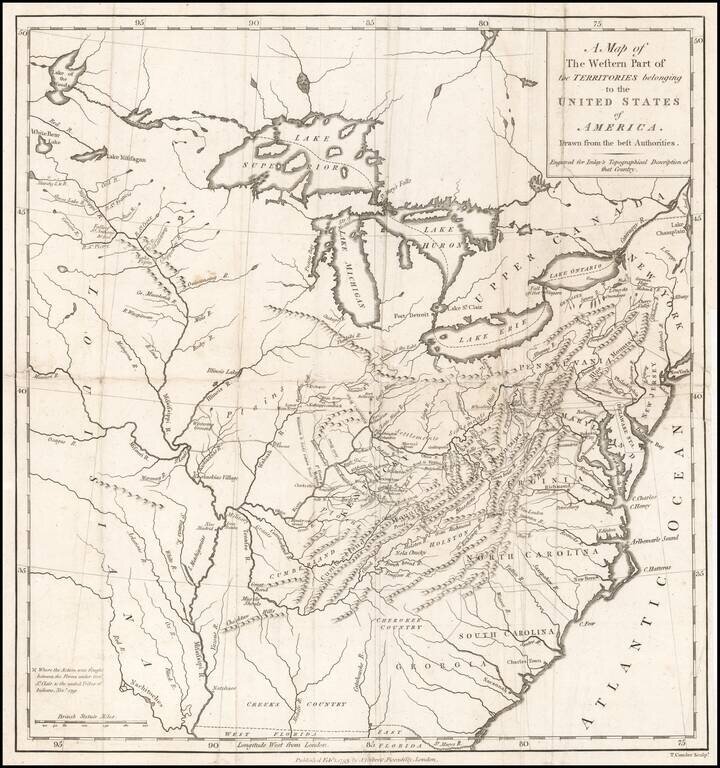
Nice example of this scarce regional map of the United States, which appeared in A Topographical Description of the Western Territory of North America ... by Gilbert Imlay. The map covers the region from the Great Lakes through Georgia and from the...
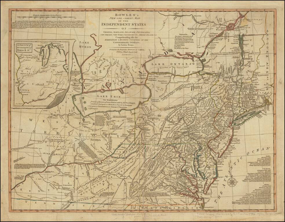
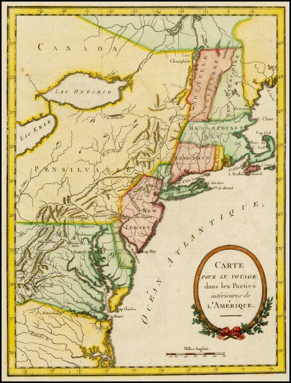
Rare Map of the Mid-Atlantic Issued Shortly After The 1783 Treaty of Peace. A nice example of the Bowles & Carver post-Revolutionary War edition of Lewis Evans' seminal map of the British Colonies in North America, including early references to...
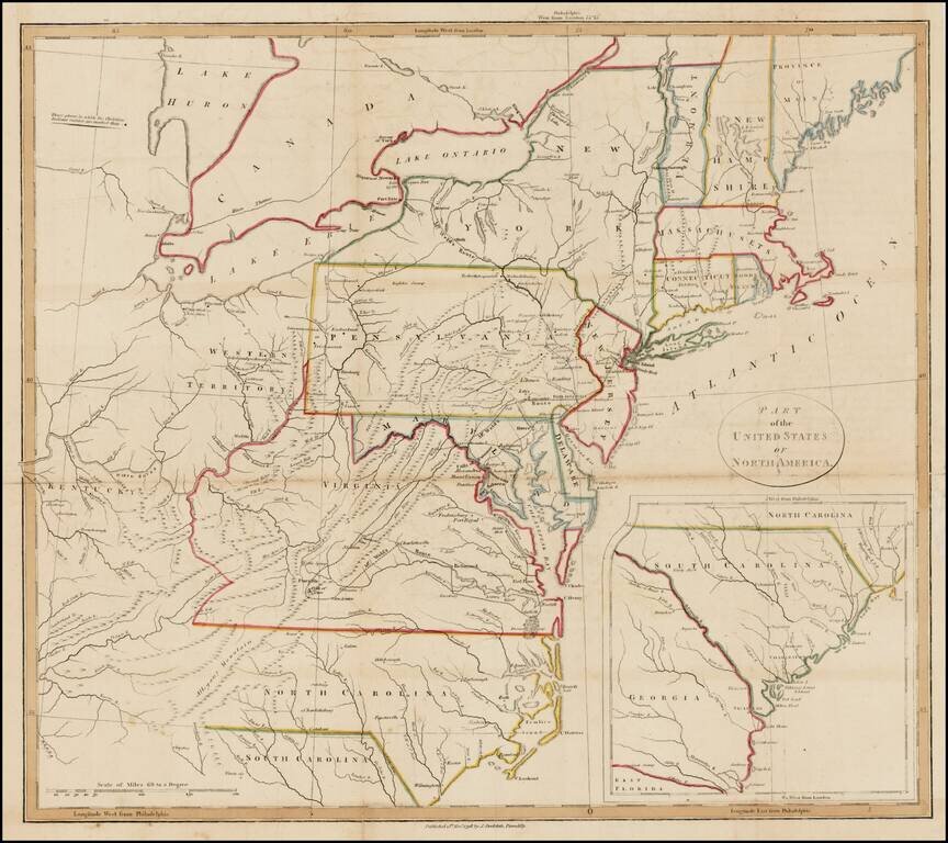
Interesting map of the United States with large inset of South Carolina and Georgia. The map extends east to include the confluence of the Kentucky and Ohio Rivers and names Kentucky, but not Ohio or Tennessee. Includes nice detail in the...
Rare separately issued map of the United States by Daniel Freidrich Sotzmann, engraved for Christoph Daniel Ebeling's Beschreibung. The present example has wide uncut deckled edges, similar to Sotzmann's individual maps of the states. The words "No....
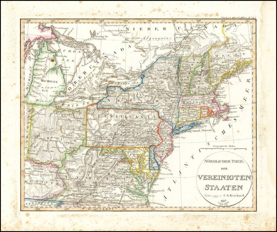
Rare early map of a portion of the Midwest and regions to the East, from Lake Michigan to Kentucky and Virginia to Maine. Early depiction of Michigan Territory.
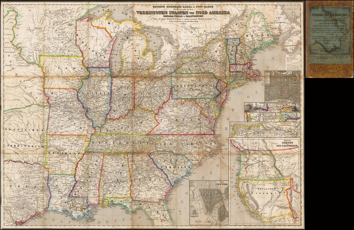
Rare Early of the Bamberg Emigrant Maps Rare Bamberg published Railroad, Canal and Post Route map of the United States, published in 1852. While later versions of the map are recorded, this 1852 edition is extremely rare, especially with the...
![(American Revolution) [Manuscript Map of New York City and Northern New Jersey]](/map/small/69609.jpg)
An American Revolutionary War Manuscript Map -- From the Collection of One of the First U.S. Frigate Captains Manuscript map in pen and ink on laid paper of New York City and northern New Jersey, "the cockpit of the American Revolution". The map was...

The magnificent capstone of British mapping of northeastern North America. A rare, monumental and momentous general chart of northeastern North America, representing the capstone of British efforts to map the region after the end of the French and...
![[East Coast & Canada ] Tierra Nueva](/map/small/64984.jpg)
One of the Earliest Printed Maps of the Northeastern Part of America Final state of Ruscelli's map of the East Coast of North America, extending from the Mid-Atlantic to the Canadian Coastline. The map shows the discoveries of Cartier and Verrazzano....
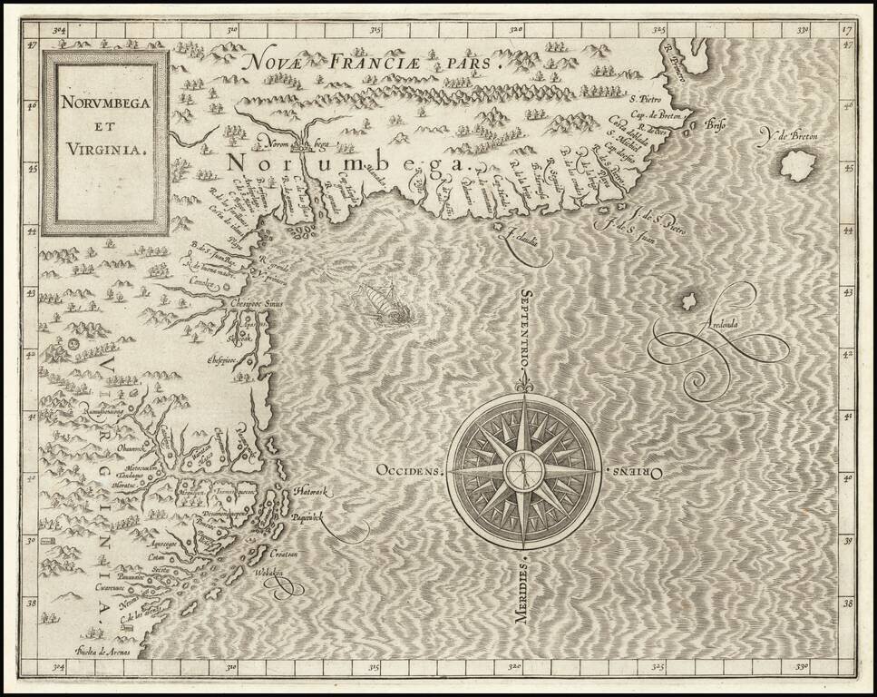
One of the Earliest Printed Maps of the East Coast of the United States. First state (left latitude written "30" instead of "39") of Cornelis van Wytfliet's Norumbega et Virginia, the highly important map of the Atlantic Seaboard of North America from...
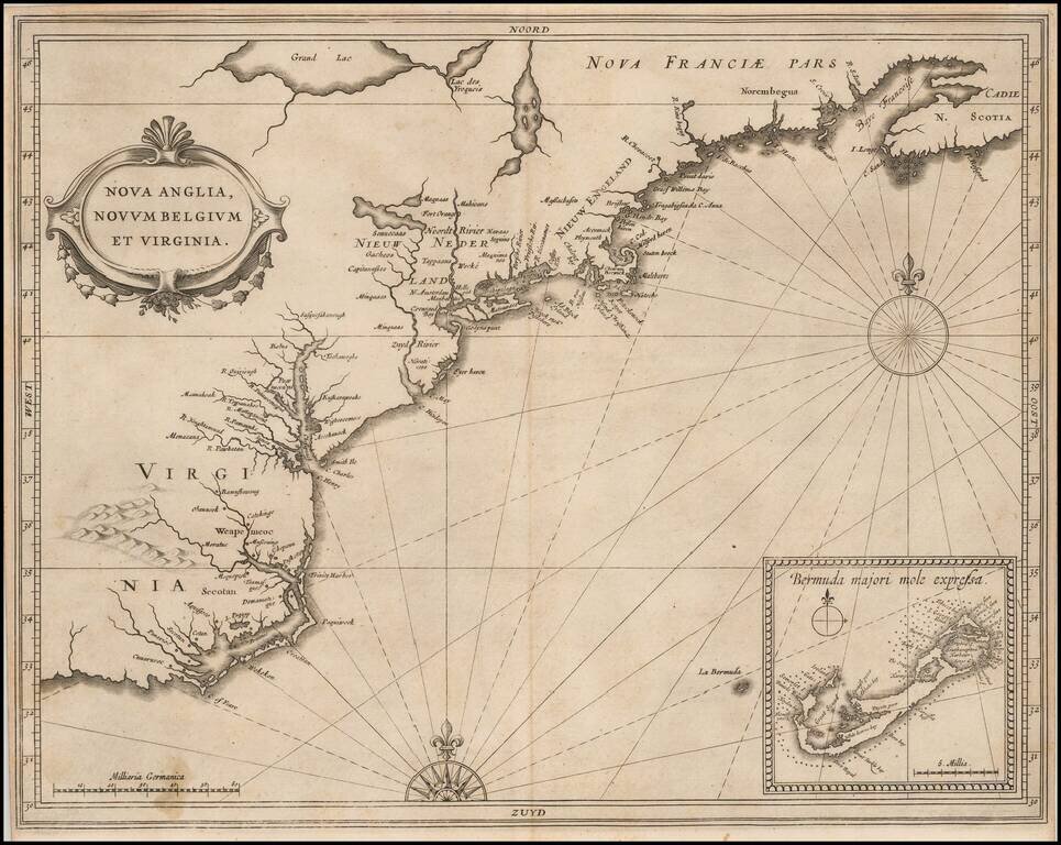
Quite Possibly The Most Important Map of the Northeast & Mid-Atlantic Published in the First Half of the 17th Century. Johannes De Laet's highly influential map of the East Coast of North America is a cartographic landmark, depicting the region...