
![Map of Yosemite National Park Showing Routes of Yosemite Transportation System, High Sierra Camps and Pack Trip Country. [on sheet with:] Map of the Floor of Yosemite Valley Yosemite National Park, California](/map/small/66362.jpg)
Illustrated Stage and Railroad Routes To Yosemite Detailed topographical / pictorial map of Yosemite and Vicinity, published as a vistor's guide promotional map. The primary map illustrates the Y.T.S. Stage Service and Railroads servicing the valley...
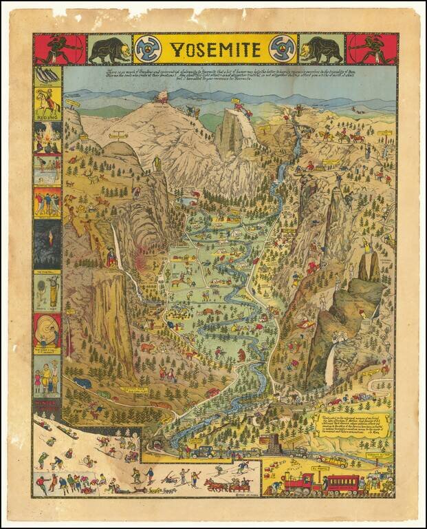
Decorative vintage pictorial map of Yosemite Valley drawn by artist Jo Mora in 1931 and later re-issued in 1941 and 1949. The map shows many humorous scenes and shows the activities common at the time in the Valley. Many landmarks are shown in an...
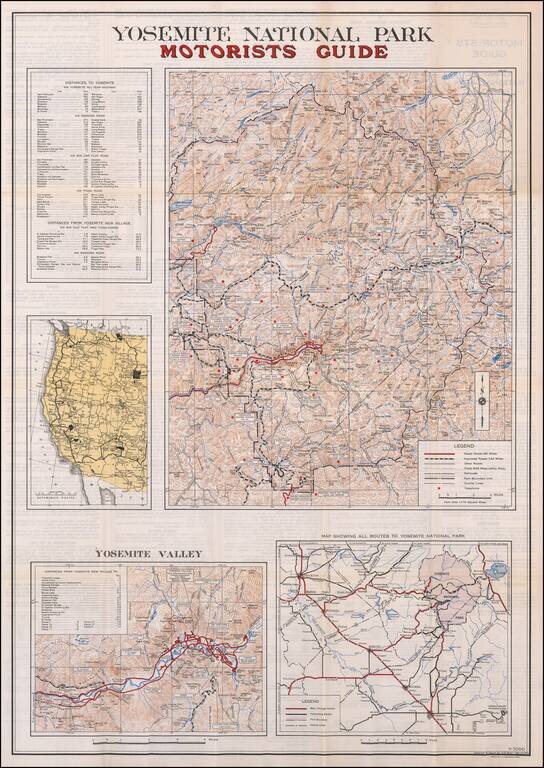
Including the Bear Feeding Platform! Large motorist guide map to Yosemite National Park, with smaller maps of Yosemite Valley, Routes to the park and a regional map. The primary maps locate Paved Roads (66 miles), Improved Roads (142 miles), Other...
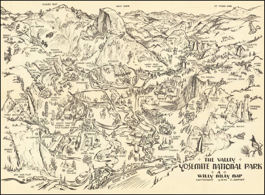
Yosemite Pictorial Rarity Rare self mailing map of Yosemite, published in 1946 by the Willy Nilly Map Company. The map is centered on Camp Curry, with an indoor venue below it having its roof blown off with music and dance. Extends to Clouds Rest,...
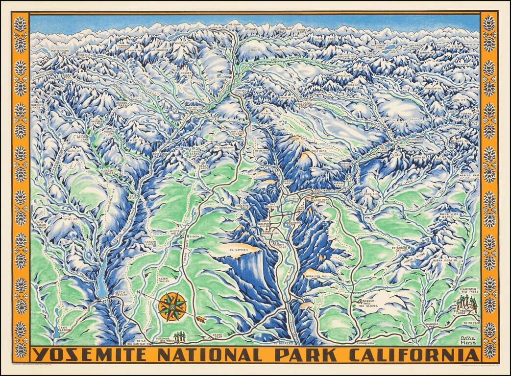
Fine example of the Della Hoss view of Yosemite National Park, published for the Yosemite Park and Curry Co. in 1955. The map provides a fine caricature view of Yosemite, locating many of its major attractions and a few not so famous, such as the...