Rare and antique old maps of the South America

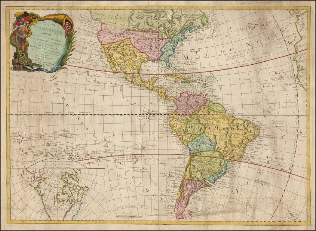
Finely engraved map of the central part of South America, from Santini's Venetian edition of d'Anville's map from "Atlas Universel," printed in 1776-84. The map includes much of Brazil, Peru, Chile and Paraguay.
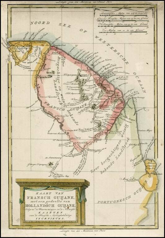
Detailed map of the Guyana Colonies, from a scarce Dutch Atlas published by Bachienne. While derived from French sources, this map is far mor attractive and better engraved than the original by Rigobert Bonne.
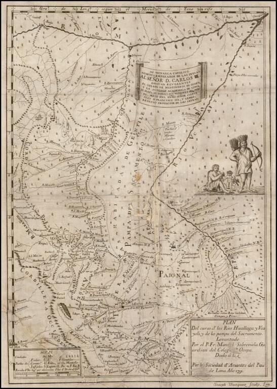
Extremely rare first edition of this important early map of part of northeastern Peru with the Marañon River at the top, the Ucayali River at right, the Huallaga River in the center and Lima at lower left, prepared from the original manuscript maps of...
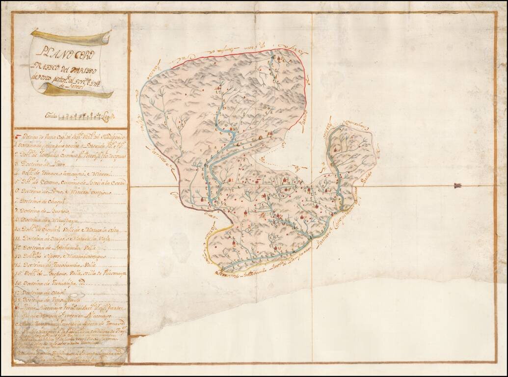
Finely Executed Spanish Colonial Government Survey Manuscript Map of the Porco District of the Mining Region of Potosi in Bolivia Remarkably detailed manuscript map of the Porco district, part of Potosi, one of the richest mining regions in the world,...
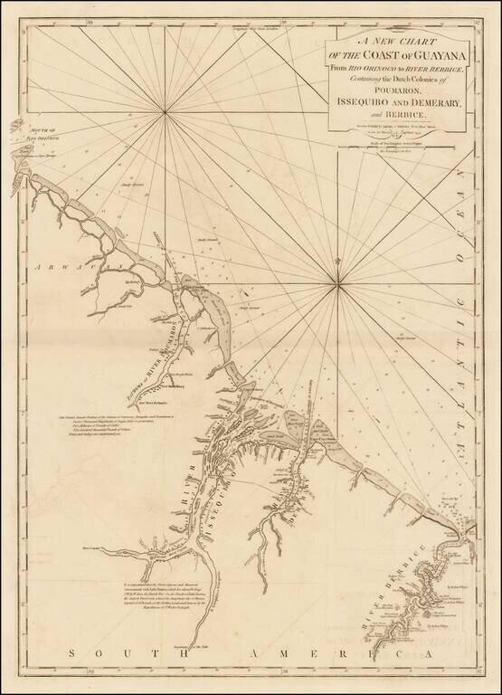
Significantly revised and updated version of Laurie & Whittle's chart of the Dutch Colony of Guayana, from Jeffery's West India Atlas. The present chart has been significatnly updated from earlier editions.
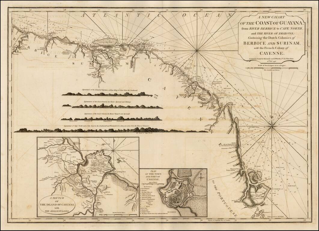
Significantly revised and updated version Laurie & Whittle's chart of the Dutch and French Colonies in Guayana, from Jeffery's West India Atlas.
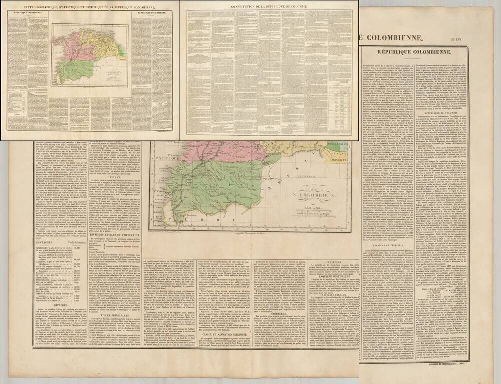
Fine map of Colombia, shortly after its indendendence, which includes an early printing of the Constitution of the Republic on a separate sheet. From 1796 to 1806, Colombia was constantly in conflict over the nature of its government. Constant...
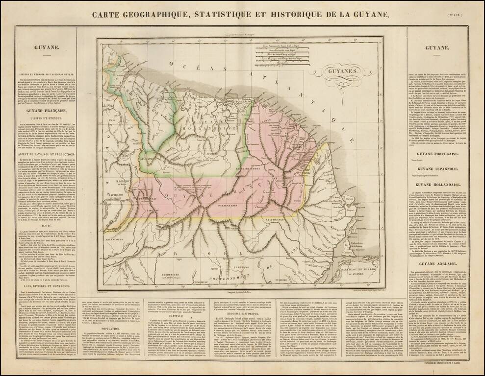
Nice example of the Buchon's map of Guyane, published in Paris in 1825. The map delineates English Guyana (Guyana), Dutch Guyana (Suriname) and French Guyana. The map is exceptionally detailed, with forts, towns, villages, mountains, rivers, etc....

Chile on the Eve of Complete Independence Nice example of Buchon's map of Chile, published in Paris in 1825, the year before last Spanish troops surrendered and the Chiloé Archipelago was incorporated into the Chilean Republic. The map covers Chile...
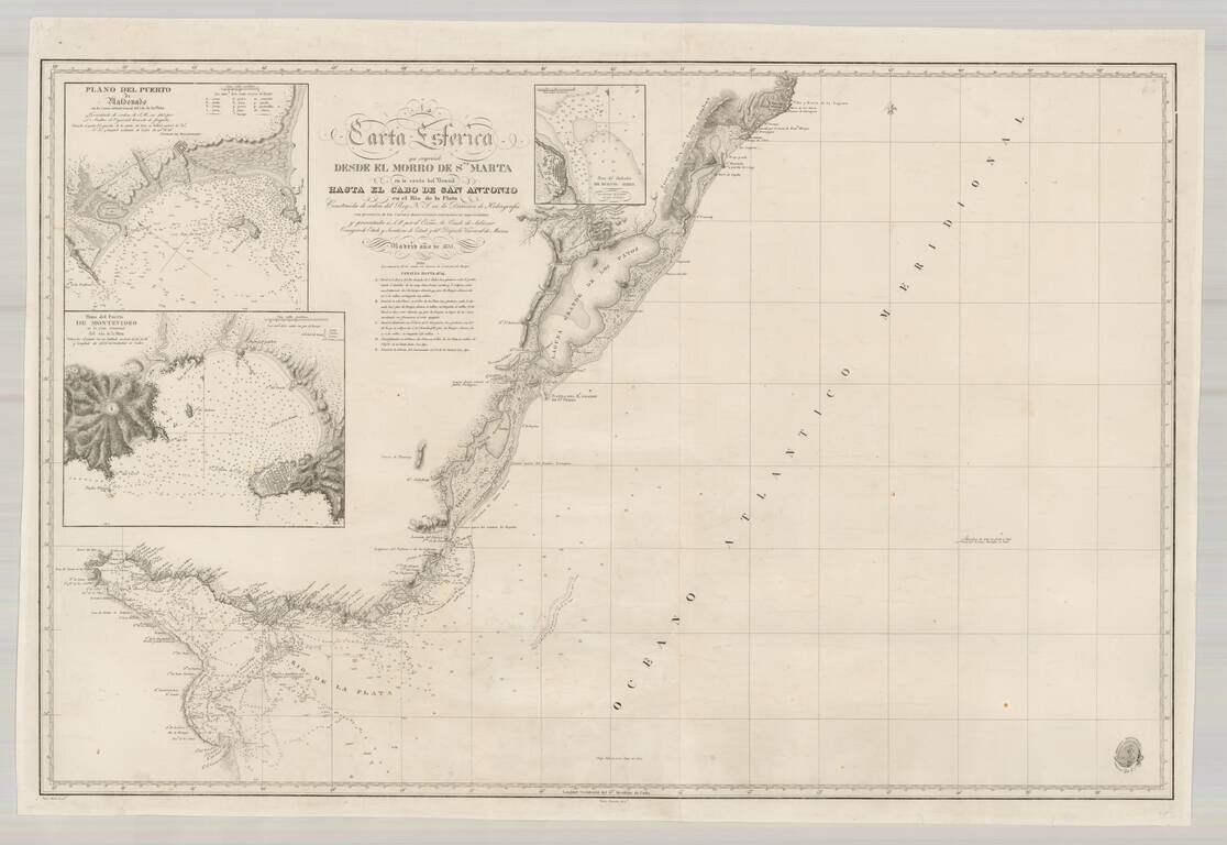
Scarce Spanish Sea Chart of the southern coast of Brazil and the Rio de la Plata, published by the Spanish Hydrographical Department. The chart includes large insets of Montevideo, Buenos Ayres and Puerto Maldonado.
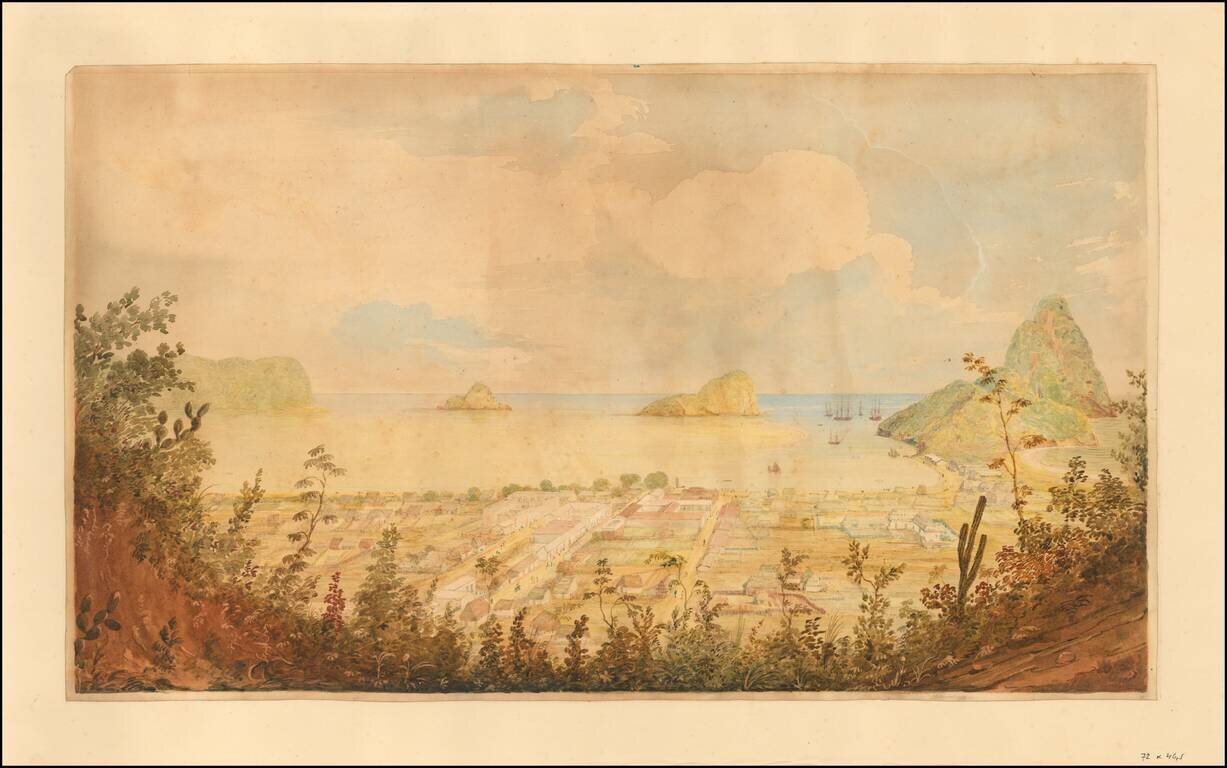
Original Watercolor View of Rio de Janeiro from 1833. Fine view of Rio De Janeiro, painting attributed to William Smyth during one of his visits to Rio as an officer in the British Royal Navy. Fine view of Rio from a high vista, looking southward...
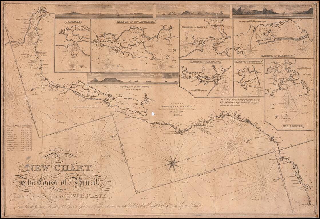
First state of this rare separately issued sea chart of the coast of Brazil, published in London by R & W Blachford. A finely detailed coastal chart, extending from Buenos Aires and the mouth of the Rio de la Plata to Cape Frio, just north of Rio...

Fine set of 4 dissected maps of South American regions, in a custom slip case, formerly owned by Admiral Sir Edwin Gennys Fanshawe of the British Admiralty. E.G. Fanshawe is perhaps best remembered for a series of over 100 watercolors in the...
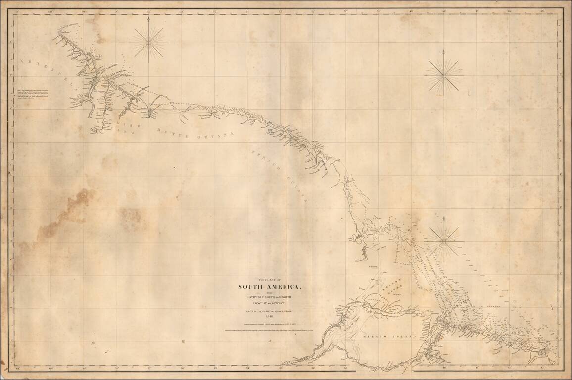
Rare separately published American Sea chart of the Northeastern coastline of South America, drawn by Charles Copley and published by Blunt. The map extends from the Orinoco River, Essequibo River and Demarara River in Venezula to Ilha Marajo, Belem...
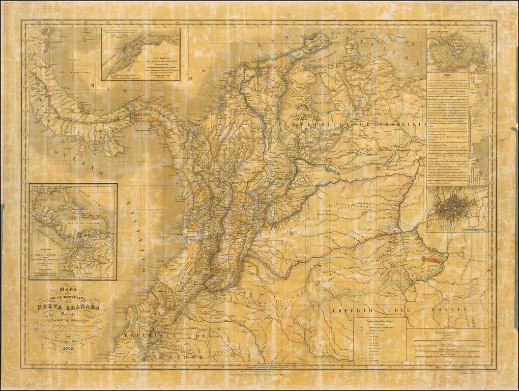
Quite Possibly The Only Official Map of the Confederation Granadine -- Originally Created By One Colombia's Most Important Historians and Scholars Second state of this rare wall map of the Republic of New Granada dedicated to the Baron de Humboldt,...
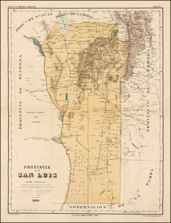
Fine map of the Provincia de San Luis in Argentina, published in the rare Atlas de la Republica Argentina. The map locates towns, roads, railroads, railroads under construction, etc.