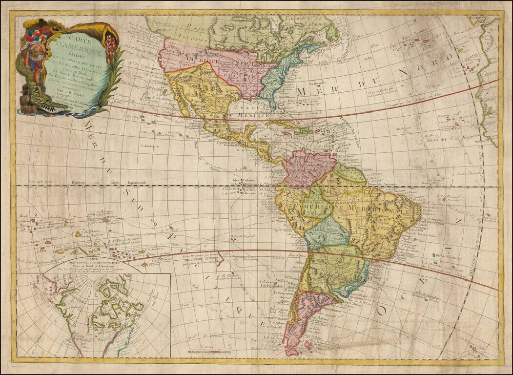
Rare and antique old maps of the South America
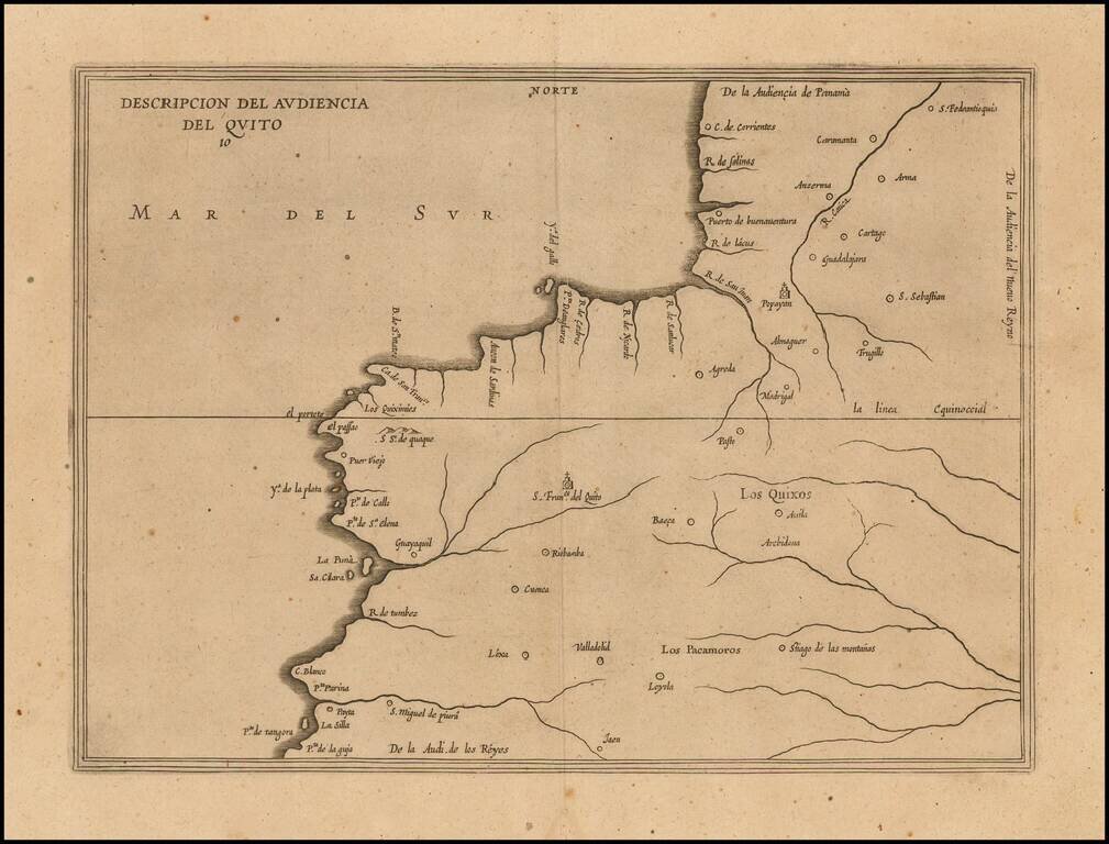
Amsterdam edition of Antonio de Herrera y Tordesillas' map of the Audiencia of Quito, from his Descripcion de las Indias Occidentalis, first published as part of his Historia General, in Madrid in 1601. This map is the earliest printed Spanish map to...
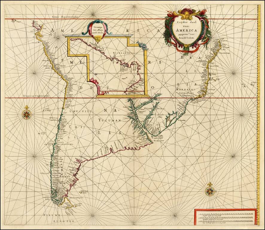
Fine example of Arnold Colom's rare and highly important sea chart of most of South America, first published circa 1656. Colom's map is one of the earliest obtainable Dutch Sea Charts to show the Sea Coasts of South America and the rarest of the early...
![[Galapagos] Carte de la Cote Occidentale D'Amerique Comprise Entre Le Golfe de Tehuantepec et le Golfe de Guayaquil (Amerique Centrale, Nlle Grenade, Equateru) . . . .1864](/map/small/57942.jpg)
Scarce sea chart of Central America and the coasts of Colombia, Equador and Peru, published by the French Hydrographical Office. Includes a relatively large treatment of the Galapagos Islands, just five years after Charles Darwin's publication of his...
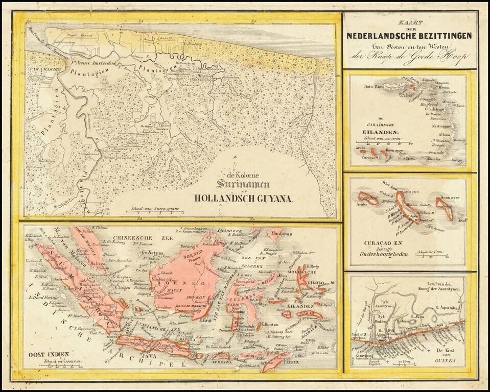
Interesting Map of the Dutch Colonies. The map consists of 5 separate maps, entitled: The Caribbean Islands Curacao and Dependencies The Suriname Colony The Coast of Guinea in Africa East Indies The map appeared in Nieuwe Atlas van het...
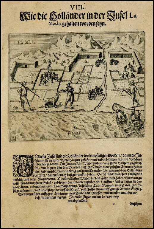
Theodore De Bry's edition of this rare view of settlement on the Island of Mocha in Chile, including an indigenous chiliquenes (Llama), copied from Olivier Van Noort's expedition narrative. The island was historically inhabited by an indigenous...
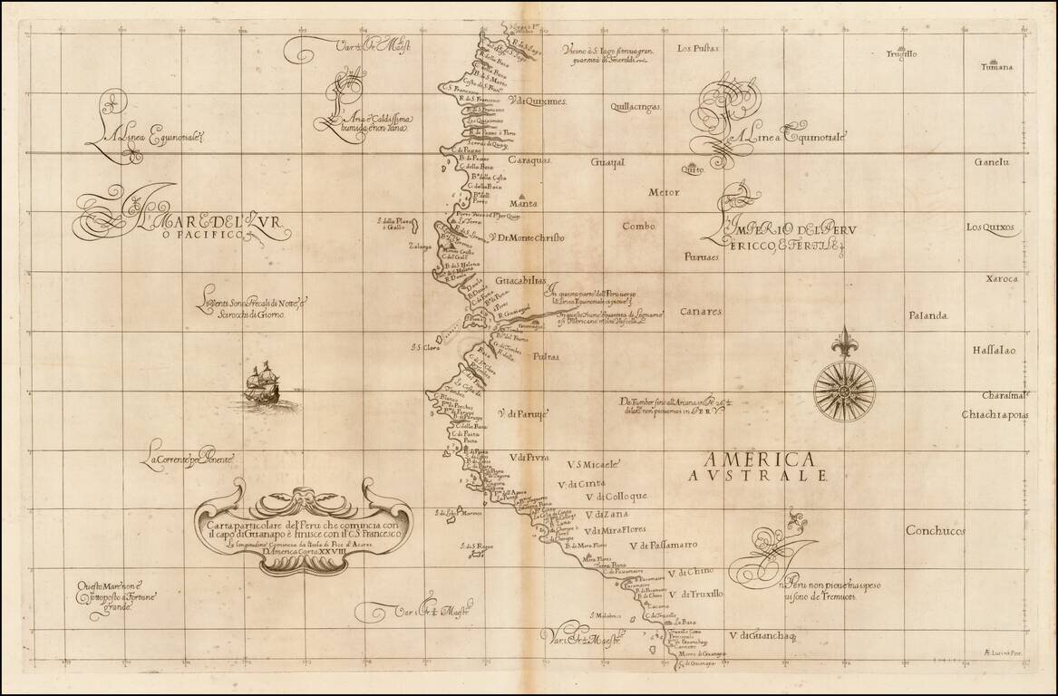
Fine example of the first state of Robert Dudley's chart of a part of the northwestern coastline of South America, the earliest obtainable chart of the region. The chart is centered on Quayquil and the coast of Ecuador, extending south to the area of...
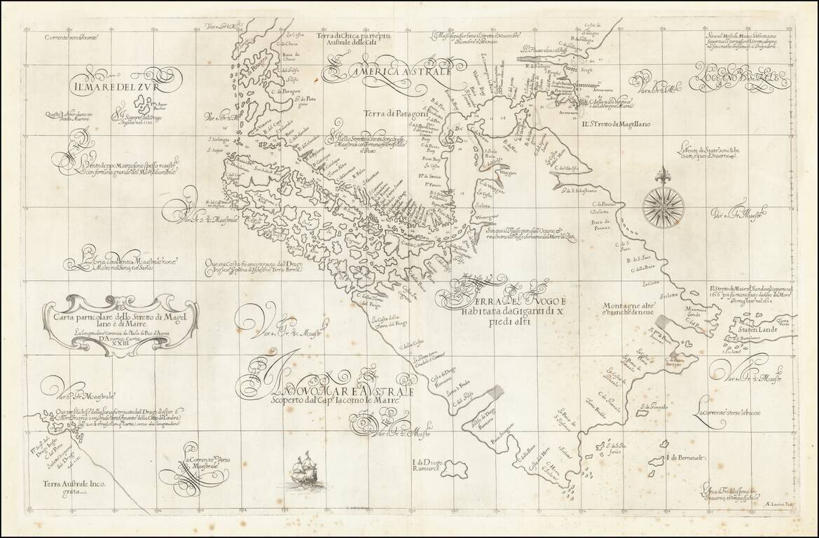
A Remarkable Early Sea Chart of the Strait of Magellan and Tierra del Fuego Important early map of the Straits of Magellan and the Straits of Le Maire, the latter of which was first discovered by Jacob Le Maire and Willem Schoten only 30 years prior...
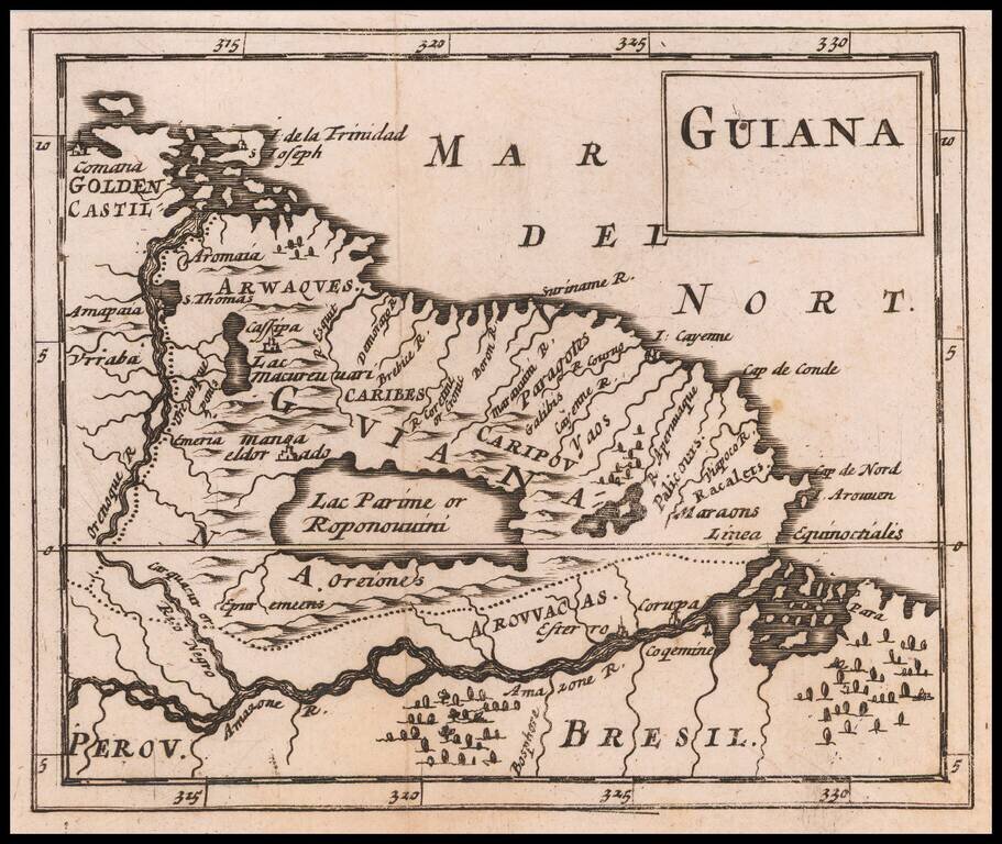
Rare Miniature English Map of Guiana, Including Manoa or El Dorado Rare map of Guiana, including the Lake Parime region, with the town of Manor or El Dorado shown, published by Sir Jonas Moore in London. The map appeared in Moore's A New Geography....
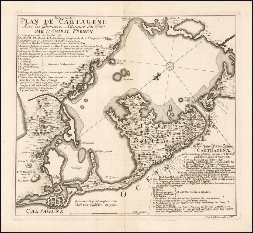
Rare German plan of the siege of Cartagena (Cartagena de Indias), by the Vice-Admiral Vernon , in 1741, probably drawn after Harding and Toms chart, and published the same year. The map states that it is based upon an English original of 1741 and has...
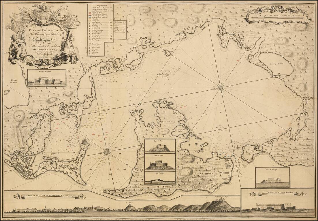
An Impressive and Rare Separately Issued Map of the Battle of Cartagena in 1741, showing Vernon's Fleet in Action in the Harbor. Engraved map of Cartagena and environs with touches of original hand-coloring. The present map is an exceptional example...
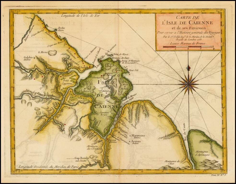
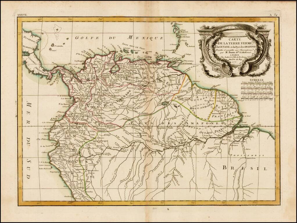
Detailed and well engraved sea chart of French Guiana and the island of Cayenne. The map was pubilshed in 1763 by Bellin (1703-72), a prolific cartographer assigned the Ministry of the French Navy. The chart shows soundings, anchorage's, channels,...
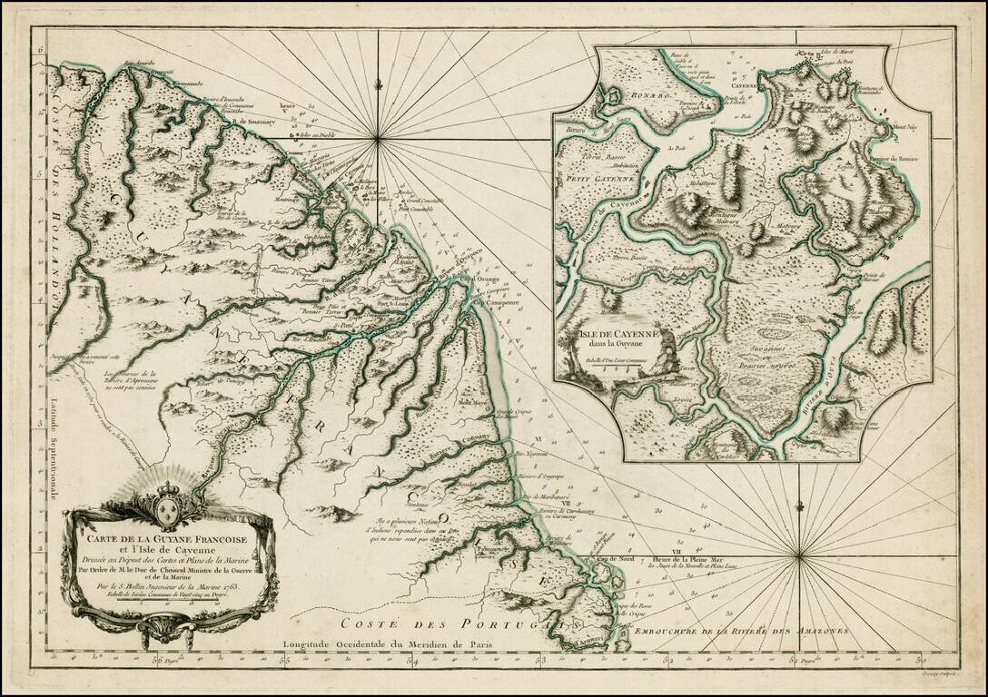
Detailed and well engraved sea chart of French Guiana and the island of Cayenne. The map was pubilshed in 1763 by Bellin (1703-72), a prolific cartographer assigned the Ministry of the French Navy. The chart shows soundings, anchorage's, channels,...
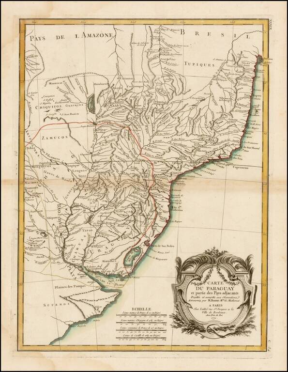
A detailed and attractive regional map of Brazil and Paraguay with a decorative cartouche. Rigobert Bonne served as the map maker to the King of France.
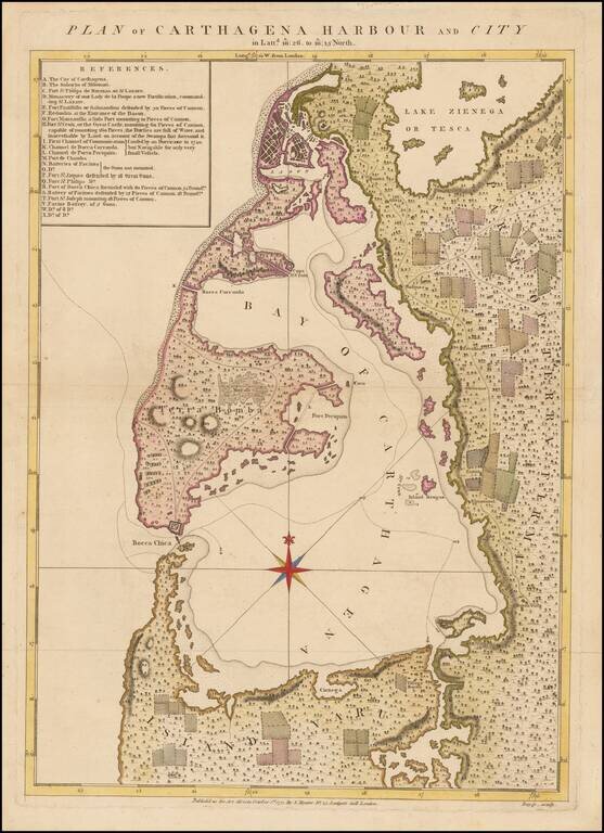
One of the Rarest Maps of Cartagena Rare plan of Cartagena and environs, engraved by Bayly and published in Speer's The West-India Pilot, sold by Samuel Hooper. The map includes a detailed key locating approximately 23 points of interest, including...
Striking 18th Century map of the northern portion of South America, including, Columbia, Venezuela, Ecuador, Guyana and the northen part of Brazil, on the eve of their independence from Spain. The map is divded into Spanish intendencies, with the...

A Rare Separately Published Example From A Storied English Country Mansion. Striking two-sheet, engraved map of South America below the Rio de La Plata, produced by Thomas Kitchin in London in 1772. Attractively-engraved by Kitchin, the map features...