
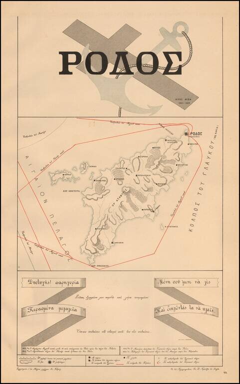
A Rare Greek Independence Propaganda Map Propaganda map of the Island of Rhodes, from Ivan Petrov's Atlas of the holy struggle of the Greeks for Independence" [ "Ατλας Τον Υπερ Ανεζαρτηησιας Ιερο Των Ελληνων...
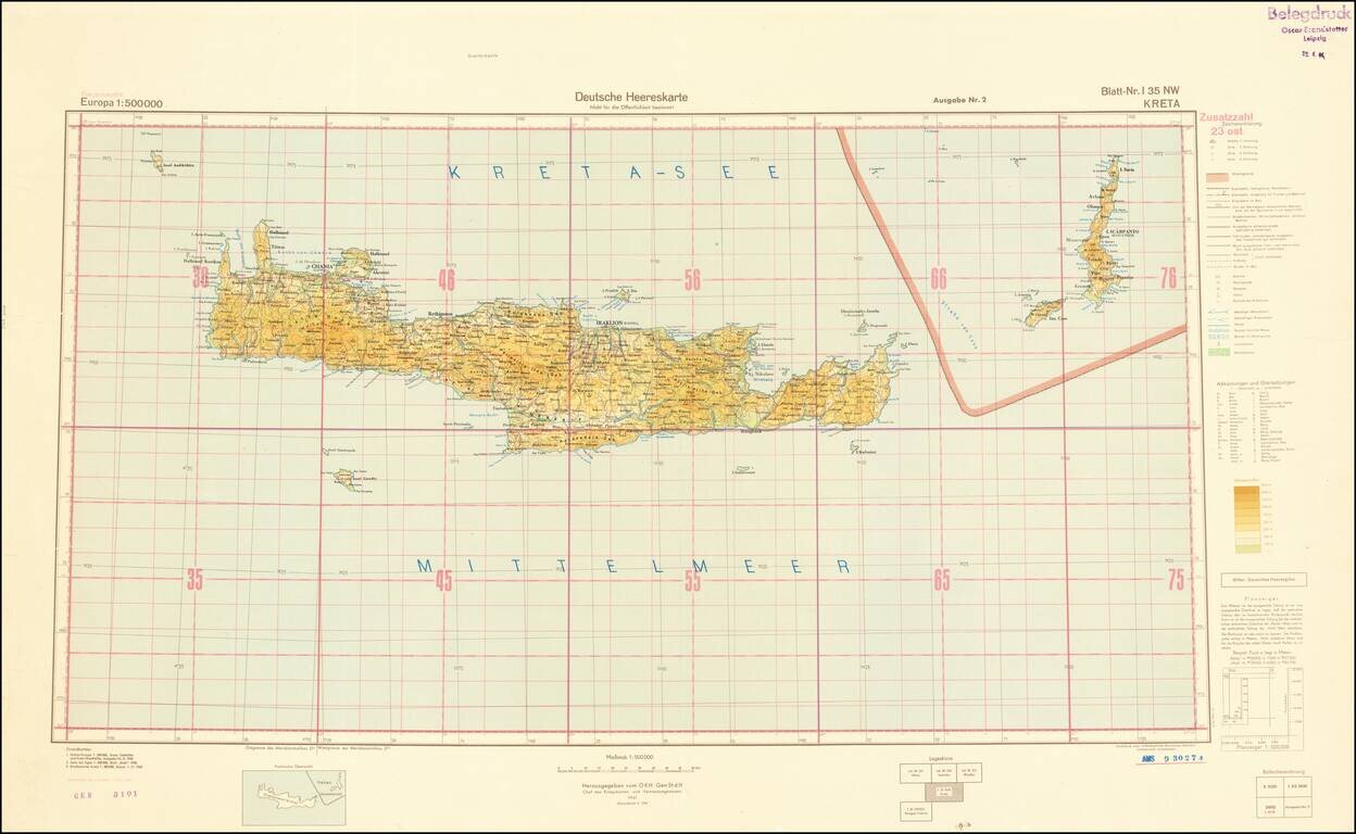
World War II-era German Army map of Crete, published shortly before the liberation of Crete from Germany occupation in October of 1944. The map is a sheet from the 1:500,000 Europa series and it is replete with topographical and political data. This...
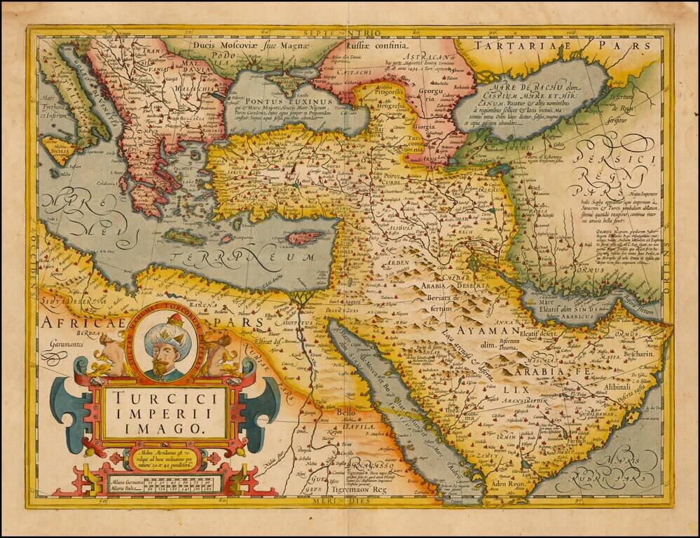
Fine Map of the Ottoman Empire from the Mercator-Hondius Atlas Striking example of this map of the Ottoman Empire, showing their territories in the Balkans, Anatolia, the Levant, the Arabian Peninsula, and North Africa. It was published by Henricus...
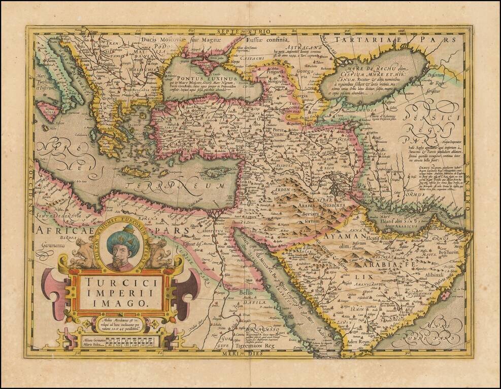
Fine Map of the Ottoman Empire from the Mercator-Hondius Atlas Striking example of this map of the Ottoman Empire, showing their territories in the Balkans, Anatolia, the Levant, the Arabian Peninsula, and North Africa. It was published by Henricus...
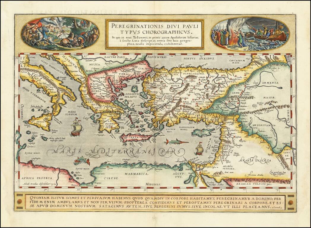
A gorgeous example of Ortelius' map of the travels of St. Paul the Apostle through the Mediterranean, extending west to Italy and east to the Euphrates, including parts of the Red Sea and the Black Sea. Several sailing ships and sea monsters in the...