
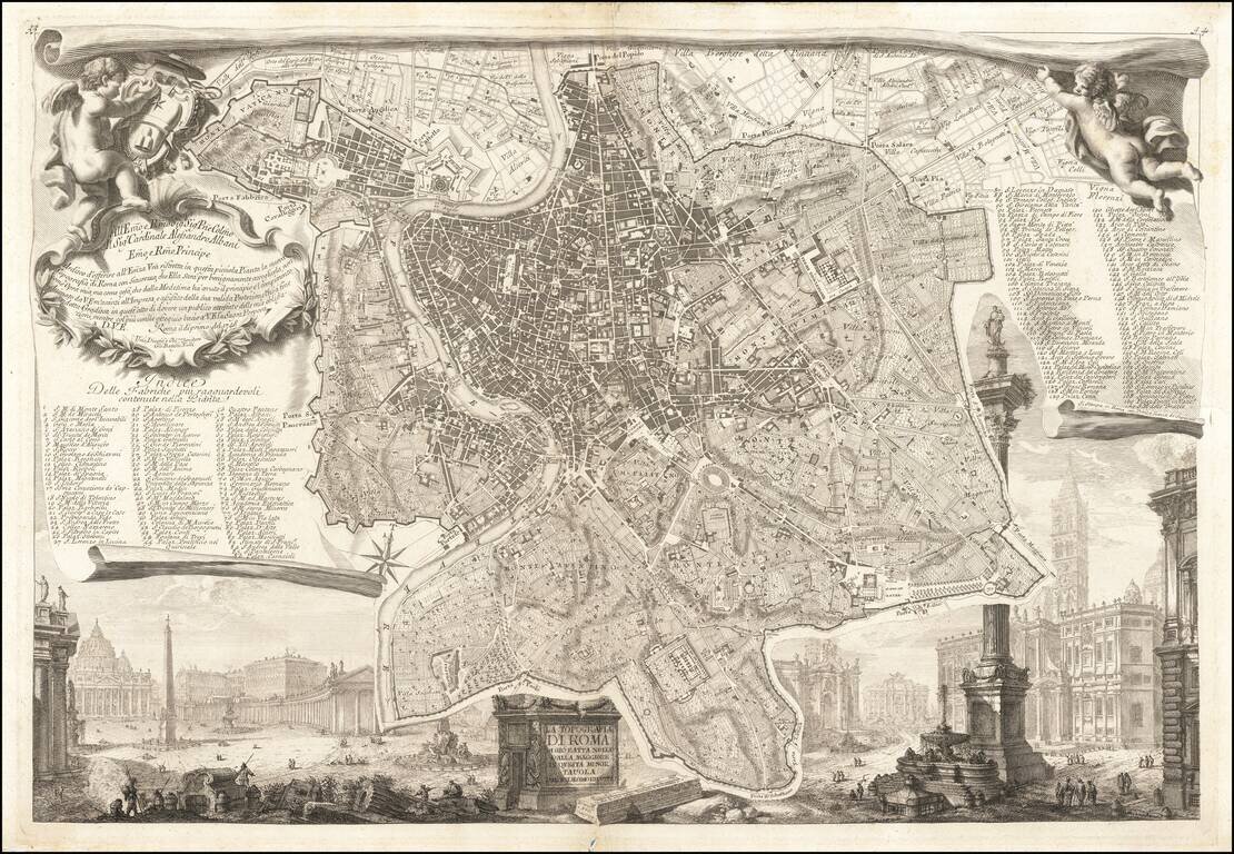
Piranesi's Map of Rome Nice example of this celebrated plan of Rome, engraved by Giovani Battista Nolli and Charles Nolli, with decorative elements engraved by Giovanni Battista Piranesi. The map shows the center of Rome in great detail, lying on a...
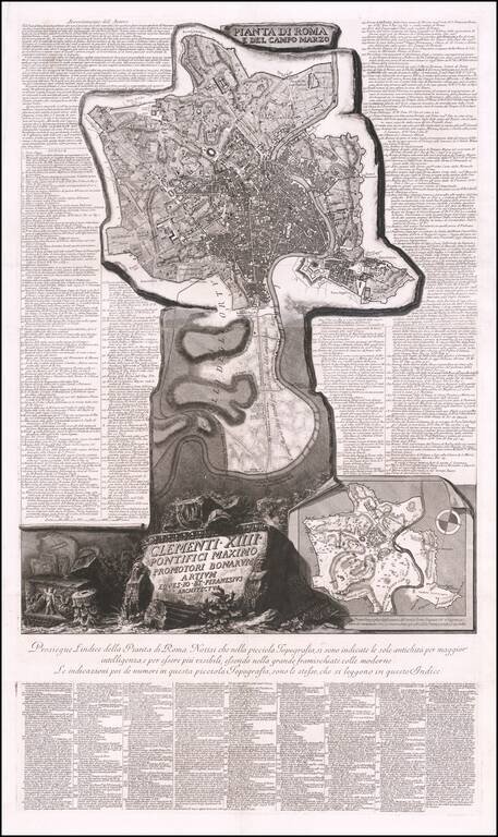
Fine example of Piranesi's remarkable modern map of Rome, dedicated to Pope Clement XIV. First issued in 1774, the map is oriented with south at the top. Piranesi's remarkable large format map shows the modern city of Rome within Aurelian Walls,...
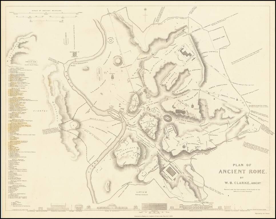
This is a fabulous town plan of Ancient Rome, including a description and location of many of the ancient walls and buildings that made up the city. This view of the imperial city strips away the many layers of later development, allowing the viewer to...
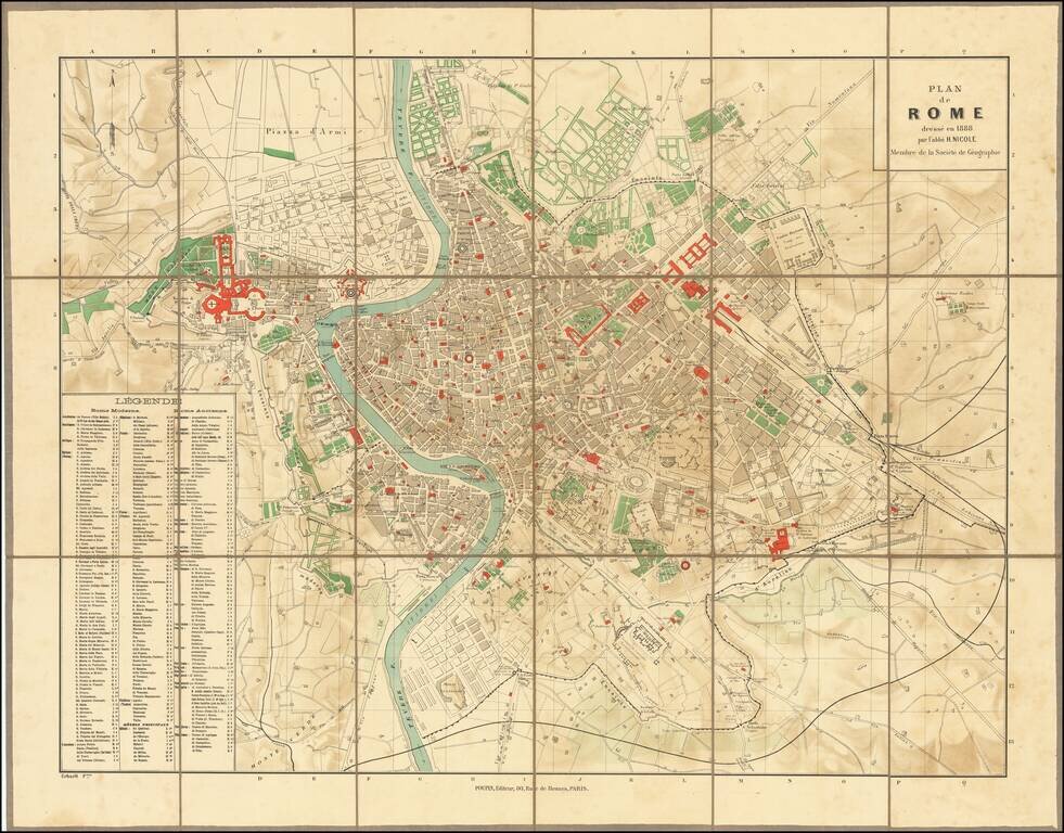
Highly detailed plan of Ancient and Modern Rome, published in Paris. The map is credited to "l'abbe H. Nicole," a member of the French Geographical Society, but we are unable to locate the Abbey. The key locates hundreds of important ancient and...
![[Expanding Rome To the Sea] Progetto per l'espansione di Roma al Mare dell'architetto Dario Carbone](/map/small/63570.jpg)
A fascinating set of maps and profiles, showing a proposal for developing the areas surrounding the Tiber River and for the expansion of Rome toward the sea, 1912, by Dario Carbone. As noted by Lina Malfona in Between Rome and the Sea: Ancient &...
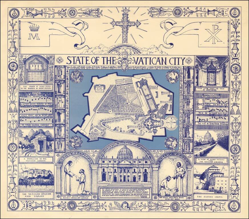
Fine large format pictorial view of the Vatican, surrounded by religious themed vignettes. We were not able to locate information on the artist, other than credits for other illustrations done in the mid-1970s.