
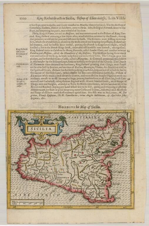
Detailed and attractive map of Sicily with a large cartouche. From the 1625-26 edition of Purchas His Pilgrims, one of the seminal early 17th Century English Language travel works. On a 13 x 9 inch sheet with English text, front and back.
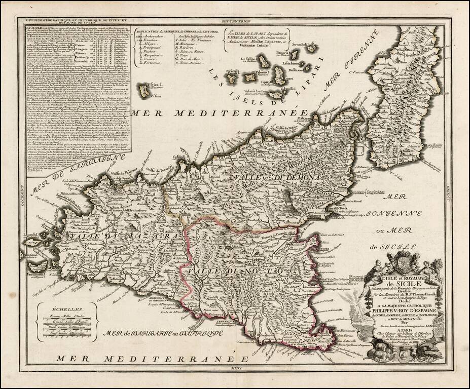
Early edition of Nolin's rare large format map of Sicily. Nolin's map is dedicated to Filipo V. The basic configuration and place names follow the map of Giacomo Cantelli. A later edition, with lengthy text annotation in the upper left corner,...
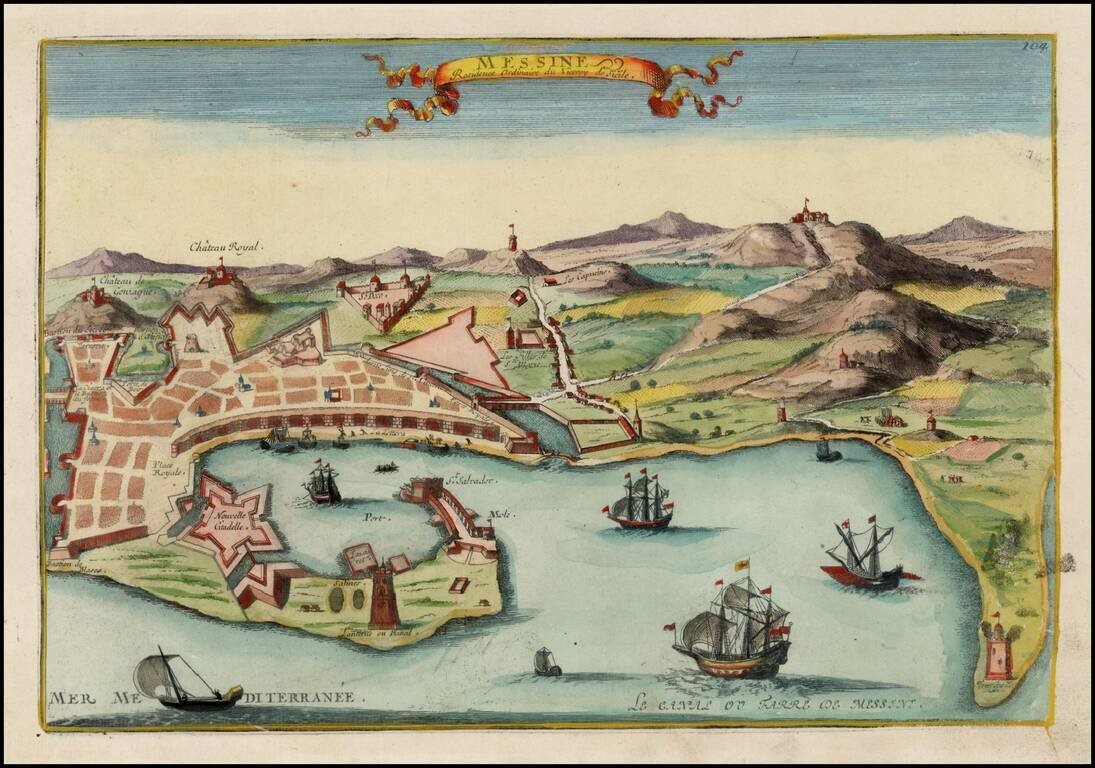
Detailed view of Messina, the residence of the Viceroy of Sicily. From De Fer's Atlas Curieux.
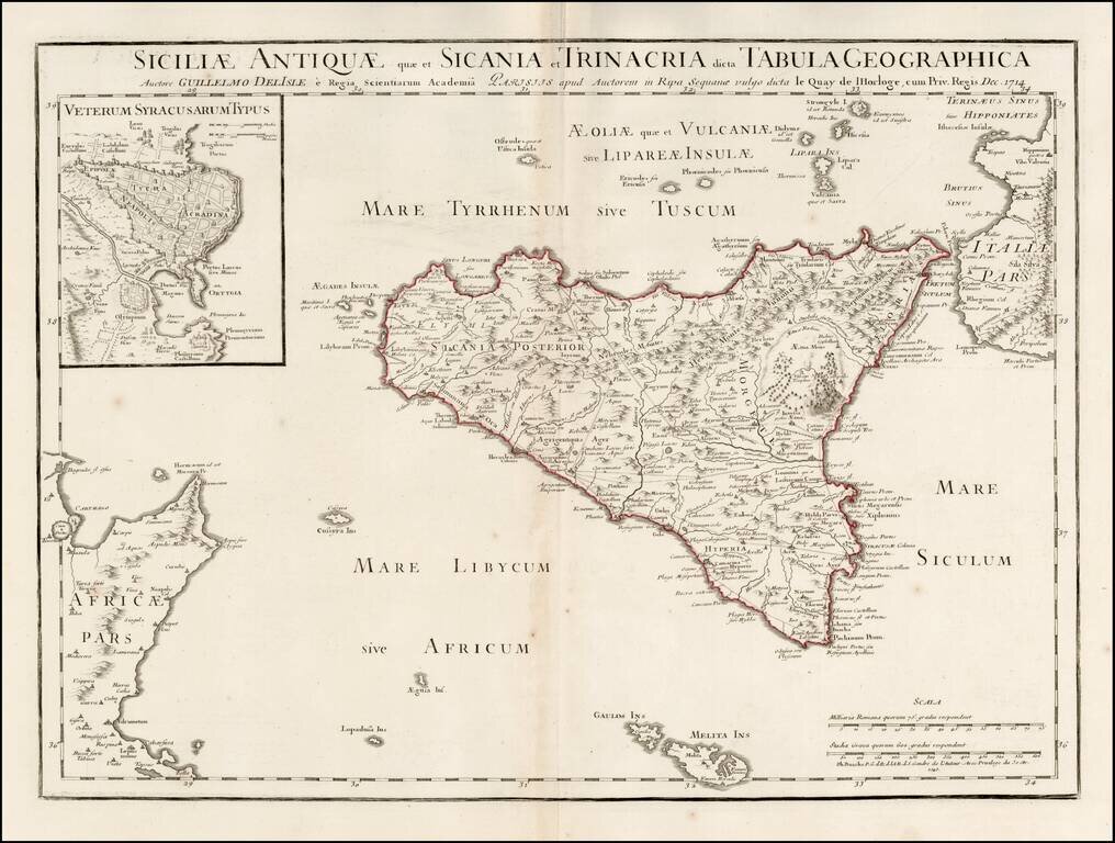
Scarce map of Ancient Sicily, with a large inset of Syracuse, originally published by Guillaume De L'Isle in 1714. Detailed map of ancient Sicily, showing roads, mountains, rivers, towns, harbors, smaller islands, etc. Extends south to Malta. Shows...
![Partie Meridionale du Royaume De Naples ou se trouvent La Calabre et L'Isle et Royaume de Sicile . . . 1779 [with] Supplement pur L'Isle De Malte](/map/small/35618.jpg)
Striking map of Sicily, Naples and contiguous islands, with a large inset of Malta, published in Venice. Includes towns, mountains, rivers, lakes and a host of other details. Decorative cartouche. Santini's maps are largely based upon De Vaugondy's...
![[Map of Italy] Карта Италіи](/map/small/66941.jpg)
Detailed and very rare Russian-language map of Italy, Sicily, Corsica and Sardinia, published in Saint Petersburg in 1836. Rarity The map is very scarce. We have been unable to find any other examples in sales databases, libraries and archives, nor...
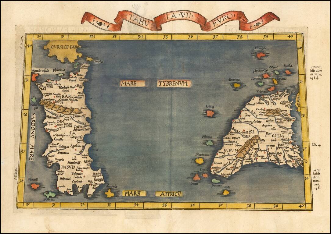
Nice example of the 1525 edition of Lorenz Fries map of Sicily and Sardinia. First published in Strasbourg by Johannes Gruninger in 1522, Fries map is based upon Waldseemuller's map of 1513.
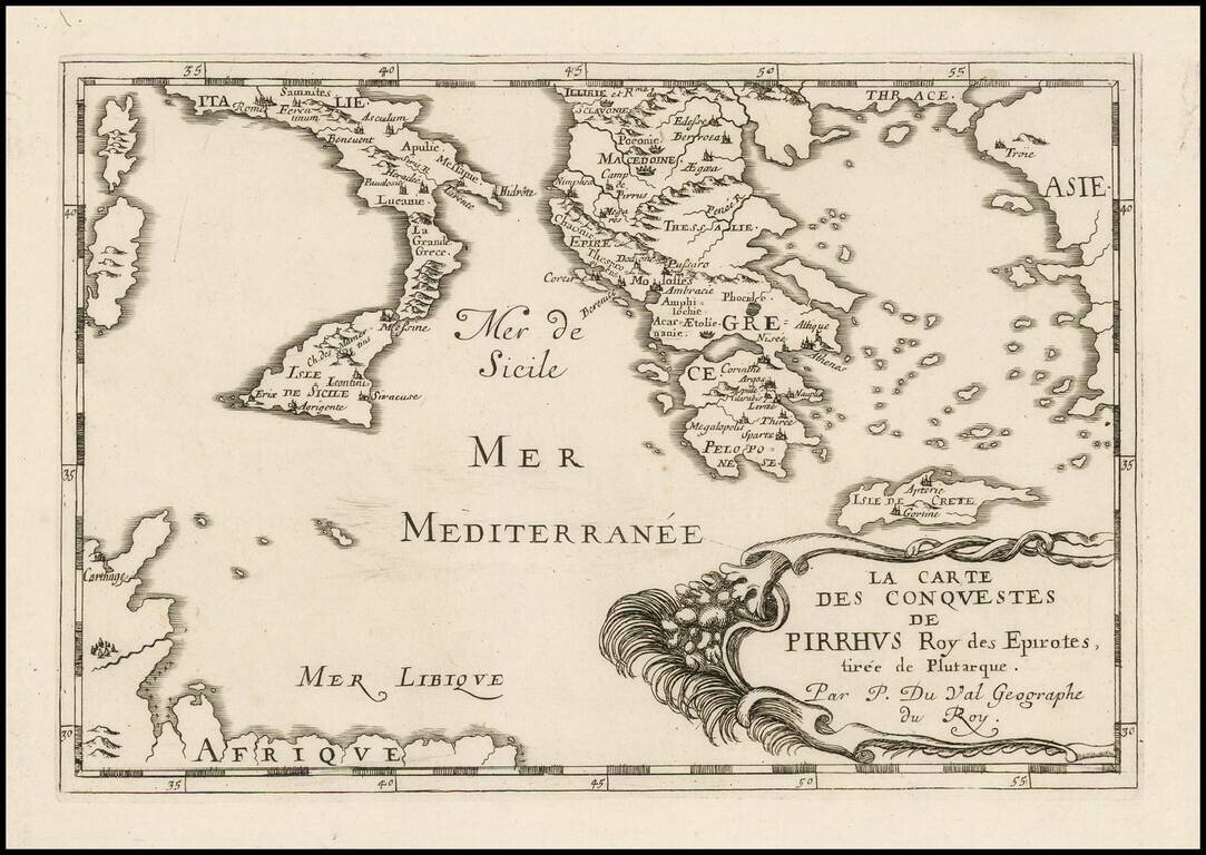
Antique engraved map of the conquests of Pyrrhus of Epirus, covering Greece, Southern Italy, and Sicily. The map was published in Paris in 1660 by Pierre Du Val.
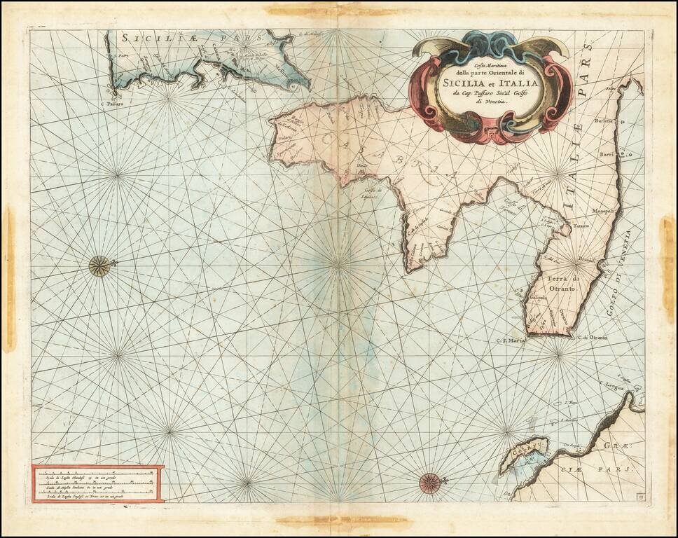
Fine chart of the Mediterranean coastline Southern Italy and southern part of Sicily, which appeared in Volume 1 of Coronelli's Corso Geographico, published in Venice. The sea chart would appear to be the chart originally issued in 1663 by Francesco...
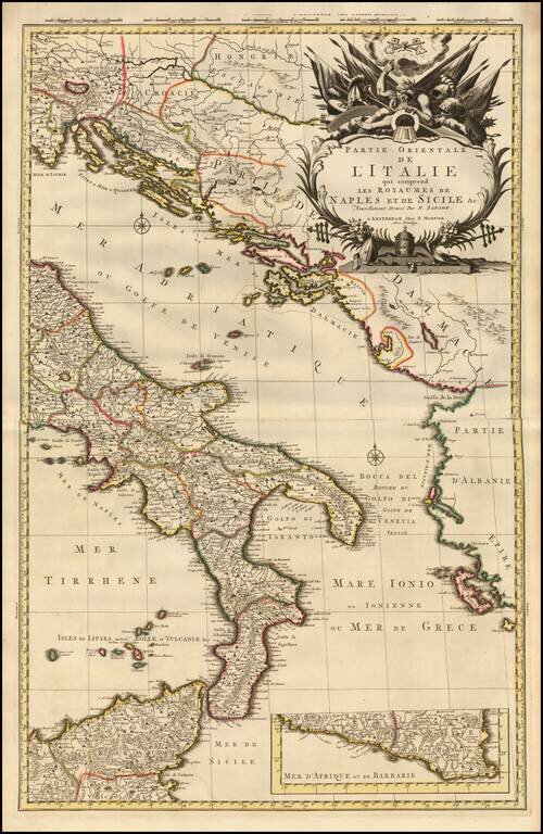
A fine example of Pieter Mortier's map of Eastern Italy which includes the Kingdoms of Naples and Sicily. The map details the surrounding areas of Italy such as the Dalmatian Islands in the Adriatic, the Aeolian Islands north of Sicily in the...
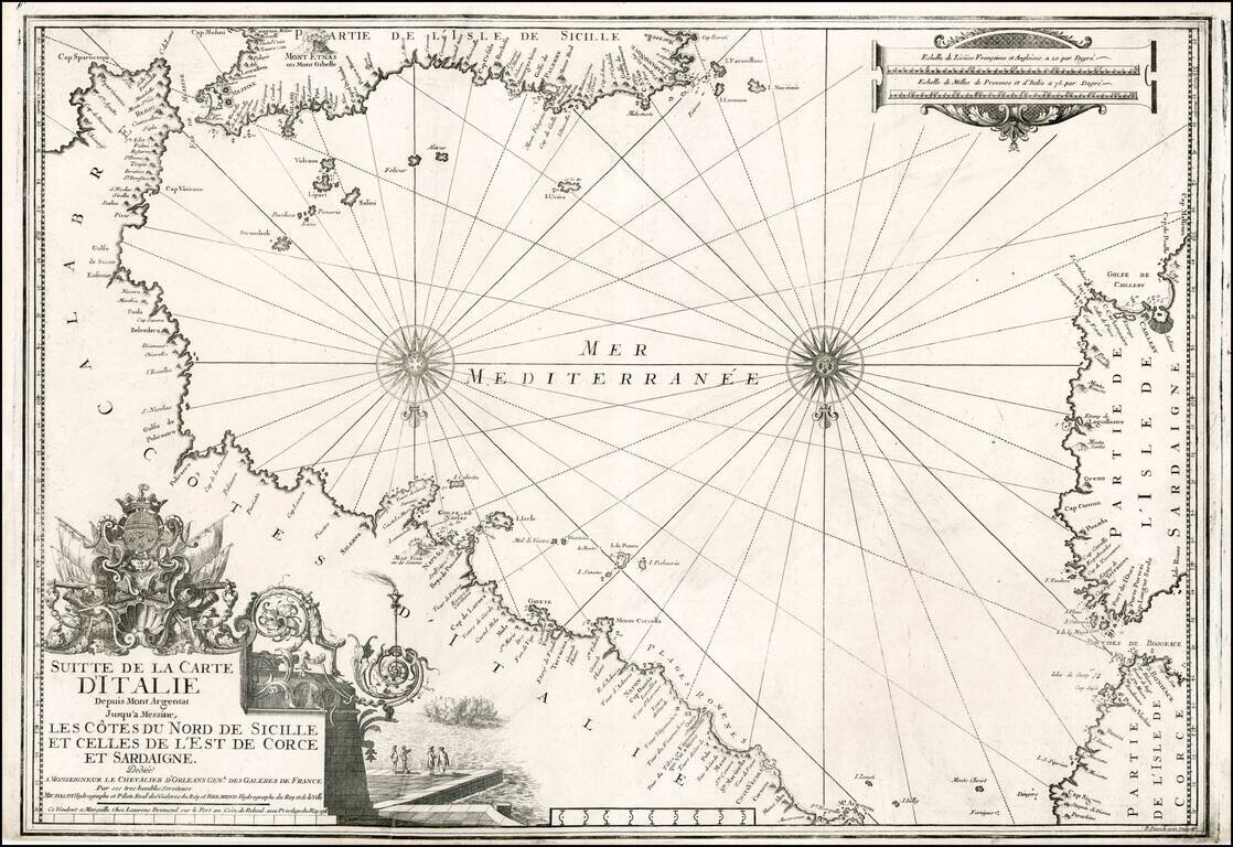
Striking chart of the Southern Italian Mediterranean coastline, from Mt. Argentate and Plages Romenes to the south tip of Calabria, north coast of Sicily, east coat of Sardinia and southeast coast of Corsica. Nice example of this scarce chart, one of...
Decorative map of Sicily with title cartouche and ornate picture frame border surrounding the map. Shows counties, towns, rivers, lakes, islands, etc. Nice example of a deluxe edition of Brion's maps, which were also offered with plain borders.
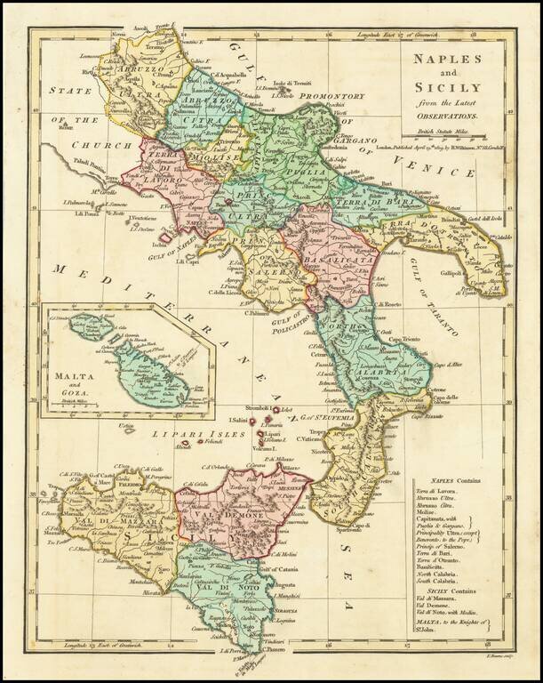
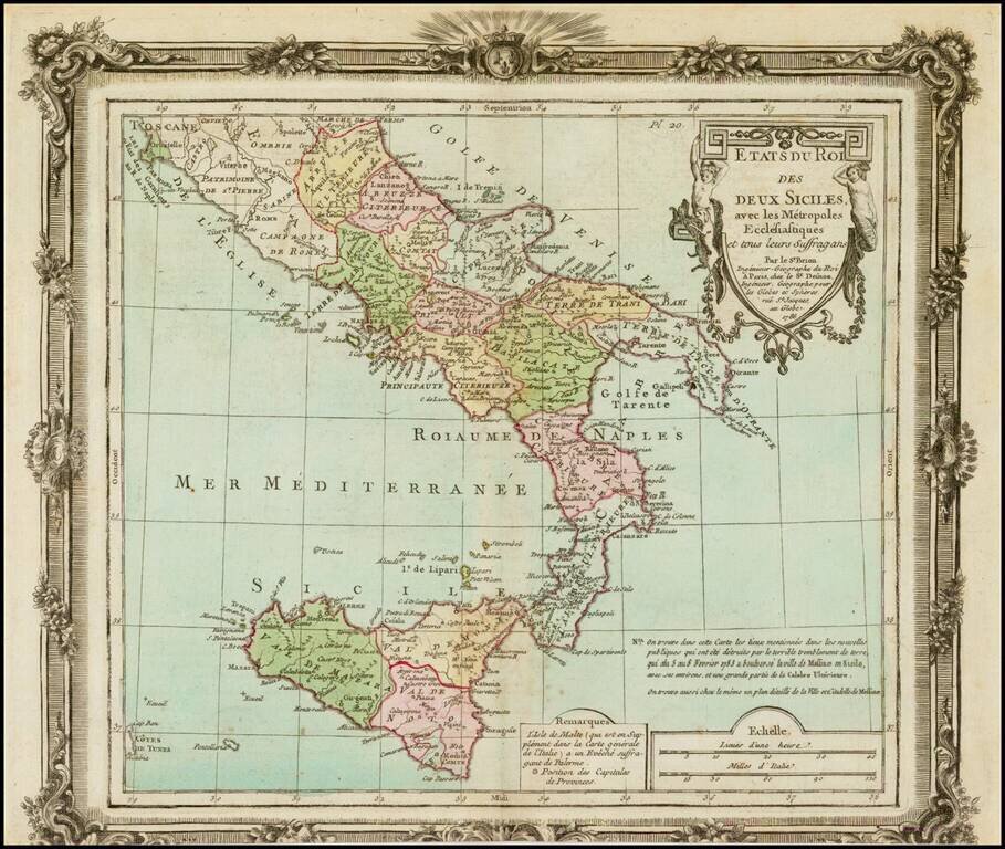
Excellent map of Southern Italy and Sicily extending North to Abruzzo Ultra, Citra and Terra Di Lavorao and showing all of Sicily. Nice detailed inset of Malta and Goza. Includes a number of place names and is colored by kingdoms. Large key shows the...
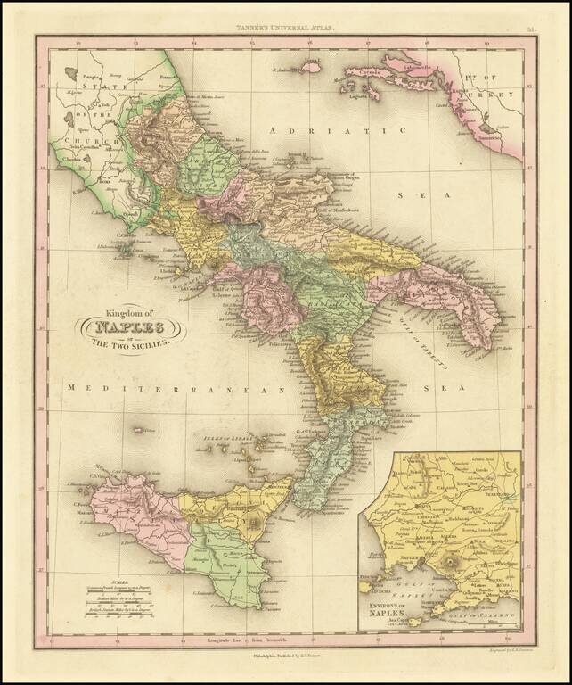
Interesting map of Naples and Sicily, divided into regions. Shows towns, rivers, roads, lakes, mountains, volcanoes, islands, bays, etc. Large inset of the Naples region. This map is from an early edition of Tanner's New Universal Atlas, first issued...
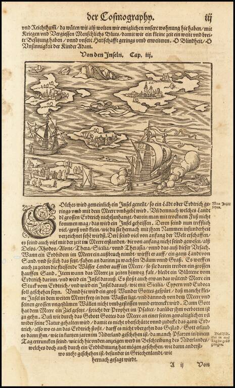
Fascinating map of a ship in the Mediterranean. Islansd mentioned in the text include Sicily, Rhodes, Delos, Alone, and Thera.
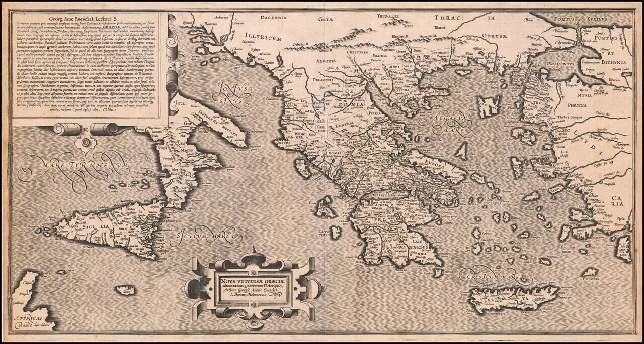
Extremely rare 16th Century map of the "New Greek Universe," by George Achatz von Eneneckel. The map extends from Sicliy and Puglia to the western coast of Asia minor, the regions controlled by the Ancient Greeks. This is the first time we have ever...