
![[Taprobana] Duodecima Asie Tabula](/map/small/58553.jpg)
Sri Lanka, As Known To The Greeks Fine old color example of this remarkable early map of Taprobana (Sri Lanka), from the 1486 Ulm edition of Ptolemy's Geographia. The map is drawn from the work of Nicolas Germanicus, whose manuscript maps were...
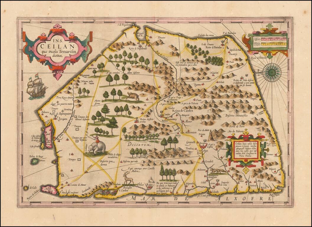
Finely colored example of Ceylon (Sri Lanka), from an early edition of the Mercator Hondius Atlas. The map is oriented with east at the top and includes elephants, gazelles and other animals, sailing ships, compass roses and 3 cartouches. The map...
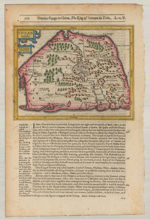
Striking early map of Ceylan with decorative cartouche. From the 1625-26 edition of Purchas His Pilgrims, one of the seminal early 17th Century English Language travel works. On a 13 x 9 inch sheet with English text, front and back.
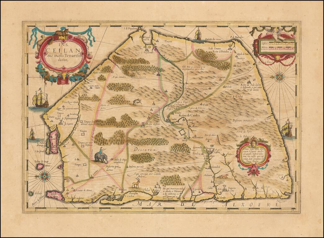
Nice example of Hondius's double-page engraved map of Ceylon (Sri Lanka), from the Mercator Hondius Atlas. The map is oriented with east at the top and includes elephants, gazelles and other animals, sailing ships, compass roses and 3 cartouches. A...
![[Sri Lanka] Insula Zeilan olim Taprobana nunc incolis Tenarisim](/map/small/59295.jpg)
Decorative map of Sri Lanka, published in the later editions of Jansson's atlas. A striking image, with a decorative title cartouche and scale of miles held aloft by mer-cherubs.
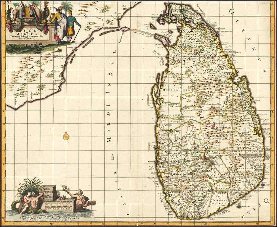
Fine Original Color Rare Johannes de Ram map of Ceilon, one of the most decorative large format maps of Ceilon of the period. The island is shown in remarkable detail, along with the contiguous coast of India. Two large allegorical cartouches. The...
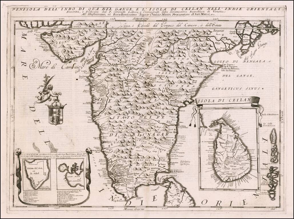
Striking example of Coronelli's detailed map of the Indian Peninsula, from Guzarate to the Ganges. Fine large format map, with detailed topographical features. The map shows India below the Tropic of Cancer, with an insets of Ceylon and Trincomalee.
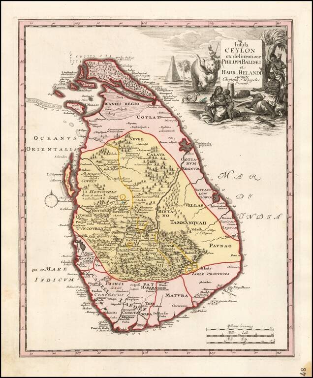
Rare modern map of Sri Lanka (Ceylon), published by Weigel in Nuremberg. The map credits Philips Baelde and Adrian Reland. Philips Baelde or Father Philippus Baldaeus was a Dutch minister. He went to Jaffna during the Dutch period in Ceylon with an...
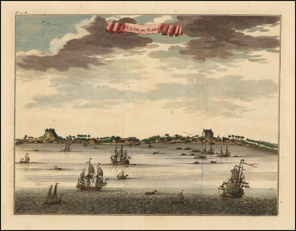
Fine early view of Colombo, Sri Lanka, including a number of buildings along the coast and the Indian Ocean teeming with vessels. Francois Valentijn Francois Valentijn was born in 1666 in Dordrecht, Holland, but spent significant time in the tropics,...
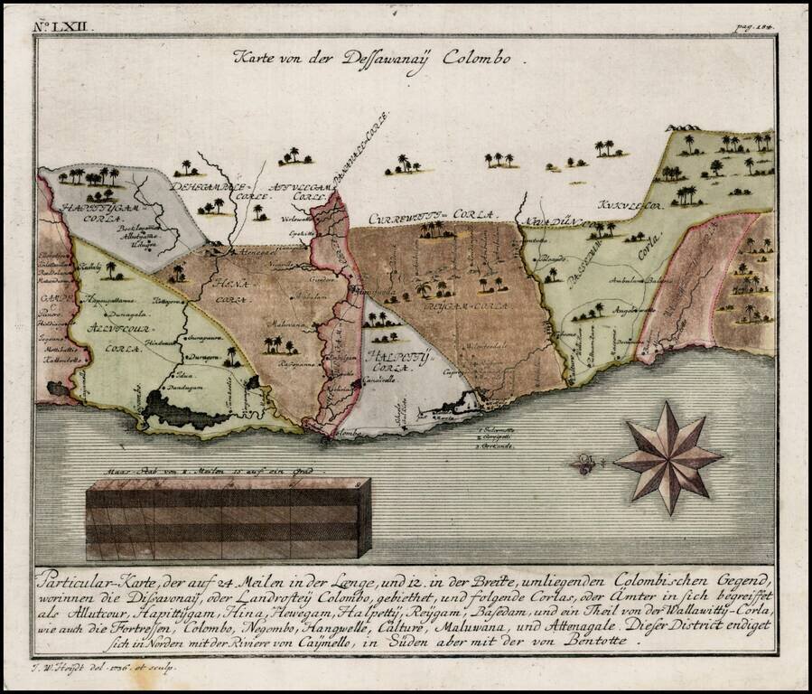
Detailed map of the Colombo region of Sri Lanka, from Heydt's Allerneuester Geographisch- und Topographischer Schau-Platz von Africa und Ost-Indie.
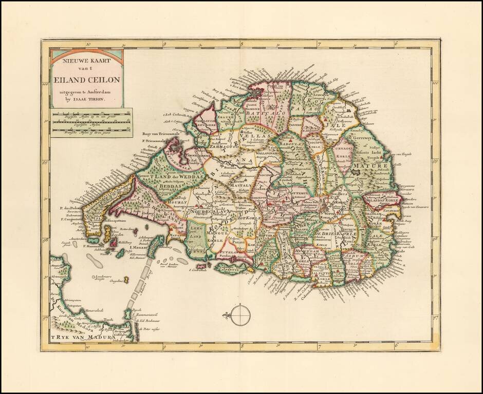
Striking example of Issak Tirion's map of Sri Lanka. Excellent and highly detailed map for the period.
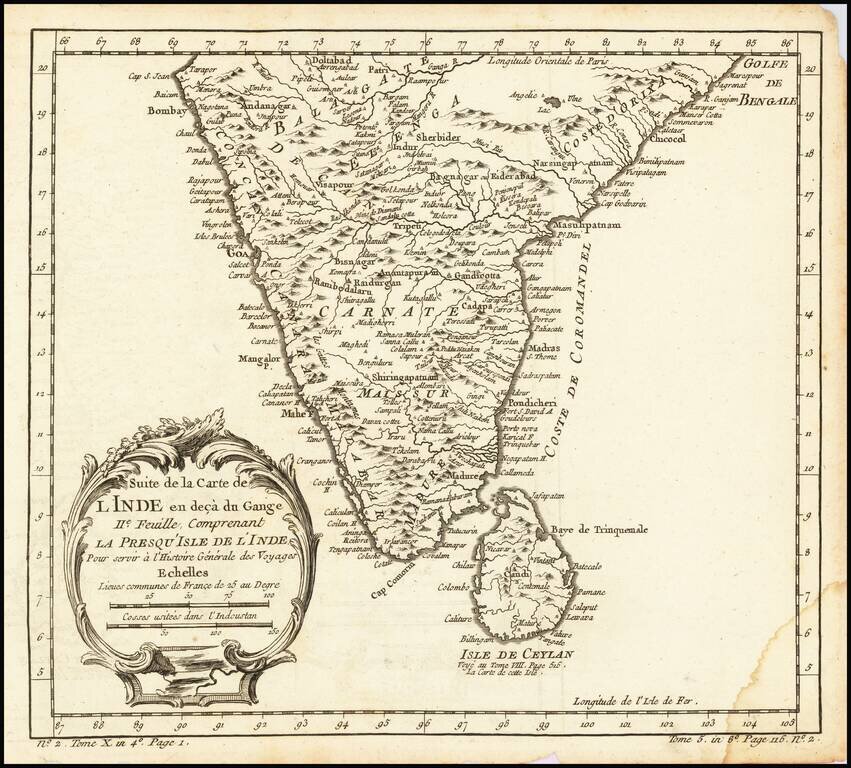
Interesting regional map of Southern India and Ceylon (Sri Lanka). A wonderfully detailed map. Includes a large decorative title cartouche. One of the maps produced by Nichlas Bellin for Prevost d'Exiles influential travel book, L'Histoire Generale...
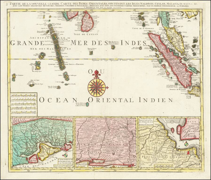
Finely detailed regional map depicting Singapore, Ceylon, the Maldive Islands, Sumatra, Southern Malaysia, etc. Remarkably detailed this map is highly decorative as well.
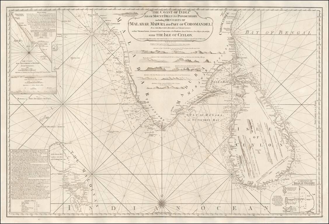
A Rare English Sea Chart of Ceylon and Southern India Fine East India Company Sea Chart, covering the southern part of India and the island of Ceylon (Sri Lanka), published in London by Laurie & Whittle. The chart was published separately and in...
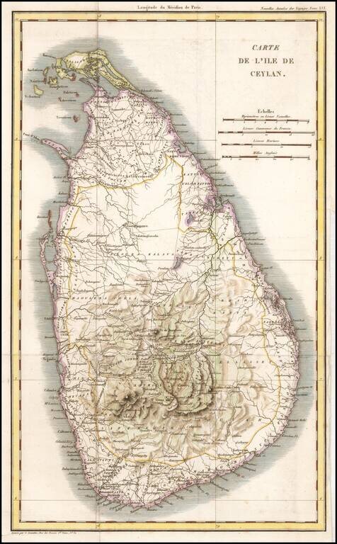
Rare French map of Ceylon, from the Celebrated Nouvelles Annales des Voyages . Engraved folding map from volume XVI of the Nouvelles Annales des Voyages, an important French serial issued throughout the first half of the 19th century, describing...
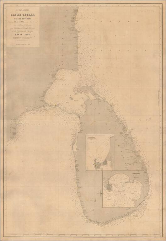
A Rare Large Chart of Sri Lanka Scarce large format sea chart of Sri Lanka and the adjacent coast of India with inset maps of the harbors at Colombo and Galle. Detail is confined to the coastlines, and includes soundings, navigational hazards and...