
![[Vietnam & Cambodia] Carte Generale de la Basse Cochinchine et du Cambodge Levee en 1861-62-63-64 par M.M. L. Manen F. Vidalin, et G. Heraud, Sous-Ingenieurs hydrographes de la Marine. Publiee Par Ordre de L'Empereur . . . 1867](/map/small/58643.jpg)
The First Large Format Map of French Cochinchina Rare separately published map of the southern part of Vietnam and Cambodia, centered on the Mekong Delta and River. The map extends from the coast and the area around Ho Chi Minh City (Saigon) to the...
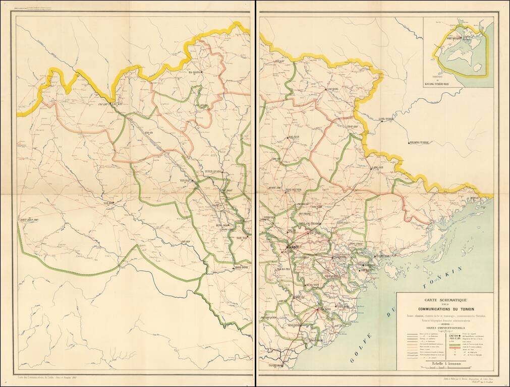
Northern Vietnamese Telegraph Railroad and Postal Map From the French Colonial Period A fine and extremely rare schematic map, emphasizing the means of communication within French Colonial Vietnam. The map is exceptionally detailed, focusing on the...
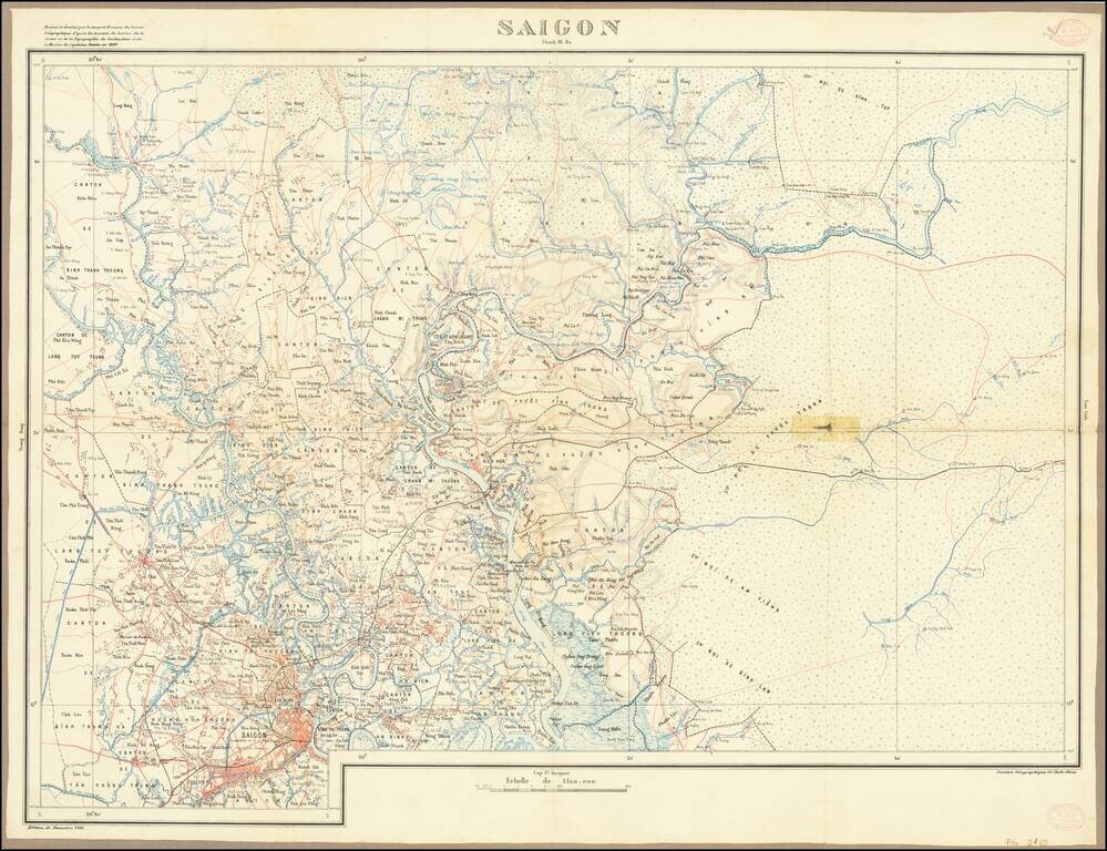
Attractive color-lithographed map of Saigon (now Ho Chi Minh City) and the region to the north and east. This map is characteristic of the exacting cartography produced during the French colonial administration of Vietnam and includes much information...
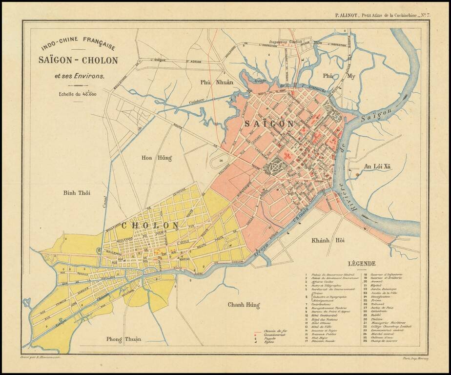
Finely executed plan of Saigon, today known as Ho Chi Minh City, on the eve of renowned French architect Ernest Hébrard's grand revisions to Saigon's urban landscape in the early 1920s. The map appeared in the Petit Atlas de la Cochinchine The map...
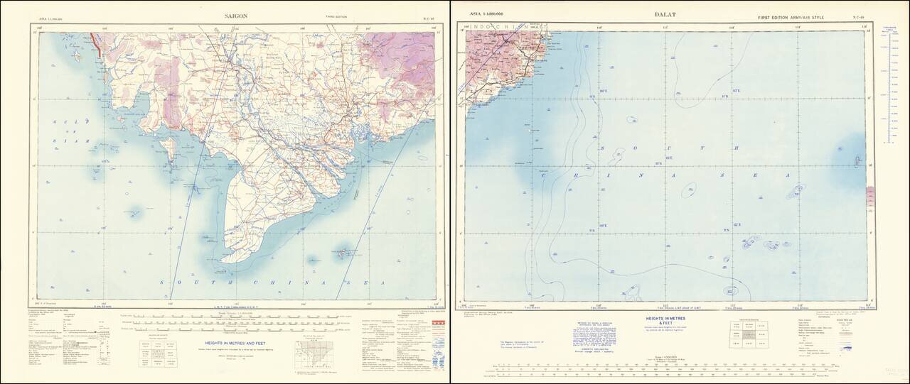
Southern Vietnam at the beginning of the First Indochina War. Scarce World War Two-era map of southern Vietnam, the Saigon region, the Mekong River delta, and adjacent parts of the South China Sea. The Saigon sheet credits the Survey of India 1944...
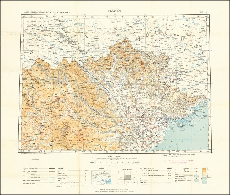
Detailed map of the area around Hanoi, Vietnam, published by the Service Geographique de l'Indochine. The map includes topographical details, as well as information on: Railway & Stations Tramways Automobile Roads Other motor roads Trails...
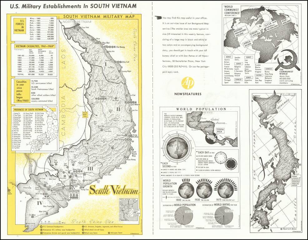
A fascinating image of South Vietnam, a decade into American involvement in the region. The main portion of the map focuses on the US military establishments in the country. Command headquarters, helicopter bases, navy bases, and other points of...