logo

1904. Saigon Chanh Mi Ha

  • Saigon Chanh Mi Ha

Map size in jpg-format: 69.2054MiB

Download "Saigon Chanh Mi Ha", in high resolution.

Saigon Chanh Mi Ha information:

Year of creation: 
Resolution size (pixels): 
 19234x14787 px
Disk Size: 
 69.2054MiB
Number of pages: 
 1
Place: 
 n.p. (Hanoi?)

Print information. Print size (Width x height in inches):
Printing at 72 dpi 
  267.14 х 205.38
Printing at 150 dpi 
 128.23 х 98.58
Printing at 300 dpi 
 64.11 х 49.29

An example of detailing the file of this map of in a printable high-resolution:

Click to open in high resolution (open in new tab).
Attention! this is just the central piece (central area 960x960 px) of the map file!
This is an example, so that you can see and study the level of detail of a given map. The entire Map will be fully available after payment!

Saigon Chanh Mi Ha

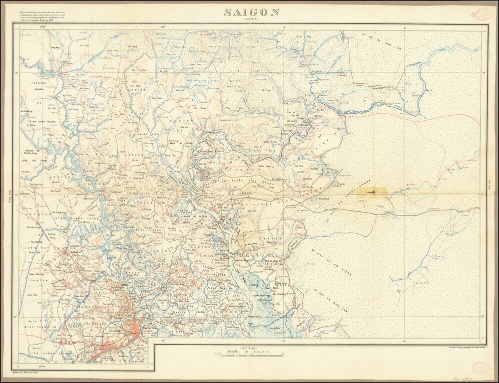
Attractive color-lithographed map of Saigon (now Ho Chi Minh City) and the region to the north and east.

This map is characteristic of the exacting cartography produced during the French colonial administration of Vietnam and includes much information about the built-up urban areas, small hamlets, railroad and road networks, and topography and toponymy.


Special conditions for students!

If you are a student, write to us in telegram: @antiquemaps and indicate what material you need and for what work you need a map in high detail. We are ready to provide material on special terms. For students only!

Item information:

Year of creation:
Size:
19234x14787 px
Disk:
69.2054MiB
Number of pages:
1
Place:
n.p. (Hanoi?)
Author:
Service Geographique de l'Indo-Chine.
$14.99

Related item