
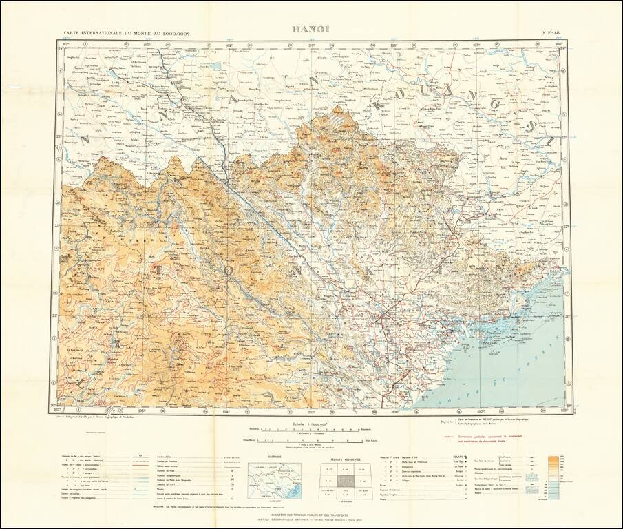
Detailed map of the area around Hanoi, Vietnam, published by the Service Geographique de l'Indochine. The map includes topographical details, as well as information on: Railway & Stations Tramways Automobile Roads Other motor roads Trails...
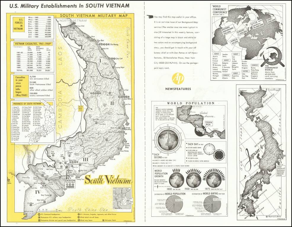
A fascinating image of South Vietnam, a decade into American involvement in the region. The main portion of the map focuses on the US military establishments in the country. Command headquarters, helicopter bases, navy bases, and other points of...
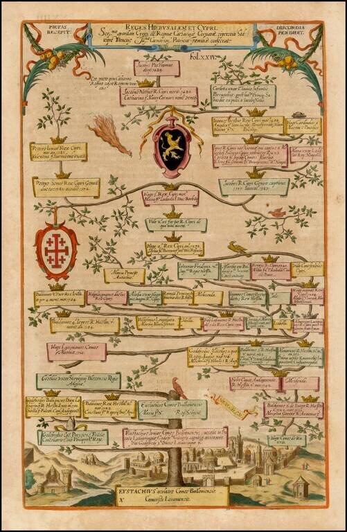
Decorative family tree showing the geneology, beginning with Eustachius, with the City of Jerusalem in the background.
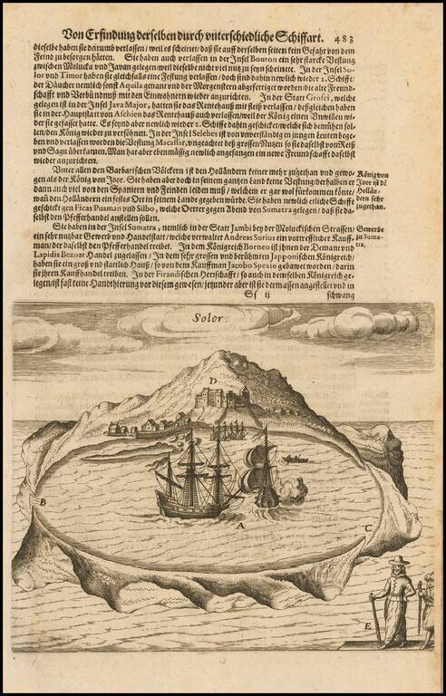
Early view of the Island of Solor in the Sunda Islands of Indonesia, from De Bry's Grand Voyages, an illustrated collection of accounts of the Americas which defined the early European picture of the New World. Around 1570, Theodorus de Bry, a...
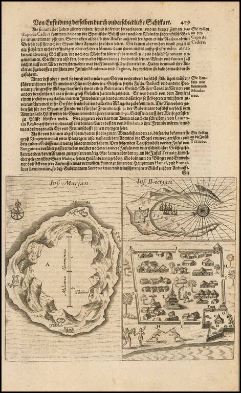
Early view of two islands in the Moluccas, from De Bry's Grand Voyages, an illustrated collection of accounts of the Americas which defined the early European picture of the New World. Around 1570, Theodorus de Bry, a Protestant, fled religious...
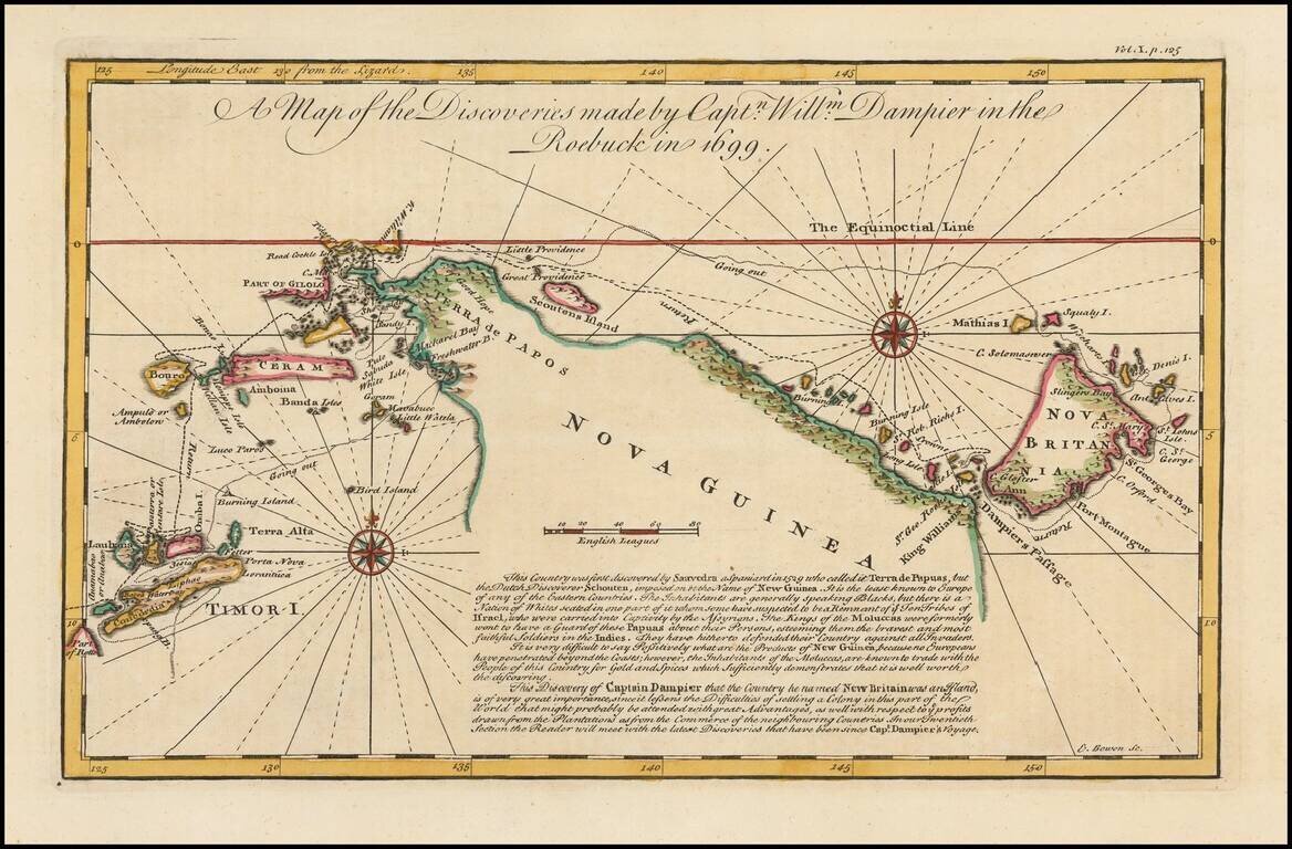
Detailed map of New Guinea as seen by William Dampier, first man to circumnavigate the world three times and first naturalist afloat This is a map of William Dampier's tracts aboard the Roebuck in 1699, included in the re-issue of John Harris'...
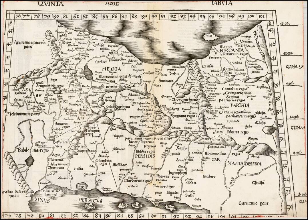
Martin Waldseemuller's important early map of Persia, Armenia and the region between the Caspian Sea to the Persian Gulf. Wood block map of Persia from Martin Waldseemüller's 1513 edition of Ptolemy, a landmark work that contributed to major advances...
![[Armenia and Caspian Region] Tabula III Asiae](/map/small/50935.jpg)
Marvelous map of Armenia and the regions between the Black Sea, Caspian Sea and the Caucus Mountains. Lorenz (Laurent) Fries was born in Alsace in about 1490. He studied medicine, apparently spending time at the universities of Pavia, Piacenza,...
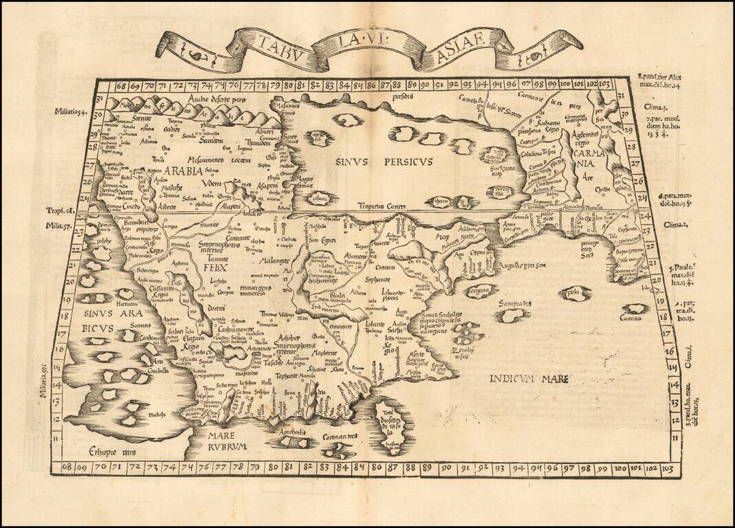
Rare 1525 Map of the Arabian Peninsula and Environs. Nice example of the 1525 edition of Lorenz Fries map of the Arabian Peninsula, Sinus Persicus and adjoining regions. Important early map of the Middle East, from the 1535 edition of Lorenz Fries'...
![Tabula VIII Asiae [Central Asia] (Title on Verso)](/map/small/50940.jpg)
Gorgeous Ptolemaic map of Central Asia and Tartary and Western China, from Lorenz Fries' edition of Ptolemy's Geographia. This map is largely based on the 1513 map by Waldseemuller.

Fine example of De Jode's modern map of the Middle East, from his Speculum Orbis Terrae, published in Antwerp in 1578 and engraved by Joannes & Lucas Van Deutecum. The complete title reads: Secundae partis Asiae: typus qua oculis subijciuntur...
Detailed early map of Persia, including the Caspian Sea, parts of Arabia and Northwestern India, from this scarce 16th Century mapmaker. The map is based upon Gastaldi's modern map of Persia, as copied by Ortelius.
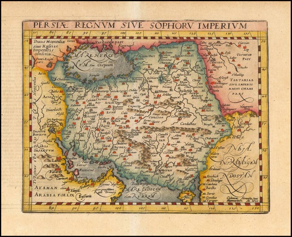
Nice colored example of Jansson's map of Persia. The map extends from the Eastern Mediterranian to Tacalistan and the Indus River and the Dalanguer Mountains and the Cabul Region, with the Red Sea and the Persian Gulf in the South and Caspian and...
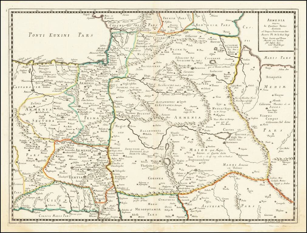
Ancient Armenia Scarce and highly detailed map of Ancient Armenia by De La Rue. One of the earliest printed maps to focus on Armenia.
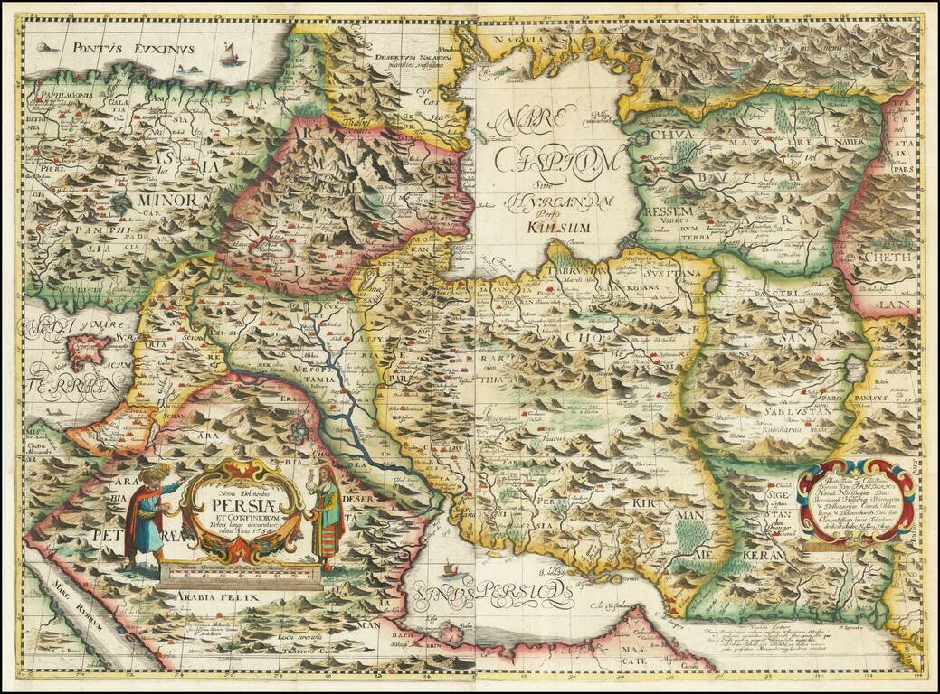
The First Realistic Map of Iran Highly important regional map of the Persian Empire, published by Adam Olearius in 1656.. Olearus' map represents a milestone in the cartographic history of the mapping of Persia and most notably its treatment of the...
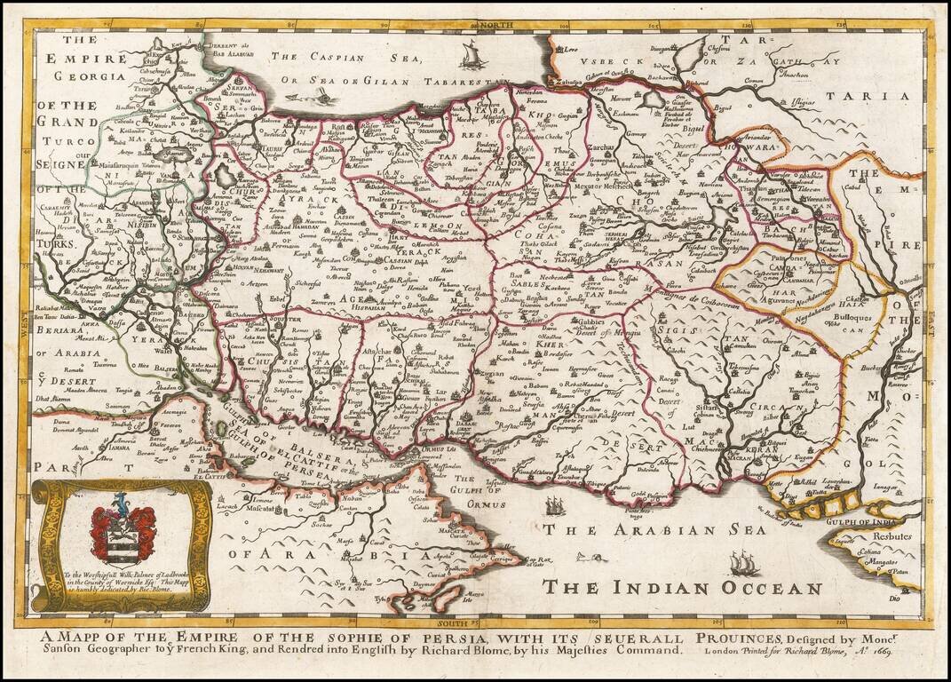
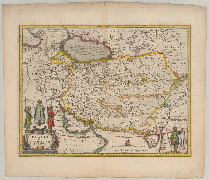
A striking dark impression of Richard Blome's scarce map of Persia, the earliest folio sized map of the region to be engraved in England. The map demonstrates the naïve engraving style characteristic of 17th century English engravers, and features an...