
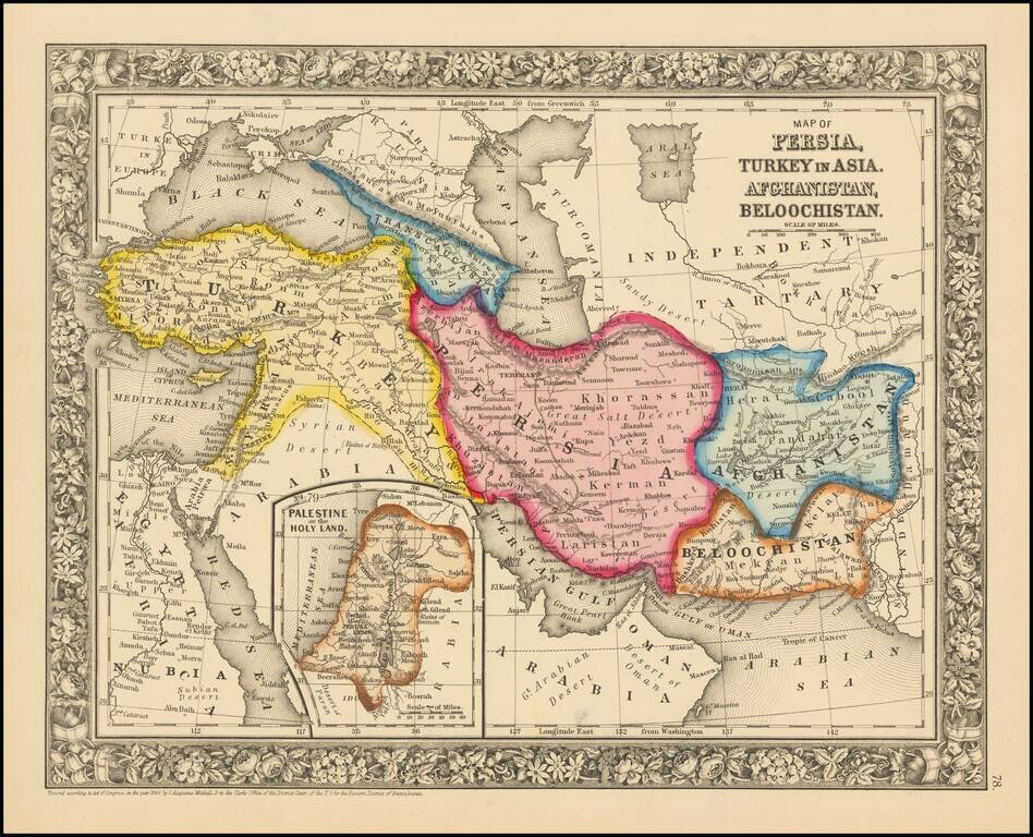
Attractive map centered on Persia and extending from Turkey and the Black Sea to Afghanistan and Beloochistan. Colored by countries Shows towns, tribes, roads, rivers, mountains, lakes, etc.
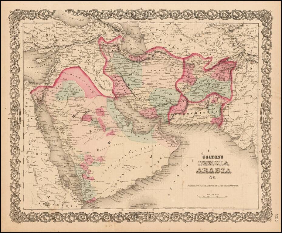
Detailed map of the Middle East, colored by Tribes, etc. Shows towns, roads, deserts, rivers, lakes, mountains, islands, etc. A terrific regional map, from JH Colton, one of the most prolific American mapmakers of the mid-19th Century.
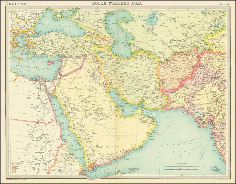
Detailed regional map of the Middle East and environs, from the Times London Atlas. "El Qatar" is shown, as is Doha. Further to the east, Abu Dhabi, Sharja, Ras el Kheimah, and Debai (Dubai) are shown in Trucial Oman.
![Le Guerre du Petrole [Caspian Sea and Northern Iran]](/map/small/63437.jpg)
Interesting map of the Caspian Sea, western Iran, Armenia, Azerbaijan, Georgia, and Eastern Iraq, illustrating the so-called "Guerre du Petrole" (Petroleum War). The map focuses on the growing importance of the Middle East and the Caucasus to global...
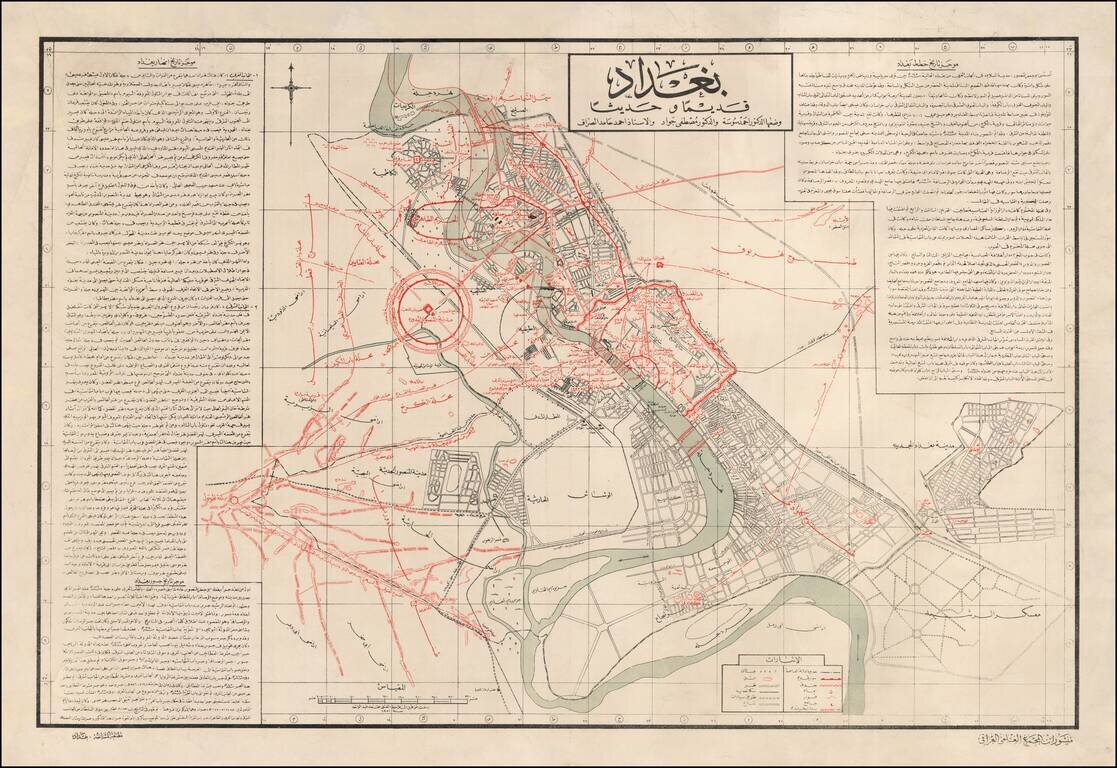
Historical Map of Baghdad by the Iraqi Academy of Science and Famed Iraqi Scholar Mustafa Jawad Fine map describing the early and modern history of Baghdad, with richly detailed text produced by Iraq’s top scholars and a focus on the changing course...
![[Armenia] [Published in Fresno!]](/map/small/68443.jpg)
Fresno, California Imprint! -- Striking and Informative Brochure Map of Armenia Celebrating Armenian History and Culture Fine map of Armenia SSR by a noted Armenian printer and scholar. The central map shows Armenia’s borders as it existed under...
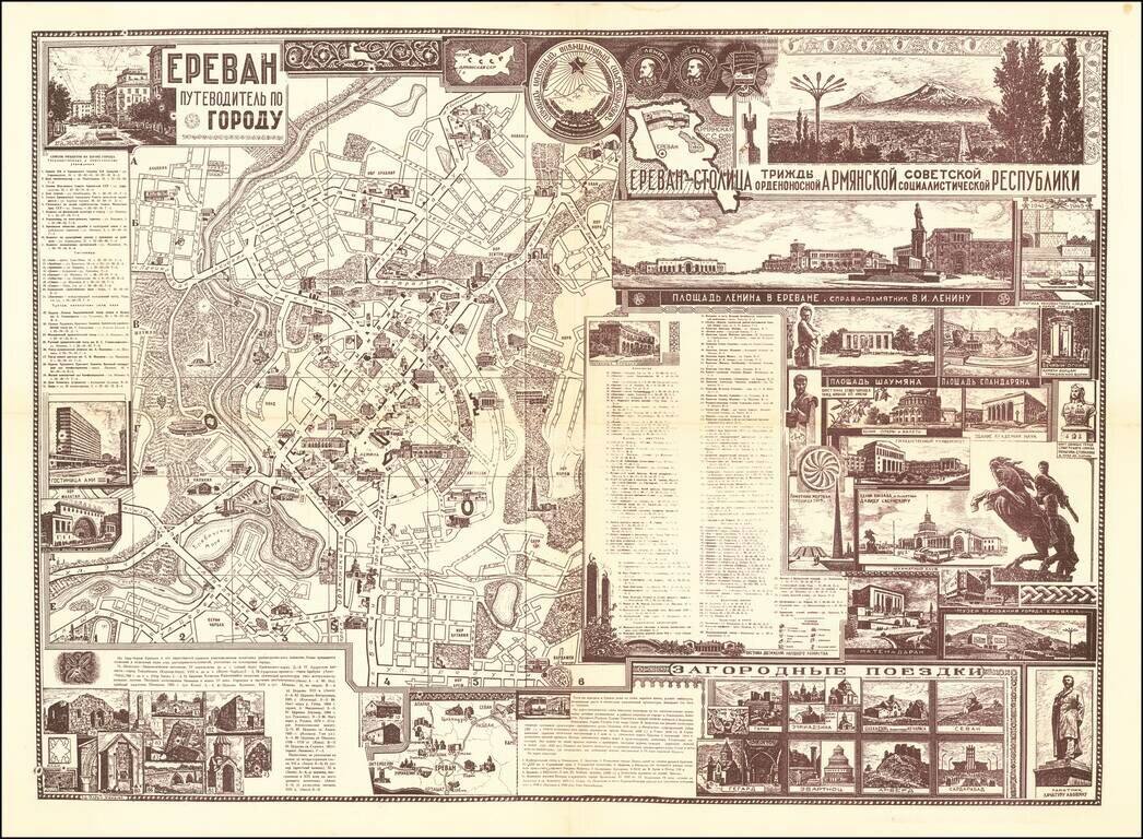
A rare and highly attractive double-sided sheet featuring a map and city guide to Yerevan, the Armenian capital, issued in Russian Cyrillic with original graphics in a mélange of mid-century Soviet-style and traditional Armenian motifs, executed by...
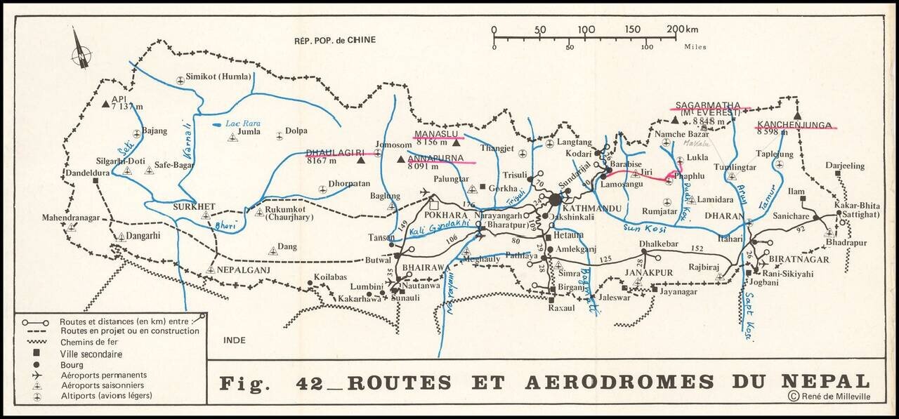
Scarce chart showing the routes and airports in Nepal, with numerous additional routes drawn in and named by a prior owner. Kathmandu appears at the low center, with a number of permanent and seasonal airports and landing strips noted, along with...
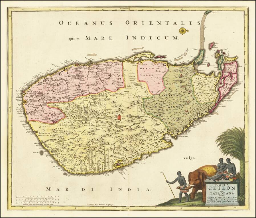
Fine large format map of Sri Lanka, first published in Amsterdam by Nicolas Visscher. One of the largest atlas maps of Sri Lanka, with a striking cartouche, embellished with an elephant and local Sri Lankans.
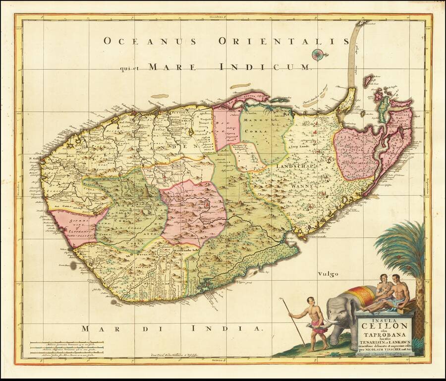
Fine large format map of Sri Lanka, first published in Amsterdam first published by Nicolas Visscher and later re-issued by Schenk. One of the largest atlas maps of Sri Lanka, with a striking cartouche, embellished with an elephant and local Sri...
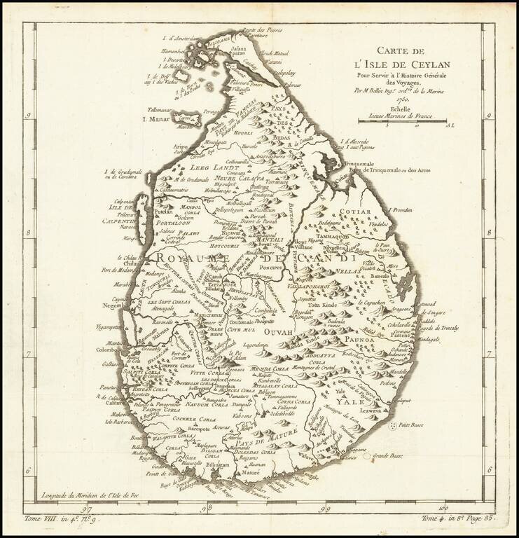
Finely engraved map of Sri Lanka, from Jacques Nicolas Bellin's Le Petit Atlas Maritime Recueti de Cartes et Plans des Quatre Parlies du Monde en Cinq Volumes, first published in Paris in 1764. Jacques Nicolas Bellin Jacques Nicolas Bellin...
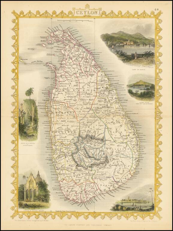
Striking full color example of the John Tallis map of Ceylon. Decorative vignettes of Lake of Kandy, Adams Peak from the Lake of Colorado, Temple of Buddha Kalany and the Ruins of the Dagora at Toopharamaya. Engraved for R. Montgomery Martin's...
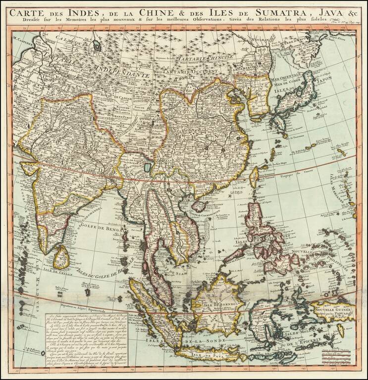
Names the Sea of Korea A large and very detailed map of East Asia, from India and the Indian Ocean in the west to Japan, Korea, and the Philippines. Place names are extensive on this map, both on land and at sea. French text at the bottom describes...
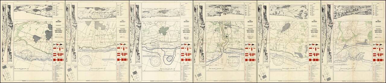
A Complete Set of TOP SECRET Landing Maps For Okinawa Produced in the Lead Up to the Invasion. Six color-printed sheets (of six, i.e., complete), showing all of the American landing beaches on Okinawa. Each sheet is composed of ten frames: the...
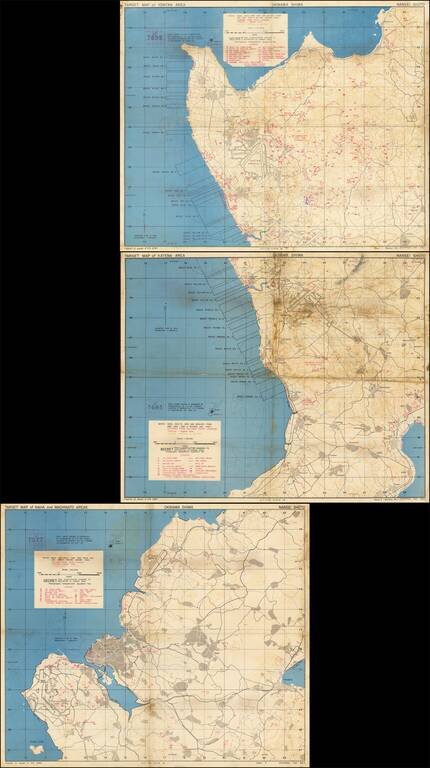
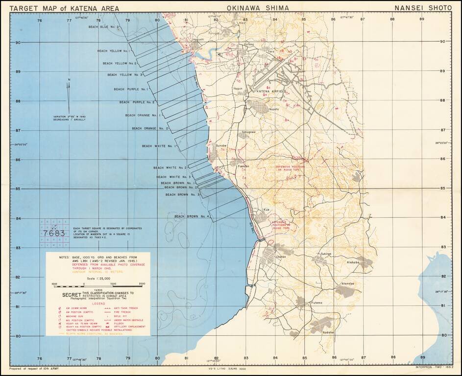
Immediate Pre-Invasion, SECRET Map Set Showing the Landing Beaches and Defenses on Okinawa. Fantastic set of three color-printed maps (the complete set) "prepared at the request of 10th ARMY" showing the west coast of Okinawa and the extent of the...
Immediate Pre-Invasion, SECRET Map Showing the Landing Beaches (Blue No. 2 through Brown No. 4) and Defenses on Okinawa. Fantastic color-printed map "prepared at the request of 10th ARMY" showing the west coast of Okinawa and the extent of the U.S....