
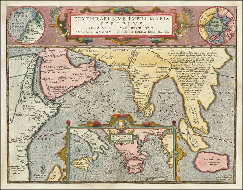
Fine Ortelius Map of the Indian Ocean Linking Mythical, Ancient, and Contemporary Exploration Striking historical map of the Indian Ocean and contiguous regions of the Middle East, India and Southeast Asia, published by Ortelius in his Parergon. This...
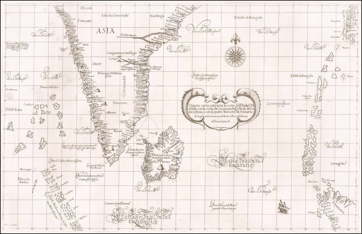
First state of Robert Dudley's rare sea chart of India, Sri Lanka, the Maldives, northwestern Sumatra, the Andaman Islands, the Nicobar Islands and a part of Pegu (Myanmar). The chart is an elegant engraving by Antonio Francesco Lucini, with a Baroque...
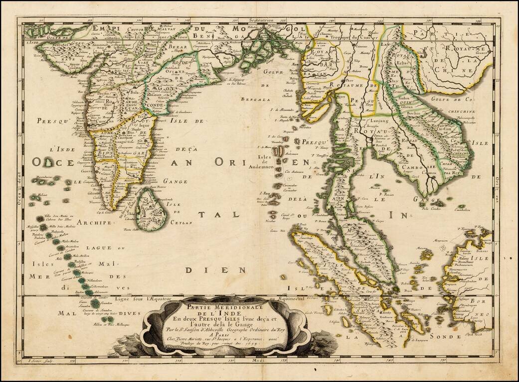
Nice example of this important early map of India and Southeast Asia from Pierre Du Val, the main rival to Nicolas Sanson among French mapmakers of the 17th century. First published in 1654 and issued separately, then included in Sanson's Atlas Les...
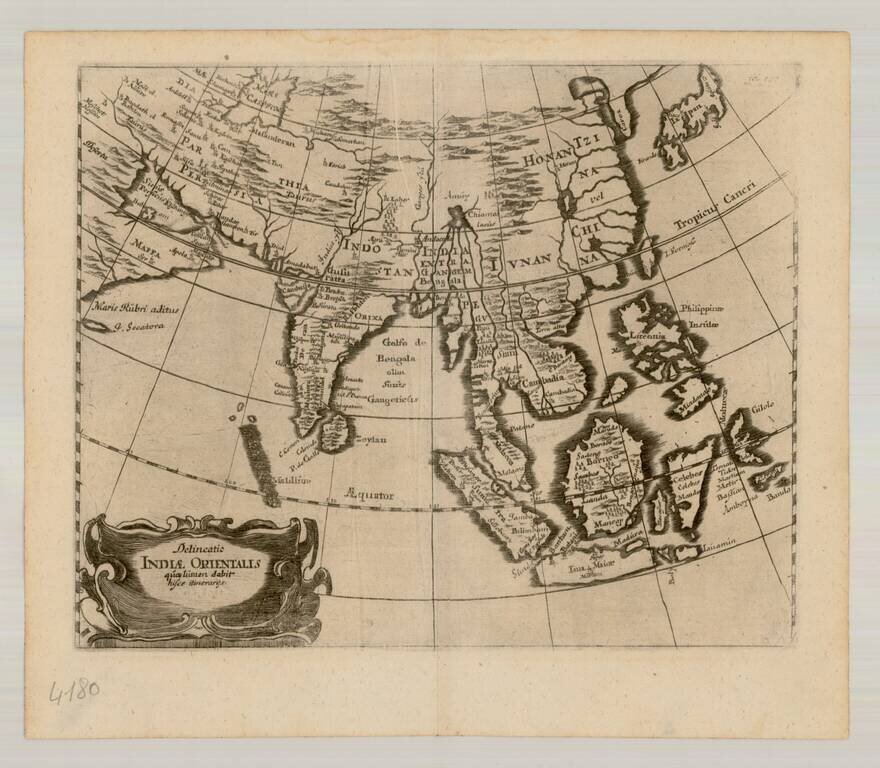
Scarce map of East Asia and the Indian Ocean, extending from Japan and Korea to the Caspian Sea and the Persian Gulf. The map is centered on the Indian Ocean.
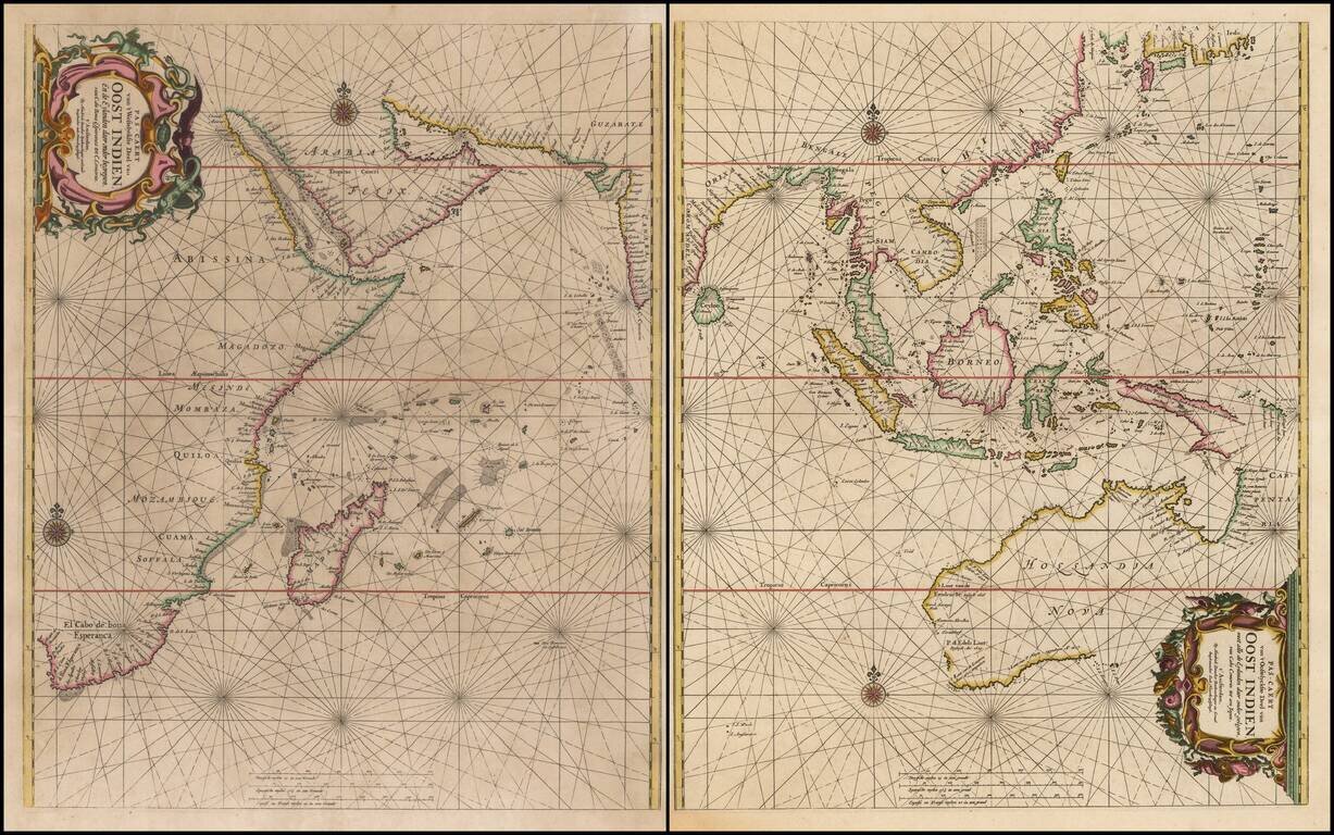
Rare Sea Chart of Australia, Southeast Asia, and the Indian Ocean from the Dutch Golden Age of Cartography Early pair of sea charts of the Indian Ocean and contiguous regions. Australia is remarkably delineated for this early date and reflects recent...
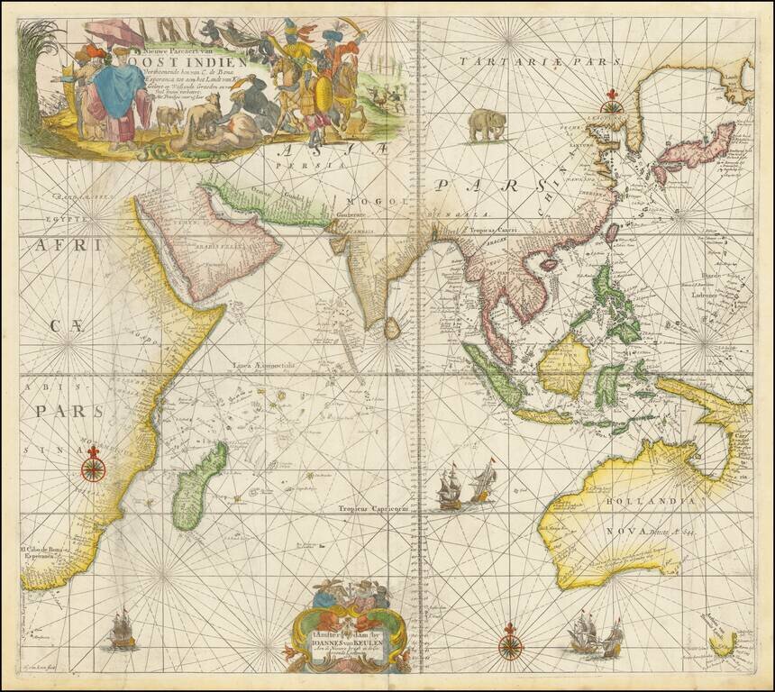
A Rare Dutch Chart of Southeast Asia, Australia, and the Indian Ocean A beautiful example of this rare sea chart of the Indian Ocean, Australia, etc., published in Amsterdam by Johannes Van Keulen. The chart appeared in Van Keulen's rare Maritime...
![Carte Particuliere d'une Partie d'Asie ou sont Les Isles D'Andemaon, Ceylan, Les Maldives . . . [with] Partie Occidentale d'une D'Asie ou sont les Isles De Zocotora De l'Amirante . . .](/map/small/66433.jpg)
Fine Chart of the Indian Ocean from the Mortier issue of the Neptune Francois Striking old-color example of the first edition of Pierre Mortier's fine, two-sheet map of the Indian Ocean and contiguous regions, first published in 1700. Both were...
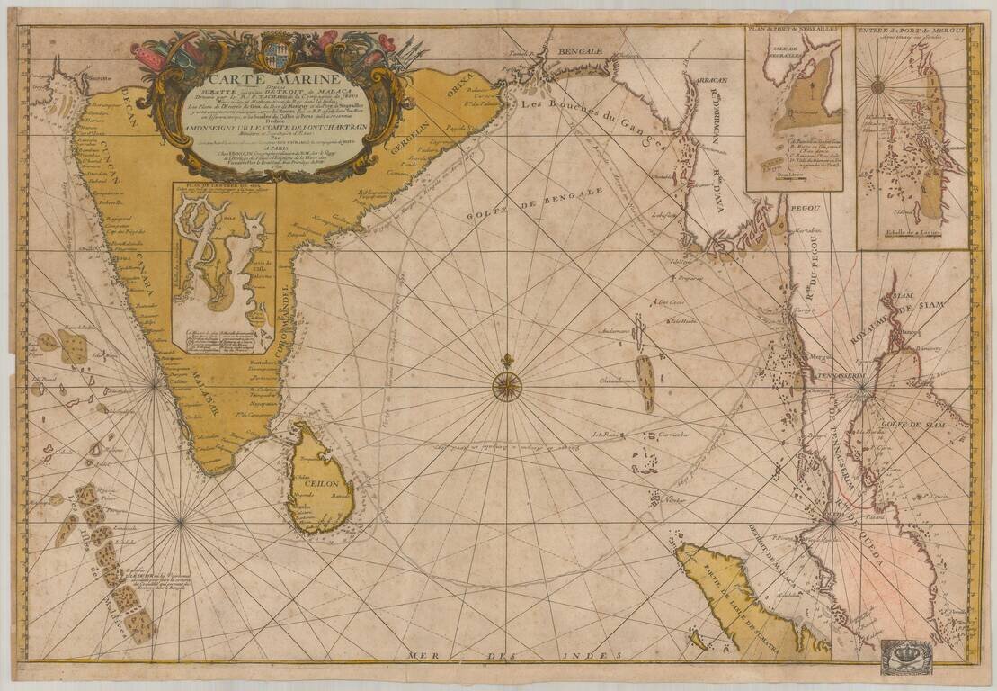
Old color example of this important chart of the Indian Ocean, illustrating the route of the Jesuit priest Guy Tachcard in 1697. The present example bears the bookplate (bottom right) of the Prussian Royal Academy of Sciences ( Königlich-Preußische...
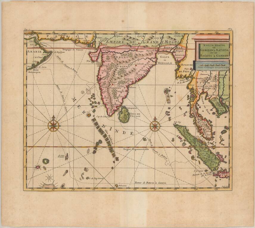
Fine example of the Cornelis De Bruyn map of the Indian Ocean, showing his route from Gamron (modern Bandar Abas) to Batavia (Jakarta). The map shows India and Indochina, including Sumatra and Thailand (Siam). The cities of Bombay and Calcutta are...
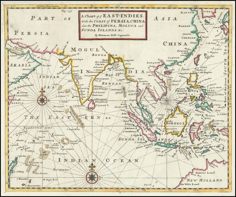
Detailed map of the Indian Ocean, Southeast Asia, China, Formosa, the Philippines and part of Australia. A classic example of Moll's fine engraving work. The map shows various sea routes, prevailing currents and other interesting features. The map...
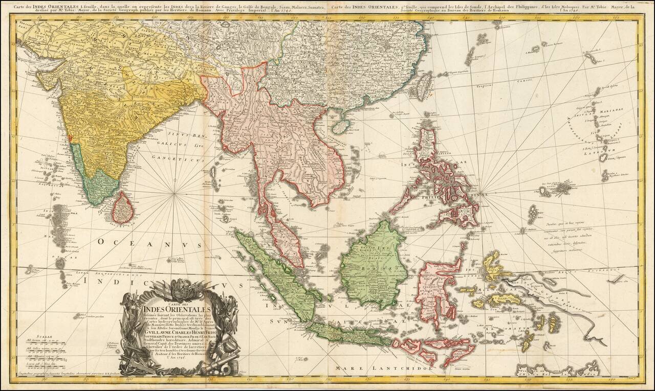
Highly detailed map of the region between India and the Philippines, centered on the Malaysian Peninsula. Extends north to China. Includes rhumblines and a highly ornate cartouche.
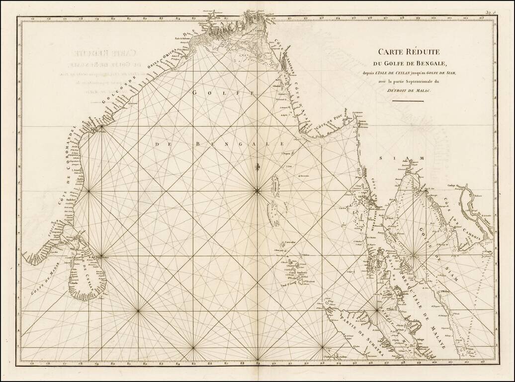
Fine sea chart from Mannevillette's Le Neptune Oriental, first published in 1775. Important early sea chart showing the coastlines of India, Ceylan, Thailand, Malaysia, Sumatra, Cambodia and Vietnam. Jean Baptiste Nicolas Denis D'Apres de...
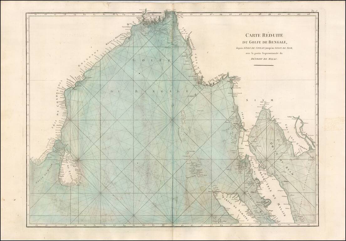
Fine sea chart from Mannevillette's Le Neptune Oriental, first published in 1775. Important early sea chart showing the coastlines of India, Ceylan, Thailand, Malaysia, Sumatra, Cambodia and Vietnam. Jean Baptiste Nicolas Denis D'Apres de...
![[Indian Ocean Currents] Carte du Sisteme des courants des Mers de L'Inde dans le tems de la mousson du N.E. au N. de la Ligne. Publiee par Vicomte Grenier en 1776](/map/small/58646.jpg)
Finely illustrated sea chart of a portion of the Indian Ocean, highlighting the direction of the ocean currents and prevailing winds in the region. Important chart illustrating the fastest sailing routes through the region. The present chart is one...
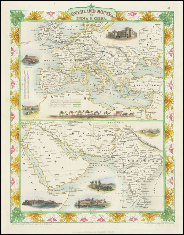
Striking full color example of this fascinating map, showing the various trade routes to Europe, with a larger map of Europe and the Mediterranean at the top, and a detailed regional map of the Middle East and Western India at the bottom. Decorative...
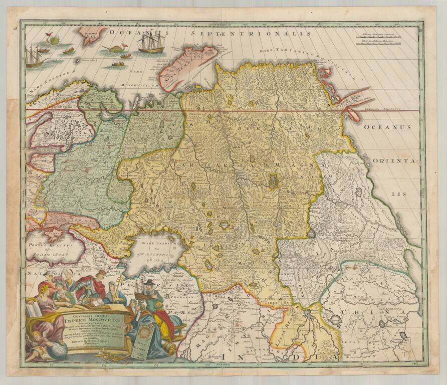
Decorative map of Russia and Central Asia, showing the Northeast Passage. Extends from the Black Sea and th Baltic to Kamchatka, China, Northern India and the mouth of the Indus River. Includes remarkable detail in areas still then not yet explored....