
![[Book with map] Nova Descriptio Geographica Tattariae Magnae tam orientalis (with Das Nord =und Ostliche Theil von Europa und Asia . . . )](/map/small/68134.jpg)
First Edition of Strahlenberg's Seminal Work on Russia, bound with an English Edition of the Map Nice example of the London edition of Strahlenberg's map of Russia, one of the most important maps of Russia published in the 18th century, bound with the...
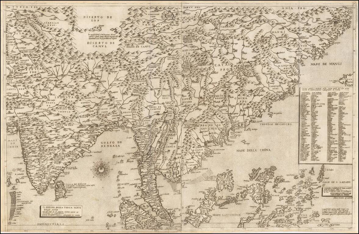
First State of the Most Influential Map of Eastern Asia Published in the Sixteenth Century Rare and highly influential map of India, China, and Southeast Asia by Giacomo Gastaldi, one of the most celebrated Italian cartographers of the sixteenth...
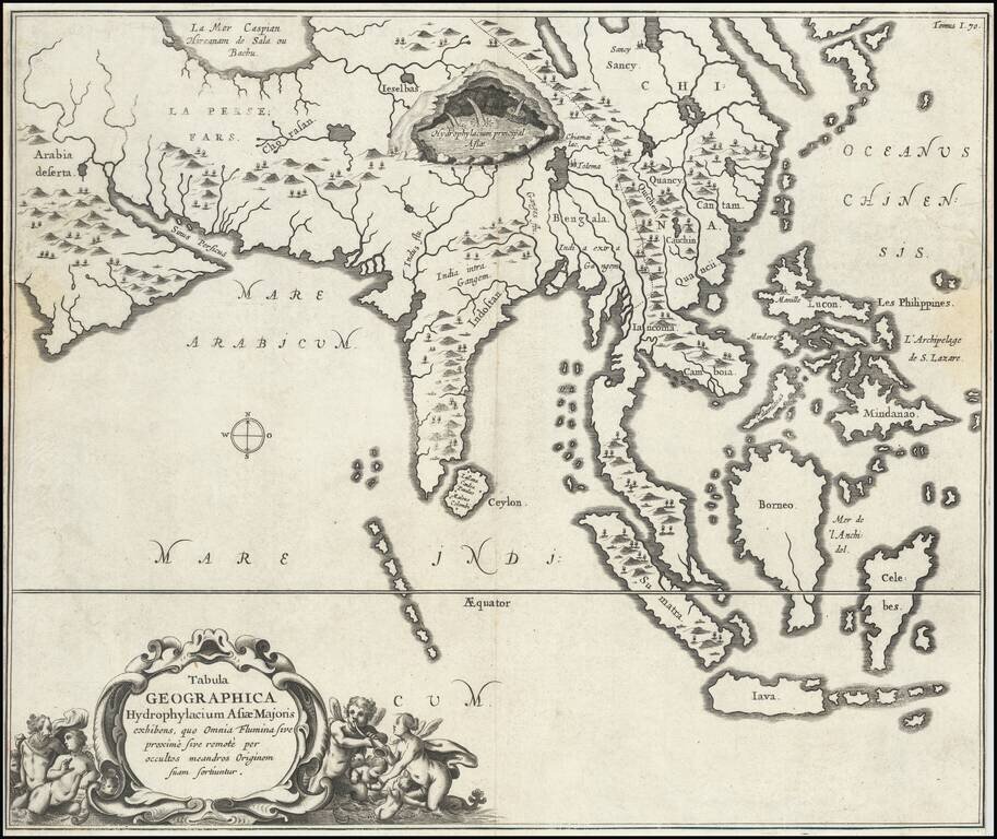
Fine, Distinctive Map of Asia by Polymath Athanasius Kircher Fascinating map of Asia, illustrating the theories of the Jesuit scholar Athanasius Kircher, from his Mundus Subterraneus. It was one of the earliest thematic maps. This very unusual map...
Antique engraved map of Asia, from Persia to China, illustrating various routes of travel across the continent. The map was published in Kircher's China Illustrata in 1667. The sea route from Goa to Macao is depicted. Many overland routes are also...
![Tabula Asiae VII [Iran, Afghanistan, Turkmenistan, Uzbekistan, Kazakhastan, Pakistan, India]](/map/small/60604.jpg)
Nice example of Munster's Ptolemaic map of the region north and east of the Black Sea and the Persian Gulf, extending to the Imaus Mountains. The map is unchanged from the 1540 first edition of this landmark work. Munster's Geographia was a...
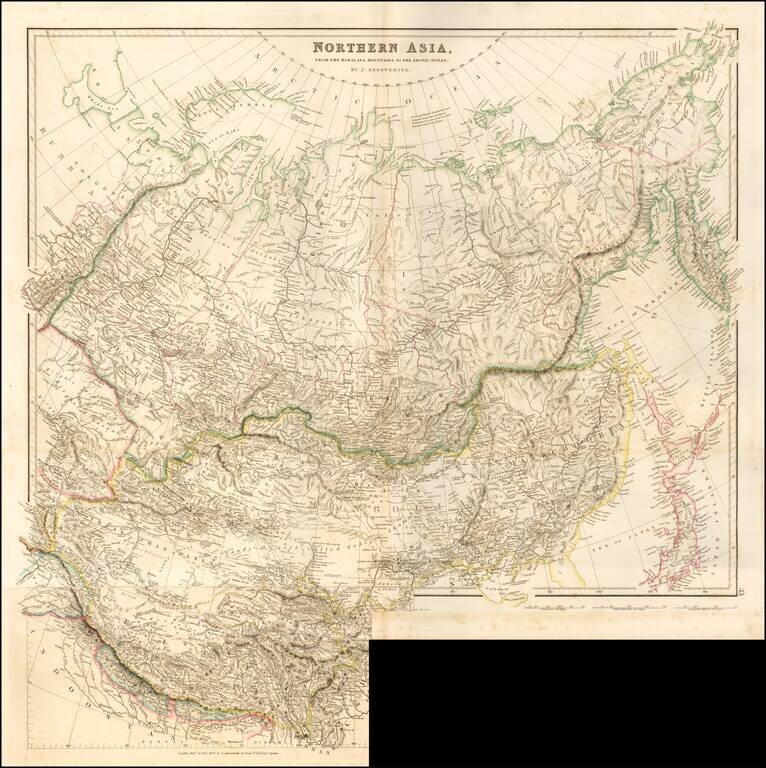
Striking example of Arrowsmith's rare map the region North of the Himalayas. A highly detailed map of Northern Asia, taking in Mongolia, Tibet, Bhutan, Tartary, Siberia and Manchuria. Part of Japan engraved also. The map provides a highly detailed...
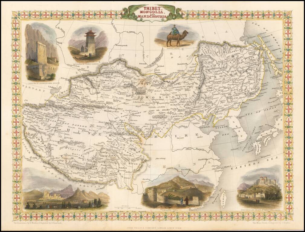
Striking full color example of this marvelous regional map. Extends to Nepal and Lake Balkach. Decorative vignettes of Dwelling of Tessaling Lama, Shigatei, Mausoleum At Teshoo Loom Boo, a Mongol Noble riding a camel, Fortress and Palace of the Dalai...
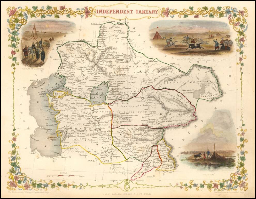
Striking full color map of Tartary, with vignettes of the Bride Chase, Tartars on the journey, and the Tent of those days. Engraved for R. Montgomery Martin's Illustrated Atlas. Tallis was one of the last great decorative map makers. His maps are...
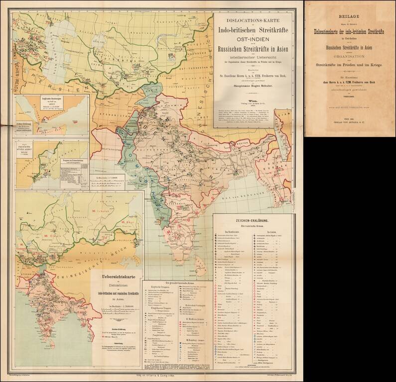
A Comprehensive Map of the Great Game. 4to, original ½ calf over blue paper boards, with original paper title label onlaid. Title, folding table, and large color-lithographed, German-language folding map covering central Asia and India, focusing on...
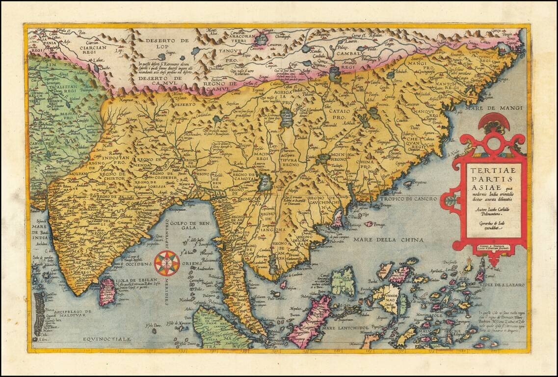
Fine old color example of Gerard De Jode's map of Eastern Asia, published in 1593, Engraved by Joannes and Lucas van Deutecum, who's signature is in the lower left part. De Jode's map is drawn directly from the first (northern) two sheets of Giacomo...
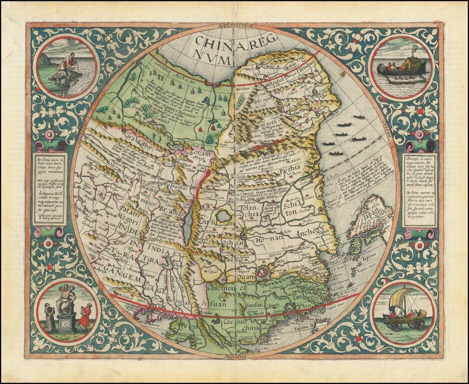
The Rarest and Most Coveted Map of China Published in the Sixteenth Century Striking example of De Jode's map of China, one of the earliest maps of China printed in Europe and the first map to begin to show the emergence of Korea on a printed map....
Fine example of Hondius' map of China and Southeast Asia, from a French edition of the Mercator-Hondius Atlas. One of the finest early Dutch maps of the region, first published in 1606 as one of the 37 new maps engraved for Jodocus Hondius' expanded...
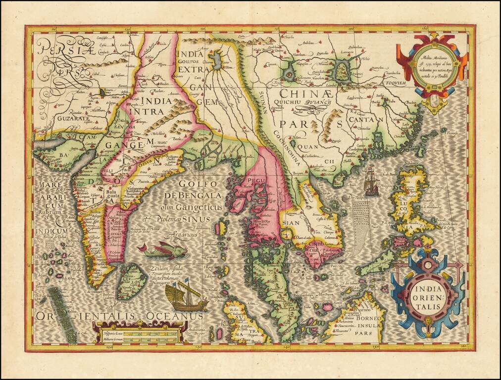
Southeast Asia with an Early Depiction of Northwestern Australia Based on Gerrit Frederikszoon de Witt's Discoveries in 1628 Scarce decorative map of Southeast Asia, China, India, the Philippines and western Oceana, along with the newly discovered...
Southeast Asia with an Early Depiction of Northwestern Australia Based on Gerrit Frederikszoon de Witt's Discoveries in 1628 This is a scarce decorative map of Southeast Asia, China, India, the Philippines, and western Oceania. Perhaps the most...
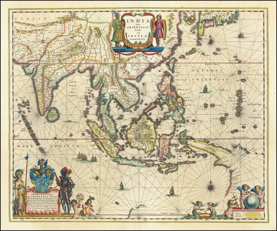
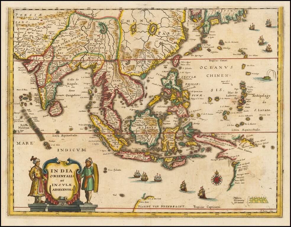
Blaeu's Detailed Map of Southeast Asia Showing Earliest Dutch Voyages to Encounter Australia Wide margined, old color example of Blaeu's map of Southeast Asia, extending from India to Tibet to Japan to New Guinea. The map is richly embellished and is...
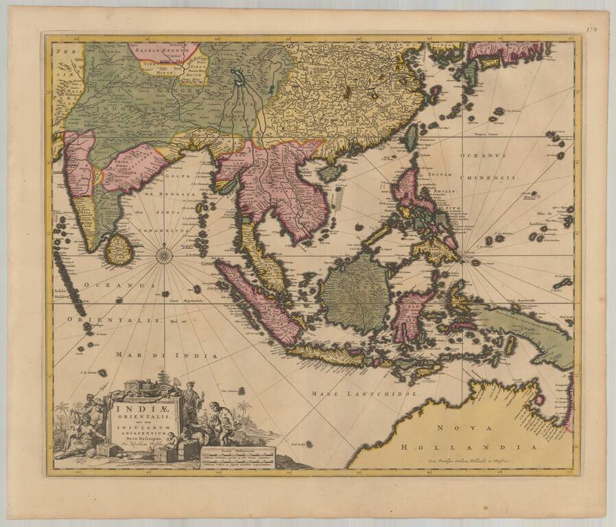
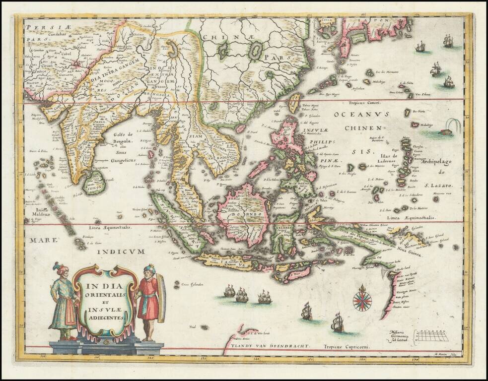
Detailed map of Southeast Asia and the North Coast of Australia, published in Amsterdam by Nicolas Visscher. The map extends from India and the Maldives in the west to New Guinea and the southern coast of Japan in the east, centered on the Stratis of...