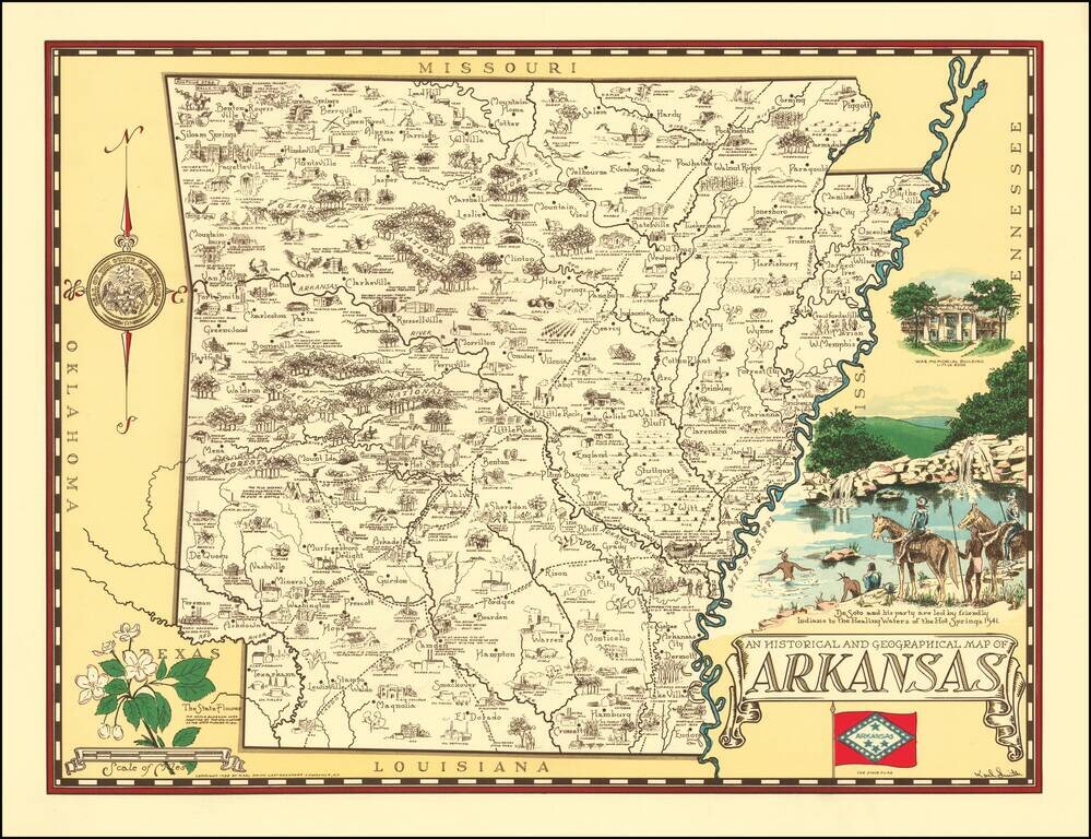
Rare pictorial map of Arkansas, drawn by Karl Smith. The map shows historic sites, locations of significant events, cities and towns, Indian settlements, agricultural products, industry, parks, historical trails, rivers, and recreational activities....

Scarce vintage pictorial map of Kentucky, celebrating the state's agricultural industries, produced by Karl Smith, one of the 1930s' prominent makers of state pictorial maps. The map features an exhaustive list of Kentucky's 120 counties at the time,...
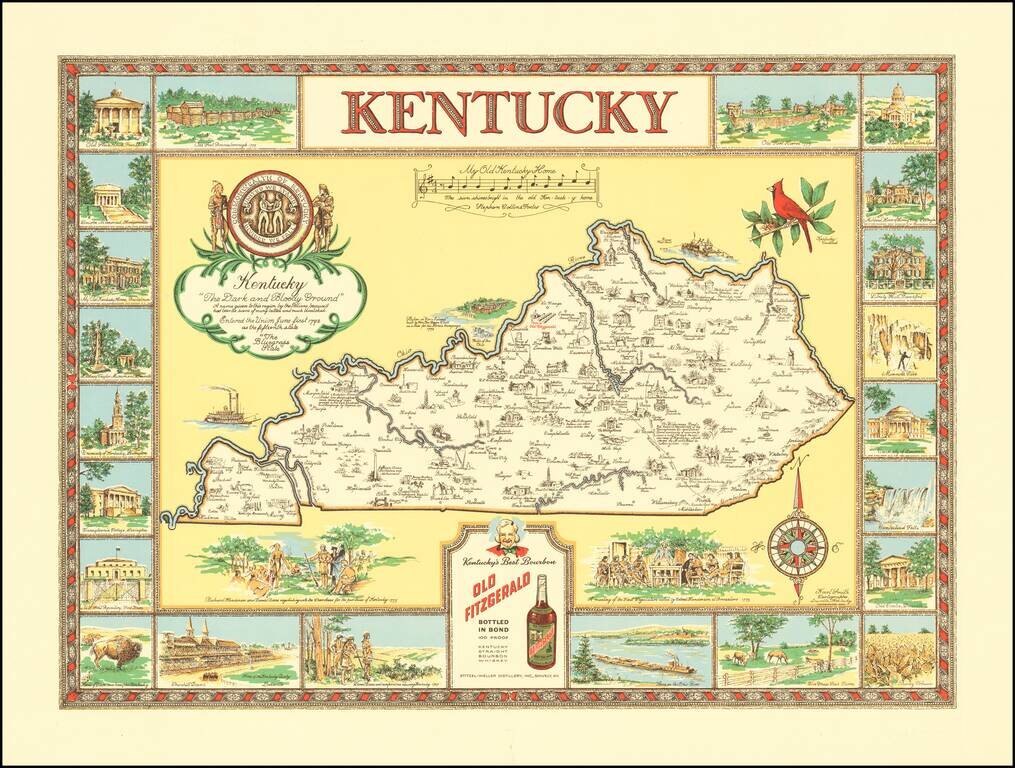
"The Dark and Bloody Ground" Rare pictorial map of the Kentucky, one of a number of different pictorial maps of Kentucky by the prolific illustrator Karl Smith. The map illustraes landmarks and historical events in the decorative panels which make up...
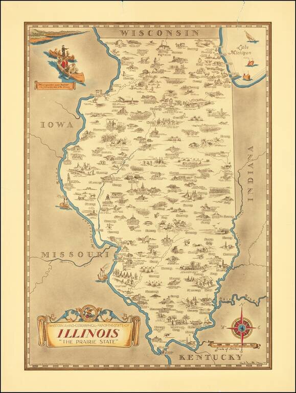
Scarce pictorial map of the Illinois, by the prolific illustrator Karl Smith. The map is filled with historical vignettes, telling the story of Illinois's history. Color vignette on upper left illustrating "Marquette and Jolliet the first white men...