Pieter van der Aa (1659-1733) was a Dutch mapmaker and publisher who printed pirated editions of foreign bestsellers and illustrated books, but is best known for his voluminous output of maps and atlases. Van der Aa was born to a German stonecutter from Holstein. Interestingly, all three van der Aa sons came to be involved in the printing business. Hildebrand was a copper engraver and Boudewyn was a printer.
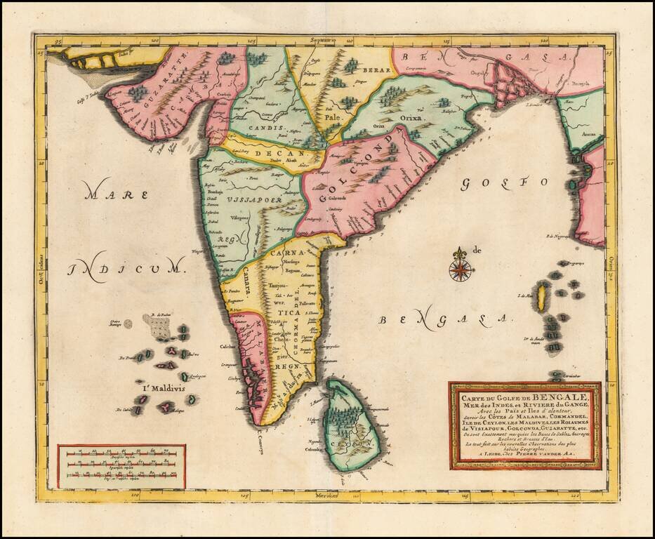
Detailed map of the southern part of India, Sri Lanka and the Maldives, published by Vander Aa in Leiden. The map provides a highly detailed treatment of the region, including topographical details.
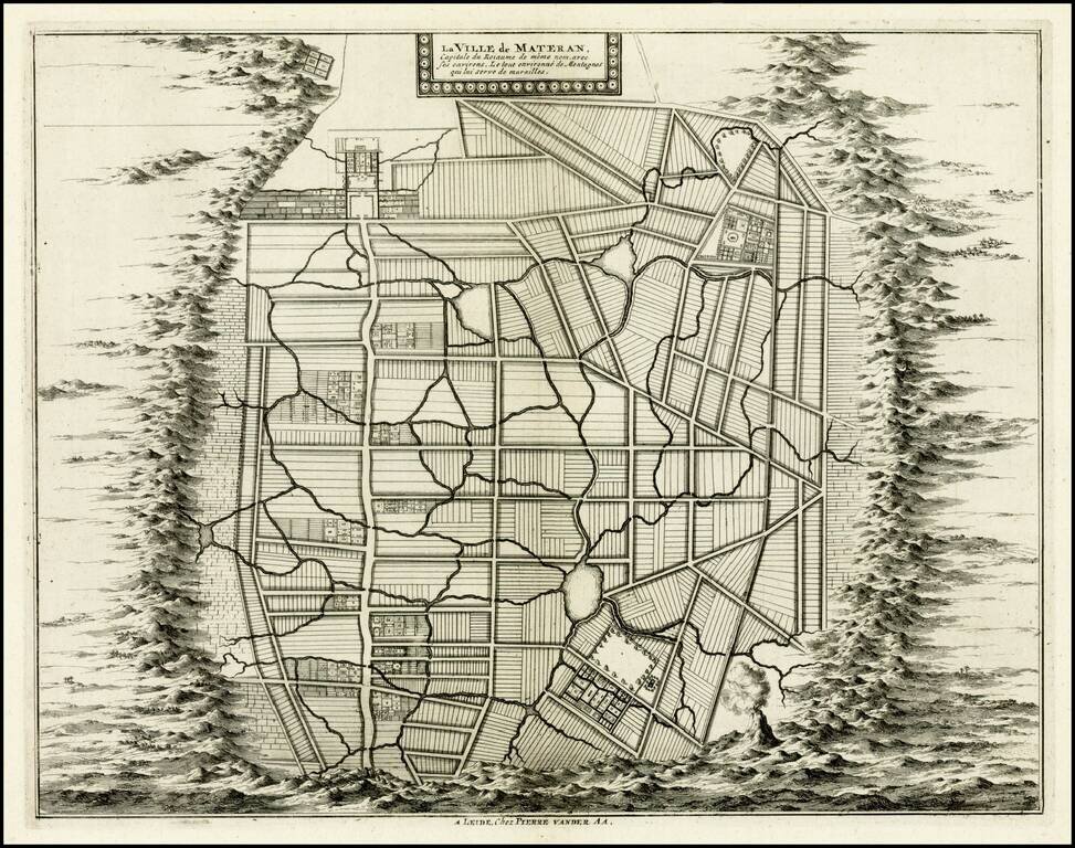
Rare plan of the city of Mataram on the Island of Lombok, immediately east of Bali in Indonesia. The Dutch had first visited Lombok in 1674 and the Dutch East India Company concluded its first treaty with the Sasak Princess of Lombok.
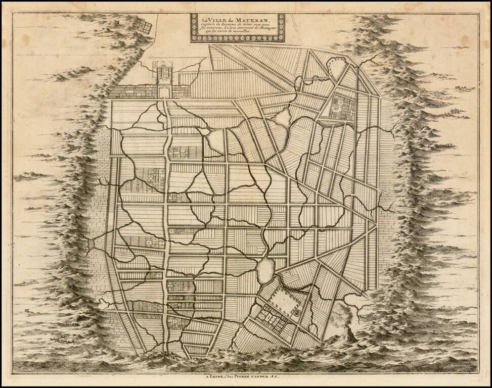
Rare plan of the city of Mataram on the Island of Lombok, immediately east of Bali in Indonesia. The Dutch had first visited Lombok in 1674 and the Dutch East India Company concluded its first treaty with the Sasak Princess of Lombok.
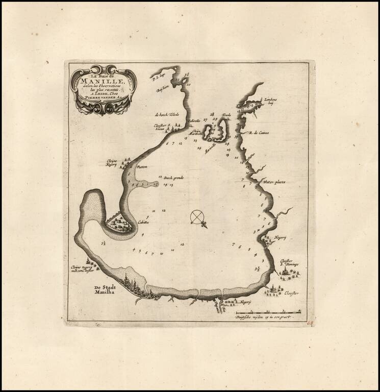
Rare Variant / Manilla Rarity! Rare early map of Manilla Bay, which appeared in Vander Aa's La galerie agréable du monde. The map is oriented with southwest at the top and includes a small town plan for Manilla and other places. Soundings are also...
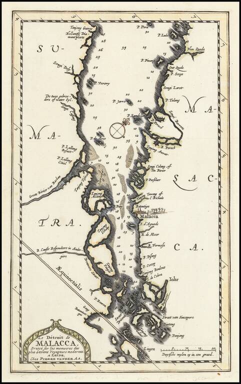
Finely executed map of the Straits of Singapore and the Straits of Malacca, which appeared in Pierre Vander Aa's monumental La Galerie agreable du Monde . . ., published in Leiden. The map shows Sumatra from Tanjong Goeree to Pulau Singkep and P. Lada...
![l'Ile de Sumatra . . . [shows Singapore]](/map/small/68965.jpg)
Detailed map of Sumatra, Singapore Straits (Straet van Sincapura), Bintan Island (P. Panjang) and the contiguous coastline of Malaysia. Malacca is named, with some coastal and river details around Kuala Lumpur (P. Perach, R. Perang, Songi Borros)....
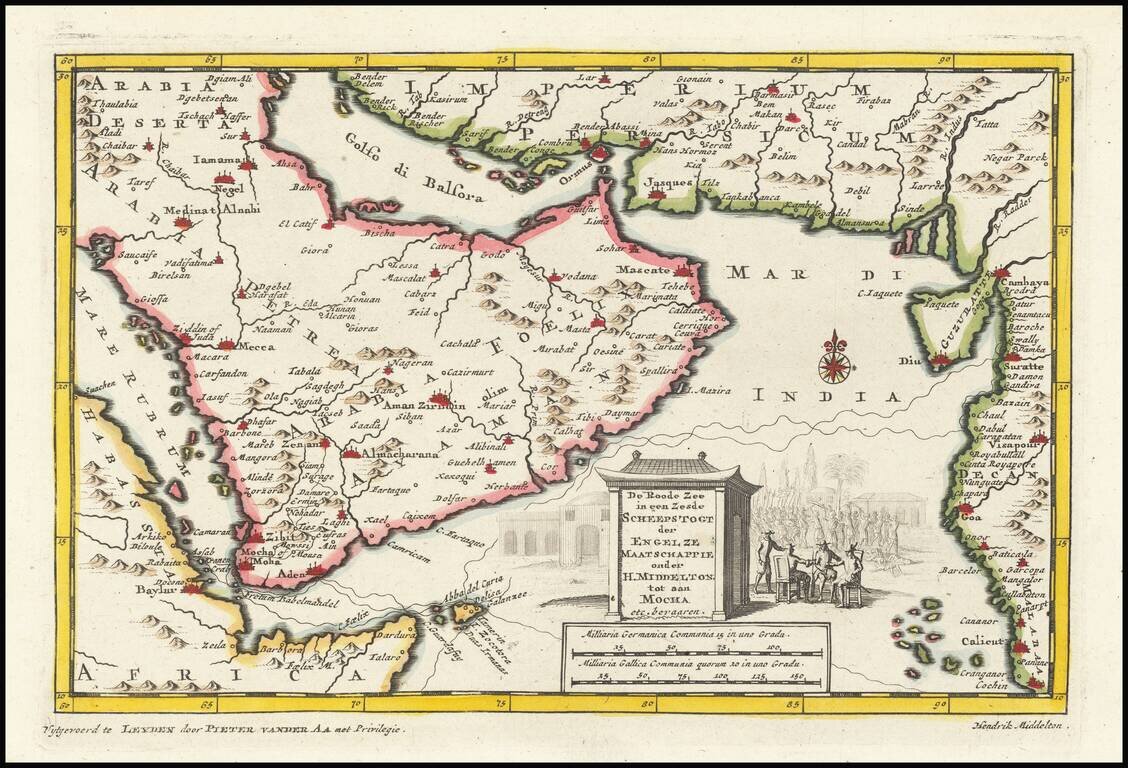
This is an interesting map centered on the Arabian peninsula. The title of the map refers to the (supposed) sixth voyage of Sir Henry Middleton on behalf of the East India Company. The map shows the Arabian peninsula in full, Abyssinia, the Horn of...
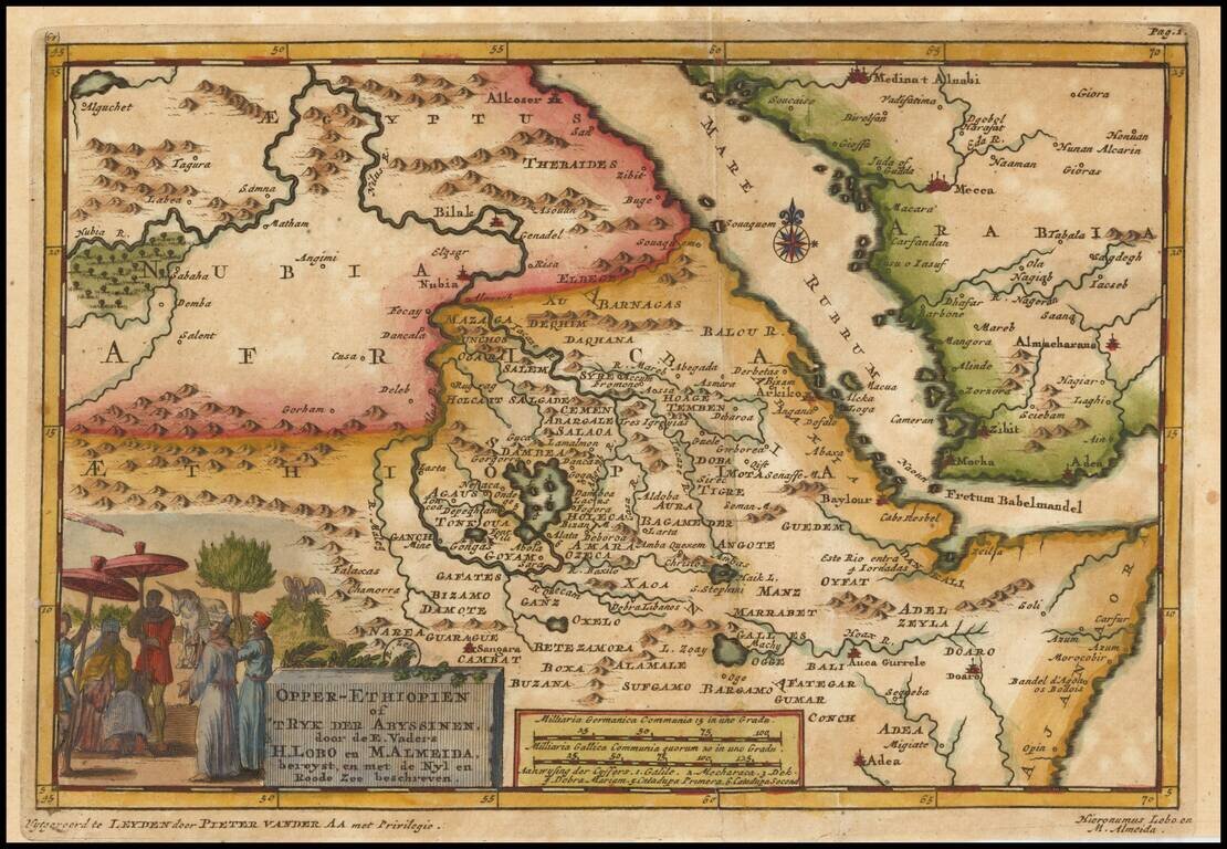
Decorative map centered on the Red Sea and the Sources of the Nile River, published by Vander Aa. The map shows the explorations of Jeronimo Lobo. Jerónimo Lobo (1595– 1678) was a Portuguese Jesuit missionary. He took part in the unsuccessful...
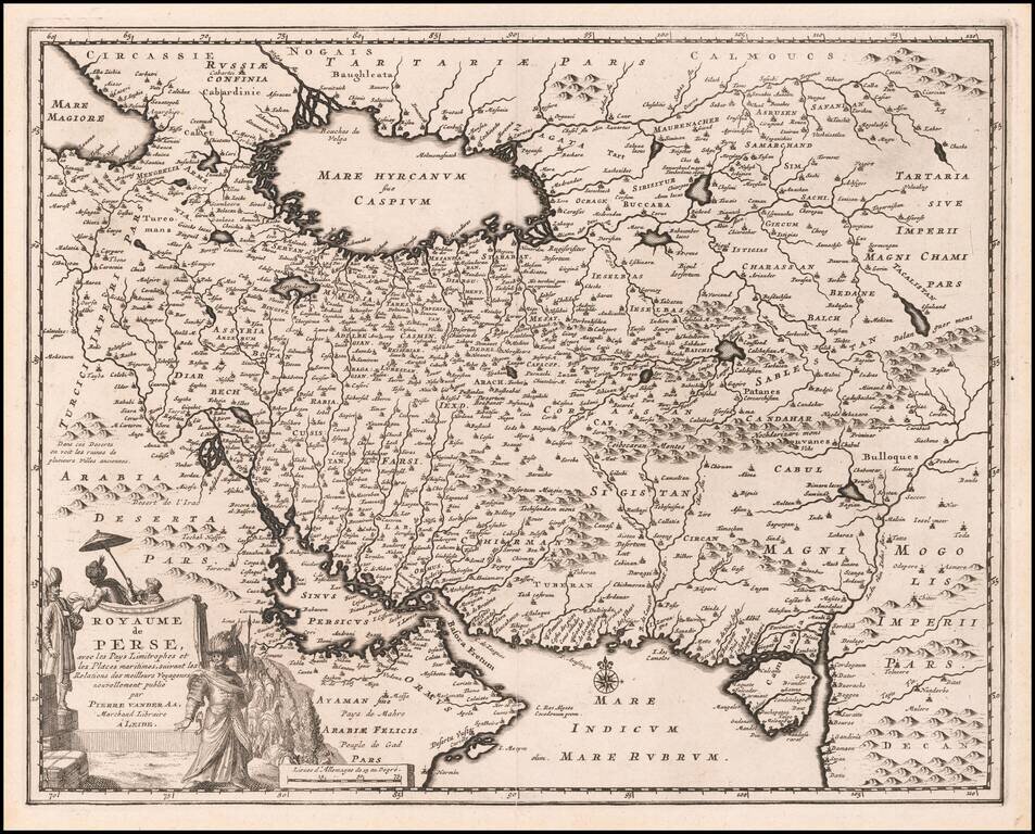
Scarce map of the Persian Empire showing the area that is now Iran, Afghanistan and Iraq with a portion of Oman near the Persian Gulf. The Sinus Persicus is remarkable distorted. The cities and mountains are graphically depicted and a beautiful...
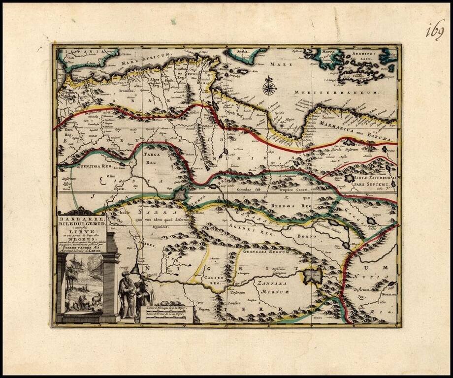
Decorative regional map of North Africa, with an elaborate title cartouche. The map illustrates North Africa and part of the region inhabited by the Negro Countries.
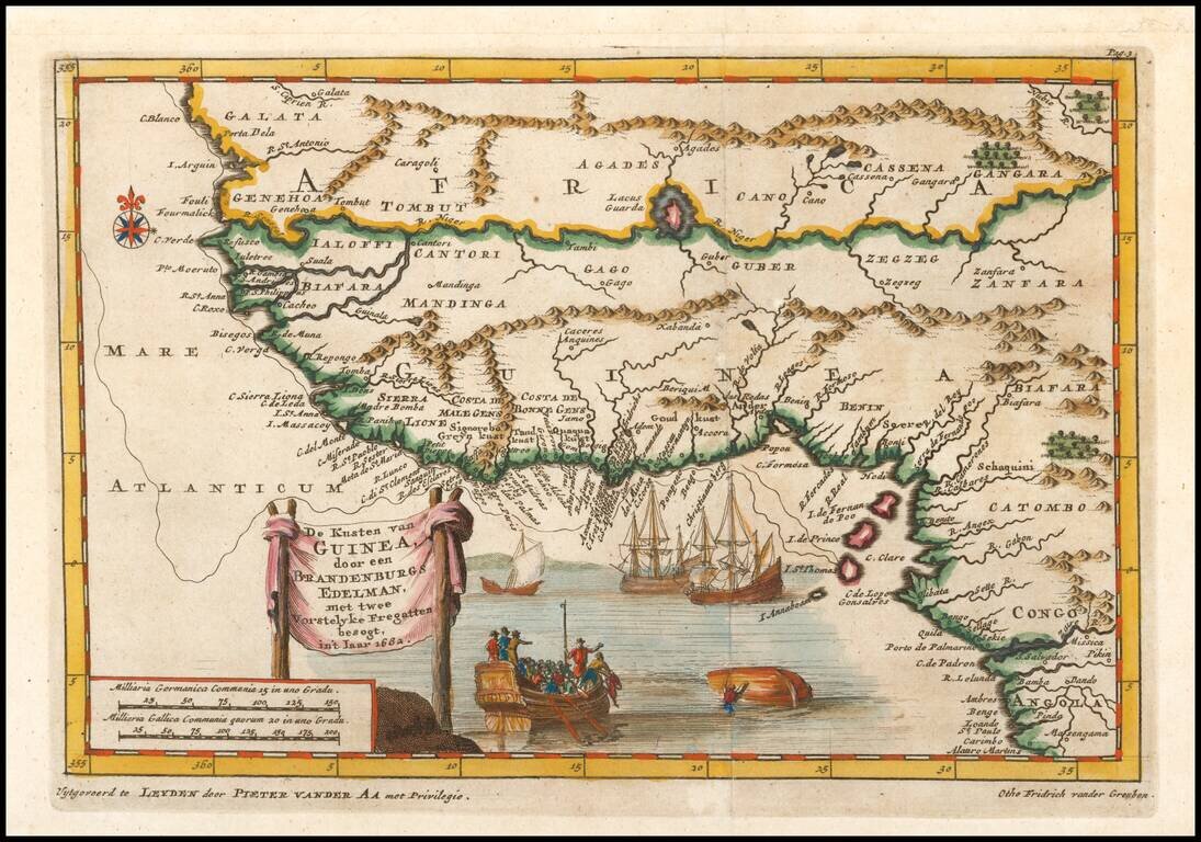
Sriking map of western Africa based upon the 1682 desciptions of Otho Frederic vander Greuben. Includes nice detail along the coast and in the interior, 4 ships (one capsized) and other decorative features.
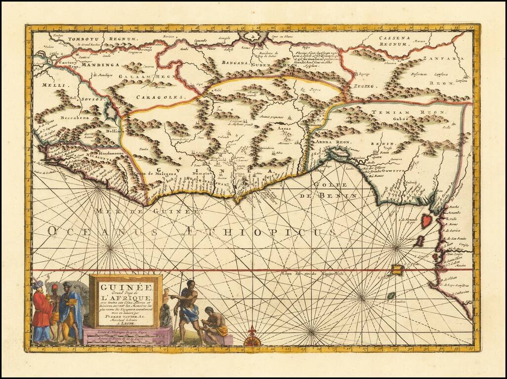
Striking map of West Africa, including extensive notes in the interior and nice topographical details. Vander Aa's decorative maps were some of the best engraved and most interesting maps of the early 18th Century.