Pieter van der Aa (1659-1733) was a Dutch mapmaker and publisher who printed pirated editions of foreign bestsellers and illustrated books, but is best known for his voluminous output of maps and atlases. Van der Aa was born to a German stonecutter from Holstein. Interestingly, all three van der Aa sons came to be involved in the printing business. Hildebrand was a copper engraver and Boudewyn was a printer.
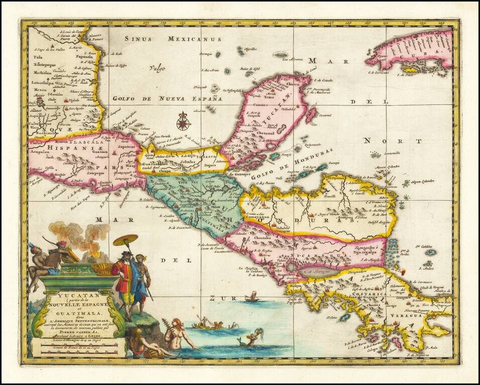
Rare early map of Central America and the Caribbean, published by Vander Aa in Amsterdam. Decorative map of the region from Mexico City to Panama City, extending to include part of Cuba, and is based on Blaeu's map of the Yucatan peninsula. Cozumel...
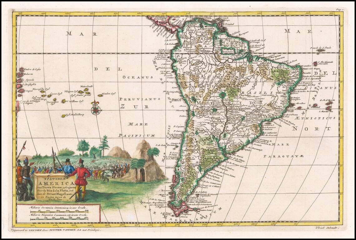
Detailed regional map of South America, illustrating the voyage of Ulrich Schmidt von Straubingen to the Rio La Plata, detailing the Spanish conquests in the region from 1534 to 1554. This work was not translated into Dutch until Vander Aa and was not...
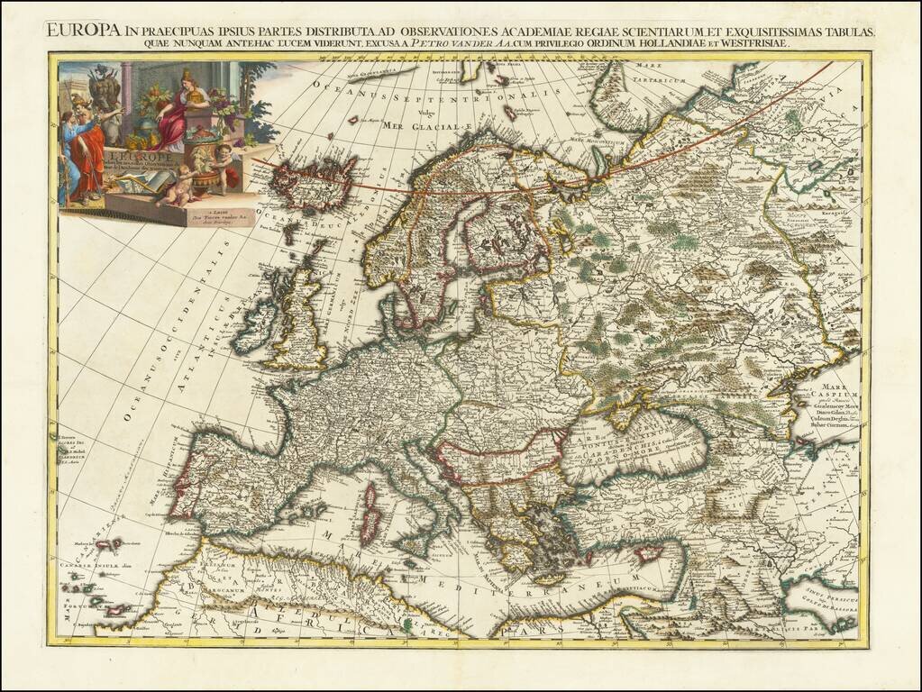
Beautifully engraved map, from the larger-format suite of continental maps made by Van Der Aa in 1713. The map stretches from the Caspian in the east to Iceland (albeit incorrectly located) in the west. These Van Der Aa continental maps are...
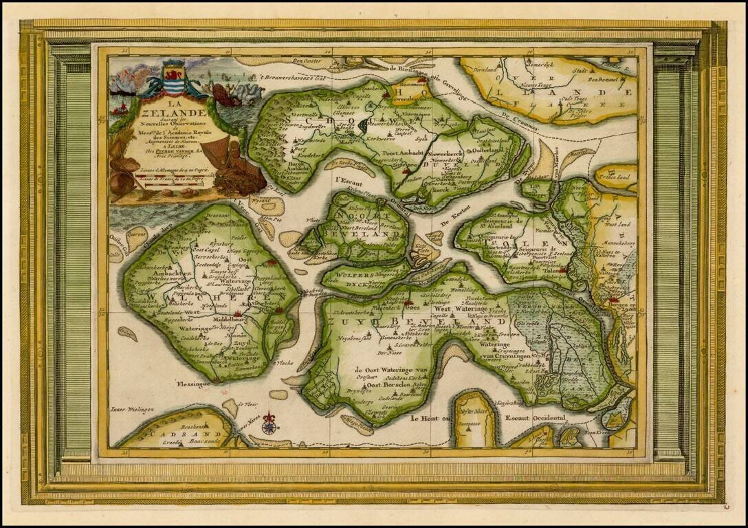
Decorative example of Vander Aa's map of Zealand. Nice example, with the picture frame border, which appeared in Vander Aa's Nouvelle Theatre Du Monde, published in 1713.
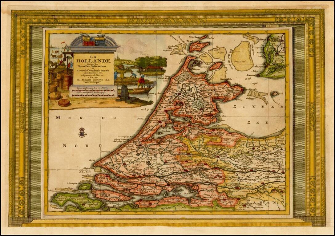
Decorative example of Vander Aa's map of Holland. Nice example, with the picture frame border, which appeared in Vander Aa's Nouvelle Theatre Du Monde, published in 1713.
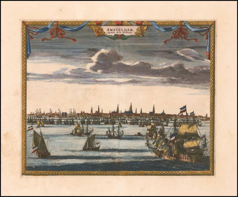
Attractive and uncommon panorama of Amsterdam, which appeared in Van der Aa's Galerie Agreeable du Monde.
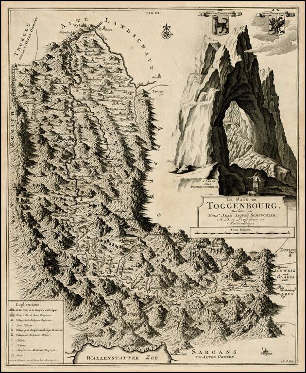
Detailed regional map of Toggenbourg in the Kanton of St. Gallen, with two coat of arms and a striking mountain image. Fantastic topographical image.
Fascinating map illustrating a voyage from Dieppe to Marseille, via the Straits of Gibralter. Decorative cartouche.
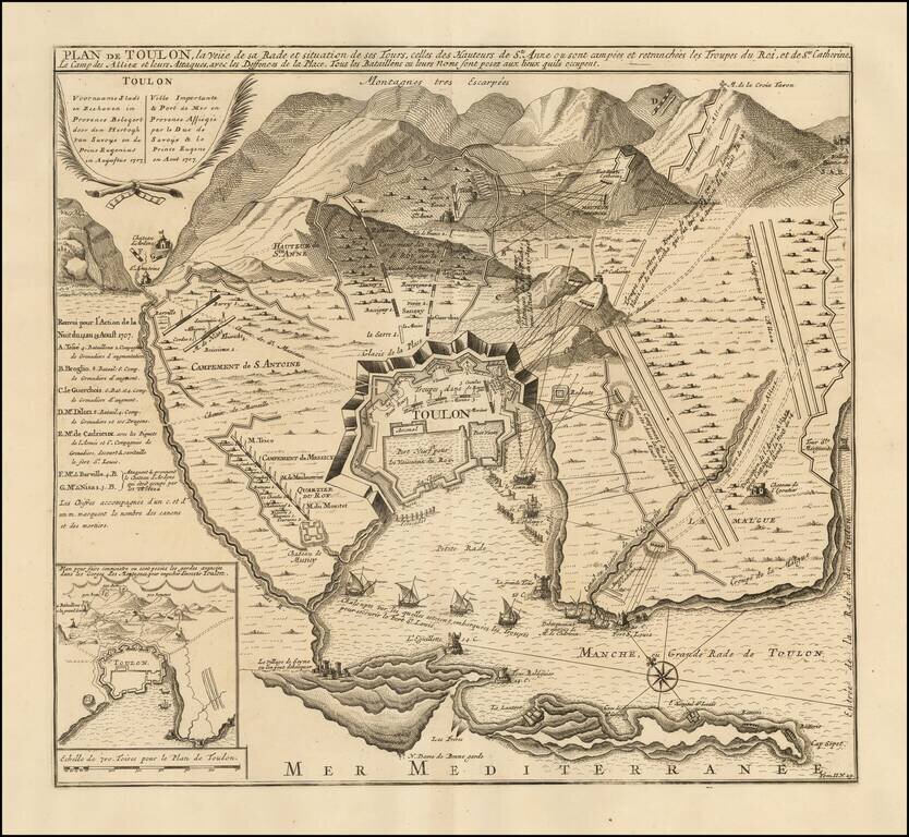
Fine battle plan of Toulon, showing the engagement at the Battle of Toulon in 1707. The map provides an exceptional overview of the engagement, showing fortifications, battery positions and the bombardments from the harbor by various named ships....
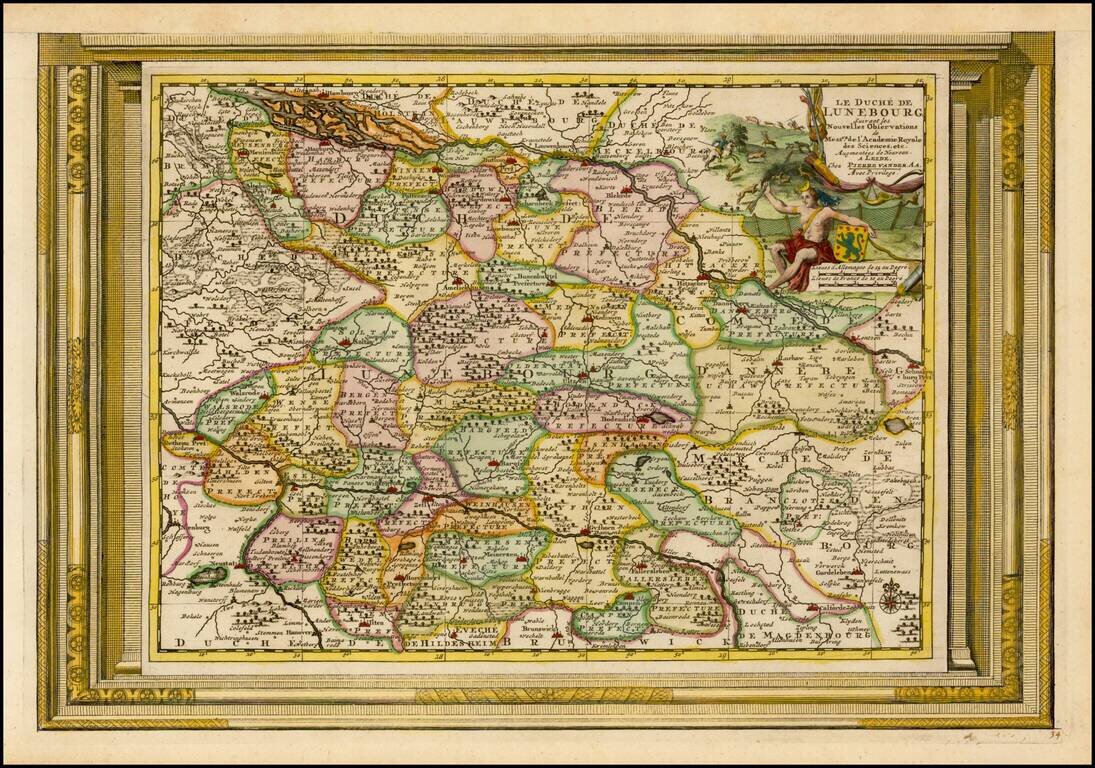
Decorative example of Vander Aa's map of the Duchy of Lunebourg. Nice example, with the picture frame border, which appeared in Vander Aa's Nouvelle Theatre Du Monde, published in 1713.
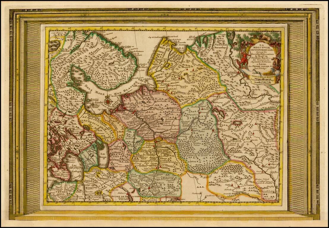
Decorative example of Vander Aa's map of the northern part of European Russia. Nice example, with the picture frame border, which appeared in Vander Aa's Nouvelle Theatre Du Monde, published in 1713.
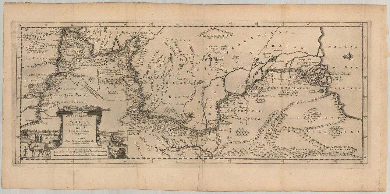
Nice example of Olearius' map of the Volga River, which first appeared in of Olearius' Relation du voyage d'Oléarius Adam en Moscovie, Tartarie, et Perse avec celui de I.A. De Mandelslo aux Indes Orientales - traduit de l'Allemand et augmenté par A....
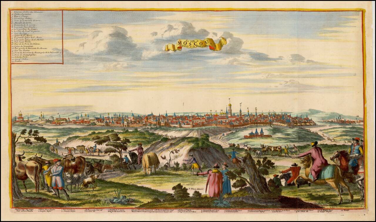
Fine view of Moscow, after Nicolas Witsen's view. The view includes a key identifying 24 locations.
![Constantinoplen en Egypten door Nicolaus Schmidt in enn zes Jarige Reystogt uyt Duytsland [shows Cyprus]](/map/small/57615.jpg)
Decorative map of the region bounded by Italy, Corsica, Sardinia and Sicily in the west and extending to Cyprus, Asia Minor and the Holy Land in the east. Centered on Greece and the Balkans. The map was engraved to illustrate a Dutch translation of...
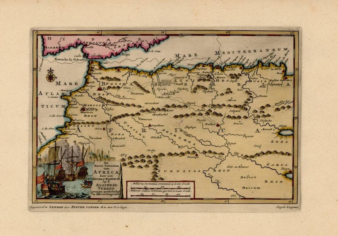
Interesting map of the Western Mediterranean and contiguous parts of Spain and North Africa, showing the tracks of Engels Koopman in 1648. The map offered here was used by Vander Aa to illustrate a Dutch Translation of Koopman's travels in the region...
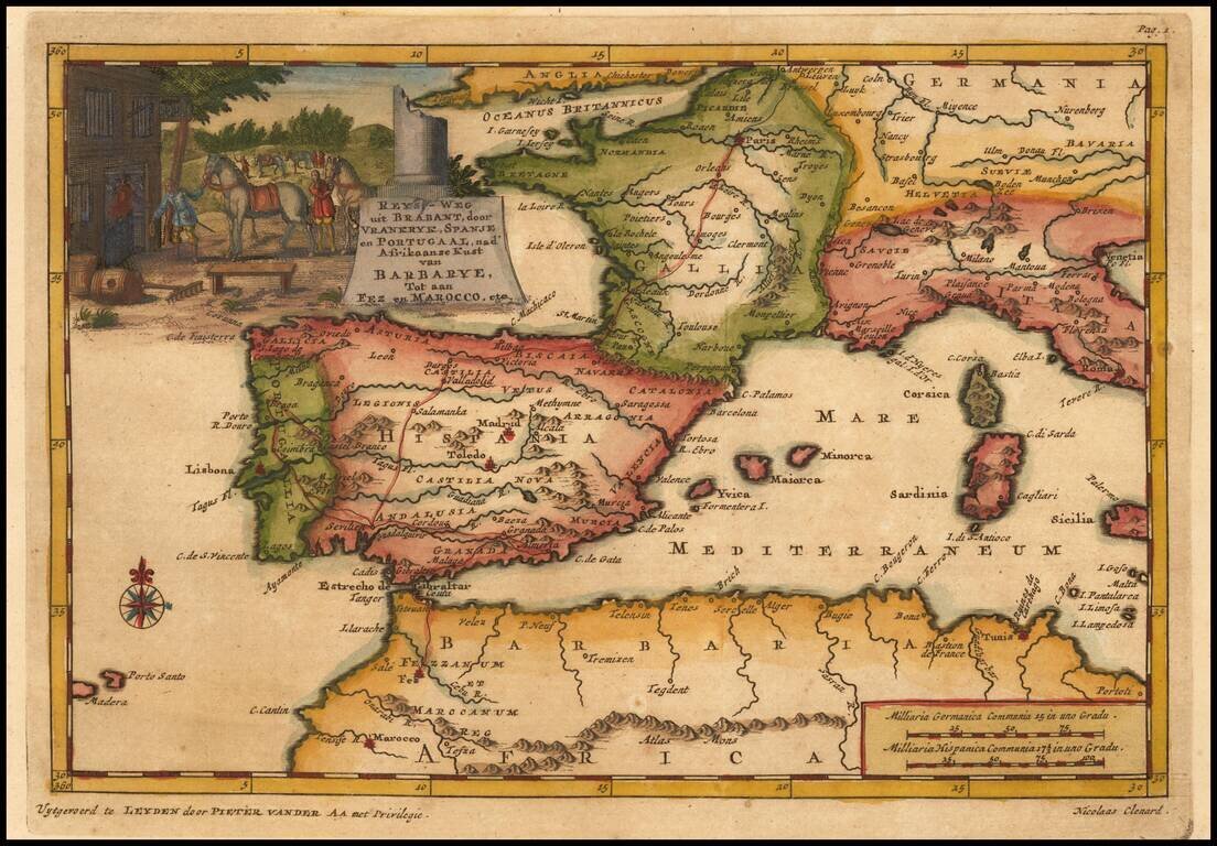
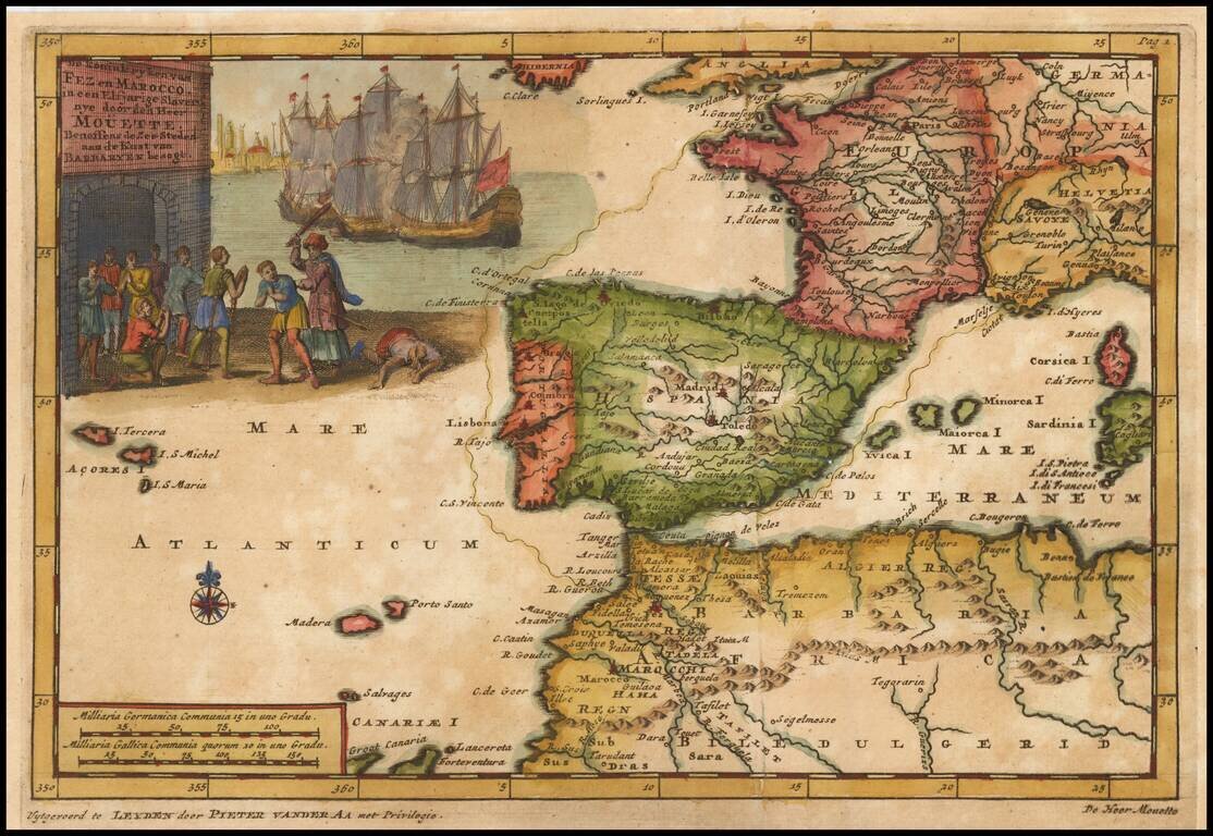
Detailed map of Spain, France and the Western Mediterranean. Francis Brooks was an Englishman who was enslaved by the Moors at the end of the 17th Century. After his escape, he wrote a narrative of his captivity, which detailed the practices of the...