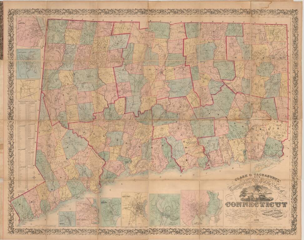
One of the Most Impressive and Decorative Maps of Connecticut, Here in the Desirable Folding Map Format. Hand-colored lithographed folding map of Connecticut, the most detailed and authoritative map of the state of its time. It includes topographical...
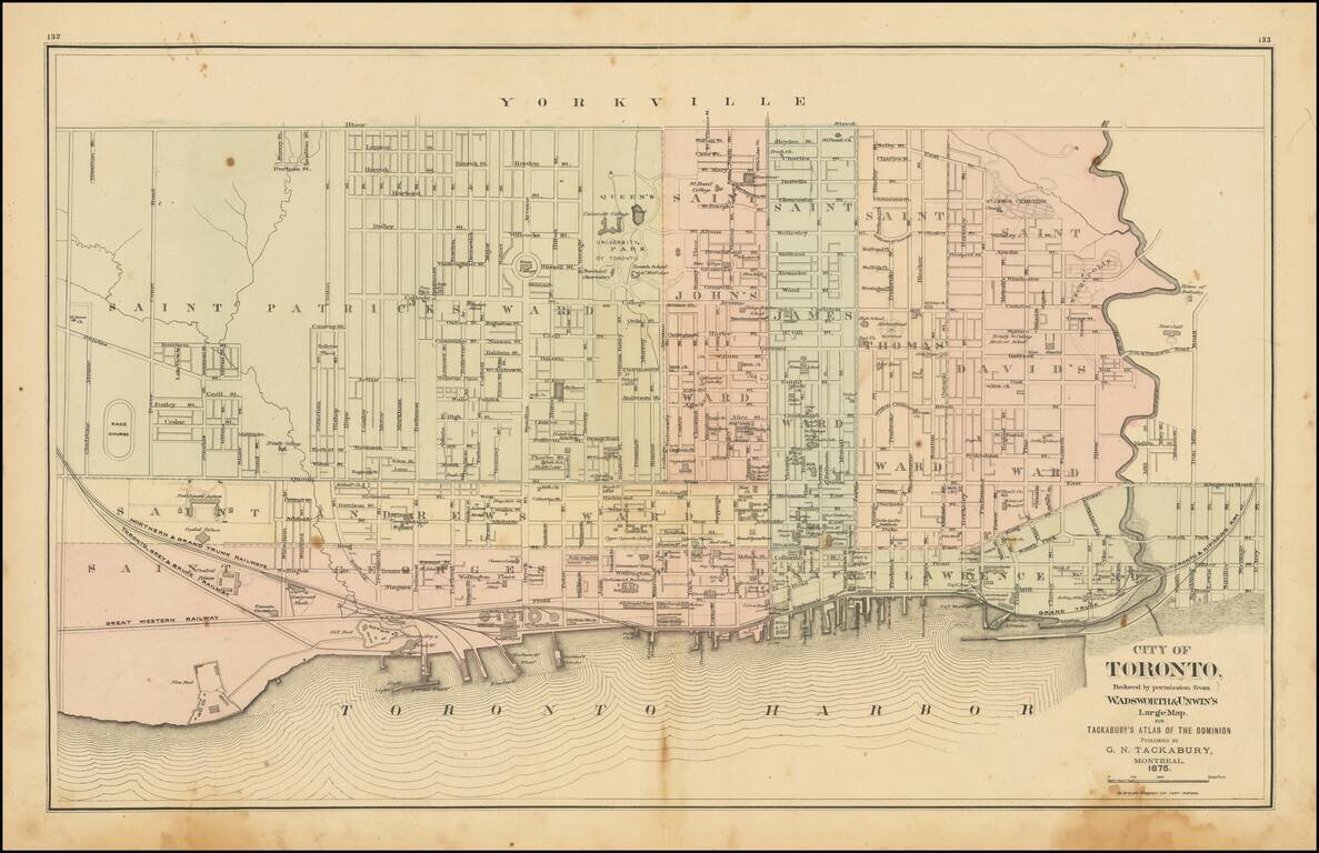
Detailed map of Toronto, colored by Wards, from Tackabury's Atlas of the Dominion. Locates a number wharfs, buildings, railroad lines and other details. Toronto was originally named York, changing its name in 1834. The map shows Toronto during a...
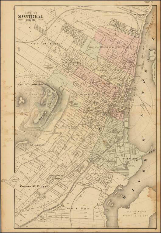
Scarce lithographed map of Montreal, probably from Tackabury's Atlas of the Dominion of Canada (1876). Hand-colored by wards. Many important public buildings are outlined and labeled. The topography of Mount Royal is rendered with hachuring.