Herman Moll (c. 1654-1732) was one of the most important London mapmakers in the first half of the eighteenth century. Moll was probably born in Bremen, Germany, around 1654. He moved to London to escape the Scanian Wars. His earliest work was as an engraver for Moses Pitt on the production of the English Atlas, a failed work which landed Pitt in debtor's prison. Moll also engraved for Sir Jonas Moore, Grenville Collins, John Adair, and the Seller & Price firm. He published his first original maps in the early 1680s and had set up his own shop by the 1690s.
Moll's work quickly helped him become a member of a group which congregated at Jonathan's Coffee House at Number 20 Exchange Alley, Cornhill, where speculators met to trade stock. Moll's circle included the scientist Robert Hooke, the archaeologist William Stuckley, the authors Jonathan Swift and Daniel Defoe, and the intellectually-gifted pirates William Dampier, Woodes Rogers and William Hacke. From these contacts, Moll gained a great deal of privileged information that was included in his maps.
Over the course of his career, he published dozens of geographies, atlases, and histories, not to mention numerous sheet maps. His most famous works are Atlas Geographus, a monthly magazine that ran from 1708 to 1717, and The World Described (1715-54). He also frequently made maps for books, including those of Dampier’s publications and Swift’s Gulliver’s Travels. Moll died in 1732. It is likely that his plates passed to another contemporary, Thomas Bowles, after this death.
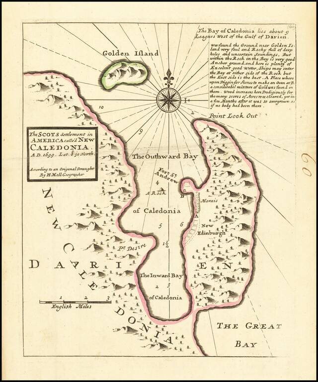
Interesting map depicting the site of the short-lived Scottish colony of New Edinburgh. In 1698, William Paterson, Scottish Governor and founder of the Bank of England, proposed a plan to create a colony in modern day Panama. The Company of Scotland...
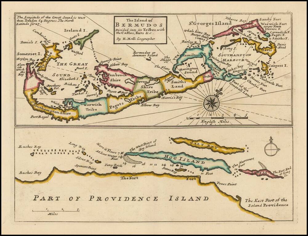
Striking full color example of this Moll's map of Bermuda and the North Coast of Providence Island, with Hog Island, Long Island, Salt Key, etc. The Bermuda map includes significant details, including Tribes, towns, bays, islands, sounds, and other...
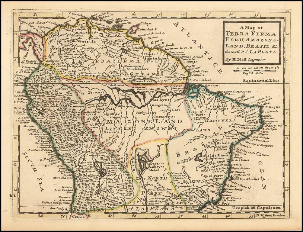
Interesting early 18th Century map of Columbia, Venezuela, Ecuador, and part of Peru, Brazil and Argentina (then La Plata).
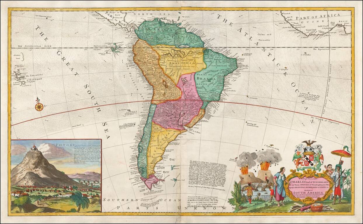
A Large English Map of Colonial South America Striking large format map of South America, published by Herman Moll, one of the leading English map makers in the first half of the 18th Century. The map includes a large inset of San Luis Potosi,...
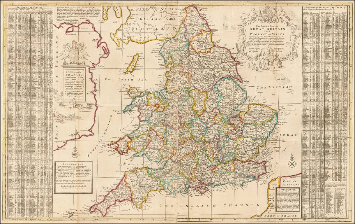
Striking large format map of England and Wales, published by Herman Moll in London. The map is embellished with two large cartouches and an extensive table locating "all ye Cities, Market Towns, Boroughs and whatever Places in South Britain have ye...
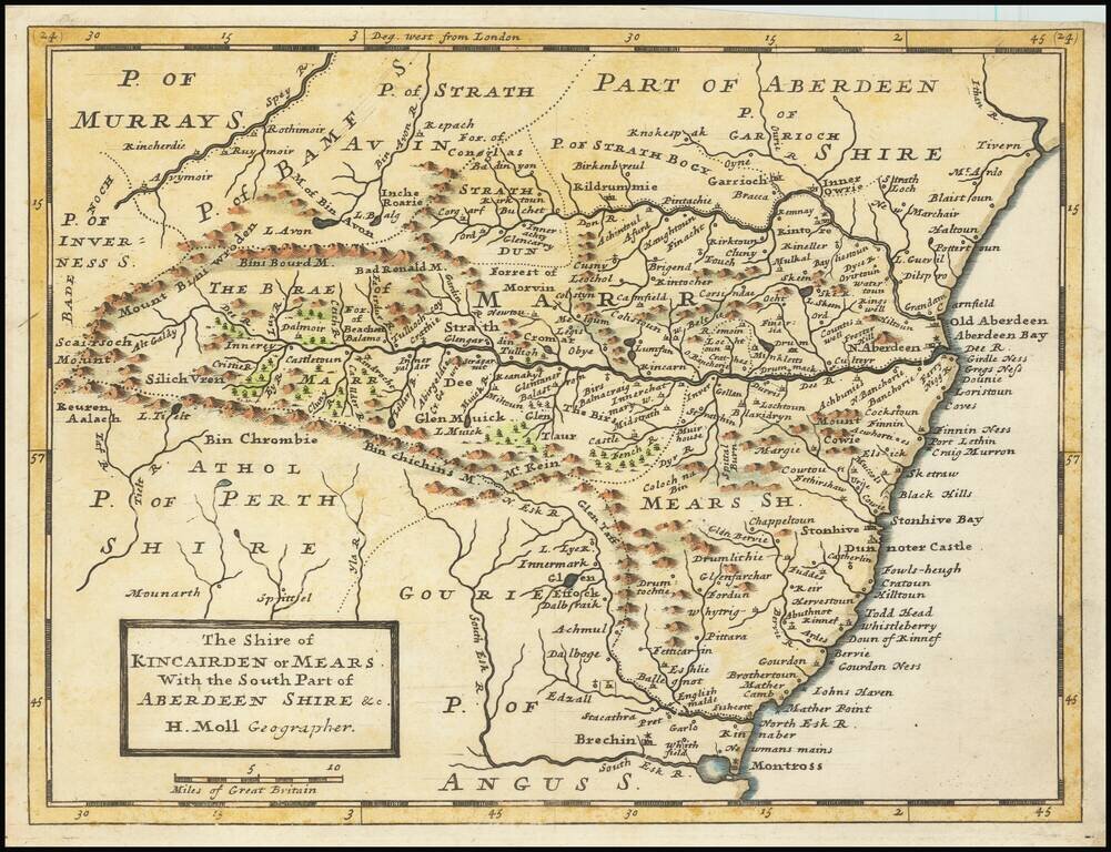
Small engraved map of the region around Aberdeen, Scotland, by Herman Moll. Shows the old shires Kincairden or Mears and part of Aberdeenshire.
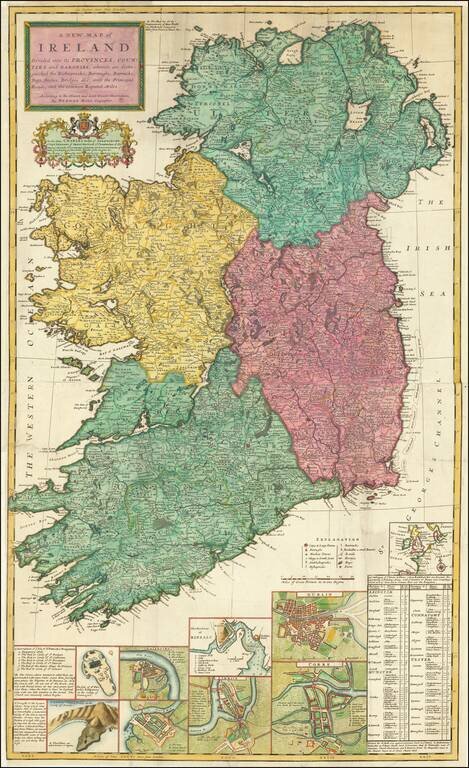
Decorative large map of Ireland, published by Herman Moll. Includes a number of insets including plans of Galloway, Waterford, Limerick, Dublin, and Corke. The map also includes an interesting depiction of the Giants Causeway, with the note "These...
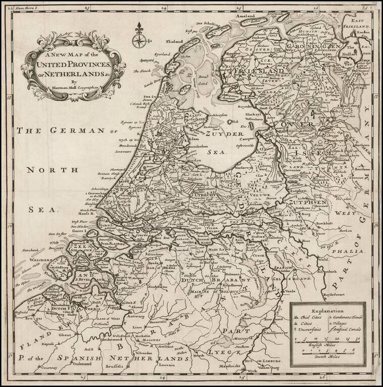
Scarce map of the Netherlands, published in London by Herman Moll. Includes a large inset map of Arx Britannica, a Fortress built by the Roman Emperor Caligula, at the mouth of the Rhine River, which disappeared from view at the end of the 16th Century...
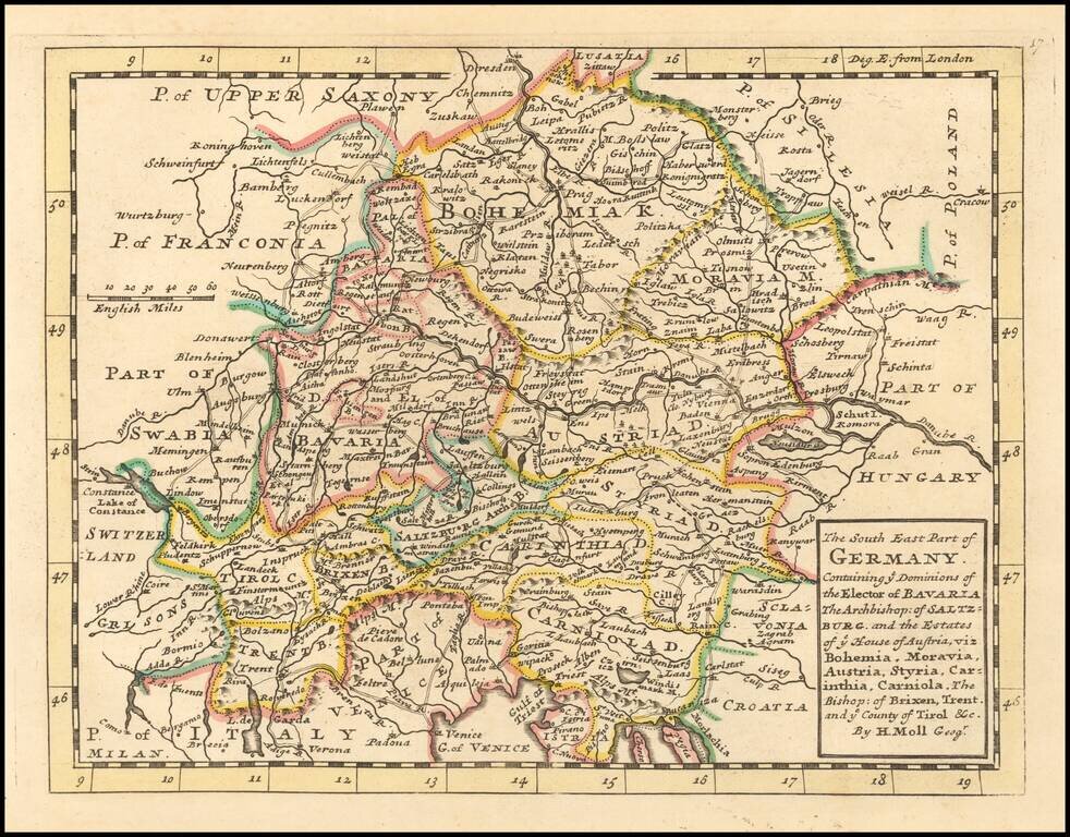
Interesting early 18th Century map of southeastern Germany. The map was published by one of London's leading mapmakers, Herman Moll.
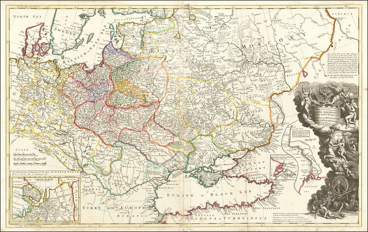
Striking large format map of Russia, Ukraine, Poland, Finland and the Baltic Countries and extending south to the Black Sea and the Balkans, with an ornate dedication cartouche to Peter the Great, including a portrait of the Czar near the bottom of the...
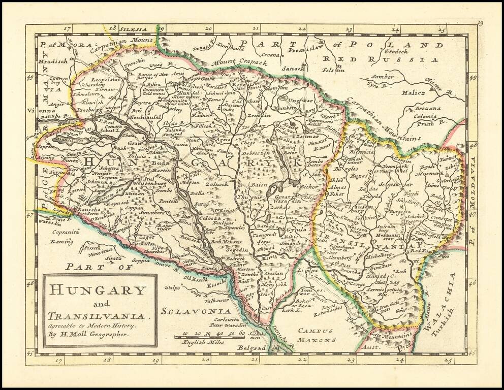
Scarce map of Hungary and Transylvania, published in London by Herman Moll.
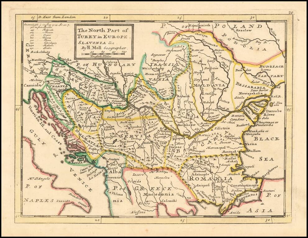
Interesting early 18th Century map of Balkans region, at a time when the region was still controlled by Turkey. The map extends from the Black Sea to Slovenia, Croatia and Dalmatia. The map was published by one of London's leading mapmakers, Herman Moll.
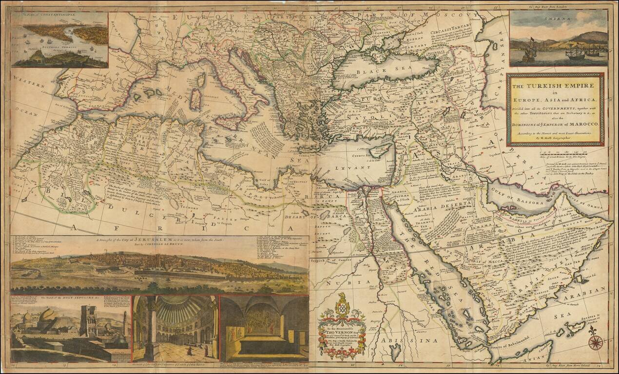
Dynamic Map of the Ottoman Empire with Rich Imagery of Jerusalem Striking large-format map of the Ottoman Empire by Herman Moll, one of England's leading map makers at the beginning of the eighteenth century. The map shows the sprawling Ottoman...
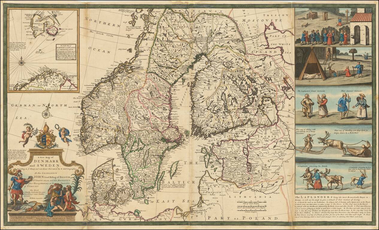
Nice example of Herman Moll's map of Scandinavia, with a large inset map and 5 wonderful vignettes, including a very early example of skiing. A very interesting note on the Laplanders below the vignettes and other notes throughout. This example of...

Detailed map of Denmark, published in London by Herman Moll.