John Pinkerton (1758-1826) was Scottish literary critic, historian, poet, and geographer. From age twelve he educated himself at home in Edinburgh, as his father had declined to send him to university. His father instead apprenticed John to a lawyer, William Aytoun, but the boy did not like the legal profession. In his spare time, the young man wrote poetry and collected Scottish ballads, which he tried to have published. After the death of his father, Pinkerton moved to London in 1781, to be closer to the vibrant literary scene.
Pinkerton’s earliest publications were collections of ballads. However, a fellow critic uncovered that Pinkerton had forged several of the “ancient” poems and published accusations against Pinkerton in the Gentleman’s Magazine. Throughout the 1780s, Pinkerton published poetry, works on numismatics, and historical works. He corresponded with Sir Walter Scott, Horace Walpole, and Edward Gibbon, but most of his friendships ended in acrimony. Pinkerton was a hypochondriac, unorthodox about morality and religion, and a prickly personality who lived with several women during his lifetime, marrying illegally at least once.
After 1800, Pinkerton turned to geographical works. In 1802 he published Modern Geography, a text that was quite popular and translated into French and Italian. In 1808-15, he produced a New Modern Atlas, which was well received, followed by A General Collection of Voyages and Travels (1808-14). Soon after these projects, Pinkerton moved to Paris, where he lived until he died in 1826.
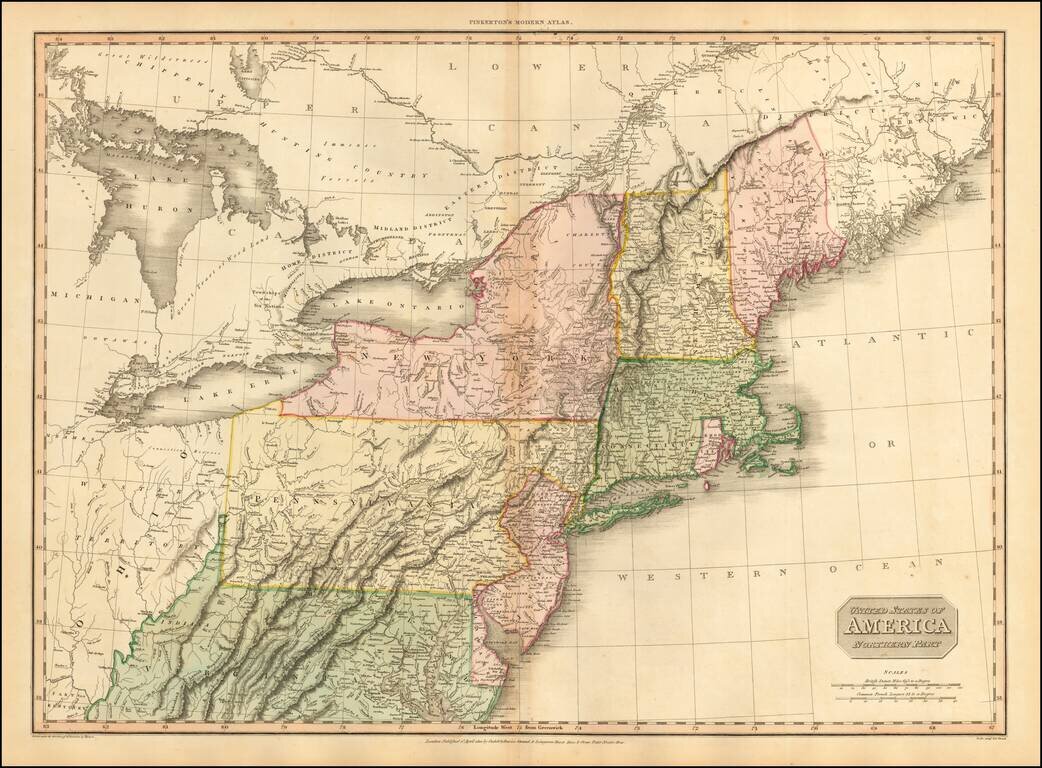
Fine large format map of the Northeast, at the end of the War of 1812, published by Pinkerton. Large detailed map of the Northeastern United States, from the District of Main to Michigan, Ohio, Virginia and Delaware, including most of the Upper...
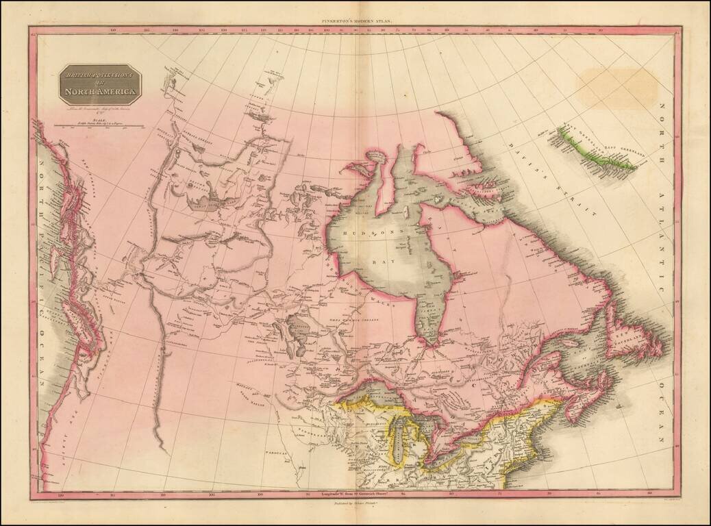
The Pacific Northwest Before Lewis & Clark Fascinating map of British America, Alaska and the Northwest part of America, immediately pre-dating the first incorporations of the details from the Lewis & Clark expeditions, published in 1814....
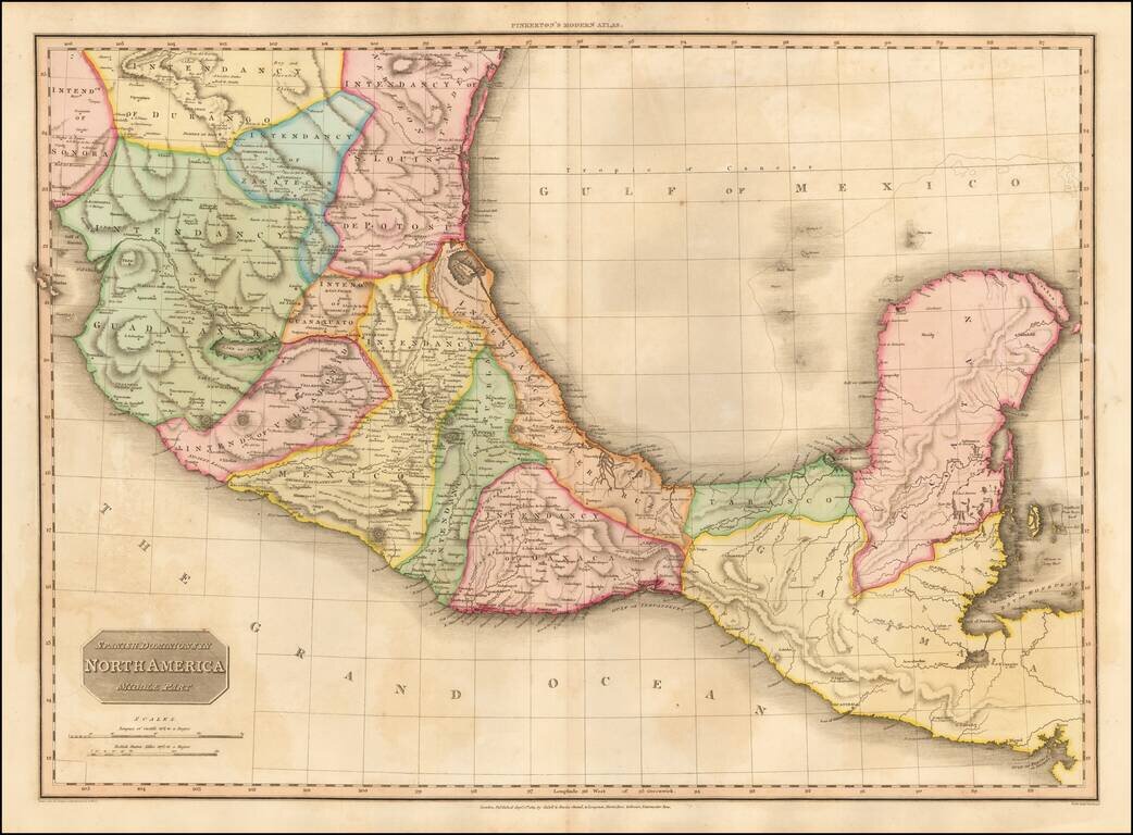
Fine example of John Pinkerton's finely detailed map of Southern Mexico, the Yucatan and Guatemala, published in 1811. The map provides a fine depiction of the heart of Mexico, just months after the Grito de Dolores, on September 16, 1810, and...
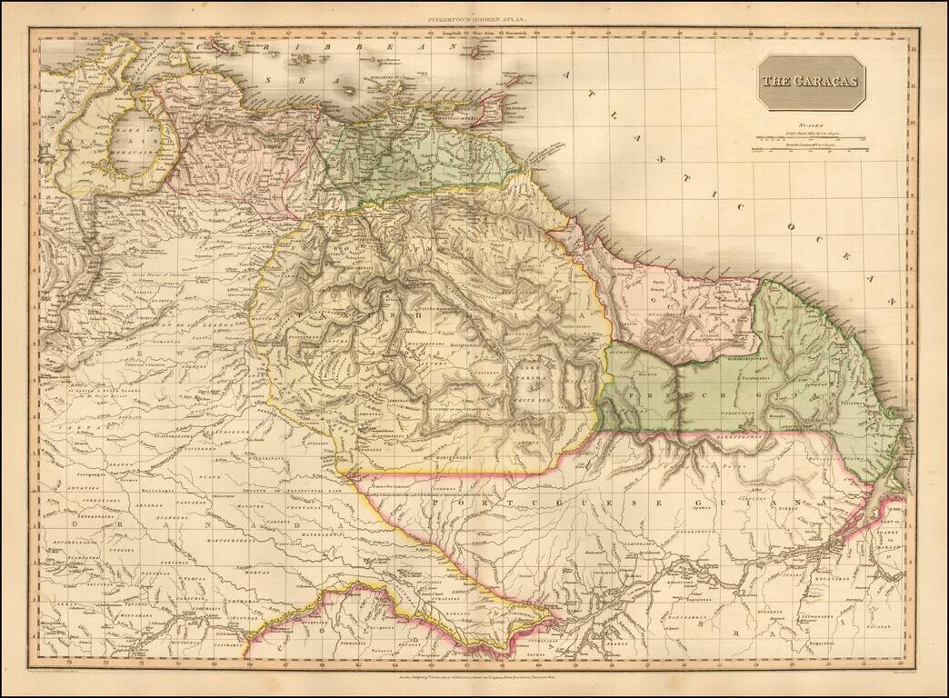
One of the Earliest Maps To Show An Independent Venezuela Highly detailed map of Venezuela, Columbia and part of Brazil, extending south to cover most of the Amazon and its tributaries, during this fascinating revolutionary period in South...
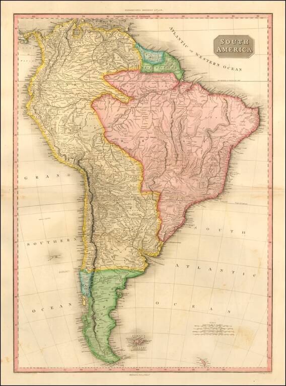
Striking and highly detailed map of South America, at the beginning of the major period of political upheaval on the Continent. The map was produced immediately after Alexander Von Humboldt's visit, which spawned so much interest in the exploration...
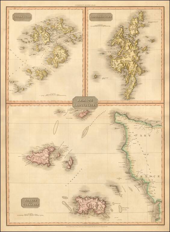
Detailed map of the remote British Isles. Excellent detail. One of the best large format English atlas maps of the period. Pinkerton's maps reflect the fine copperplate engraving work being done in Britain at the beginning of the 19th century, with...
![Scotland (Northern Part) [and] Scotland (Southern Part)](/map/small/53210.jpg)
Large and highly detailed two sheet map of Scotland, published in London by Pinkerton. One of the best large format atlas maps of the period.
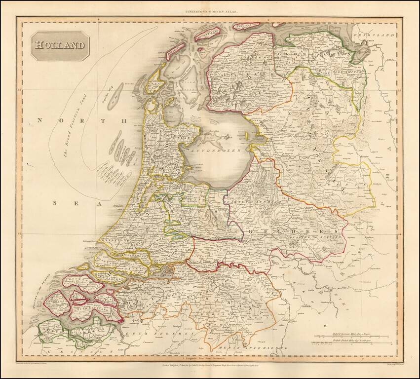
Detailed map of the Netherlands, from the rare Philadelphia edition of John Pinkerton's Modern Atlas. The map is colored by regions and shows towns, roads, rivers and a host of other details.
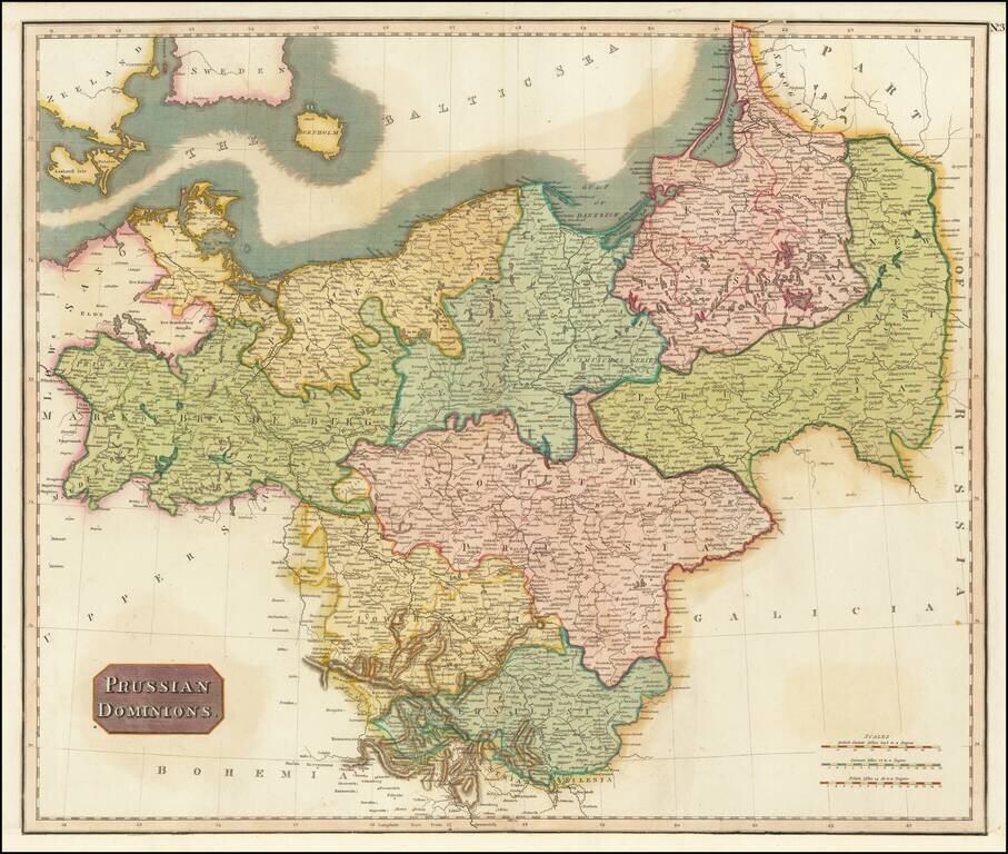
Detailed map of the Prussian Dominions, including parts of the former Kingdom of Poland. Colored by provinces. Excellent detail. One of the best large format English atlas maps of the period. Pinkerton's maps reflect the fine copperplate engraving...
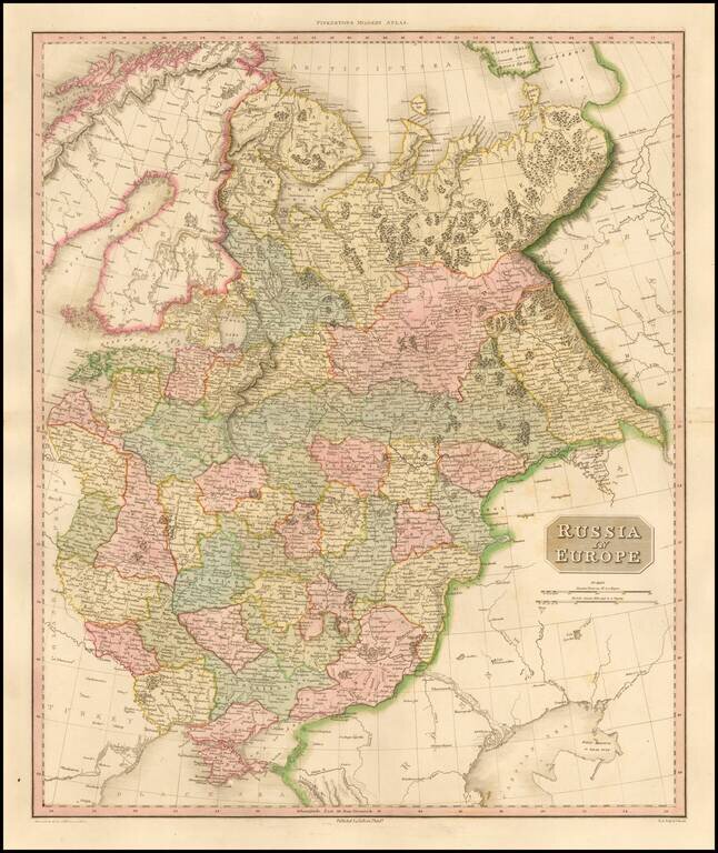
Highly detailed map of European Russia. Highly detailed regional map, one of the best regional maps of the area to appear in an English Atlas during the period. Pinkerton's now rare elephant folio atlas is one of the best engraved works of the period....
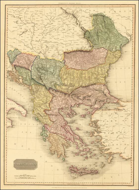
An excellent detailed regional map of the Balkans, Turkey and Greece, showing towns, roads, rivers, mountains, lakes, and other items of interest. Hand colored by regions.
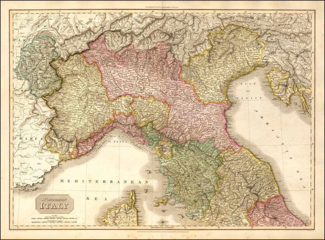
Detailed map of Northern Italy. Colored by provinces. Excellent detail. One of the best large format English atlas maps of the period. Pinkerton's maps reflect the fine copperplate engraving work being done in Britain at the beginning of the 19th...
![Turkey In Asia [shows Cyprus]](/map/small/42881.jpg)
Detailed map of Turkey, Asia Minor, Persia, Syria, Iraq, Armenia, etc. Very large Cyprus shown. Colored by provinces. Excellent detail. One of the best large format English atlas maps of the period. Pinkerton's maps reflect the fine copperplate...
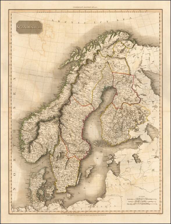
Detailed map of Scandinavia. Excellent detail. One of the best large format English atlas maps of the period. Pinkerton's maps reflect the fine copperplate engraving work being done in Britain at the beginning of the 19th Century, with remarkable...
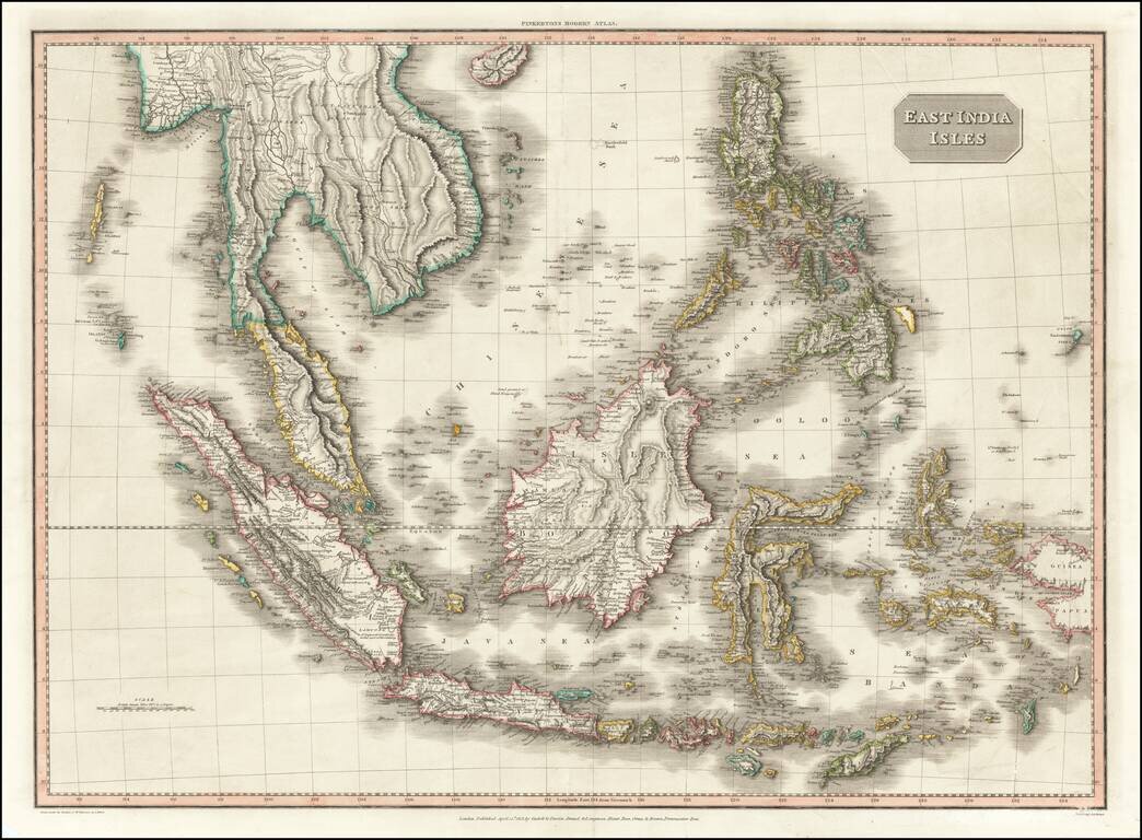
Gorgeous map of the Philippines and Southeast Asia, from John Pinkerton's scarce world atlas. The map extends from Burma, Java and Sumatra to Papua New Guinea, Pelew, the Philippines and Hainan. The map is an absolute masterpiece of fine copperplate...
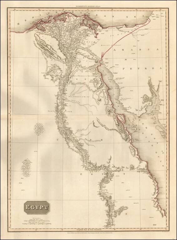
Highly detailed map of Egypt, following the Nile as far south as Asouan and Shelalat and including the Oasis of Magna, Oasis of Parva and other remarkable fine details. Includes the Gulf of Suez, Red Sea and Gulf of Acaba. One of the best regional...