John Melish (1771-1822) was the most prominent American mapmaker of his generation, even though his cartographic career lasted only a decade. Melish was born in Scotland; he moved to the West Indies in 1798 and then to the United States in 1806. By 1811, he had settled in Philadelphia and published Travels through the United States of America, in the years 1806 & 1807, and 1809, 1810, & 1811, which was richly illustrated with maps.
Melish created several regional maps of the highest quality, as well as the Military & Topographical Atlas of the United States (Philadelphia, 1813, expanded 1815). The latter work is widely considered to be the finest cartographic publication to come out of the War of 1812.
By far his best-known work is his monumental map of the United States of 1816, Map of the United States with the contiguous British and Spanish Possessions. He began working on the map in 1815 and sent it to Thomas Jefferson for comment in 1816. Jefferson enthusiastically reviewed the map and returned it with his edits. Jefferson later hung an example of the map in the Entrance Hall of Monticello and sent it to associates in Europe.
Melish’s finished product was the first map of the United States to extend to the Pacific Ocean. After its publication in 1816, Melish ensured the map was as up-to-date as possible; it was reissued in 25 known states published between 1816 and 1823. The map captured the then rapidly changing geography of the United States, as well as various boundary disputes, treaties, and expansion.
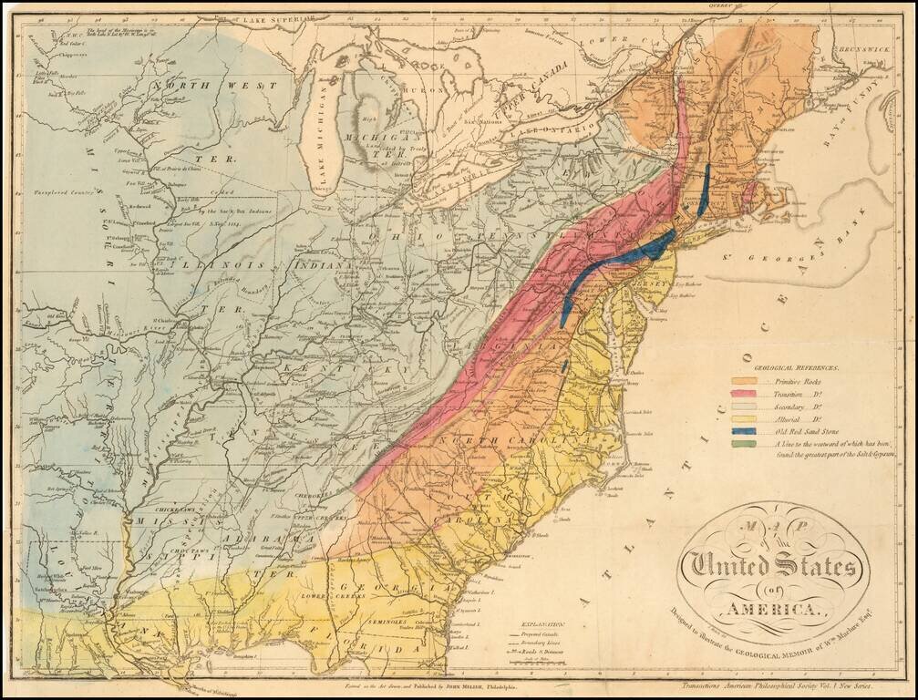
A Geological Map of the United State By The Father of American Geology The Melish-Maclure map of the United States is one of the first geological map of the United States published in America. This scarce map of the United States, was issued in...
An Early American Travel Directory By America's Most Important Early Mapmaker Rare early travel directory, published by John Melish in 1819. This is one of the earliest American Travel guides, produced by America's most important mapmaker in the...
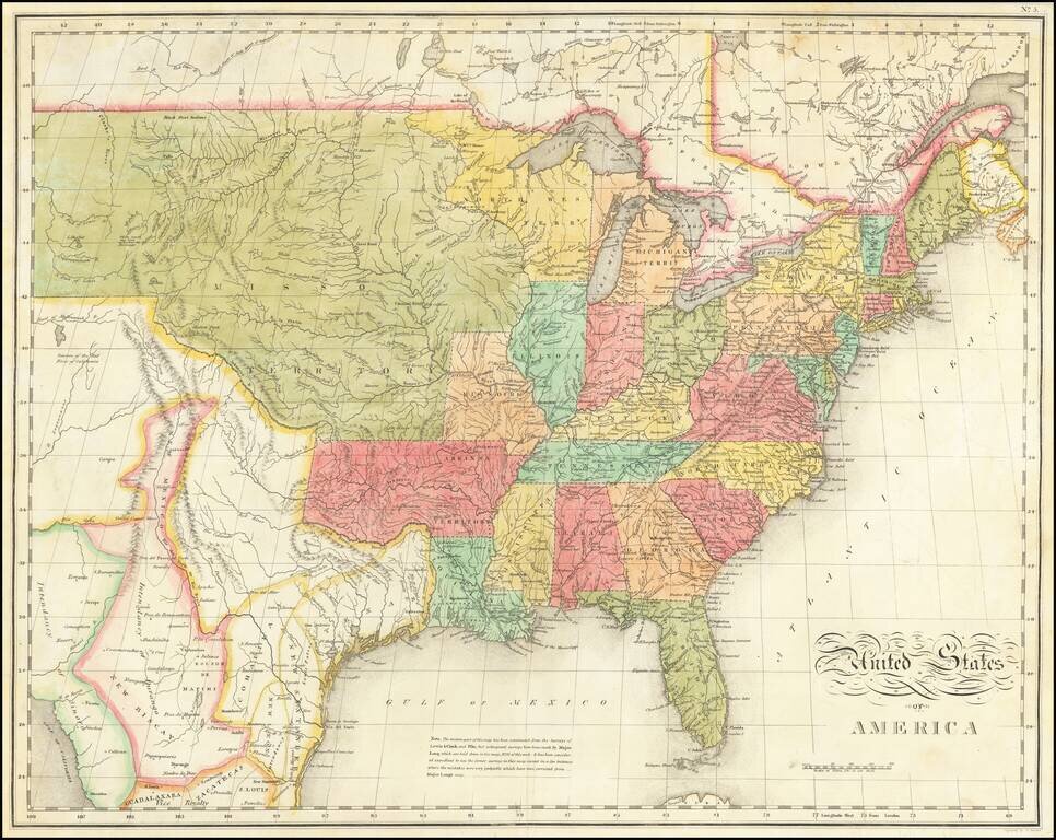
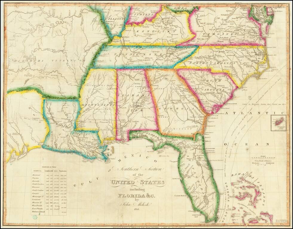
Nice example of Melish's map of the United States, which appeared in the Carey & Lea American Atlas. The map extends westward to depict the northwest, Missouri and "Arkansa" territories, and the province of Mexico, including Texas. The map draws...
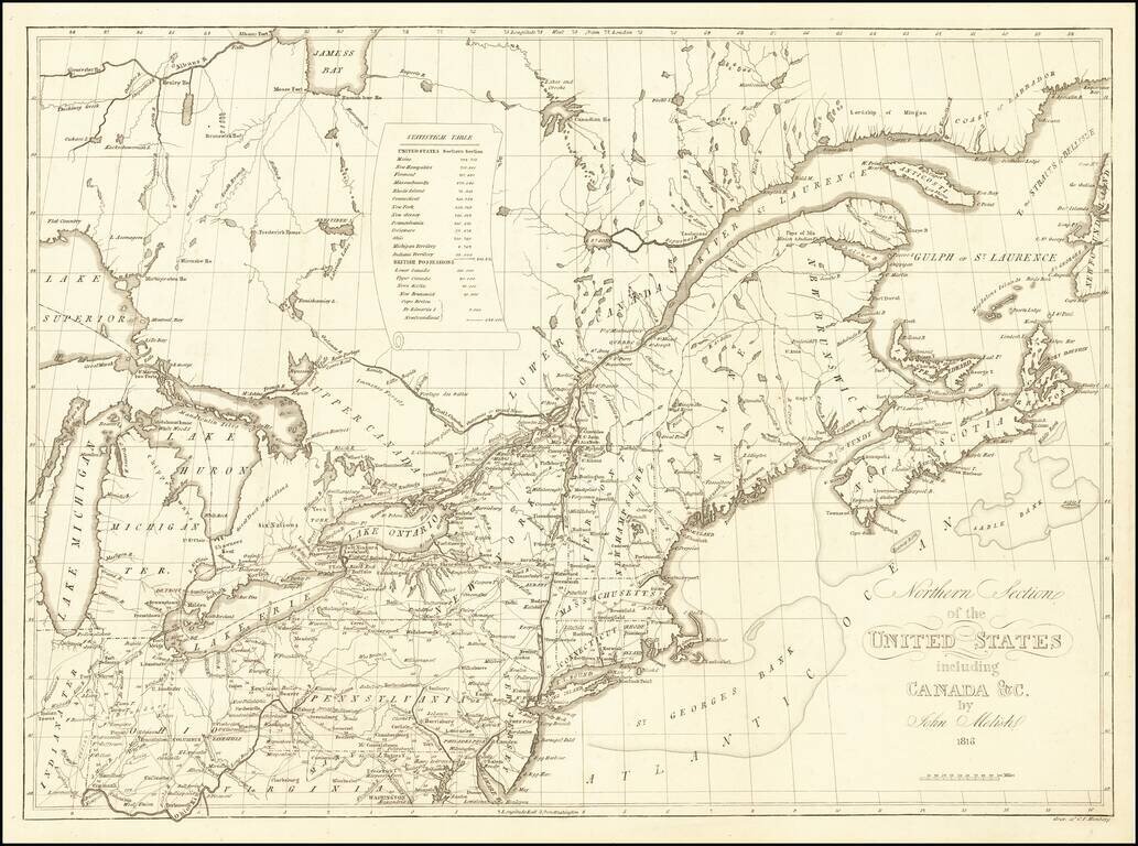
Rare map of the Northeastern United States, which first appeared in John Melish's Traveller's Directory… published in Philadelphia. This Northern Sheet, previously titled Map of the Seat of War…extends from the Great Lakes to Nova Scotia, New...
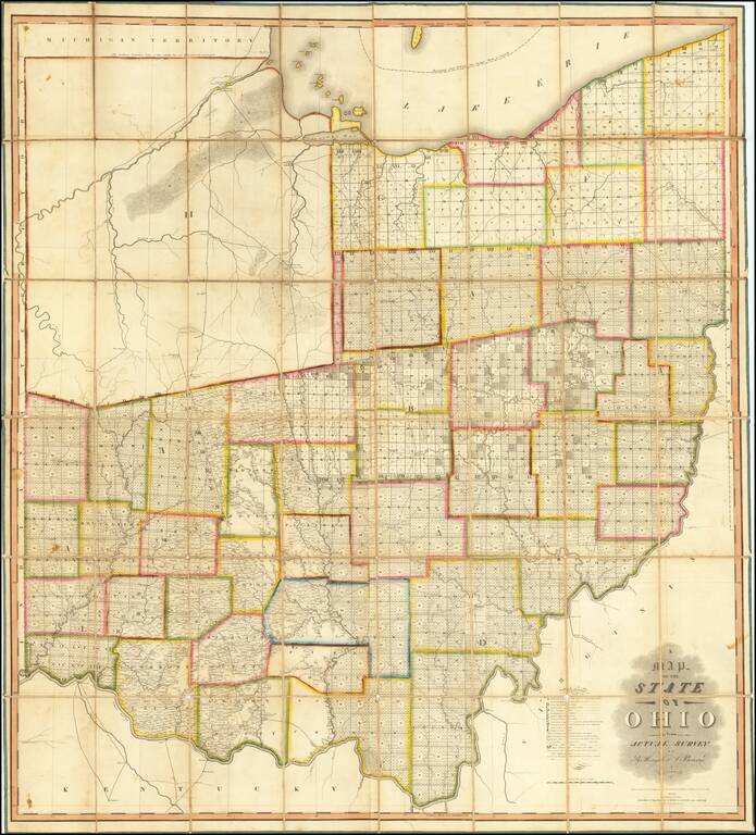
The First Great Map of Ohio Fine example of the Hough & Bourne map of Ohio, published in Chillicothe, Ohio, prepared by John Melish and printed by Benjamin Tanner in Philadelphia in 1815. Hough & Bourne's map of Ohio is the second large...