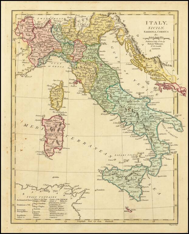
Attractive English language map of Italy, hand colored by regions. The map key shows the allegiances of the various regions (to the Pope, King of Sardinia, King of Naples, Austria, Spain, Italy, etc.) Shows towns, rivers, mountains, lakes, etc....
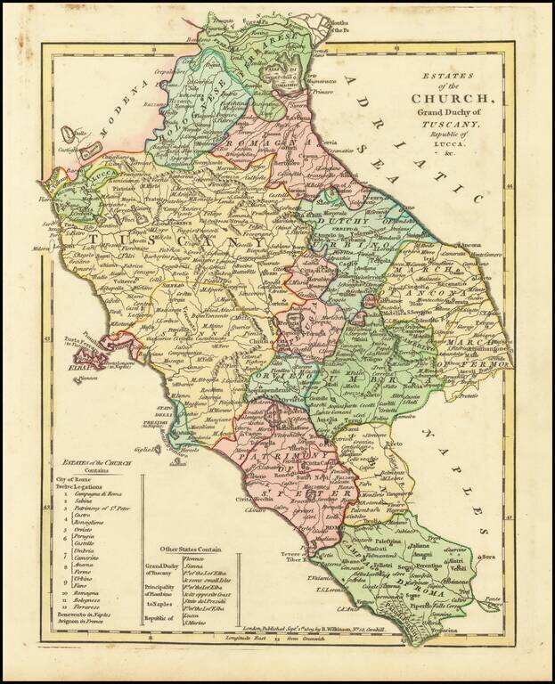
Detailed map of the region bounded by Bologna, and Campagna Di Roma. Includes Luca, Tuscany Romagna, Ferranese, Bolognese, Urbino, Ancona, Fermo, Orvieto, Perugia, Umbria, Sabina, Patrimony of St. Peter, Campagna Di Roma, the Isle of Elba, etc. Large...
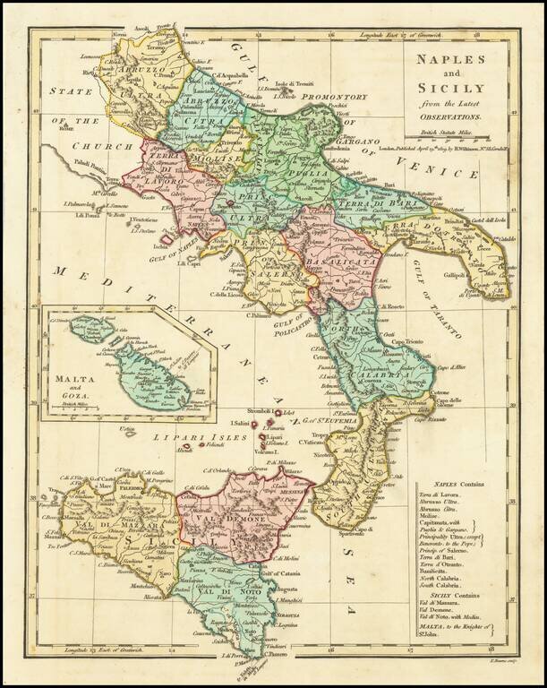
Excellent map of Southern Italy and Sicily extending North to Abruzzo Ultra, Citra and Terra Di Lavorao and showing all of Sicily. Nice detailed inset of Malta and Goza. Includes a number of place names and is colored by kingdoms. Large key shows the...
![Norway and Sweden with their Dependancies [Inset map of Iceland]](/map/small/70559.jpg)
Detailed map of Scandinavia, with a table listing the dependancies. Robert Wilkinson was active in London as a cartographic publisher from 1785 to 1825. He produced a number of nice works, including a General Atlas and a re-issuance of Bowen &...
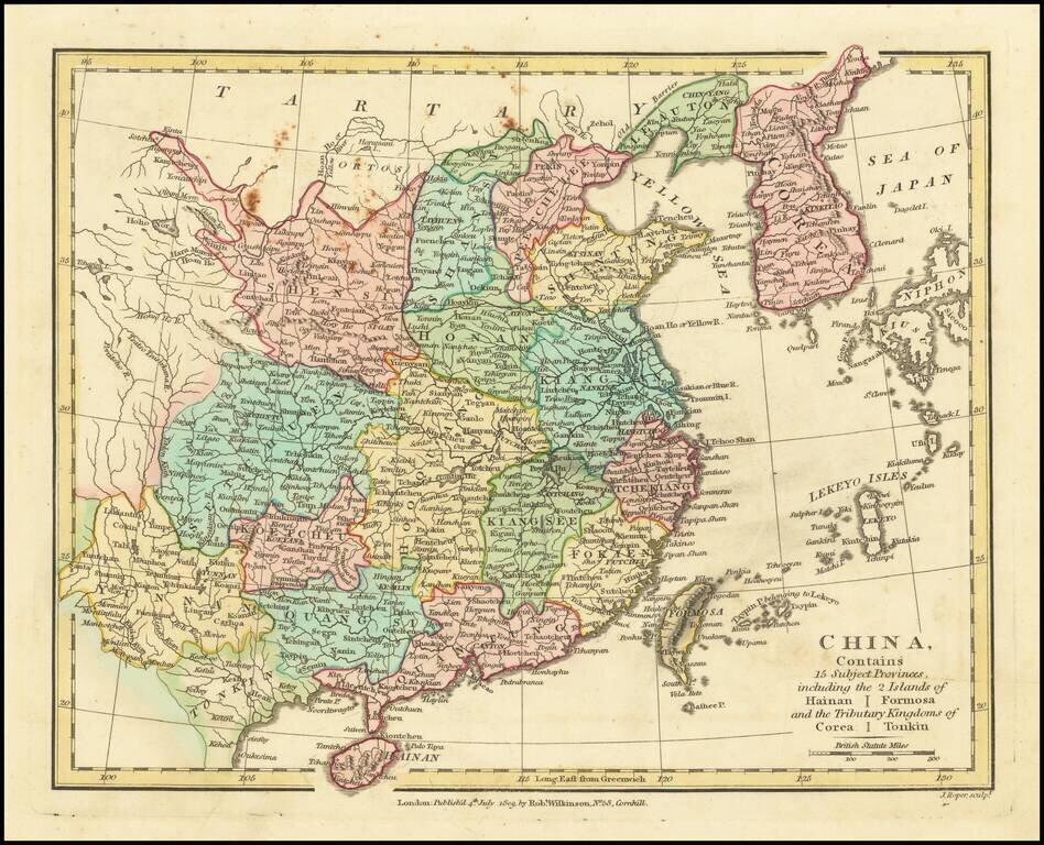
Interesting map of China, extending from Corea and the Sea of Japan and Tartary in the North, to Teypin Is. Belonging to I. Ekeyo, Formosa, Hainan, Tonkin and Yunnan Province. Hong Kong not yet named. Shows provinces, cities, towns, rivers,...
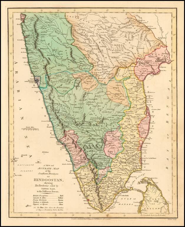
Delightful regional map of the Southern part of India and Ceylon, with nice details. Robert Wilkinson was active in London as a cartographic publisher from 1785 to 1825. He produced a number of nice works, including a General Atlas and a re-issuance...
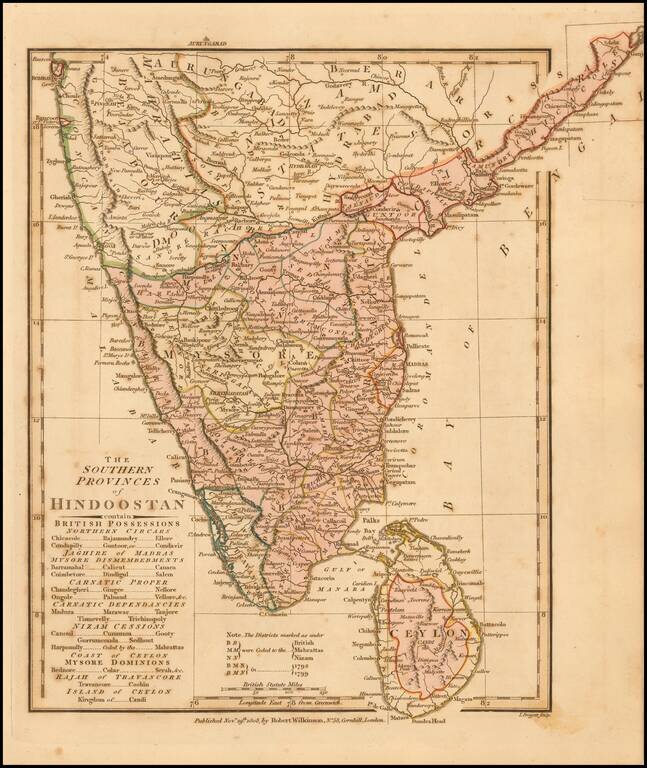
Delightful regional map of the Southern part of India and Ceylon, with nice details. Robert Wilkinson was active in London as a cartographic publisher from 1785 to 1825. He produced a number of nice works, including a General Atlas and a re-issuance...
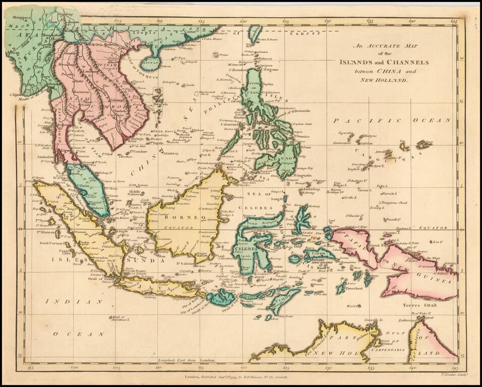
Highly detailed map of Southeast Asia, covering the region between Formosa and Hainan islands in the North and Australia in the South. Excellent detail in the Philippines and South East Asia. Robert Wilkinson was active in London as a cartographic...
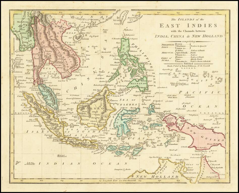
Highly detailed map of Southeast Asia, covering the region between Formosa and Hainan islands in the North and Australia in the South. Excellent detail in the Philippines, Indonesia and Southeast Asia. Johor is named, but not Singapore. Robert...
![Turkey in Asia . . . [shows Cyprus]](/map/small/52736.jpg)
Delightful regional map of Asia Minor, Cyprus, Kurdistan, Turcomania, Karaman Amasia and Natolia, with nice details. Robert Wilkinson was active in London as a cartographic publisher from 1785 to 1825. He produced a number of nice works, including a...
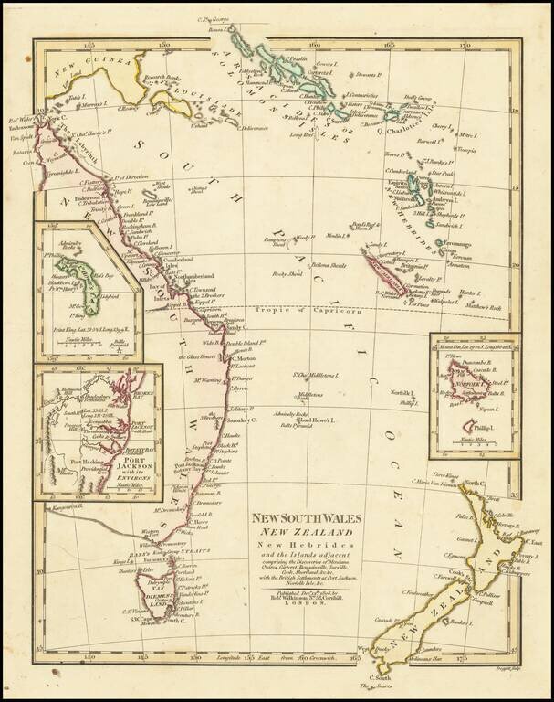
Interesting regional map of Eastern Australia and New Zealand, published by Robert Wilkinson. The map extends from the Solomon and Queen Charlotte Island in the North to New South Wales and New Zealand. Includes large insets of L. Howes and Norfolk...