William Faden (1749-1836) was the most prominent London mapmaker and publisher of the late-eighteenth and early-nineteenth centuries. His father, William Mackfaden, was a printer who dropped the first part of his last name due to the Jacobite rising of 1745.
Apprenticed to an engraver in the Clothworkers' Company, he was made free of the Company in August of 1771. He entered into a partnership with the family of Thomas Jeffreys, a prolific and well-respected mapmaker who had recently died in 1771. This partnership lasted until 1776.
Also in 1776, Faden joined the Society of Civil Engineers, which later changed its name to the Smeatonian Society of Civil Engineers. The Smeatonians operated as an elite, yet practical, dining club and his membership led Faden to several engineering publications, including canal plans and plans of other new engineering projects.
Faden's star rose during the American Revolution, when he produced popular maps and atlases focused on the American colonies and the battles that raged within them. In 1783, just as the war ended, Faden inherited his father's estate, allowing him to fully control his business and expand it; in the same year he gained the title "Geographer in Ordinary to his Majesty."
Faden also commanded a large stock of British county maps, which made him attractive as a partner to the Ordnance Survey; he published the first Ordnance map in 1801, a map of Kent. The Admiralty also admired his work and acquired some of his plates which were re-issued as official naval charts.
Faden was renowned for his ingenuity as well as his business acumen. In 1796 he was awarded a gold medal by the Society of Arts. With his brother-in-law, the astronomer and painter John Russell, he created the first extant lunar globe.
After retiring in 1823 the lucrative business passed to James Wyld, a former apprentice. He died in Shepperton in 1826, leaving a large estate.
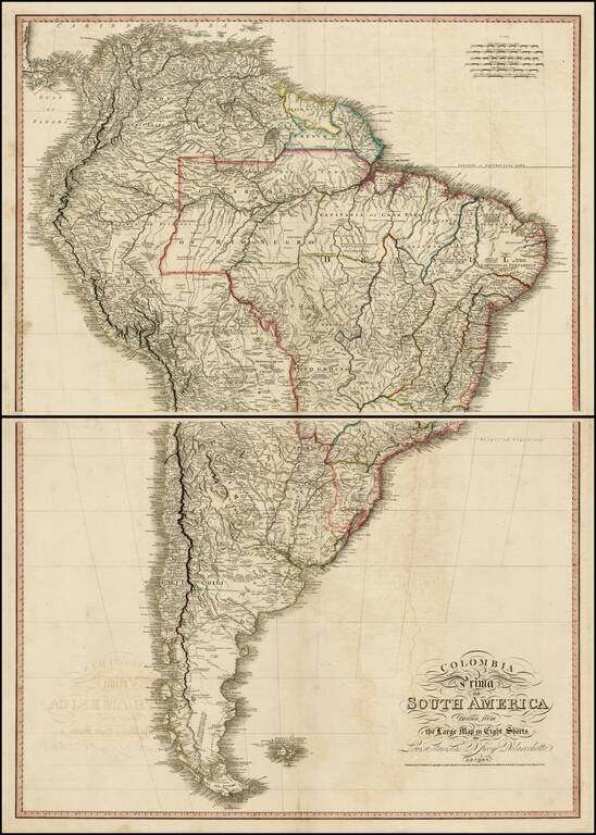
Exceptional map of South America, at the outset of its Century of Independence. The map is a fine large format two sheet version of one of the great maps of South America, drawn from Faden's 8 sheet map of South America, issued in 1807. One of the...
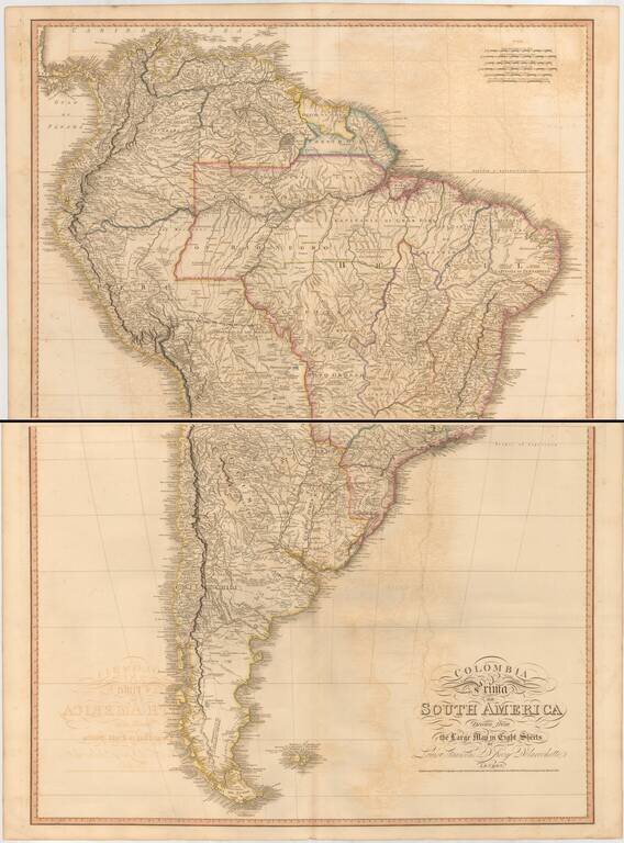
Two sheet edition of this exceptional map of South America, at the outset of its Century of Independence, without question the finest large format commercially published map of South America published in the early 19th Century. The map is based upon...
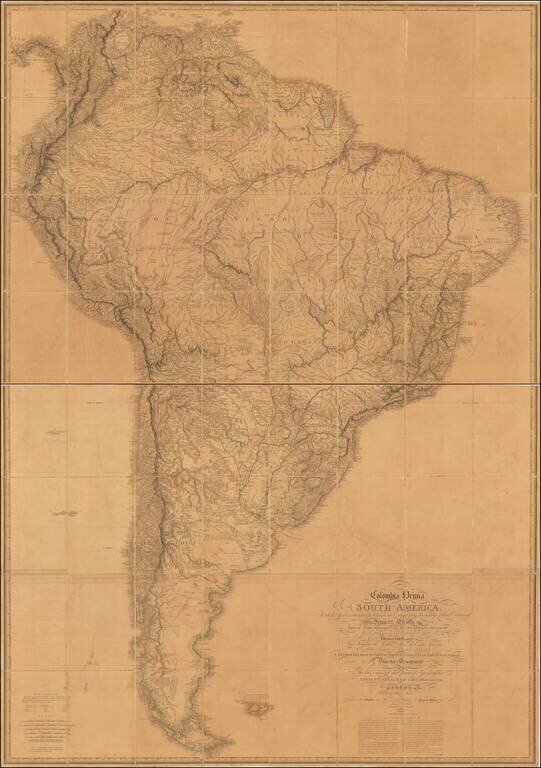
Rare Third State of The Best English Map of South America of The Early 19th Century Exceptional map of South America, at the outset of its Century of Independence, without question the finest large format commercially published map of South America...
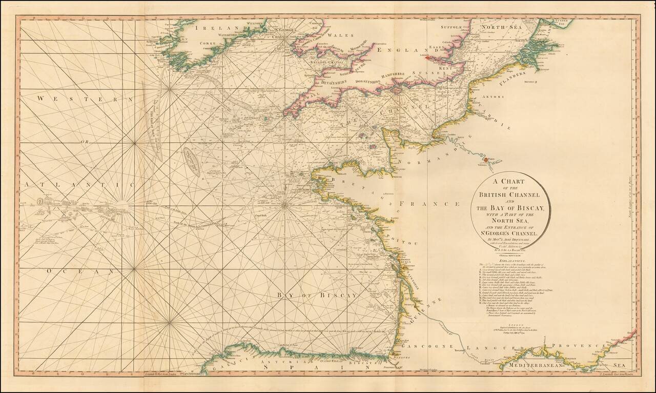
Striking 2 sheet chart of the English Channel, Bay of Biscaya, etc. The chart includes a number of coastal details, soundings, rhumb lines, etc. In addition, the routes of several historically important voyages are shown.
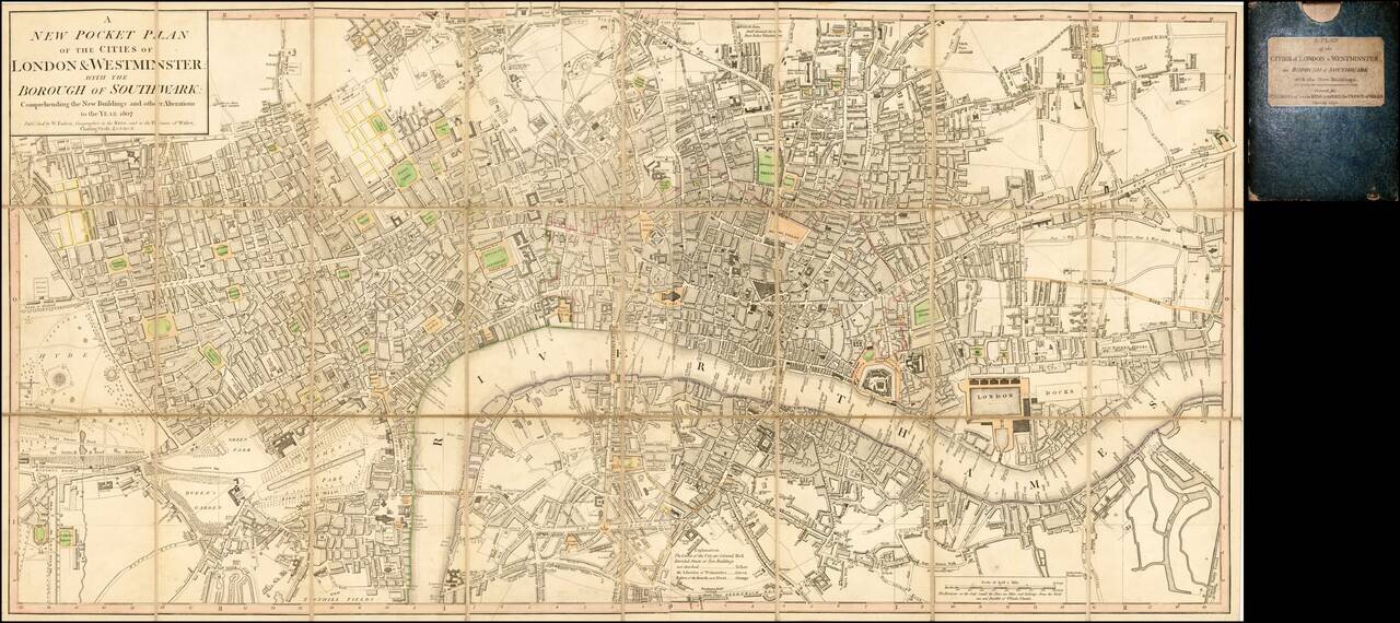
Dissected in 24 panels and laid on linen, with original slip case. A detailed and well executed folding plan of London showing the extents from Islington to Newington and Stepney to Hyde Park. Faden's plan of London was first published in the 1780s...
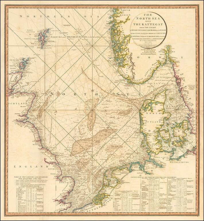
Striking and highly detailed sea chart of the North Sea from the Straits of Dover to the Shetlands and North Bergen in Norway, and east through the Kattegat to Copenhagen. Highly detailed sea chart, with extensive tables and annotations. Shows...
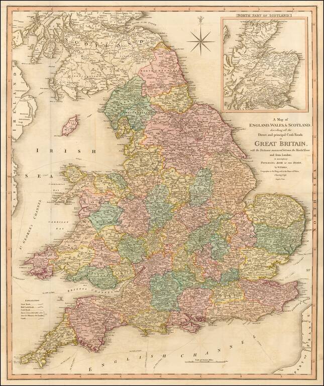
Detailed map of England, Wales and Scotland focusing on the roads between the principal market towns and showing distances. The explanation notes the Great Roads, Mail Coach Roads, Cross Roads, Distances from London, Canals, etc.
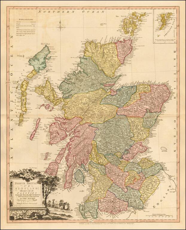
Striking map of Scotland, colored by shires, from Faden's General Atlas. One of the best late 18th Century maps of Scotland to appear in a commercial atlas.
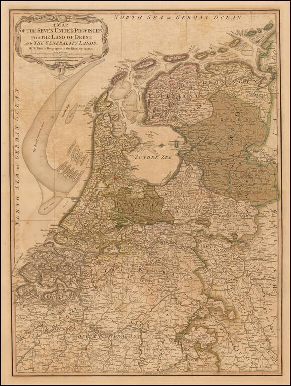
First edition of Faden's large and detailed map of Holland, originally issued 1789. The 'Generality Lands' were parts of Catholic Flanders captured and controlled by the United Provinces.
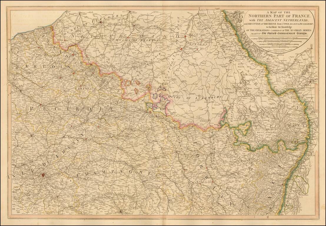
William Faden's large format map of Northern France, Luxembourg, Belgium and western Germany, showing the Theater of War between the Austrian and French Troops. A number of roads are shown. One of the most detailed English language maps of the region...
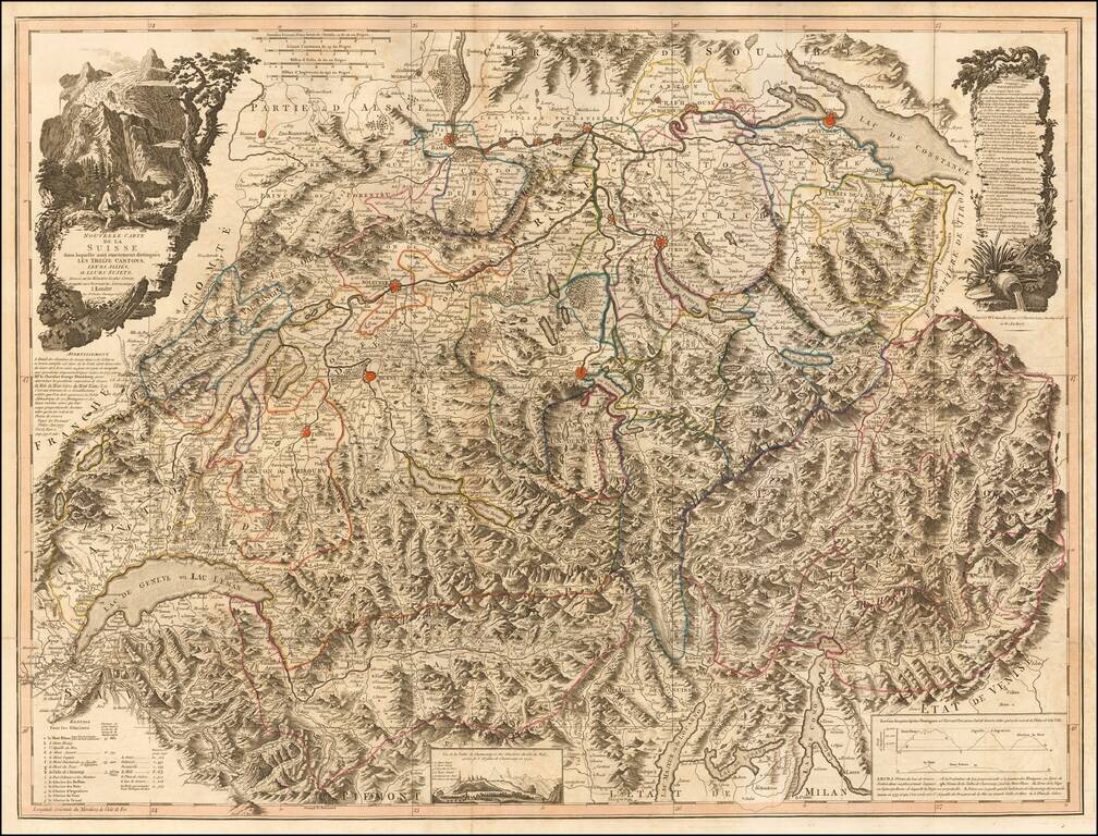
Scarce large format map of Switzerland and Northern Italy. The map is a remarkable depiction of the topography of the region, reminiscent of the work of Cantelli and Rossi at the end of the 17th Century. The map reflects the art of map printing at...
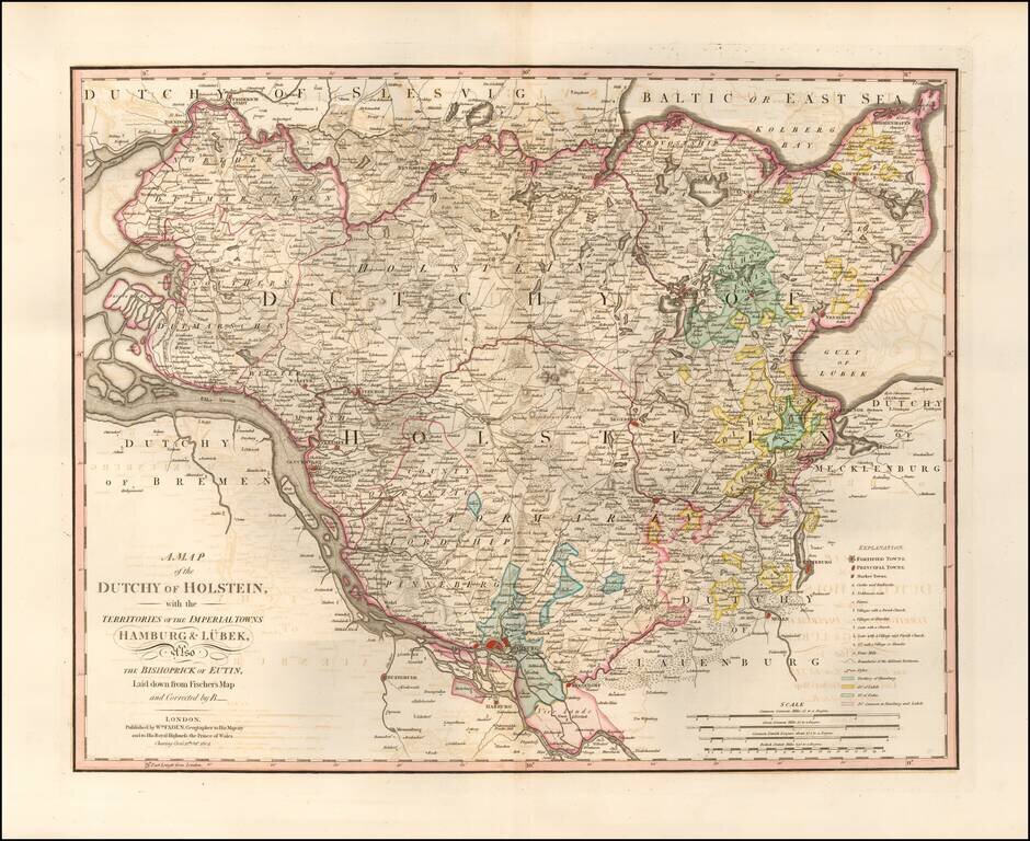
Highly detailed map of northern Germany, published by William Faden, one of England's leading mapmakers in the late 18th Century. The map provides an exceptionally detailed image of the region, including roads, towns, rivers, islands, lakes, etc.
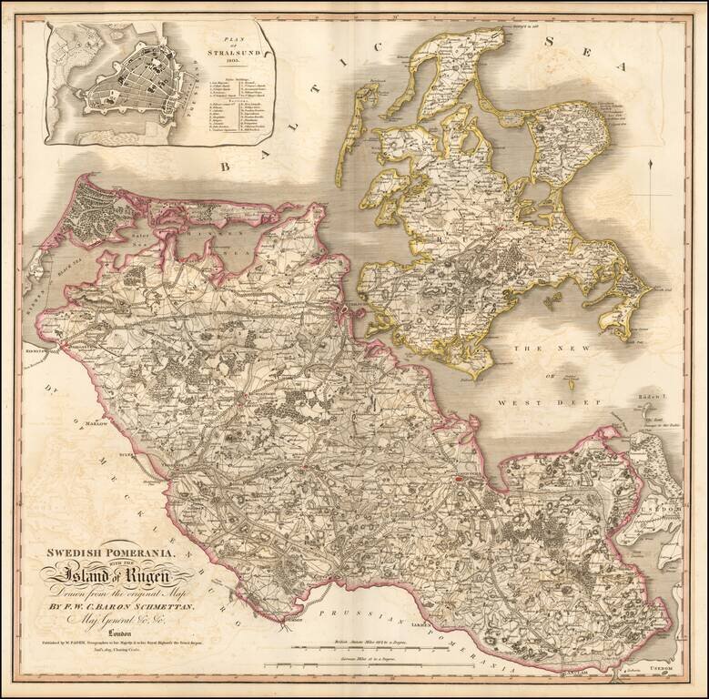
Nice example of Faden's double-page engraved map of Rugen and Swedish Pomerania, a Dominion under the Swedish Crown from 1630 to 1815, which was situated on what is now the Baltic coast of Germany and Poland. The map includes an inset town plan of...
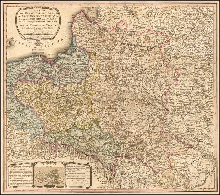
Scarce map of Poland, showing both the dismemberment and newest boundaries, following the Congress of Vienna. This map was originally published with a different title by William Faden in 1799. The map is based on the Rizzi-Zannoni 24-sheet map of 1772...
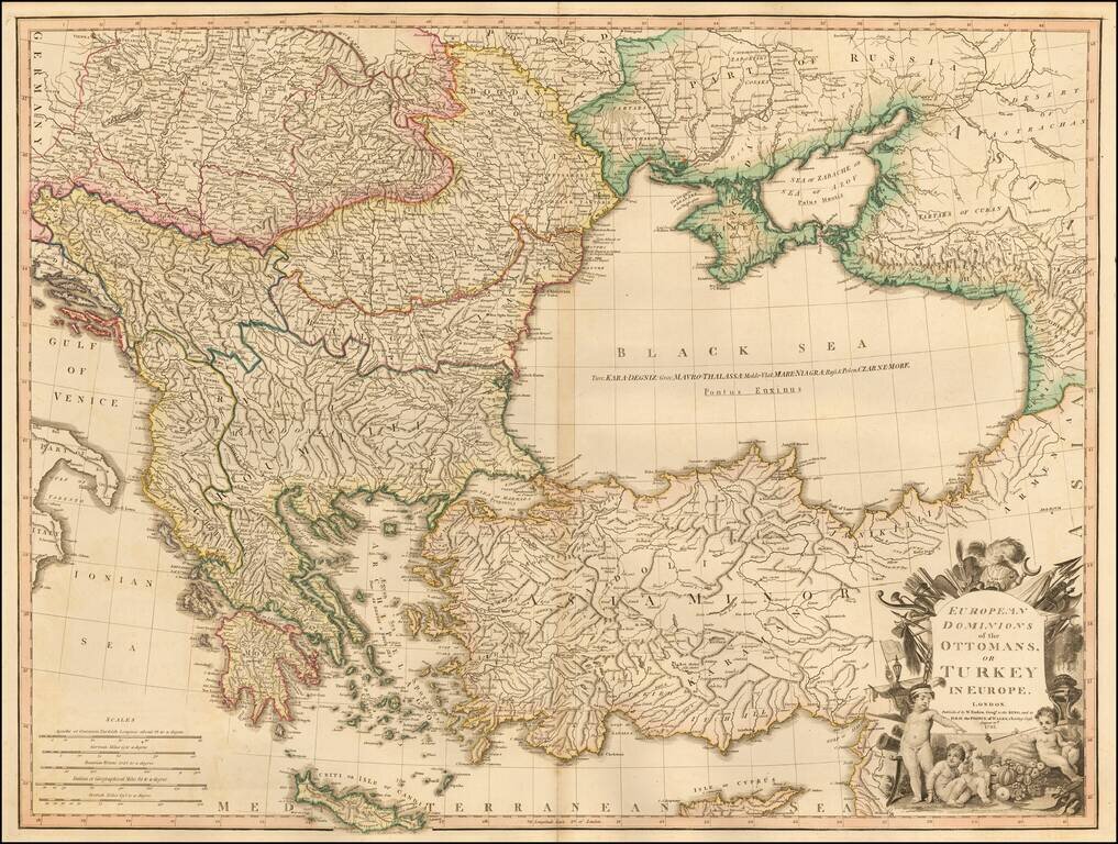
Large detailed Faden map of the region bounded by Greece and the Ionian Sea, the Ukraine, the Gulf of Venice, Asia Minor and the northern coast of Cyprus. Extremely detailed. The map shows the Ottoman Empire, circa 1720 and includes an ornate...
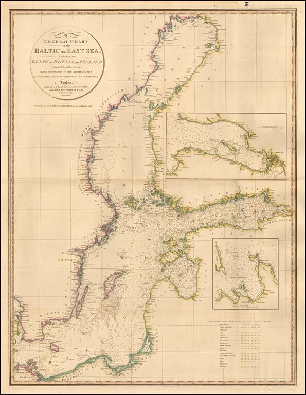
Highly detailed chart of the Baltic and contiguous coasts, from Faden's general atlas. Includes detailed insets of the areas around Revel and St. Petersburg. One of the most detailed general charts of the Baltic to appear in an English Commercial...