William Faden (1749-1836) was the most prominent London mapmaker and publisher of the late-eighteenth and early-nineteenth centuries. His father, William Mackfaden, was a printer who dropped the first part of his last name due to the Jacobite rising of 1745.
Apprenticed to an engraver in the Clothworkers' Company, he was made free of the Company in August of 1771. He entered into a partnership with the family of Thomas Jeffreys, a prolific and well-respected mapmaker who had recently died in 1771. This partnership lasted until 1776.
Also in 1776, Faden joined the Society of Civil Engineers, which later changed its name to the Smeatonian Society of Civil Engineers. The Smeatonians operated as an elite, yet practical, dining club and his membership led Faden to several engineering publications, including canal plans and plans of other new engineering projects.
Faden's star rose during the American Revolution, when he produced popular maps and atlases focused on the American colonies and the battles that raged within them. In 1783, just as the war ended, Faden inherited his father's estate, allowing him to fully control his business and expand it; in the same year he gained the title "Geographer in Ordinary to his Majesty."
Faden also commanded a large stock of British county maps, which made him attractive as a partner to the Ordnance Survey; he published the first Ordnance map in 1801, a map of Kent. The Admiralty also admired his work and acquired some of his plates which were re-issued as official naval charts.
Faden was renowned for his ingenuity as well as his business acumen. In 1796 he was awarded a gold medal by the Society of Arts. With his brother-in-law, the astronomer and painter John Russell, he created the first extant lunar globe.
After retiring in 1823 the lucrative business passed to James Wyld, a former apprentice. He died in Shepperton in 1826, leaving a large estate.
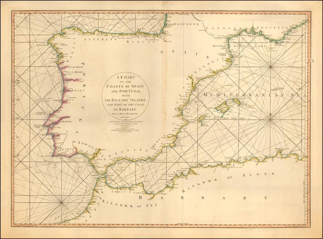
Detailed sea chart of the Balearic Islands, Spain, and Portugal. The chart extends to Provence and much of the Barbary coast to Bona. Good detail along coastal areas including the Straits of Gibraltar.
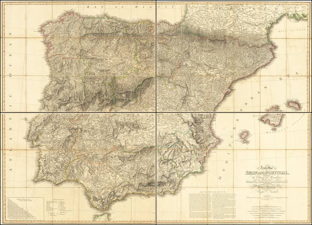
First State of Faden's Rare Map of the Iberian Peninsula Monumental large format map of Spain, published in London by William Faden in 1810. This fine large format map was distributed to British officers during the Peninsular War (1807-1814). The...
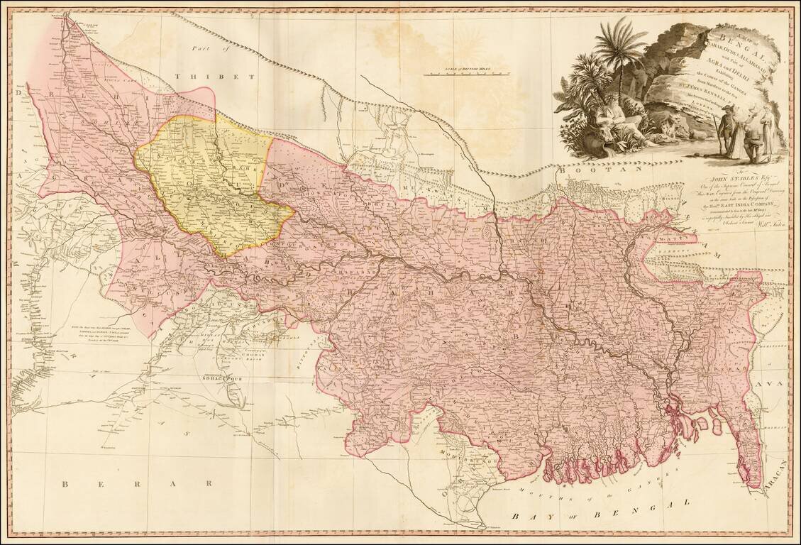
Detailed map of the Upper Indian provinces, extending to Tibet in the North and the Bay of Bengal in the South. Th map was drawn by James Rennell F.R.S., Surveyor General of India, and engraved from the original drawing in the Possession of the East...
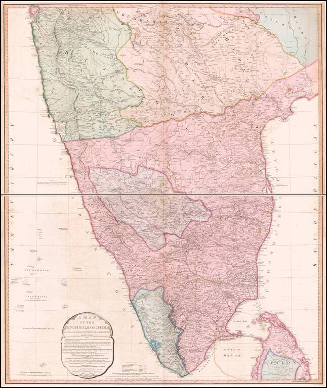
Striking Map of British India This highly detailed two-page map depicts the southern portion of India as it was known at the turn of the nineteenth century. It includes thorough information about the extent of British rule in India at the time. The...

Highly detailed map of Egypt, the Holy Land and part of the Saudi Peninsula. Shows tracks of explorers and caravan routes. Key translates Arabic names. Includes Jerusalem in the east.
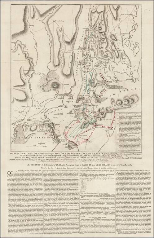
Rare Final State of Faden's Plan of the Battle of New York Fine example of Faden's separately issued broadside map showing the British Invasion of New York City in August and September of 1776. The present example is the final state of the map, with...