Frans Hogenberg (ca. 1540-ca. 1590) was a Flemish and German engraver and mapmaker who also painted. He was born in Mechelen, south of Antwerp, the son of wood engraver and etcher Nicolas Hogenberg. Together with his father, brother (Remigius), uncle, and cousins, Frans was one member of a prominent artistic family in the Netherlands.
During the 1550s, Frans worked in Antwerp with the famous mapmaker Abraham Ortelius. There, he engraved the maps for Ortelius’ groundbreaking first atlas, published in Antwerp in 1570, along with Johannes van Deotecum and Ambrosius and Ferdinand Arsenius. It is suspected he engraved the title page as well. Later, Ortelius supported Hogenberg with information for a different project, the Civitates orbis terrarium (edited by Georg Braun, engraved by Hogenberg, published in six volumes, Cologne, 1572-1617). Hogenberg engraved the majority of the work’s 546 prospects and views.
It is possible that Frans spent some time in England while fleeing from religious persecution, but he was living and working in Cologne by 1580. That is the city where he died around 1590. In addition to his maps, he is known for his historical allegories and portraits. His brother, Remigius, also went on to some fame as an engraver, and he died around the same time as his brother.
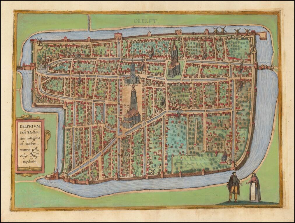
Nice old color example of the first state of Braun & Hogenberg's view of Delft. The first state includes a simple lettered title cartouche and an the name "Deelft" at the top. The later state adds a more elaborate script in both the title and the...
![[Nymmegen] Novimagium sive Noviromagum vulgo Nijmmegen . . . .](/map/small/55515mp2.jpg)
Nice old color example of this early birdseye view of Nijmegen. From Braun & Hogenberg's Civitatus Orbis Terrarum, the most important book of town plans and views published in the 16th Century. A bird's-eye view of the city, where the royal...
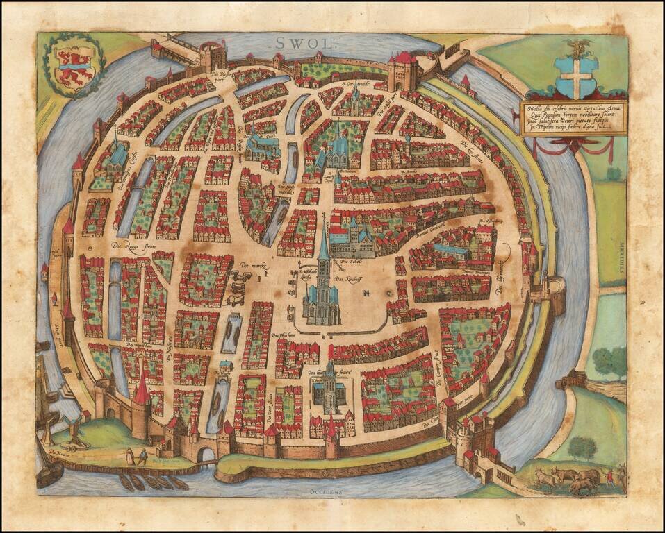
Fine early birds-eye view of Zwolle, the capital city and municipality of the province of Overijssel. From Braun & Hogenberg's Civitatus Orbis Terrarum, the most important book of town plans and views published in the 16th century.
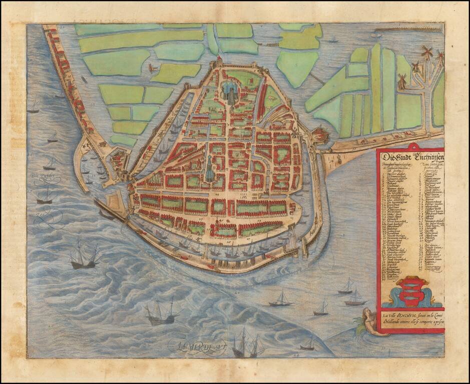
Decorative early view of Enkhuizen, from Braun & Hogenberg's Civitatus Orbis Terrarum, the most important book of town plans and views published in the 16th century.
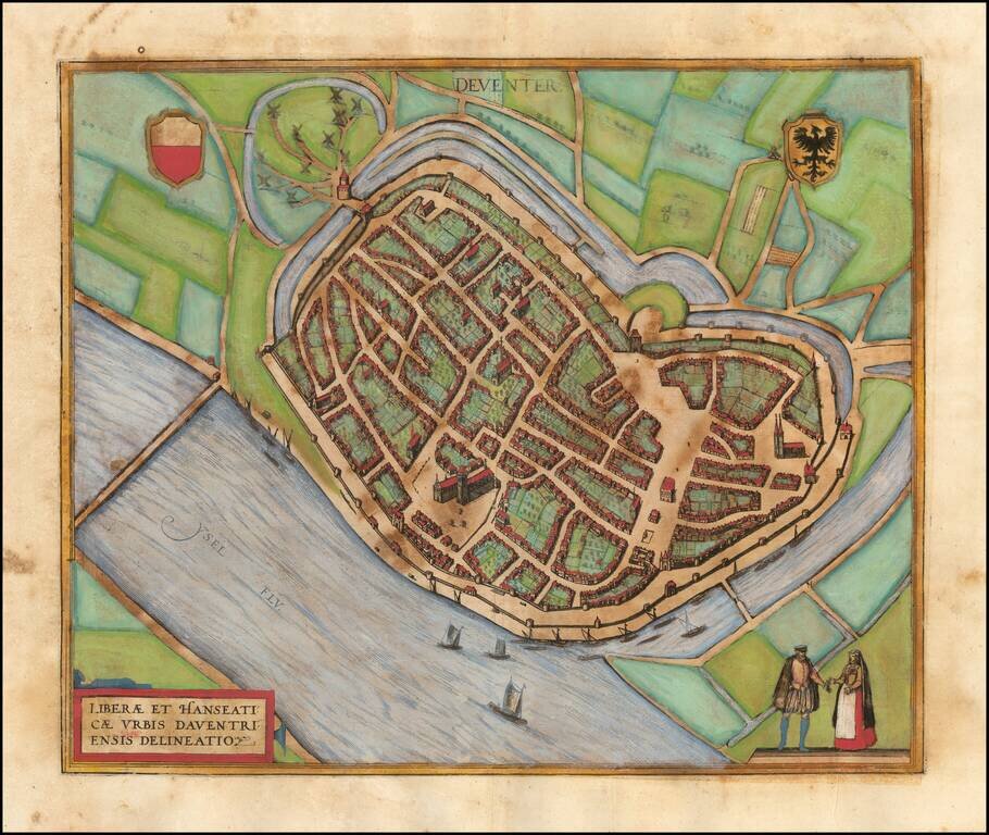
Fine early birds-eye view of Deventer. From Braun & Hogenberg's Civitatus Orbis Terrarum, the most important book of town plans and views published in the 16th century.
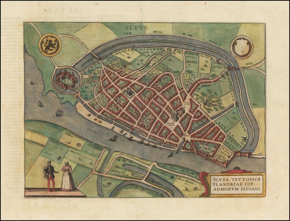
Fine early plan of Sluis, in Zeeland, published by Braun & Hogenberg. The town received city rights in 1290. In 1340, the Battle of Sluis was fought nearby at sea. In 1587, during the Eighty Years' War, the town was captured by Spanish troops...
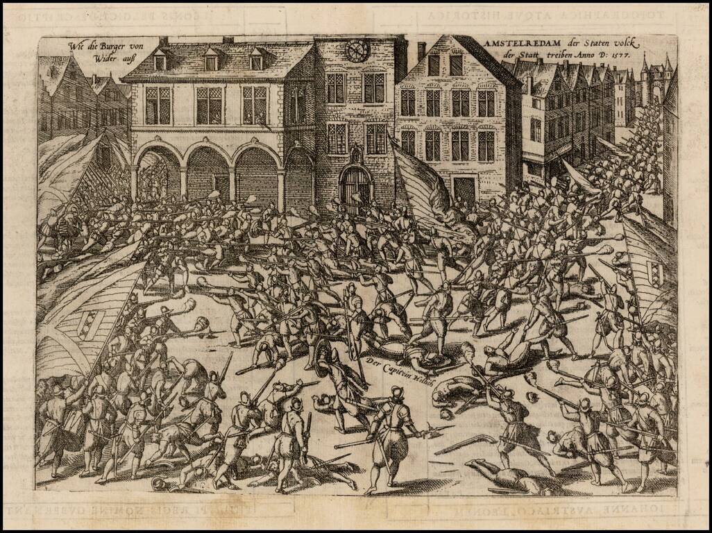
A dramatic antique engraving by Frans Hogenberg showing the troops of William of Orange battling with the citizens of Amsterdam, 23 November 1577. Captain Herman Helling is shown dead at the center of the fracas. This was an event during the Eighty...
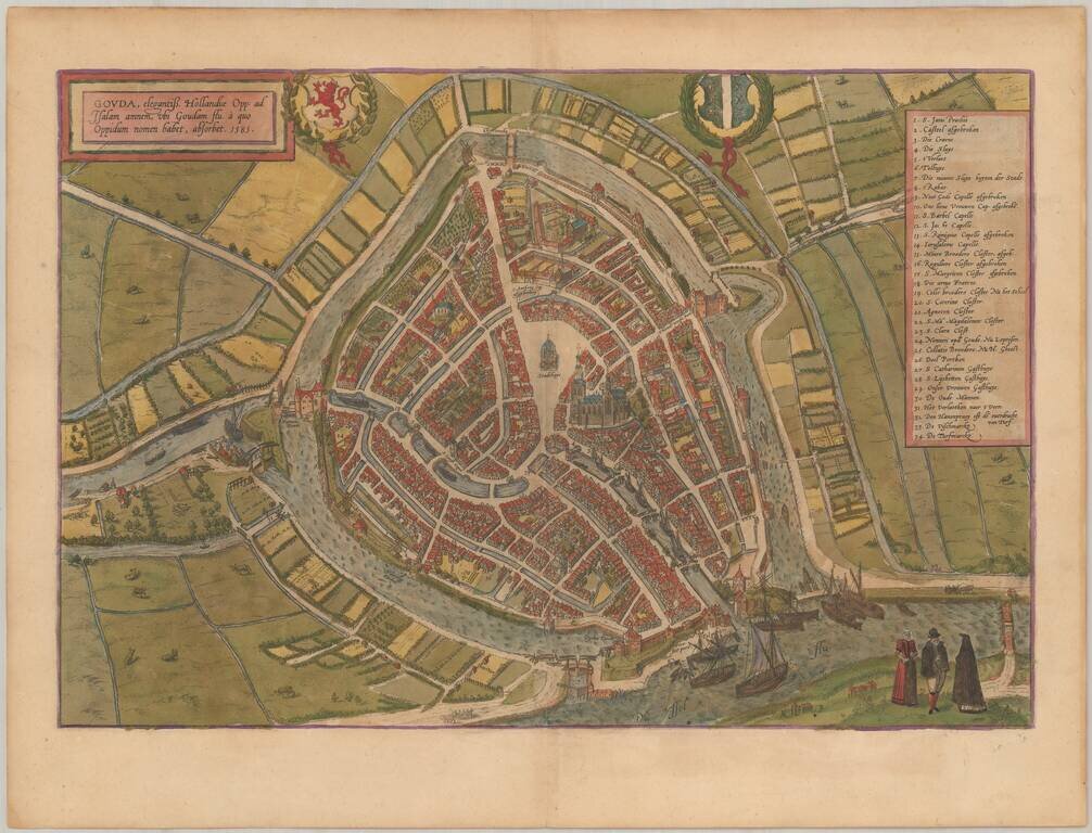
Nice old color example of Braun & Hogenberg's map of Gouda. This is a bird's-eye view of the city from the south. In the foreground is the confluence of the Gouwe and the IJssel. Prominent features are the town hall (Stadthuys) and the Gothic...
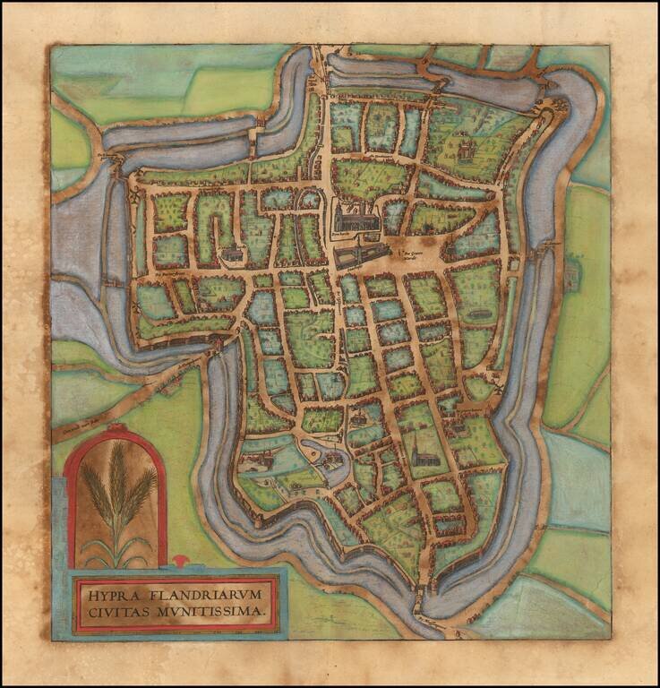
Nice old color example of of Braun & Hogenberg's view of Ieperen.
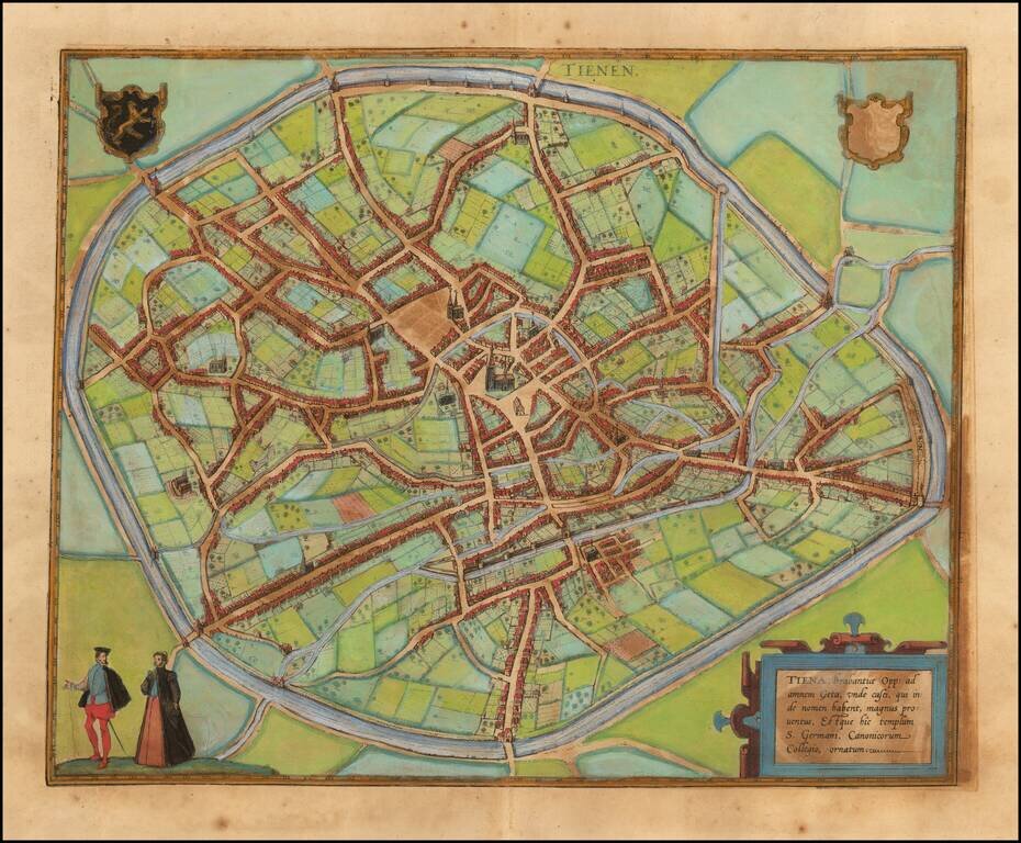
Decorative early views of Tienen in Flemish Brabant. From Braun & Hogenberg's Civitatus Orbis Terrarum, the most important book of town plans and views published in the 16th century.
![[Brugge] Brugae, Flandricarum Urbium Ornamenta](/map/small/64453.jpg)
Fine early birdseye view of the City of Brugge in Belgium. From Braun & Hogenberg's Civitatus Orbis Terrarum, the most important book of town plans and views published in the 16th Century.
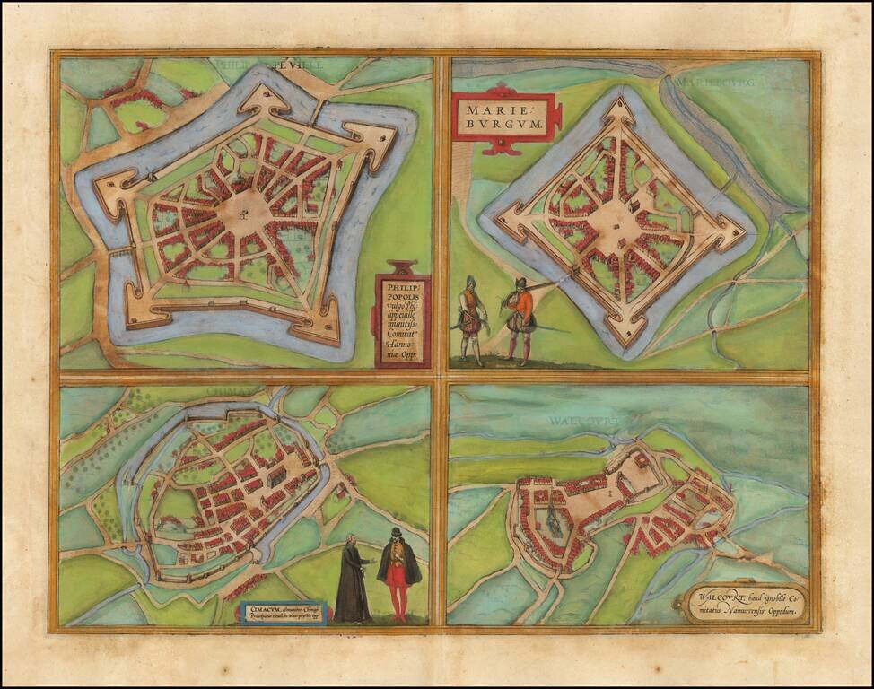
Fine set of 4 views of the towns of Philippeville, Mariembourg, Chimay, and Walcourt, from Braun & Hogenberg's Civitatus Orbis Terrarum.
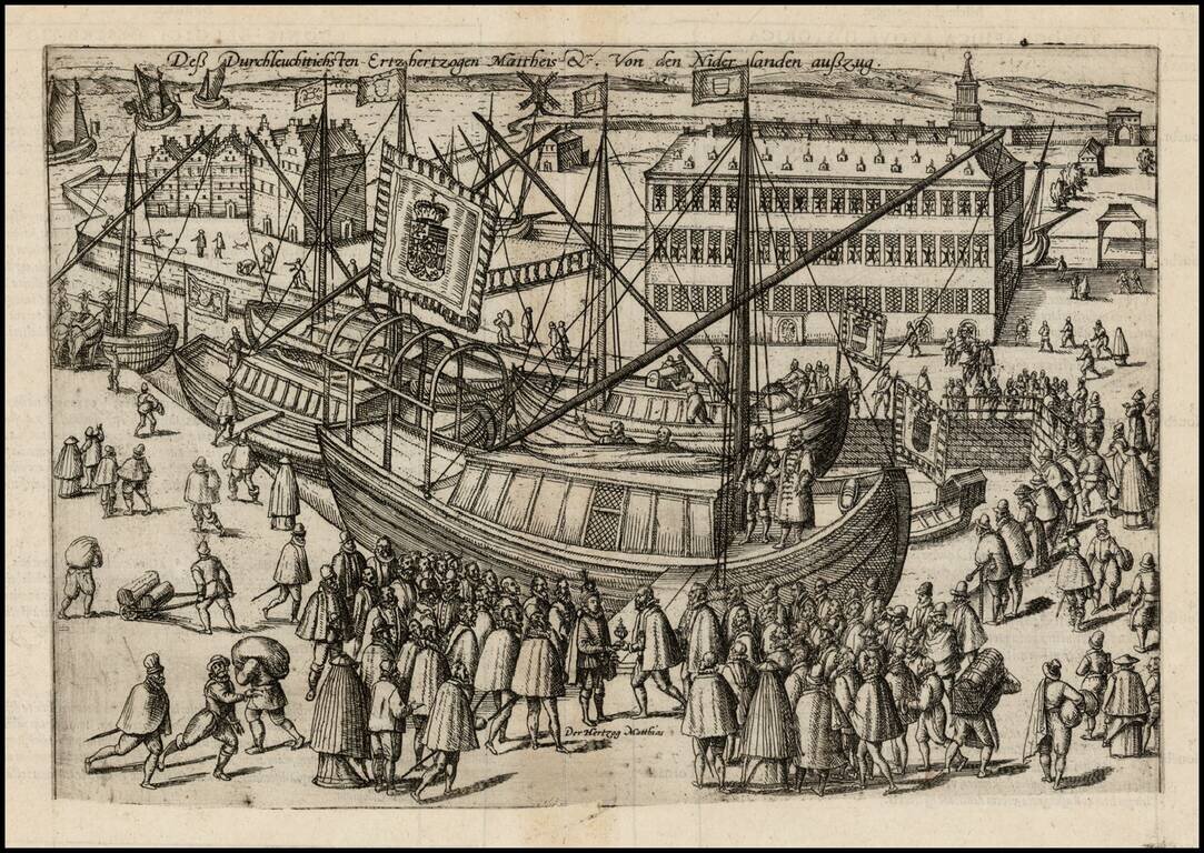
Antique engraving of the departure of Archduke Matthew from the Netherlands, 29 October 1581; Archduke Matthew and entourage are depicted embarking on their ships. This is the 1605 edition, with the plate trimmed at the bottom to remove the text,...
![[Siege of Oostende] Ostende Wie es itziger zeit gelegen, daeraus zu sehen wie weit die Ertzherzog hinan und hinein geruckt . . .](/map/small/39971.jpg)
Rare map of the Siege of Oostende, Belgium, created in the final year of the Siege of Ostend, published at the conclusion of the Spanish siege of the Ostend. Between 1601 and 1604, the Spanish besieged Ostend. The Dutch, losing 20,000 men during the...

Old hand-color example of this early plan of Luxembourg, from Braun & Hogenberg's Civitates Orbis Terrarum, the first major atlas of City Plans and Views, based upon the work of Jacob Van Deventer. The cartouche translates as follows: Luxembourg,...
![[Swiss Cities] Decem Et Tria Loca Confoederatorum Helvetia](/map/small/54682mp2.jpg)
Braun & Hogenberg's set of 13 views of Swiss towns, first issued in 1572. The towns illustrated are Schwyz, Unterwalden, Zug, Glarus, Basel, Zurich, Bern, Lucerne, Uri, Fribourg, Solothurn, Schaffhausen, and Appenzell. Between 1291 and 1512, the...