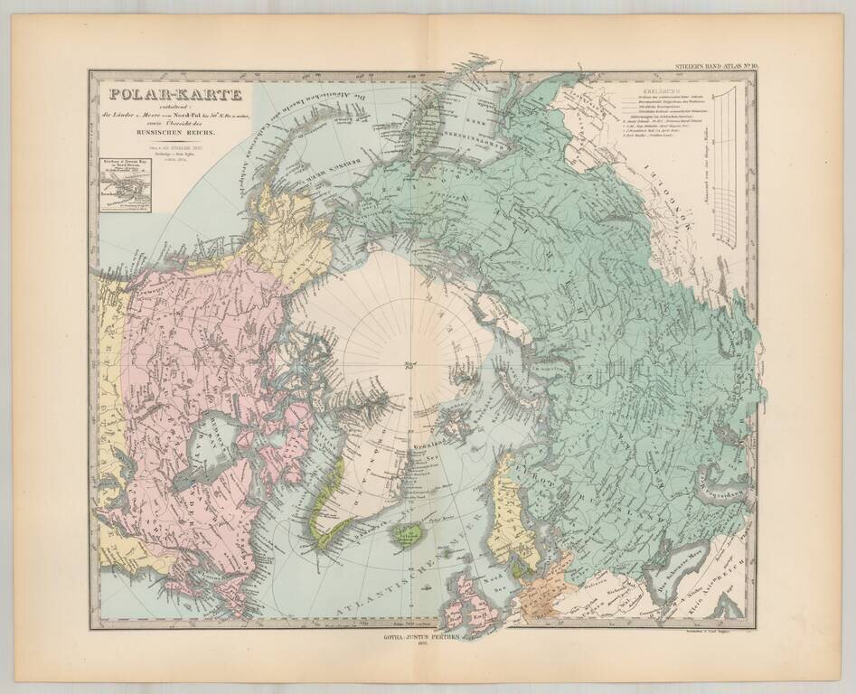
Striking map of the polar region, extending south to 50 degrees. Nice detail in Alaska and Canada, including forts, several routes and other interesting details.
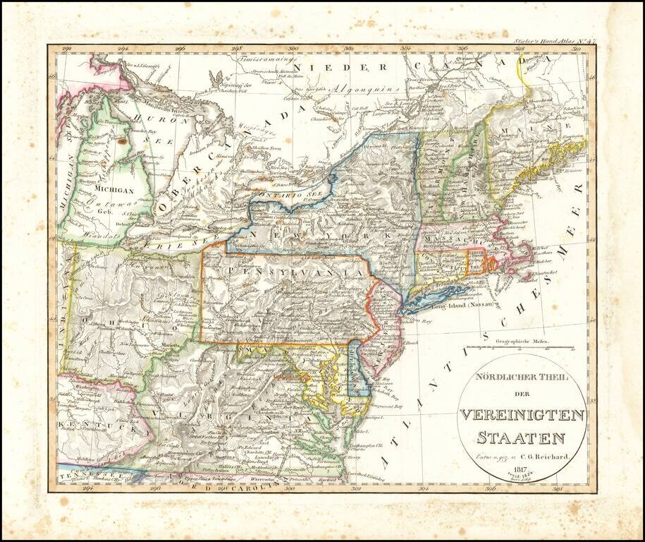
Rare early map of a portion of the Midwest and regions to the East, from Lake Michigan to Kentucky and Virginia to Maine. Early depiction of Michigan Territory.
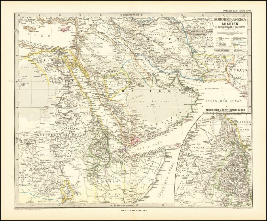
Finely detailed map centered on the Arabian Peninsula, published by Germany's leading mapmaker. Abu Dhabi is named (Abu-Debi), as is Schardscha (Sharjah), and Dibba. Katar (Qatar) is named, as is Sabara (Zubara), El Bedaa (Doha / El Bedaya) and Wakra...
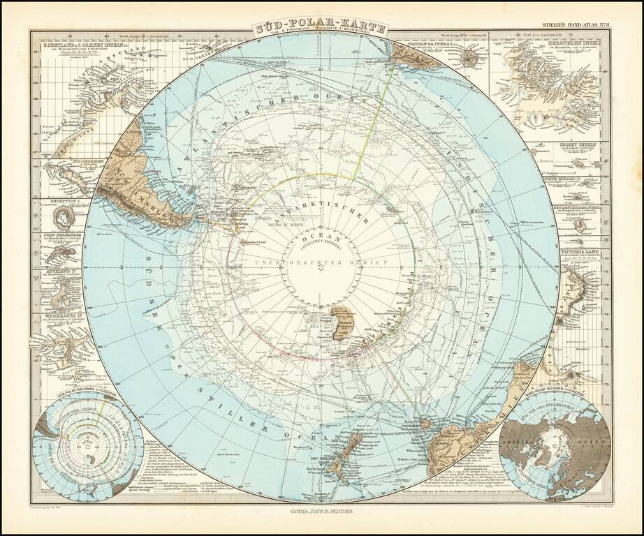
Very detailed map of the south polar regions, illustrating the great precision of Stieler's work. Remarkable amount of explorer details, including: Cook 1772-75 Bellinghausen 1819-21 Wedell 1822-23 Biscoe 1830-32 Kemp 1834 Ballen 1839...
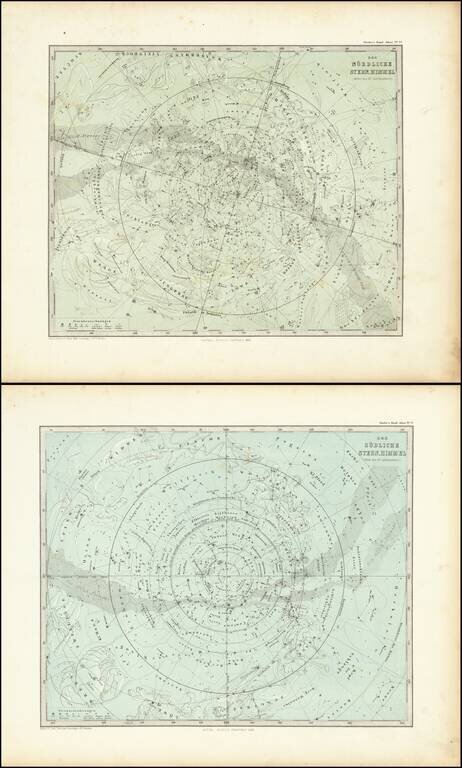
Nice pair of star charts of the Northern and Sourthern Hemisphere, showing various constellations with accompanying subtle illustrations.