Sebastian Münster (1488-1552) was a cosmographer and professor of Hebrew who taught at Tübingen, Heidelberg, and Basel. He settled in the latter in 1529 and died there, of plague, in 1552. Münster made himself the center of a large network of scholars from whom he obtained geographic descriptions, maps, and directions.
As a young man, Münster joined the Franciscan order, in which he became a priest. He then studied geography at Tübingen, graduating in 1518. He moved to Basel, where he published a Hebrew grammar, one of the first books in Hebrew published in Germany. In 1521 Münster moved again, to Heidelberg, where he continued to publish Hebrew texts and the first German-produced books in Aramaic. After converting to Protestantism in 1529, he took over the chair of Hebrew at Basel, where he published his main Hebrew work, a two-volume Old Testament with a Latin translation.
Münster published his first known map, a map of Germany, in 1525. Three years later, he released a treatise on sundials. In 1540, he published Geographia universalis vetus et nova, an updated edition of Ptolemy’s Geographia. In addition to the Ptolemaic maps, Münster added 21 modern maps. One of Münster’s innovations was to include one map for each continent, a concept that would influence Ortelius and other early atlas makers. The Geographia was reprinted in 1542, 1545, and 1552.
He is best known for his Cosmographia universalis, first published in 1544 and released in at least 35 editions by 1628. It was the first German-language description of the world and contained 471 woodcuts and 26 maps over six volumes. Many of the maps were taken from the Geographia and modified over time. The Cosmographia was widely used in the sixteenth and seventeenth centuries. The text, woodcuts, and maps all influenced geographical thought for generations.
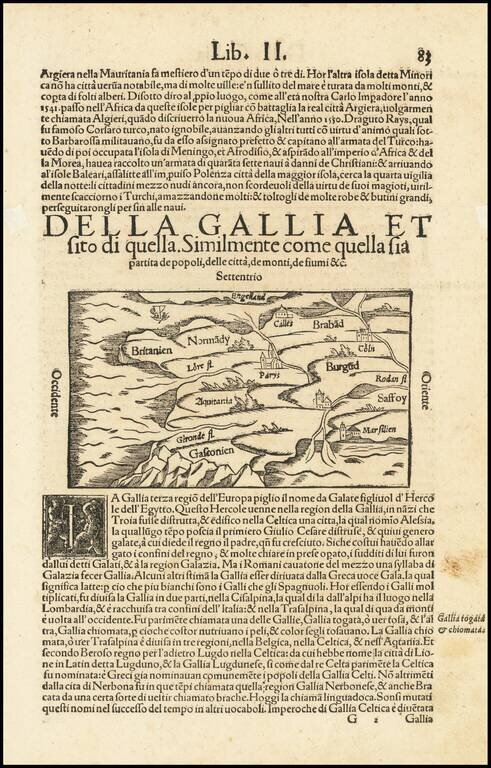
Interesting early map of France, using a stylized hill format which was popularized in maps of the 15th Century. Munster's Cosmography was one of the most influential georgraphical works of the 16th Century. It was published in a number of editions...
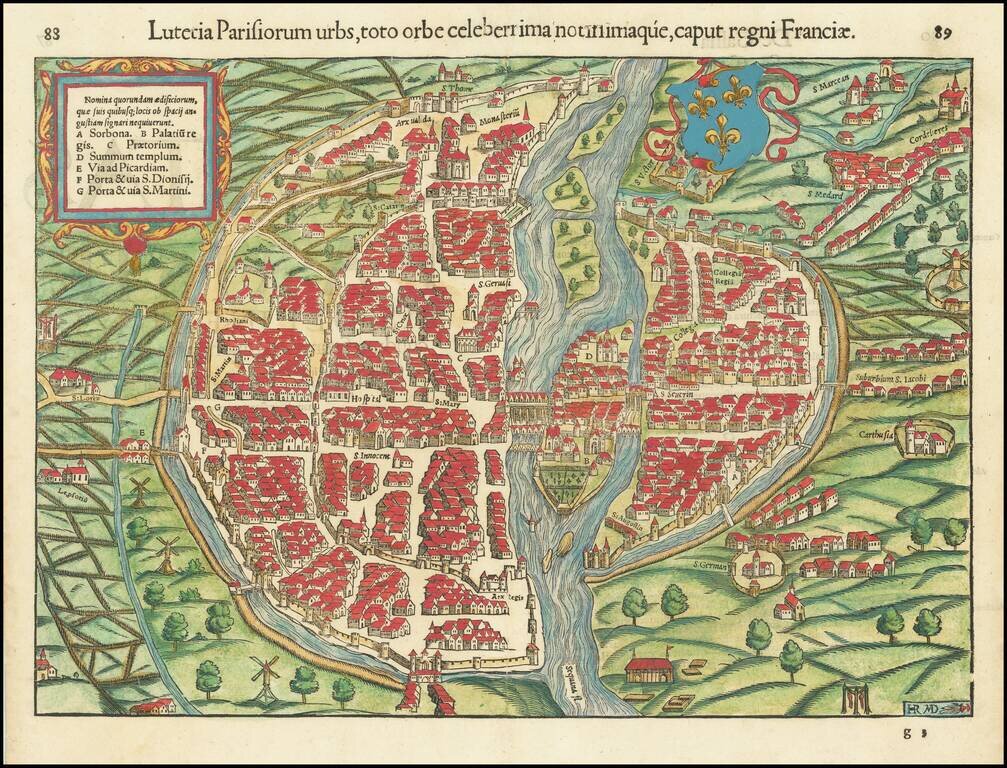
Paris in the 16th Century. Gorgeous example of Munster's early birdseye view of Paris. Includes a coat of arms and illustrates the town in remarkable detail, including buildings, bridges, the fortified walls of the city and other landmarks within the...
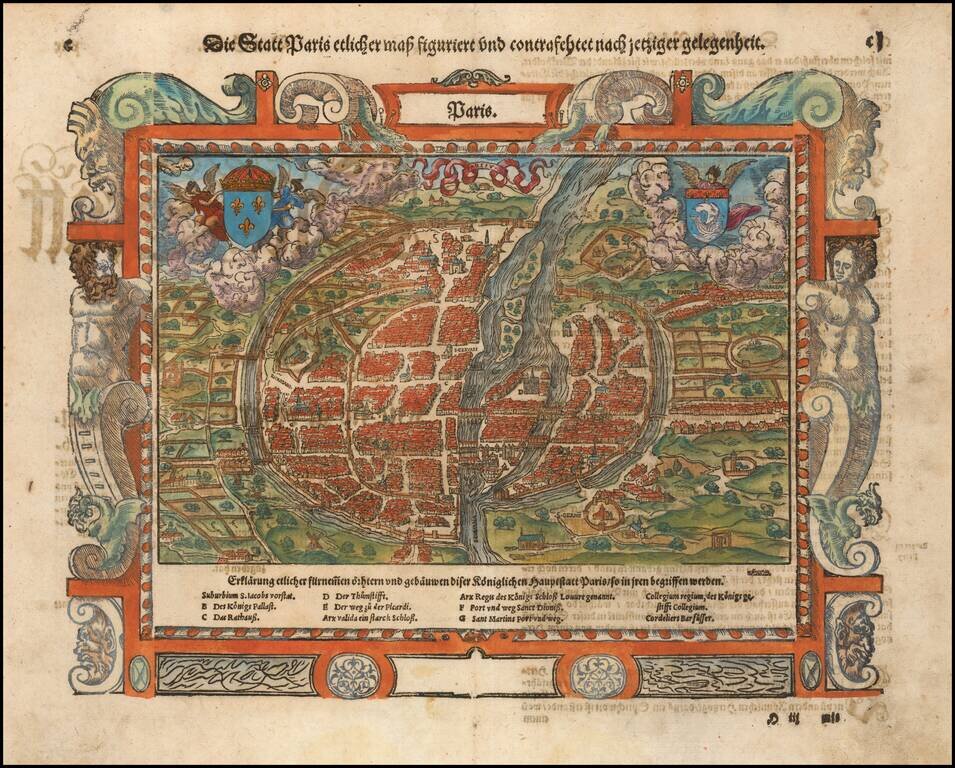
Nice example of Munster's second map of Paris, from Munster's Cosmographia. The map includes two coats of arms and a decorative picture frame border. Excellent early city plan, including the fortified walls of the city and place names inside of the...
![Tabula Europae IIII [German Empire & Baltic]](/map/small/60226.jpg)
Detailed map of the German Empire, Baltic and part of the Balkans, extending to the Carpathian Mountains and the Danube. Shows are remarkable depiction of the region, as known in Ptolemy's time. This is the 1st edition, second state of Munster's map,...
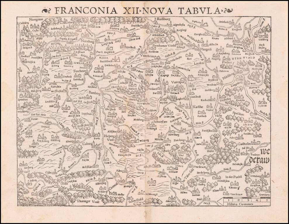
Munster's important early regional map of Germany, centered on Bamberg and the Mein River. One of the earliest obtainable modern maps of the region. From the 1542 edition of Munster's Geographia, one of the most important 16th Century geographical...
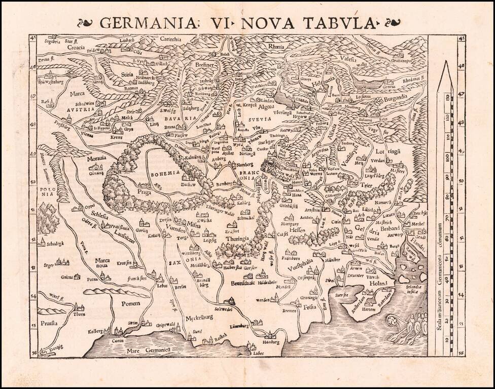
Excellent modern map of German Europe, with South oriented at the top of the map. The map extends from the Baltic (Danzig, Kolberg, Rostok and Lubec) and Vistula to the Low Countries (Amsterdam, Rotterdam, Selandie Insulae, and Ghent) in the North to...
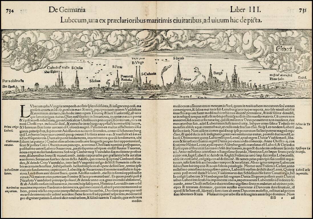
Early double page birdseye view of the city of Lubeck, with Heraldic images in the sky. Munster's Cosmography was one of the most influential georgraphical works of the 16th Century. It was published in a number of editions over a half century and was...
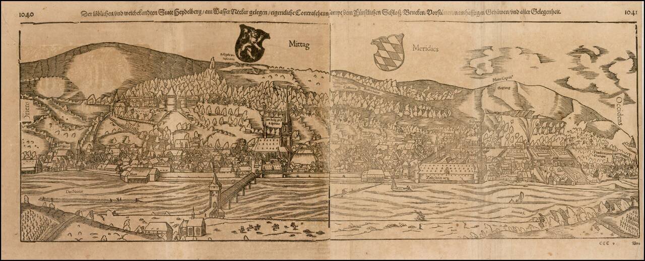
Early decorative birdseye view from a German edition of Munster's Cosmography. One of the most influential geographical works of the 16th Century. The Heidelberg view is one of the largest and most decorative of all of Munster's views.

Early double page birdseye view of Meissen, with Heraldic images and coats of arms in the sky. Munster's Cosmography was one of the most influential georgraphical works of the 16th Century. It was published in a number of editions over a half century...
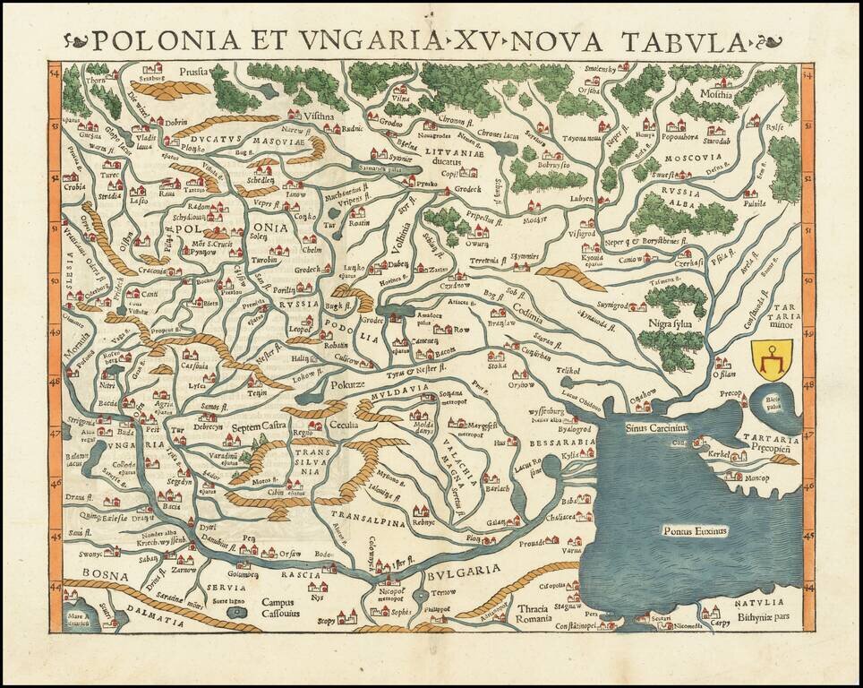
The Earliest Obtainable Map of Poland, Ukraine, Belarus, Hungary, etc. Rare early state of Munster's map of Poland, Lithuania, the Ukraine, Moscovy and the Balkans, extending from Prussia, Vilna and Smolensky in the north to Bosnia, Bulgaria,...
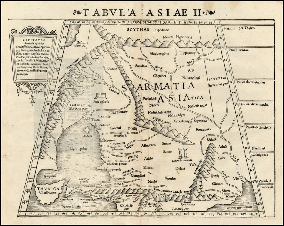
Rare first edition of Munster's Ptolemaic map of part of the Ukraine and the region between the Black Sea and Caspian Sea extending south to include all of Armenia Maior and part of Armenia Minoris. Shows Noahs Arc in the Caspian Sea, believed to have...
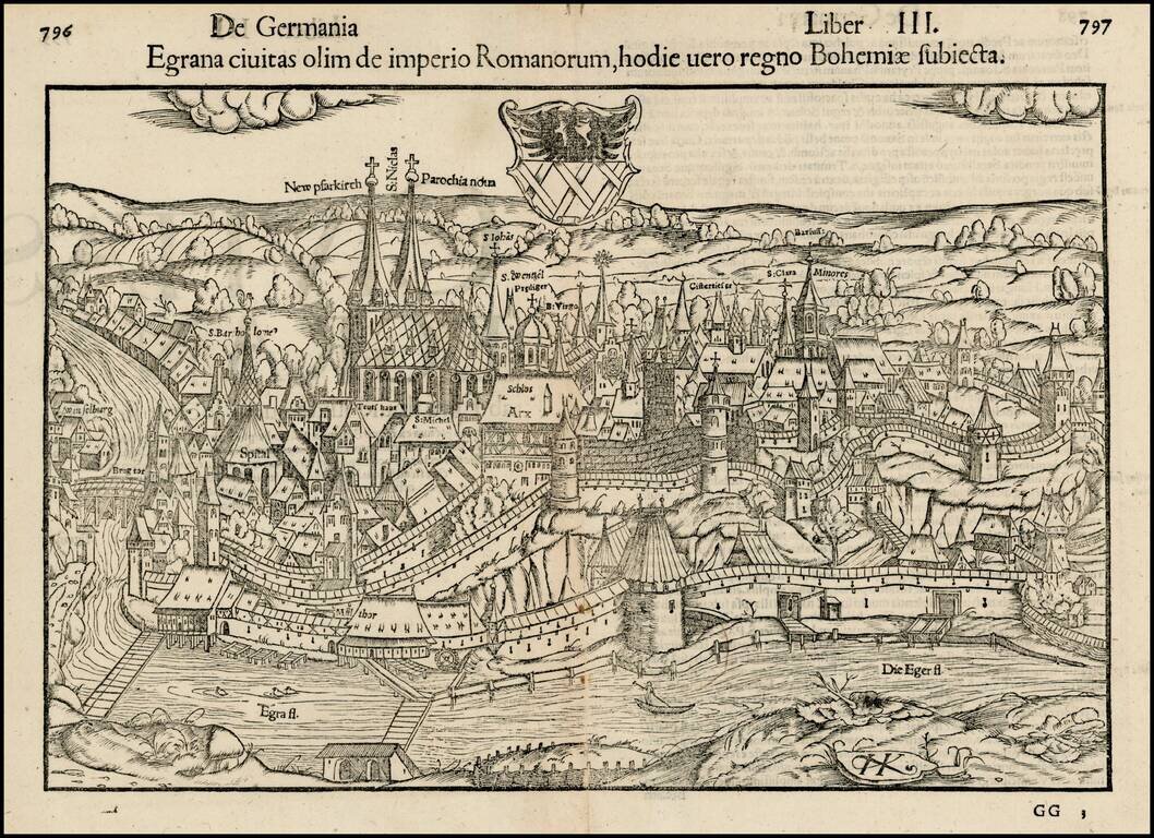
Important early view of the walled town of Eger, or Cheb, in the Czech Republic, including the city's coat of arms and the prominently labeled Church of Saint Nicholas. Munster's Cosmography was one of the most influential geographical works of the...
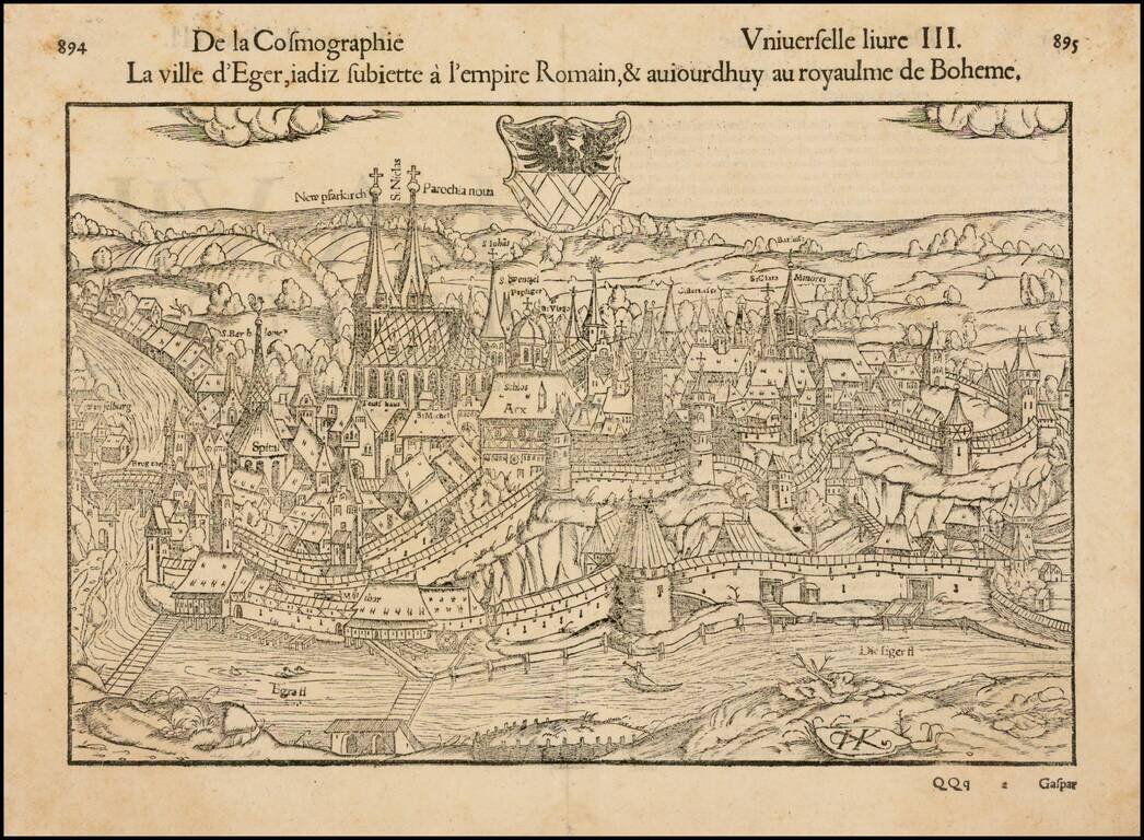
Decorative early view of Eger, in Bohemia, with coat of arms. Munster's Geographia (first published in 1540) and his later Cosmographia, were cartographic landmarks. The Geographia included not only Ptolemaic maps but also a number of landmark modern...
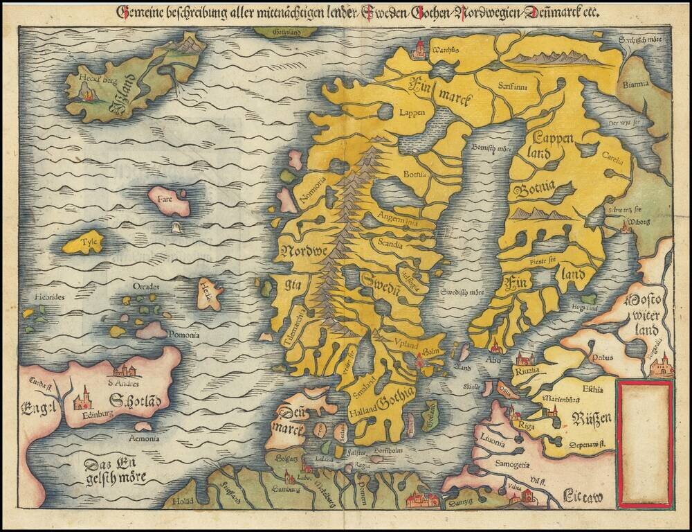
Second edition of Munster's map of Scandinavia, first issued in 1545 to replace the very rare first edition of the map, which appeared in only the first three editions of Munster's Geographia. Munster's first map relied upon the cartography of Jacob...
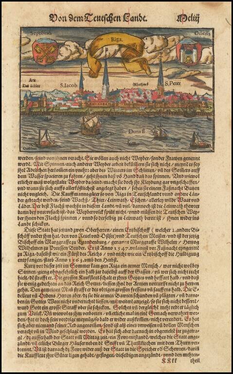
Nice example of Munster's birdseye view of Riga from the river, with decorative title banner and two coats of arms in the sky. View is from the Duna, with several major place names given. Munster's Geographia was a cartographic landmark, including...
![Tabula Europae IX [Greece & Turkey]](/map/small/60435.jpg)
Interesting map covering the region west of the Black Sea and north of the Aegean and Adriatic Seas, including the Straits of Bosphorus, from the 1542 edition of Munster's Geographia. The map is unchanged from the 1540 edition. Munster's Geographia...