Paolo Santini (1729-1793) was an Venetian engraver known especially for his religious prints and fine cartographic engravings. He published in Venice and may have a been a member of the clergy. In his maps, he largely adopted and adapted the work of his French counterparts, especially the brothers de Vaugondy.
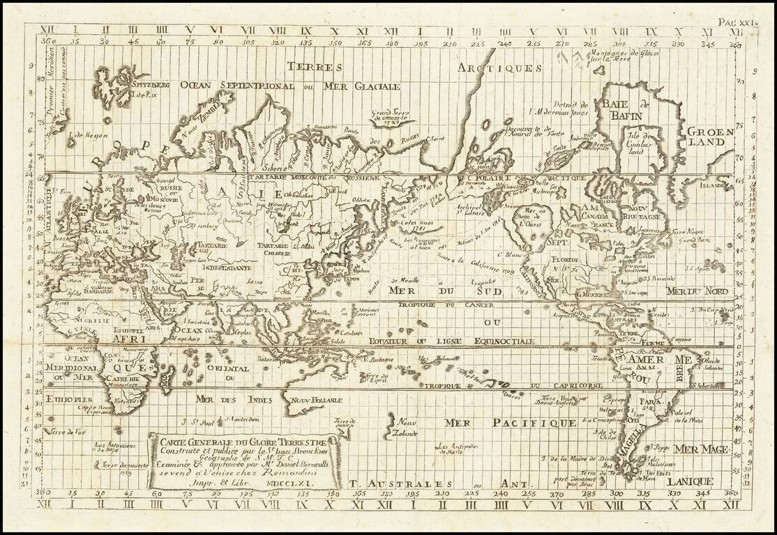
Reduced Venetian engraved copy of Isaac Brouckner's famous sea atlas of 1749, the first Prussian "Sea Atlas", published by Remondini in 1761. Our example of the original Isaac Brouckner 12-sheet wall map can be seen here:...
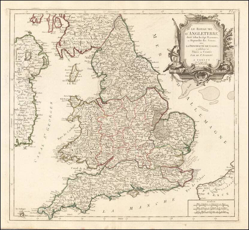
Detailed Santini/Remondini map of the English Heptarchy. An excellent large format map of England and Wales, divided by Heptarchies and showing towns, rivers, lakes, roads and many other details. Based upon De Vaugondy's map first issued in the early...
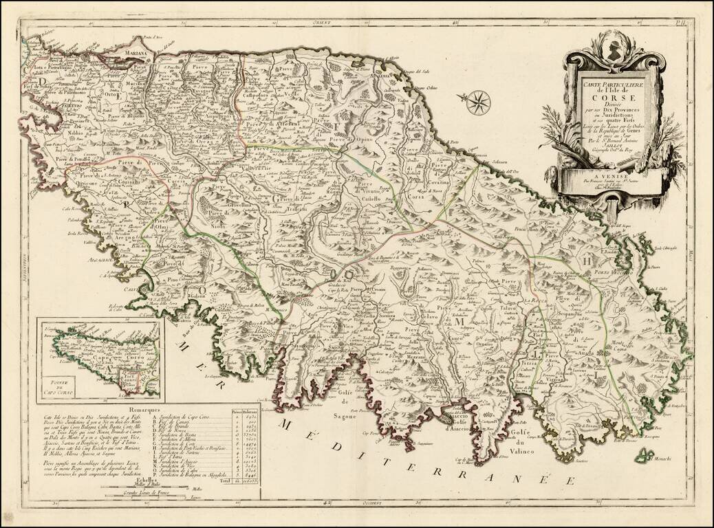
Striking large format map of Corsica, oriented with east at the top. Includes a large decorative cartouche and table showing details of the Jurisdictions and Fiefs. The map shows towns, roads, rivers, lakes, mountains, gulfs and many other details. A...
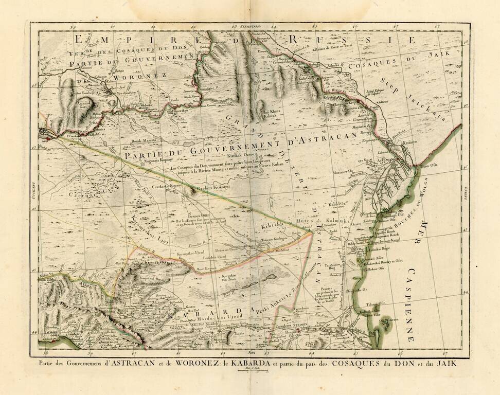
Detailed map of the region north of the Black Sea and West of the Caspian Sea. One of the most detailed maps of the region to appear in a commercial atlas.

Detailed map of Istria, from Remondini. Detailed map of the region, with decorative cartouche.
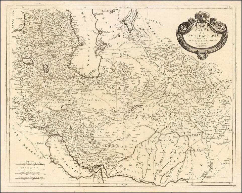
Remondini's edition of the Santini map of the Persian Empire Detailed map of the Persian Empire extending north to the Caspian Sea and Uzbekistan, and from Armenia and the Persian Gulf in the west to the Indus River and the Karachi area in the east....