Map size in jpg-format: 68.123MiB
Click to open in high resolution (open in new tab).

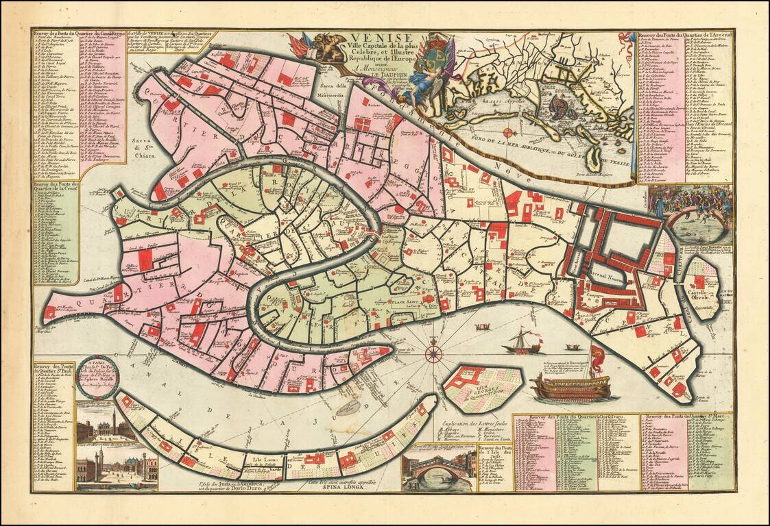
Fine example of this early edition of Nicolas De Fer's rare separately published plan of Venice, first published in Paris in 1695.
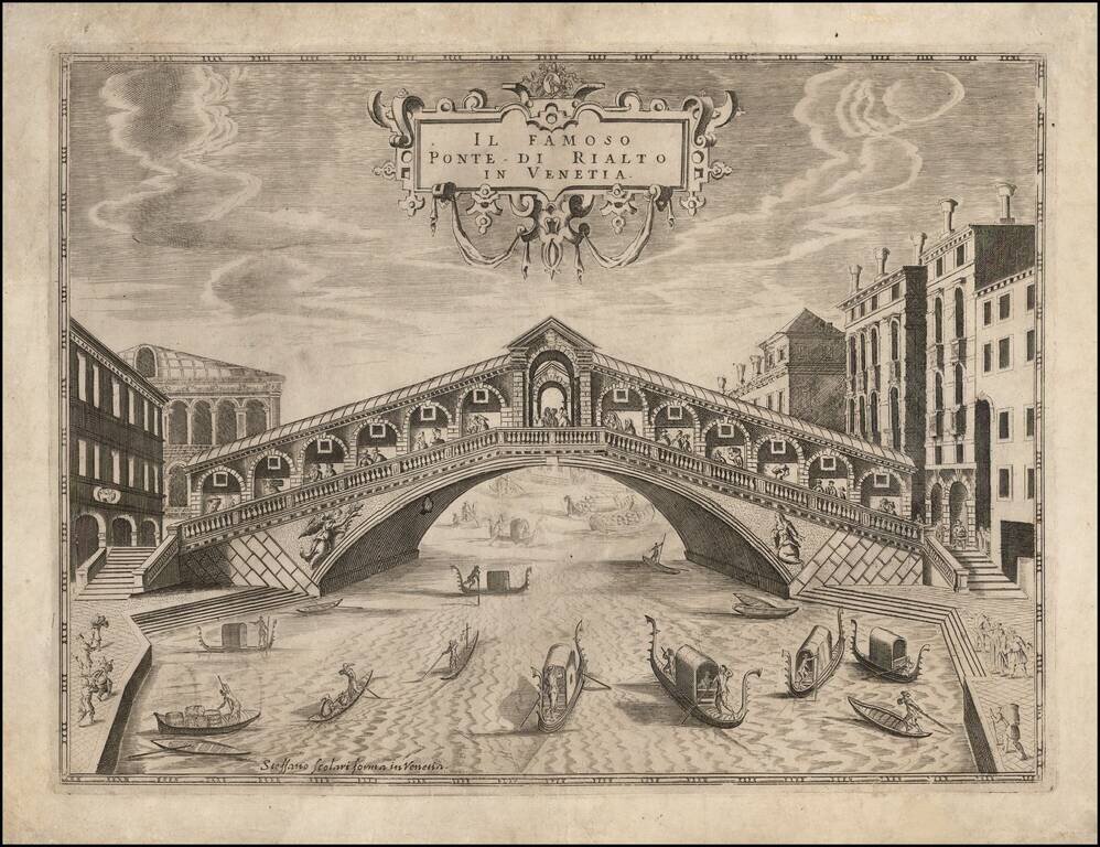
The map includes an inset of the Lagoon of Venice near the title, inset vignettes of the Lagoon, two views of the Piazza San Marco and a view of the Pont de la Rialto, a view of the Pont Saint Barnabe, and a scene involving people being thrown off the bridge. The plan also includes seven different keys (each identifying a different Quarter of Venice) identifying nearly 400 different places.
Unlike most plans of Venice of the period, De Fer's plan focuses on the major canals, squares, and public buildings, thereby presenting a much cleaner and more usable model of the city and allowing the reader to quickly identify the major points of interest within the city. The plan was copied on a reduced scale and included in the Atlas Curieux.
If you are a student, write to us in telegram: @antiquemaps and indicate what material you need and for what work you need a map in high detail. We are ready to provide material on special terms. For students only!
![[Venice]](/map/small/30280.jpg)
![[Venice] Carte Du Gouvernement Militarire De La Republique Du Venise . . .](/map/small/30732.jpg)