
"Republic of Texas" Edition. A nice example of the 1842 edition of Lizars's Edinburgh Geographical General Atlas, with two maps labeling the "Republic of Texas" within the map image. Almost all maps from the Republic of Texas period simply label the...
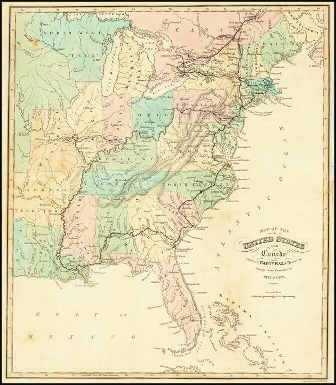
Attractive and detailed map of the United States, colored by states. Shows towns, islands, rivers, mountain ranges, great lakes, etc. Detailed record of Hall's route in bold print.
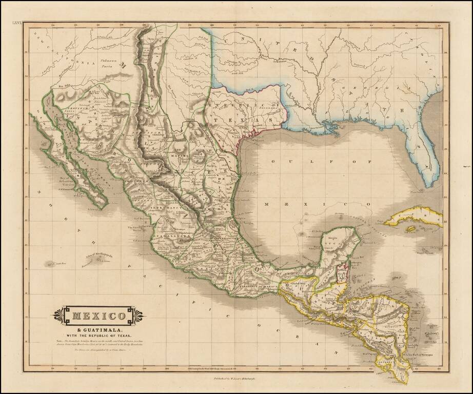
"Republic of Texas" in the Title of the Map Scarce map of Texas, Mexico, Upper California and contigous parts of the Southeastern US, naming the Republic of Texas. The present map is one of the only obtainable printed maps to name the "Republic of...
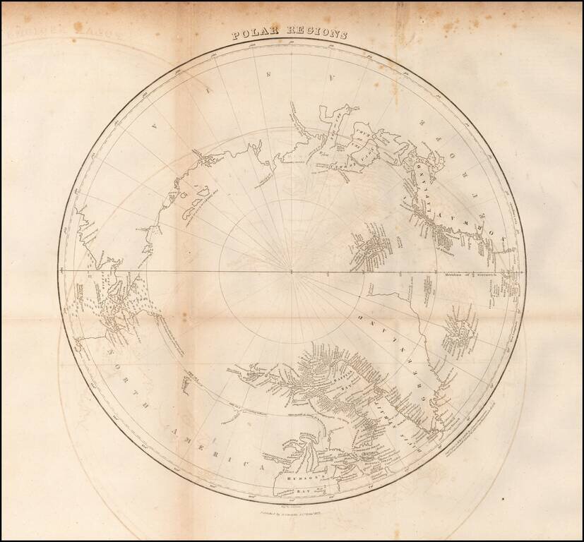
Scarce map of the Polar regions of the Arctic, published in 1822 in Edinburgh. This fascinating map of the North Pole shows a region still in the process of being discovered. There is little detail in western Canada beyond a few notes such as The Sea...