Henri Abraham Chatelain (1684-1743) was a Huguenot pastor of Parisian origins. Chatelain proved a successful businessman, creating lucrative networks in London, The Hague, and then Amsterdam. He is most well known for the Atlas Historique, published in seven volumes between 1705 and 1720. This encyclopedic work was devoted to the history and genealogy of the continents, discussing such topics as geography, cosmography, topography, heraldry, and ethnography. Published thanks to a partnership between Henri, his father, Zacharie, and his younger brother, also Zacharie, the text was contributed to by Nicolas Gueudeville, a French geographer. The maps were by Henri, largely after the work of Guillaume Delisle, and they offered the general reader a window into the emerging world of the eighteenth century.
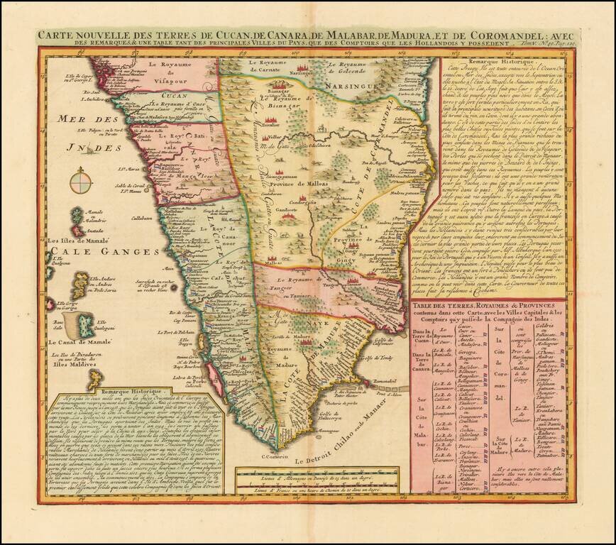
India south of Goa, from Chatelain's monumental Atlas Historique, published in Amsterdam. The map includes three text boxes giving particulars of the region and its divisions. Interior details include the Western Ghats and wild animals among the...
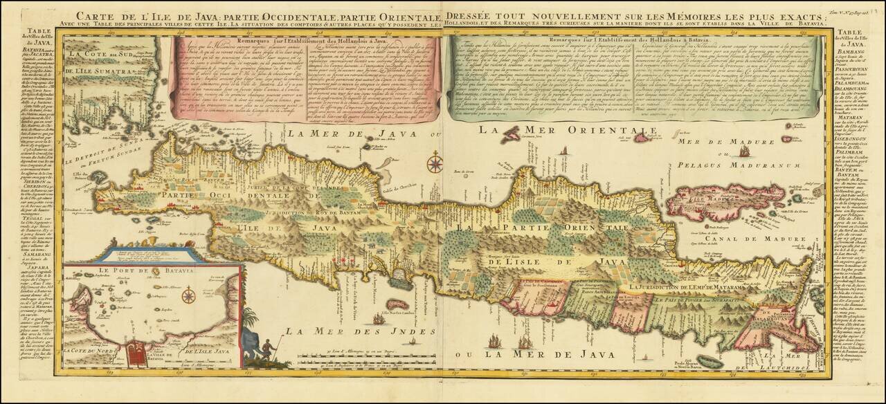
Decorative large format map of Java, with an inset of the bay of Batavia in the lower left corner. Two title banners include a short sketch of the history of the Dutch on the island, Remarques sur l'Etablissement des Hollandois à Java , written by...
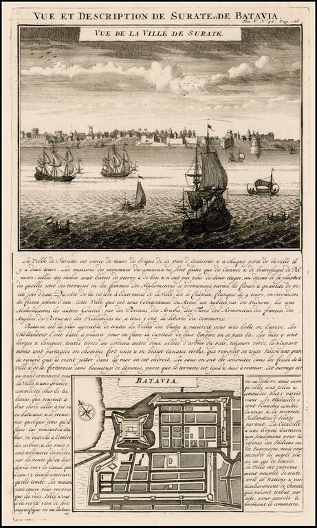
Attractive view of the town and harbor of Surate on the northwest coast of India, and a bird's-eye city plan of Batavia (Jakarta) present-day capital of Indonesia, from Chatelain's monumental 7 volume Atlas Historique, published in Amsterdam. Surate...
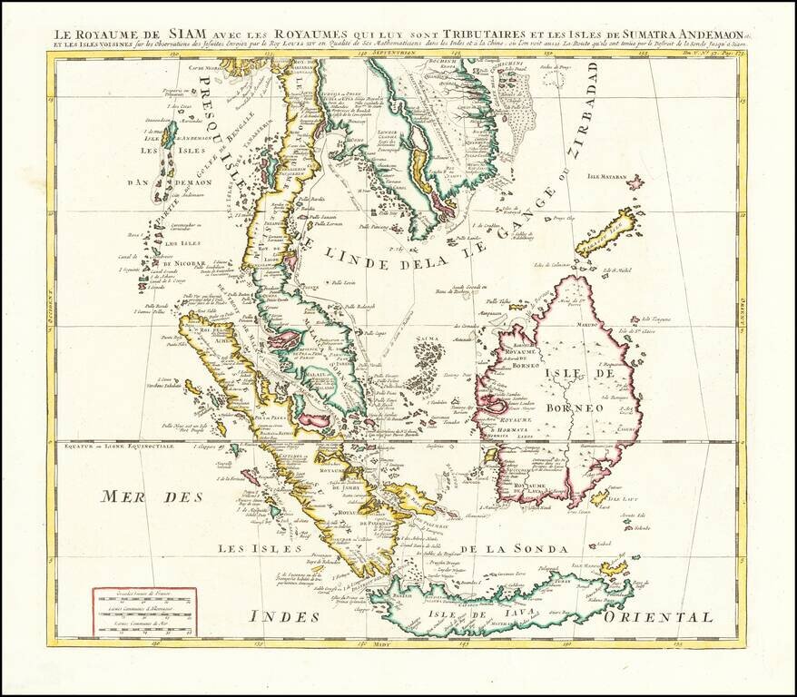
Finely colored example of Chatelain's map of Southeast Asia. The map extends from Thailand, Cambodia, Vietnam, the Malay Peninsula and Gulf of Bengal in the north to Java and Sumatra in the south, and is centered on Malacca and Borneo. Gorgeous wash...
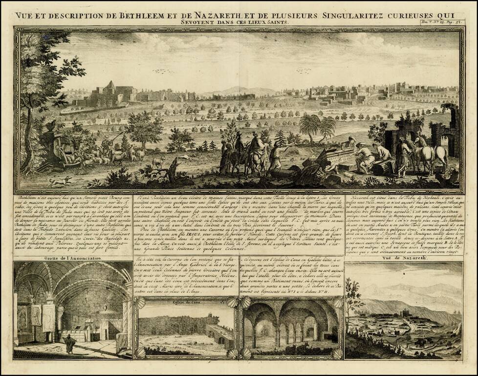
Decorative birdseye view of Bethlehem and Nazareth, from Chatelain's monumental 7 volume Atlas Historique. The view includes 4 smaller views, including the Hall of the Annunciation, Church of Cana and a second view of Nazareth.
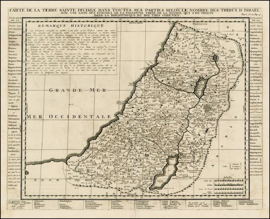
Detailed map of the Holy Land, from Chatelain's Monumental Atlas Historique et Methodique. The map extends from Gaza to Sidon and identifies the 12 Tribes and many other historical features.
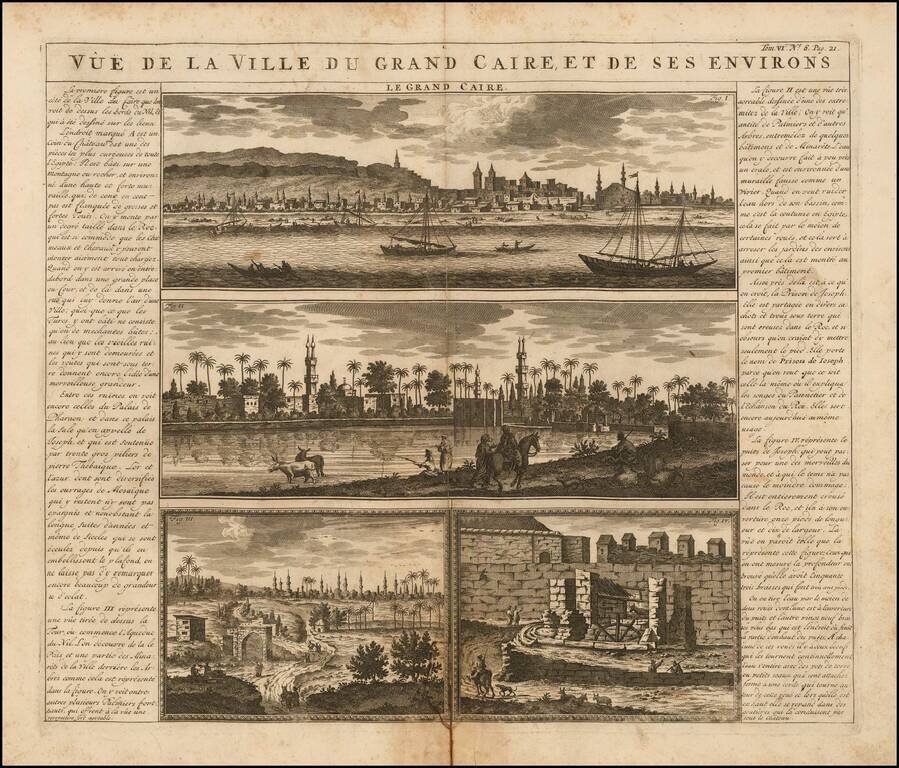
Antique engraved view of Cairo, with several supporting vignettes, from the famous Atlas Historique of Henri Chatelain, published in Amsterdam in between 1705 and 1720. The views near the River Nile are filled with palms and boats.
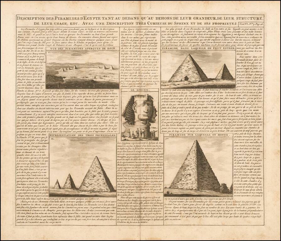
Interesting view showing 5 views of the pyramids and an image of the Sphinx. This view appeared in Henri Chatelain's monumental 7 volume Atlas Historique.
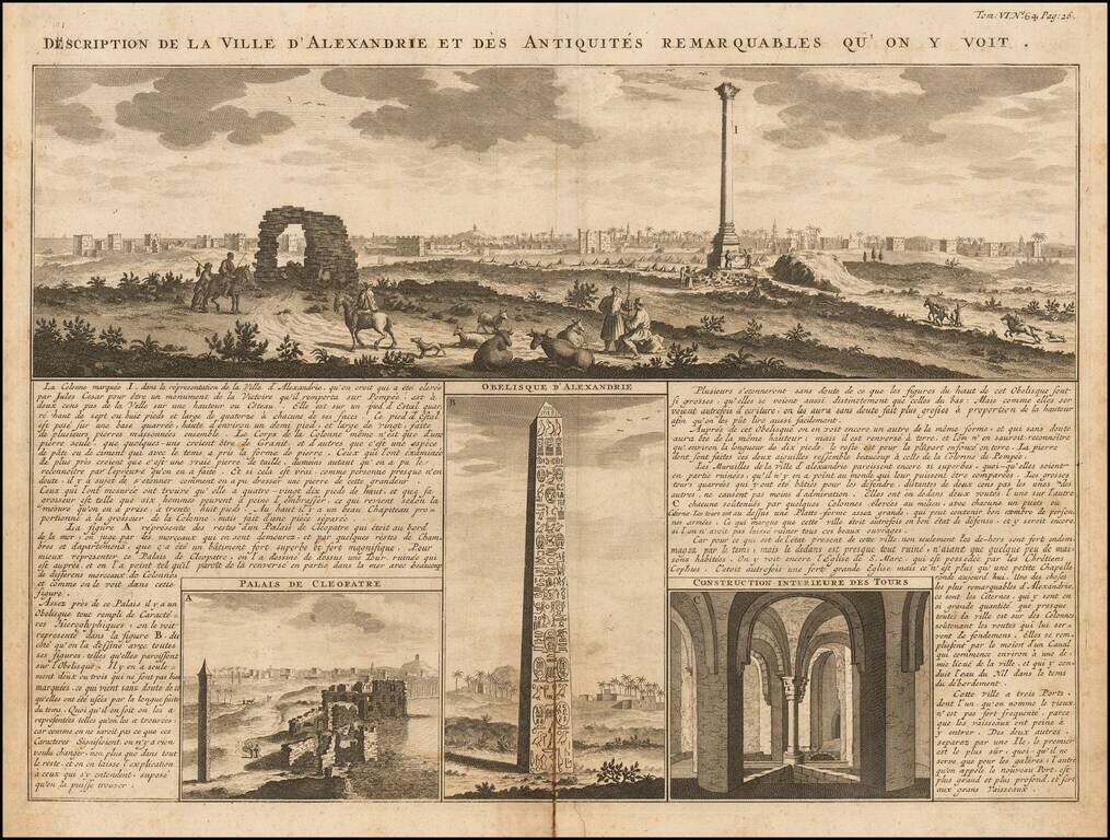
A magnificent panoramic view of the great Egyptian port city of Alexandria accompanied by detailed views of the ruins of Cleopatra's palace, the Obelisk of Alexandria, and "the interior construction of towers." The images are keyed to the surrounding...
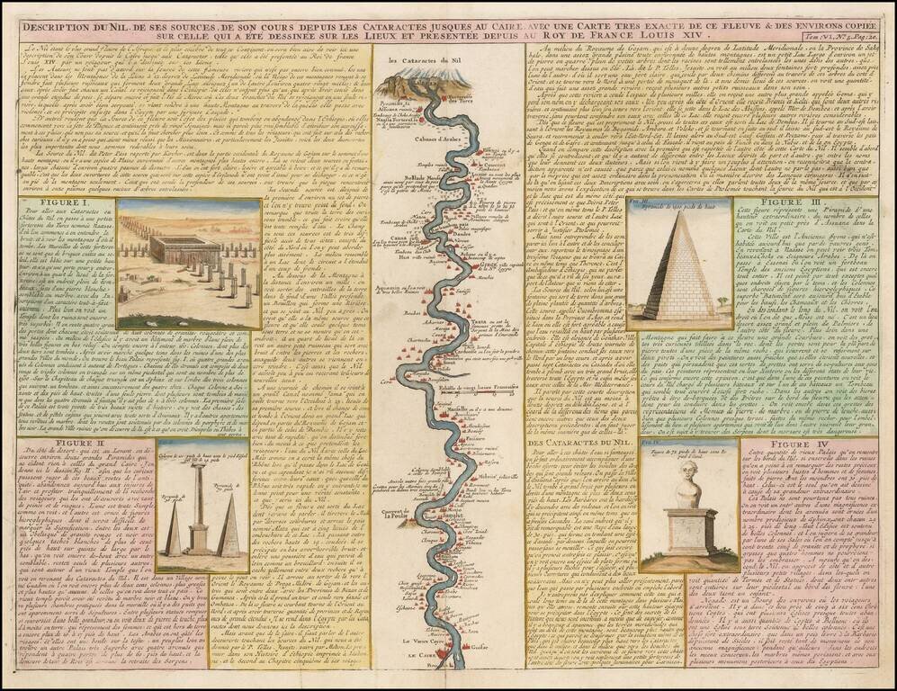
Detailed map of the course of the Nile, from the cataracts of the Nile at the south (top of the image) to Cairo and Giza. At the right, one of the Pyramids is shown (1400 Pieds tall), with additional images at the left from the Nile River Valley.
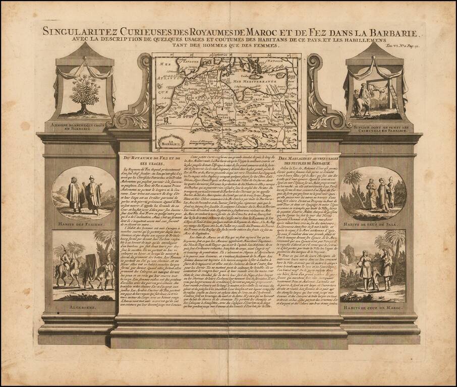
Decorative map and series of inset views of Morocco, with small vignettes of local life.
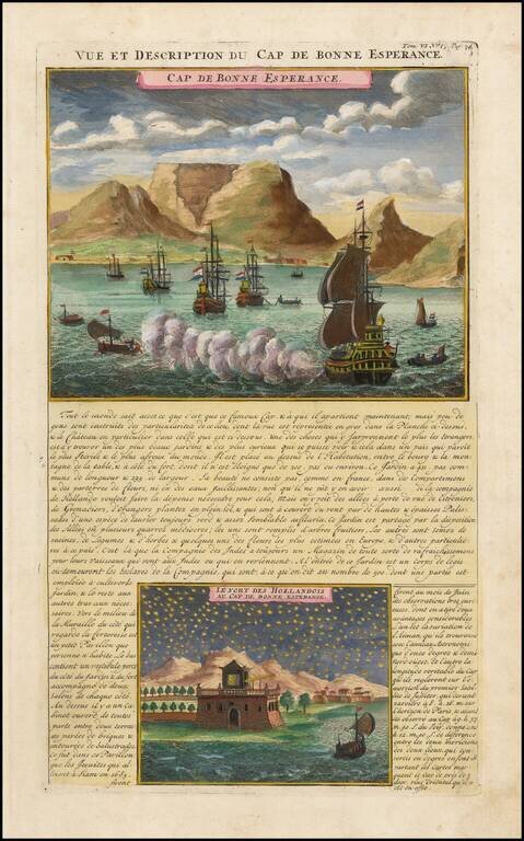
Striking view of the Cape of Good Hope, with Dutch ships in the harbor and Table Mountain in the background. A night view of the Dutch Fort at the Cape is shown below. Chatelain's Atlas Historique, published in 7 volumes at the beginning of the 18th...
![[Title Page] Atlas Historique](/map/small/37714.jpg)
Decorative Title page from Chatelain's Atlas Historique, a 7 volume work which was one of the most popular works on the world at the time and one of the most decorative. Nice example. This seems to be a scarce title page, as we have not previously...
![[Title Page] Title & Dedication Pages](/map/small/43632.jpg)
Title page and decorative dedication page of Volume 5 of Chatelain's Atlas Historique, a 7 volume work which was one of the most popular works on the world at the time, and one of the most decorative.
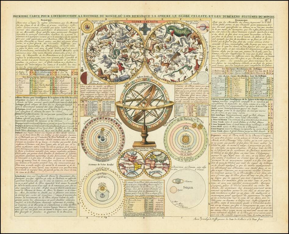
Decorative work showing a double hemisphere Celestial model, Double Hemisphere map of the world w/California as an Island, Armillary Sphere, Copernican Ptolomaic and Tycho Brahe models of the Solar System and a number of other Celestial and Solar...
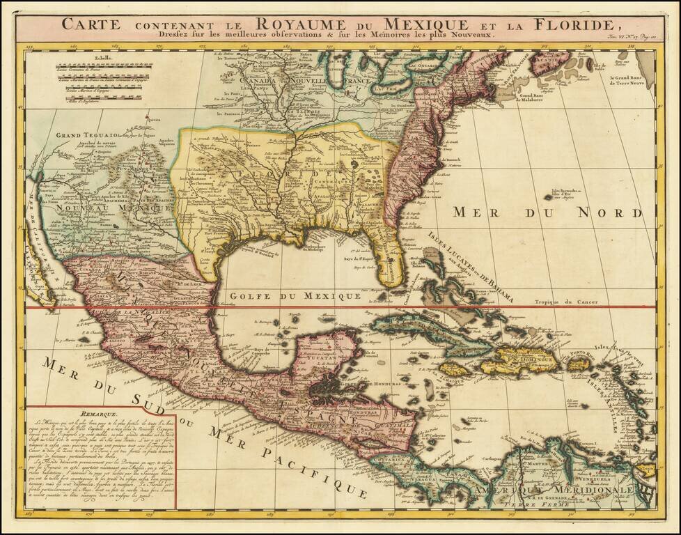
An Early Re-Issue of a Cartographic Landmark Map This is a finely executed map of the southern part of North America by the French mapmaker Henri Chatelain. The map draws its inspiration from the royal mapmaker Guillaume de L'Isle's landmark map of...