Henri Abraham Chatelain (1684-1743) was a Huguenot pastor of Parisian origins. Chatelain proved a successful businessman, creating lucrative networks in London, The Hague, and then Amsterdam. He is most well known for the Atlas Historique, published in seven volumes between 1705 and 1720. This encyclopedic work was devoted to the history and genealogy of the continents, discussing such topics as geography, cosmography, topography, heraldry, and ethnography. Published thanks to a partnership between Henri, his father, Zacharie, and his younger brother, also Zacharie, the text was contributed to by Nicolas Gueudeville, a French geographer. The maps were by Henri, largely after the work of Guillaume Delisle, and they offered the general reader a window into the emerging world of the eighteenth century.
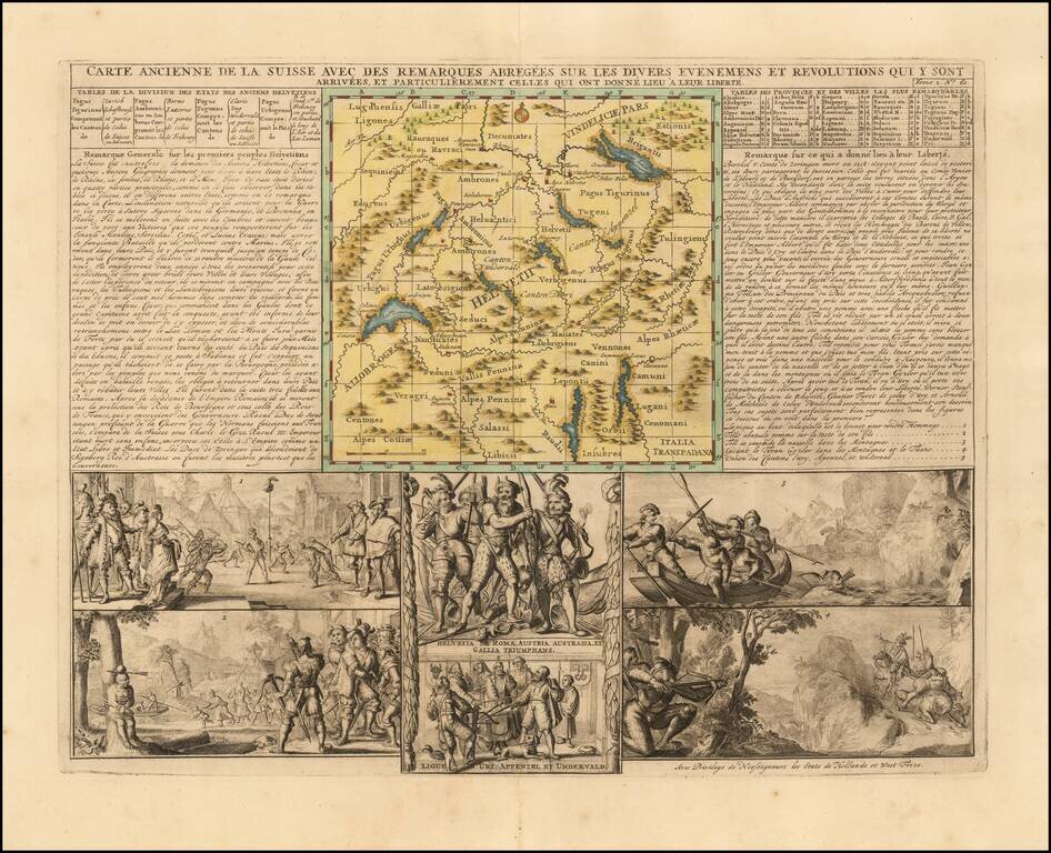
Attractive double-page engraved map of Switzerland by Henri Chatelain, in his typical style, with the map image in the center and descriptive historical text and imagery surrounding it. Shows the Old Swiss Confederacy, which lasted roughly from the...
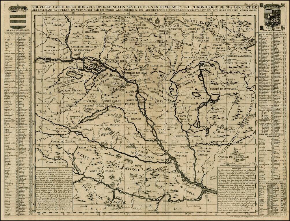
Detailed large format map of the Hungarian Empire, extending to Bosnia, Slovenia, Temeswar, and the Saw River in the south to Moravia, and the Frontiers of Poland in the north, centered on the course of the Danube from Vienna to Belgrade. Includes...
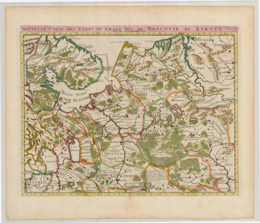
Striking regional map of the northern parts of European Russia. The map appeared in Chatelain's monumental Atlas Historique.
![Carte De La Partie Meridionale du Royaume de Suede avec une Table des Provinces et des Villes Principales [including Baltic Sea, Estonia, Latvia and Lithuania]](/map/small/41643.jpg)
Detailed map of the Southern part of Scandinavia, the Baltic Sea and contiguous parts of Estonia, Latvia and Lithuania. From Chatelain's monumental Atlas Historique.
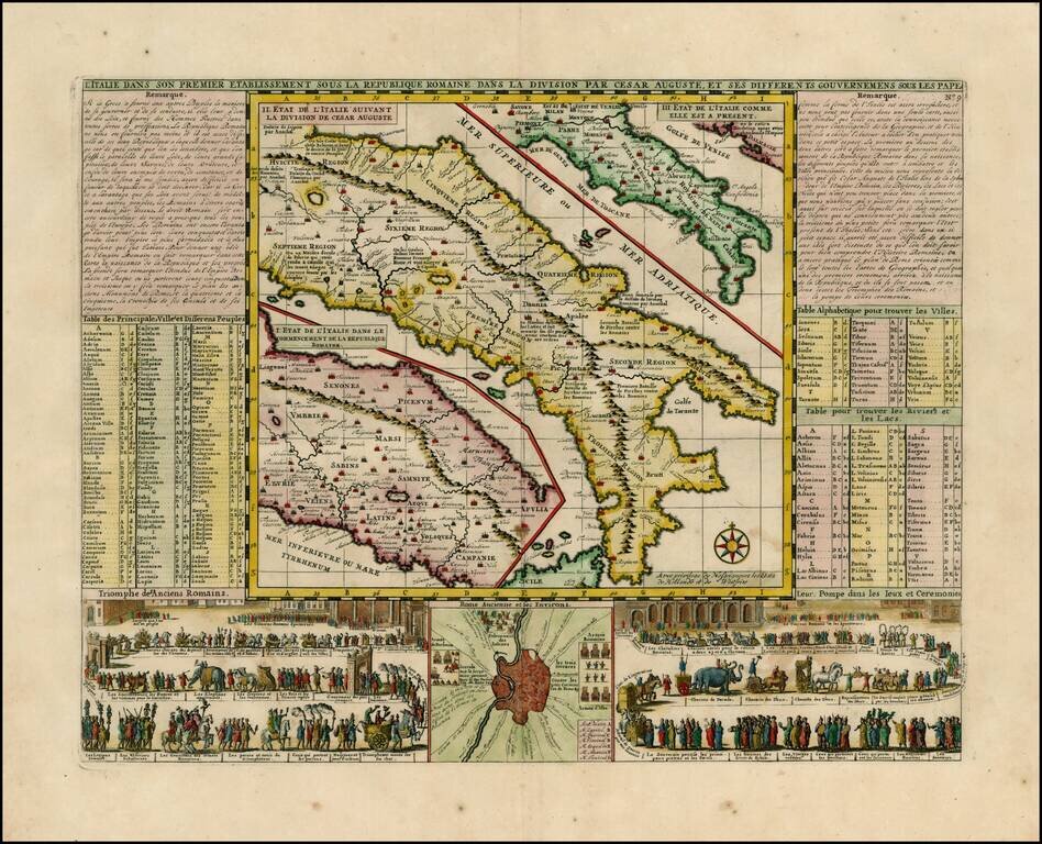
Wonderful map of Italy, comprising maps of Italy during modern (1720) times, at the time of Cesear and at the time of the commencement of the Roman Republic. Large inset of the environs of Rome with two large vignettes showing a Parade of the Ancient...
![[Venice] Carte Du Gouvernement Militarire De La Republique Du Venise . . .](/map/small/30732.jpg)
Decorative set of views of Venice. The inner views are of the Piazza San Marco, a scene of the Gondoliers and a second scene on the Lagoon and a view of the Ponte de la Rialto on the Grand Canal. A striking and decorative map from Chatelain's Atlas...
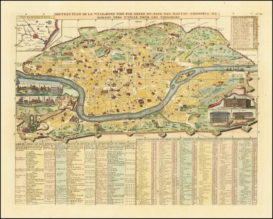
A decorative map of Rome, with inset views of ten major churches and structures, including St. Peter's and the Vatican. A key identifies a number of buildings, which are shown on the map. Other insets as well as text add further information to the...
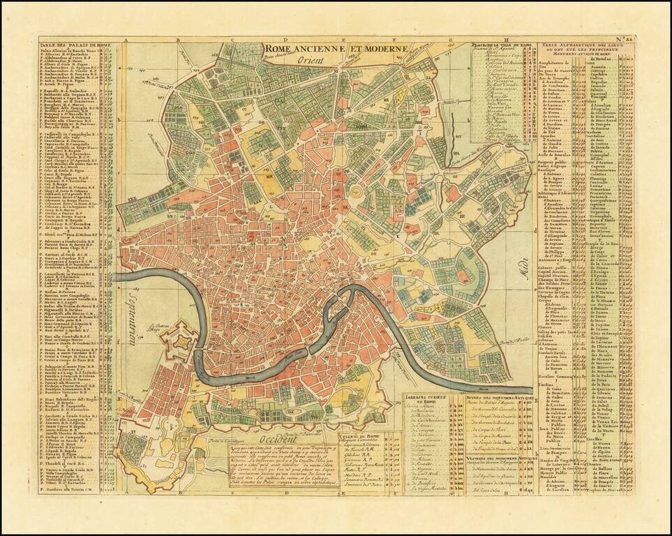
Highly detailed plan of Rome with substantial notes concernign locations of the various buildings, streets, gardens, colleges, churches etc. A finely engraved map from Chatelain's monumental 7 volume Atlas Historique, one of the most famous and...
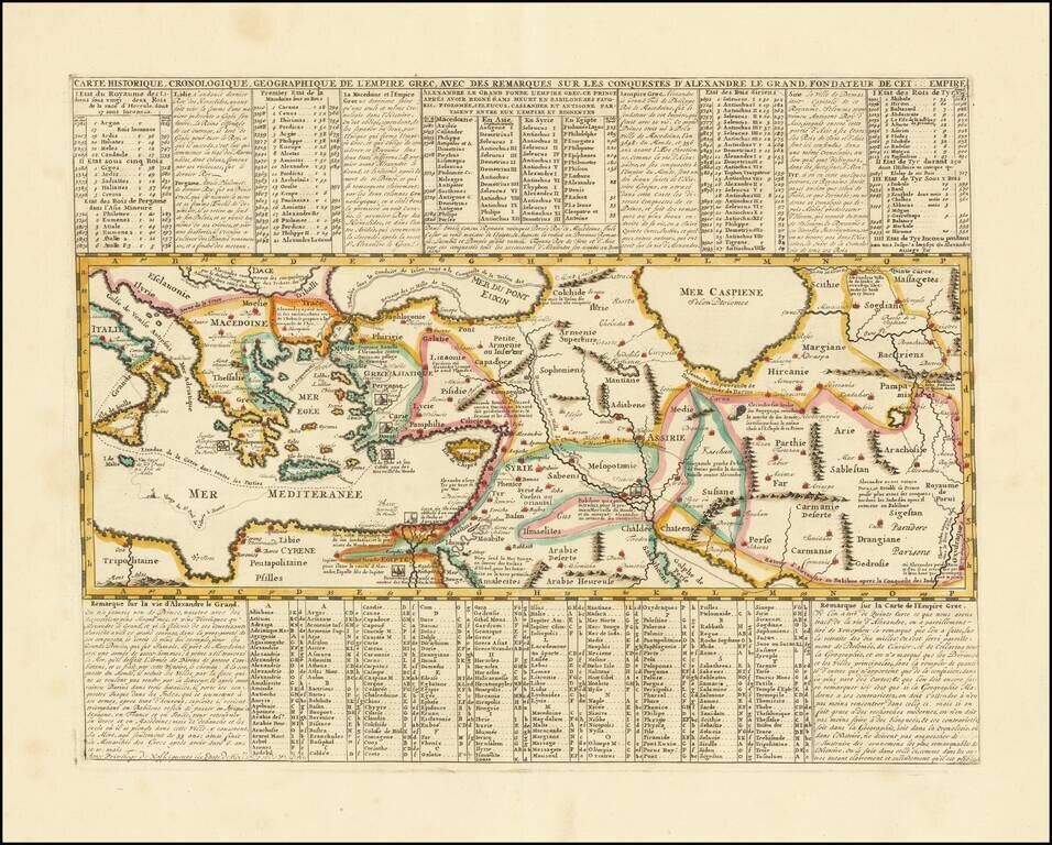
Mapping the Conquests of Alexander the Great. Interesting historical map of the Mediterranean, Black and Caspian Sea regions under Greek Rule. The map has excellent toponymic detail throughout, including extensive notes, trade routes, etc. The...
![Bosphore de Thrace. Vue De Constantinople Due Cote Du Bosphore [with] Aqueduc De Constantinople [with] Colomne De Pompee](/map/small/64422.jpg)
Finely engraved and beautifully colored plate showing views of Constantinople, the aqueduct of Constantinople, and the Pompee Column. The map appeared in Chatelain's monumental Atlas Historique, published in Paris.
![[Views of Constantinople] Etat Abrege de la Maison du Grand Seigneur,](/map/small/64525.jpg)
Decorative views of Constaninople, from Chatelain's monumental Atlas Historique.
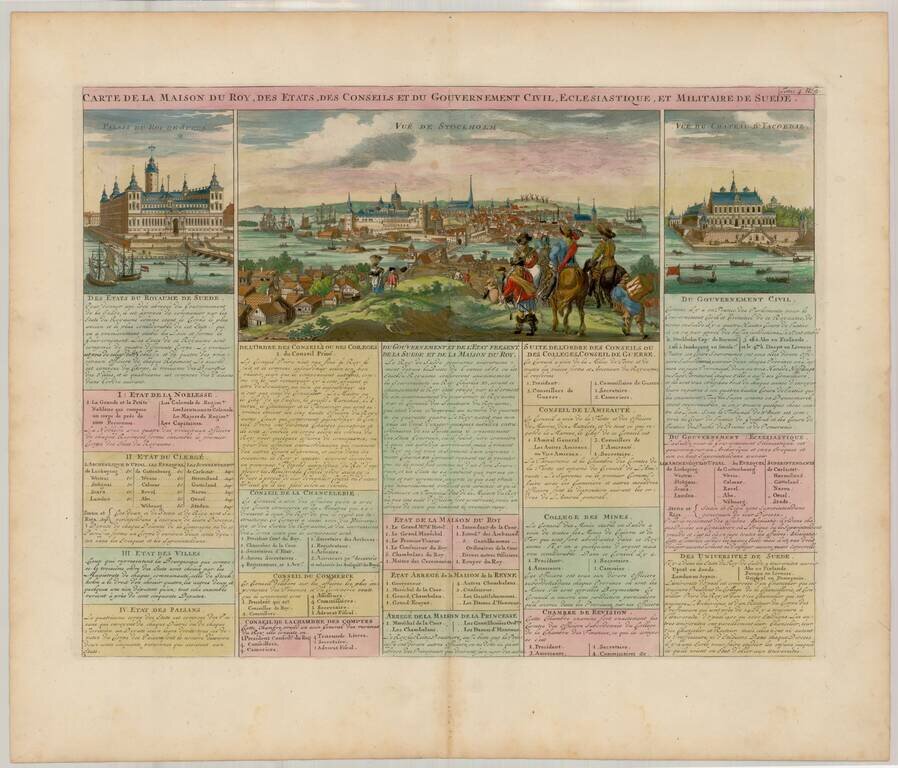
Decorative view of Stockholm, etc. from Chatelain's monumental 7 volume Atlas Historique.
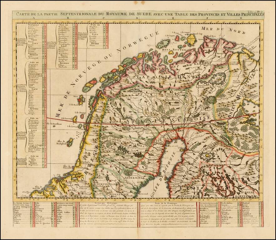
Detailed map of the Northern part of Scandinavia. From Chatelain's monumental Atlas Historique.
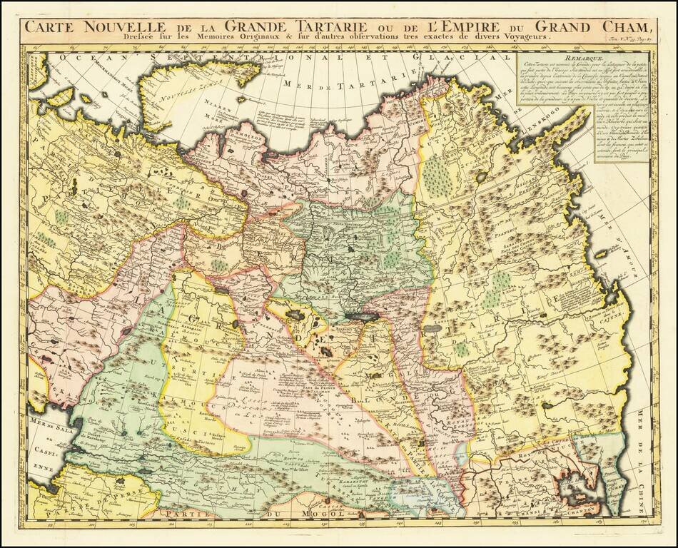
Decorative and detailed map showing Central Asia and the Tartary, from Chatelain's monumental 7 volume Atlas Historique. The map extends from Nova Semla in the northwest towards northern China and the peninsula of Korea in the southwest of the map....
![Genealogie Des Empereurs Mogols Depuis Tamberlan ou Tamerlan . . . [maps of the Empire of the Grand Mogol, Kingdom of Kachemire and 3 indigenous views]](/map/small/43161.jpg)
Interesting pair of maps, Genealogical tree and 3 indigenous views of the Mogol Empire, from Chatelain's Atlas Historique. The upper maps show the Empire of the Great Mogol and the Kingdom of Kachimere. The center includes a tree showing the Mogol...
![[Dutch Forts -- Jakarta, Amboine, Ternate, Solor, Banda] Vue et Description de Quelques-Uns des Principaux Forts des Hollandois dans les Indes](/map/small/43122.jpg)
Interesting sheet with seven detailed views illustrating the most important Dutch trading outposts and fortified colonial possessions in the East Indies The sheet includes 4 harbor views Batavia (Jakarta), Amboina, Ternate, and Solor, and 3 fort...