Antonio Zatta (fl. 1757-1797) was a prominent Italian editor, cartographer, and publisher. Little is known about his life beyond his many surviving published works. It is possible that he was born as early as 1722 and lived as late as 1804. He lived in Venice and his work flourished between 1757 and 1797. He is best known for his atlas, Atlante Novissimo (1779-1785), and for his prolific output of prints and books that were both precisely made and aesthetically pleasing. Zatta clearly had a large network from which to draw information; this is how he was able to publish the first glimpse of the islands visited by Captain Cook in the Atlante Novissimo. Zatta also published books of plays and architecture.
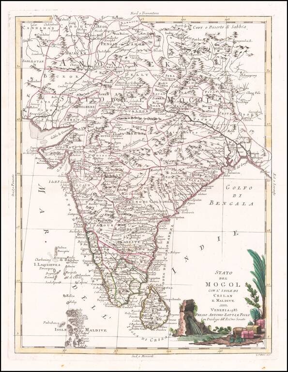
18th Century Antique Map of India Terrific map of India and Ceylon, along with the Maldive Islands. Includes a large decorative title cartouche. The map was issued in Zatta's Atlante Novissimo a monumental 4 volume work and is one of the last great...
![[Philippines, Indonesia, Brunei, Malaysia, Singapore]](/map/small/68224.jpg)
Decorative map of the Southern Philippines, Indonesia, southern Malaysia, Singapore, Brunei, etc, published by Zatta. The map is bottom left sheet of a 4 sheet map of the region, but was issued as a separate sheet in Zatta's atlas. Antonio Zatta was...
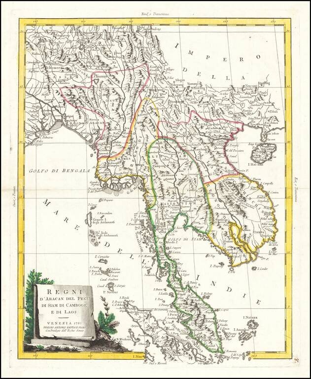
Striking map of the region from the Gulf of Bengal to Hainan, centered on the Malay Peninsula, Straits of Malacca and most of Sumatra. The map was issued in Zatta's Atlante Novissimo, a monumental 4 volume work and one of the last great decorative...
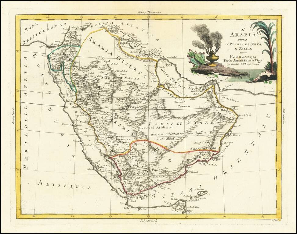
Decorative Map of the Arabian Peninsula. Detailed map of Saudi Arabia, the Red Sea, Persian Gulf, and the Gulf of Aden. "Golfo Persico" is named, as are the "I Baharem" and "I Samak" (Bahrain and Qatar). There is excellent topographical detail. The...
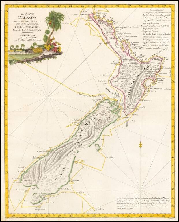
The First Decorative Map of New Zealand -- Drawn From Cook's Official Account Nice hand-colored example of Zatta's map of New Zealand, one of the most decorative and highly sought after editions of Cook's mapping of New Zealand and one of the largest...

Interesting pair of models of the Solar System, published in Venice. At the left, the system of Claudius Ptolemy is shown, illustrating a geocentric model of the Universe (earth at the center). At the right, the system of Nicolas Copernicus is shown,...
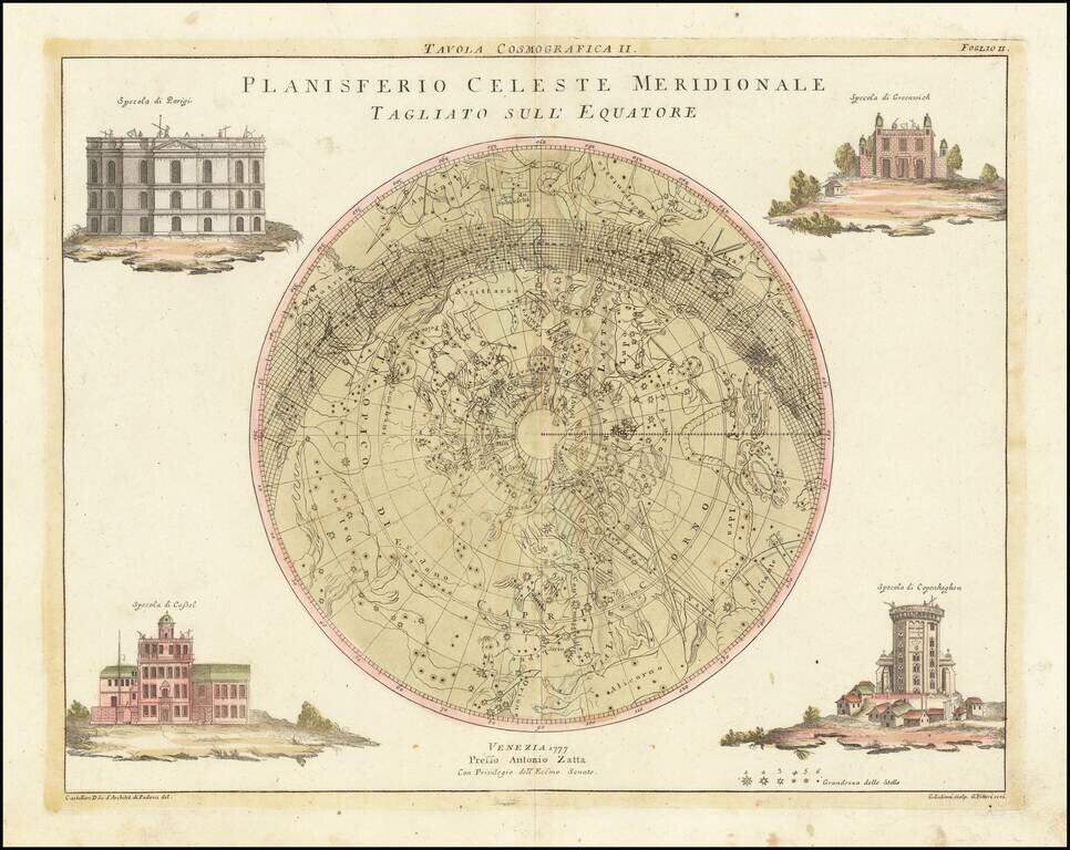
This is a star-chart depicting the constellations and features of the northern sky, by the Italian cartographer Antonio Zatta. Dozens of constellations are shown, and hundreds of stars have their brightness indicated. The chart is framed by elegant...
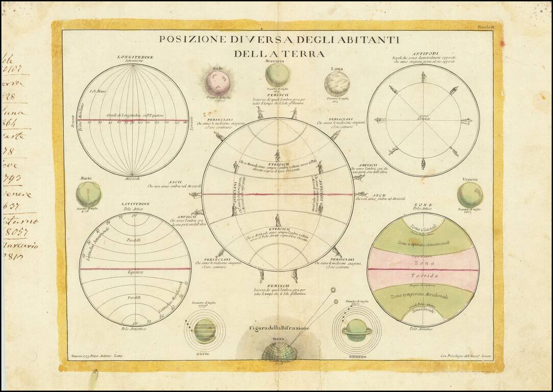
Scarce set of five spheres and eight drawings of the known planets, the sun and the moon. The large central sphere describes the spatial relationship of the "Residence of the Land" on different parts of the Earth. Saturn is shown with five satellites...