Antonio Zatta (fl. 1757-1797) was a prominent Italian editor, cartographer, and publisher. Little is known about his life beyond his many surviving published works. It is possible that he was born as early as 1722 and lived as late as 1804. He lived in Venice and his work flourished between 1757 and 1797. He is best known for his atlas, Atlante Novissimo (1779-1785), and for his prolific output of prints and books that were both precisely made and aesthetically pleasing. Zatta clearly had a large network from which to draw information; this is how he was able to publish the first glimpse of the islands visited by Captain Cook in the Atlante Novissimo. Zatta also published books of plays and architecture.
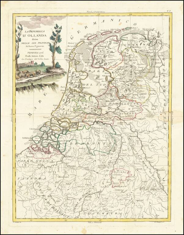
Decorative map of the Low Countries from Zatta's Atlante Novissimo.
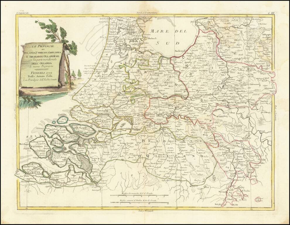
Decorative map of Dutch provinces of Zeland, Utrecht, Geldria and Dutch Brabant, from Zatta's Atlante Novissimo.
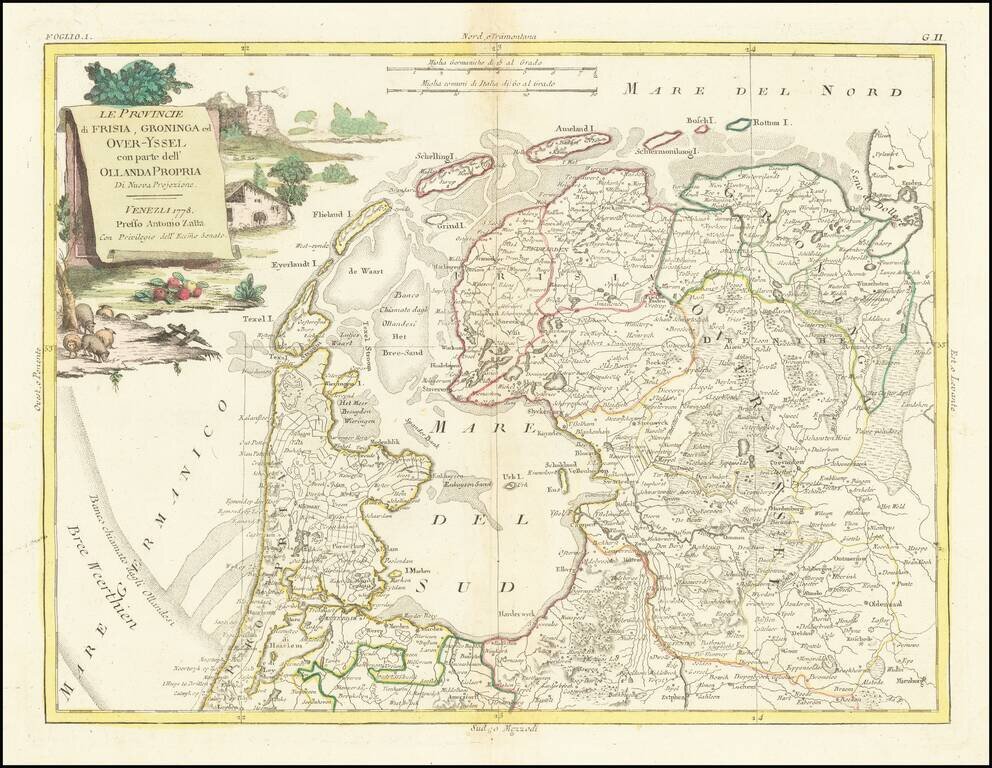
Decorative map of Dutch provinces of Frisia, Over-Yssel and Groningen, from Zatta's Atlante Novissimo.

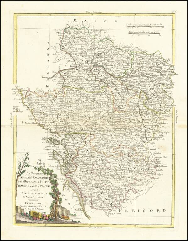
Striking map of France, divided by Governments (pre-dating the Department system). Decorative title cartouche. From Zatta's monumental Altante Novissimo, one of the last great decorative atlases of the 18th Century.
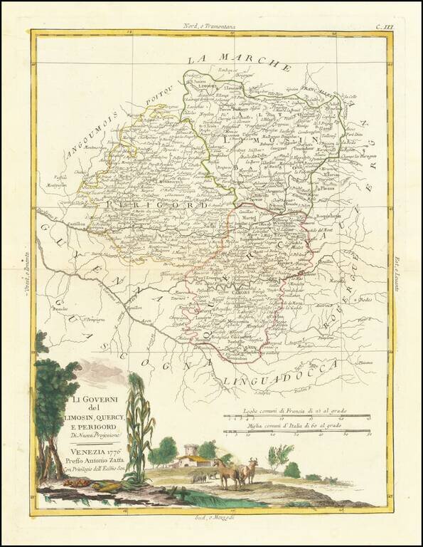
Decorative map of Southern France. Includes Limoges, Perigueux, Bergerac, Cahors, Montauban, Castillon-la-Bataille, etc. Includes a large decorative title cartouche. The map was issued in Zatta's Atlante Novissimo, a monumental 4 volume work and one...
Attractive antique map of Southwestern France, including Bordeaux and the Basque region. Includes a large decorative title cartouche, surrounded by emblems of winemaking which made the region famous. The cartouche includes vines of wine grapes and...
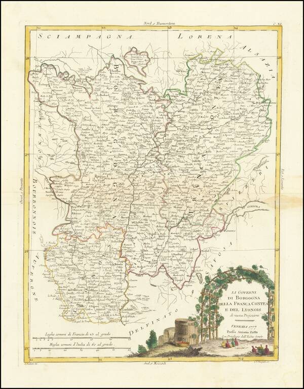
Decorative map of the Burgundy, Franche Comte and Lyon regions. Includes a large decorative title cartouche. The map was issued in Zatta's Atlante Novissimo, a monumental 4 volume work and one of the last great decorative atlases.
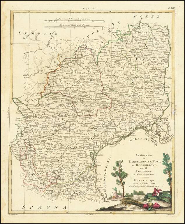
Decorative map of South France. Includes Montpellier, Nimes, Beziers, Narbonne, Perpignan, Toulouse, Montauban, etc. Includes a large decorative title cartouche. The map was issued in Zatta's Atlante Novissimo, a monumental 4 volume work and one of...
Decorative map of South France. Includes Montpellier, Nimes, Beziers, Narbonne, Perpignan, Toulouse, Montauban, etc. Includes a large decorative title cartouche. The map was issued in Zatta's Atlante Novissimo, a monumental 4 volume work and one of...
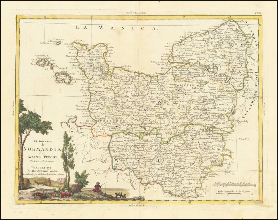
Striking map of Normandy and contiguous regions, published in Venice. Includes a decorative title cartouche. The map appeared in Zatta's monumental Altante Novissimo, one of the last great decorative atlases of the 18th Century.

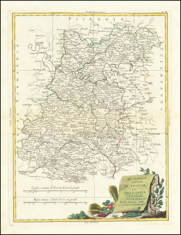
Decorative map of the Champagne and Brie regions. Includes a large decorative title cartouche. The map was issued in Zatta's Atlante Novissimo, a monumental 4 volume work and one of the last great decorative atlases.
Decorative map of South France. Includes a large decorative title cartouche. The map was issued in Zatta's Atlante Novissimo, a monumental 4 volume work and one of the last great decorative atlases.
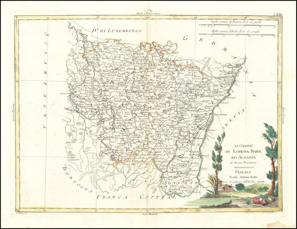
Striking map of Lorraine, Alsace and contiguous regions, published in Venice. Includes a decorative title cartouche. The map appeared in Zatta's monumental Altante Novissimo, one of the last great decorative atlases of the 18th Century.
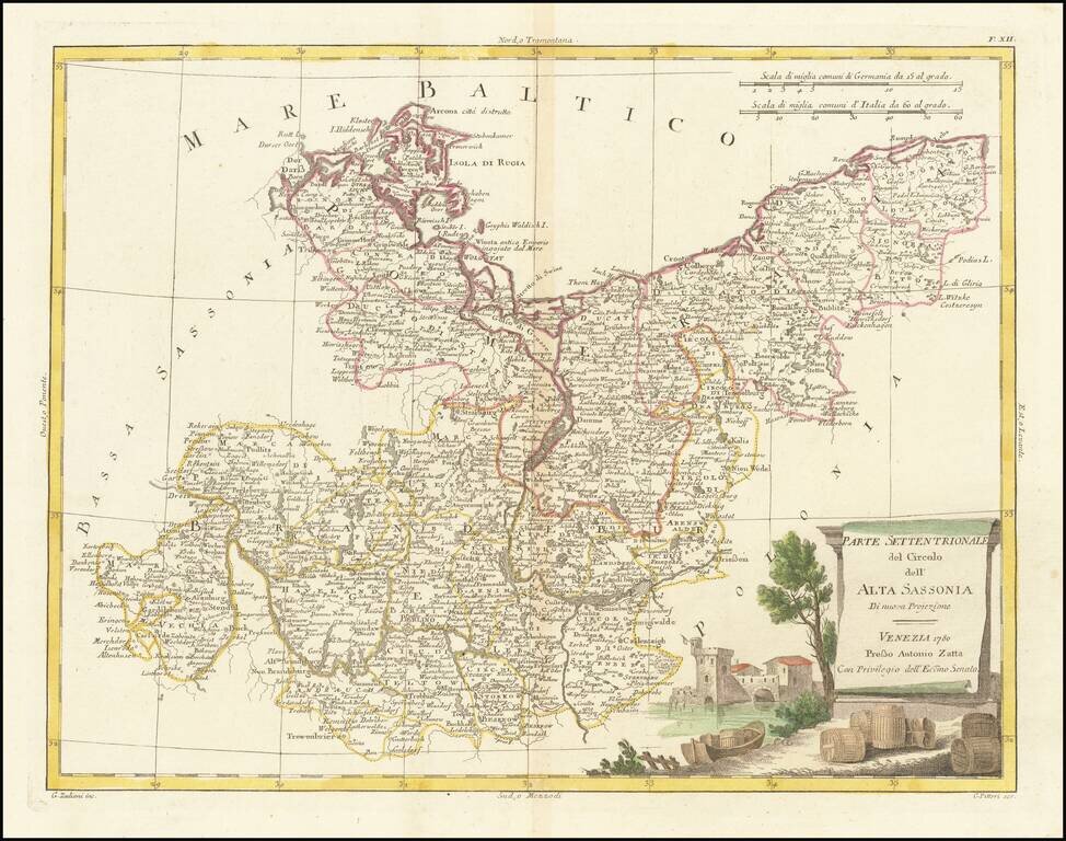
Detailed map of Upper Saxony (Obersachsen), published in Venice by Antonio Zatta in 1780.
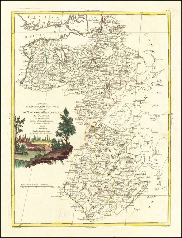
Antique engraved map of the Duchies of Livonia and Estonia, and the Governments of Novgorod, Belgorod, and Kiev. The map was published by Antonio Zatta in Venice in 1782.
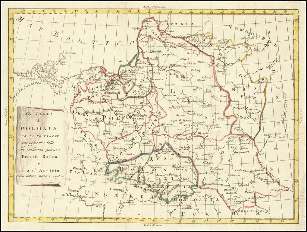
Rare map of Poland, in the midst of its dismemberments. The map locates the Polish territorial acquistions of Russia, Austria and Prussia in the second half of the 18th Century.