Antonio Zatta (fl. 1757-1797) was a prominent Italian editor, cartographer, and publisher. Little is known about his life beyond his many surviving published works. It is possible that he was born as early as 1722 and lived as late as 1804. He lived in Venice and his work flourished between 1757 and 1797. He is best known for his atlas, Atlante Novissimo (1779-1785), and for his prolific output of prints and books that were both precisely made and aesthetically pleasing. Zatta clearly had a large network from which to draw information; this is how he was able to publish the first glimpse of the islands visited by Captain Cook in the Atlante Novissimo. Zatta also published books of plays and architecture.
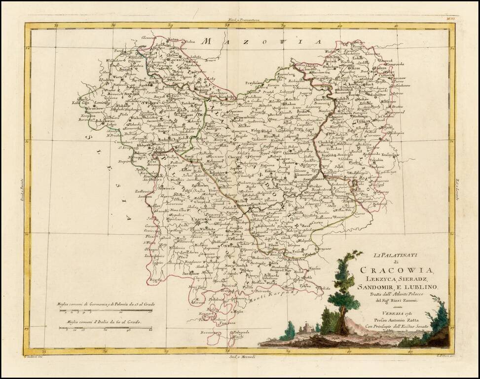
Decorative regional map of part of Poland. Major towns shown include Cracowia, Leczica, Sieradz, Radomisko, Ostzeszow, Lublin, and Sandomirsz. Issued as part of Zatta's Atlante Novissimo.
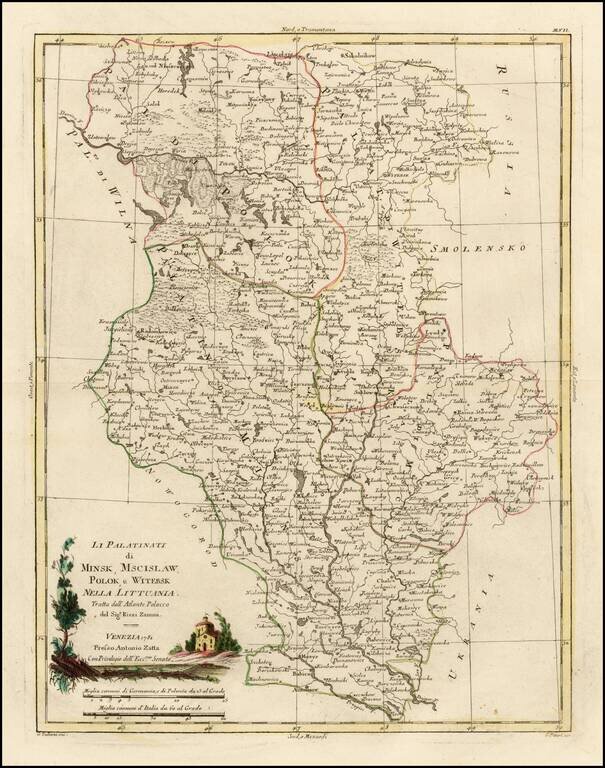
Decorative regional map of several Palatinates in modern day Belarus, centered on the Upper Dniepr River and Upper Dwina River. Issued as part of Zatta's Atlante Novissimo.
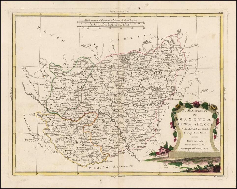
Decorative regional map of part of Poland. Major towns shown include Warsawia, Ieruzalem, Rawa, Lowicz, Ianowa, Nowidor, Radzilow, Nowygrod, Ciechanowiec, Minsk and Biala. Issued as part of Zatta's Atlante Novissimo.
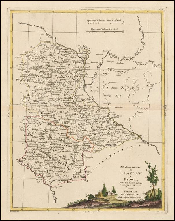
Decorative regional map of several Palatinates in modern day Ukraine and Belarus. The map shows the region east of the Dniester River, centered on Kiev. Issued as part of Zatta's Atlante Novissimo.

A highly detailed map of Poland, published by Zatta. The map stretches from the Baltics to Hungary, Moldavia, the Ukraine and Russia. Shows, towns, rivers, mountains and other features. Based upon the work of Antonio Rizzi Zannoni.
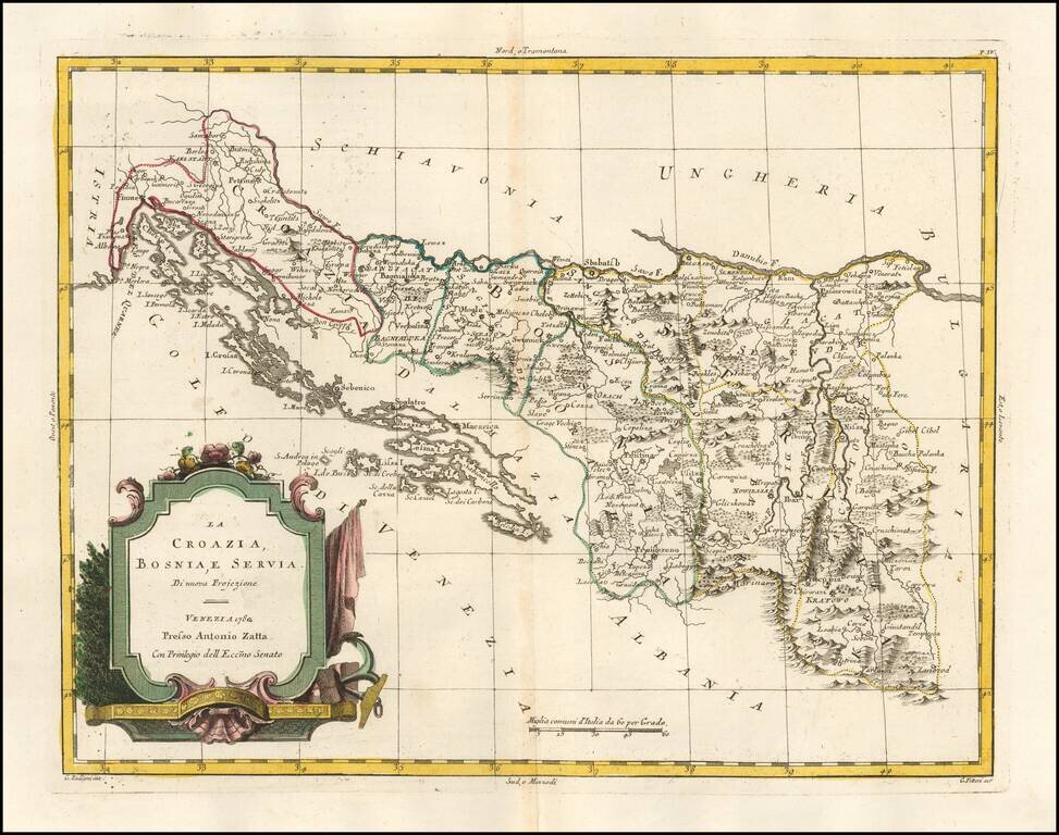
Detailed map of Croatia, Bosnia-Herzagovenia and Serbia, published in Venice by Zatta. Excellent coastal detail.
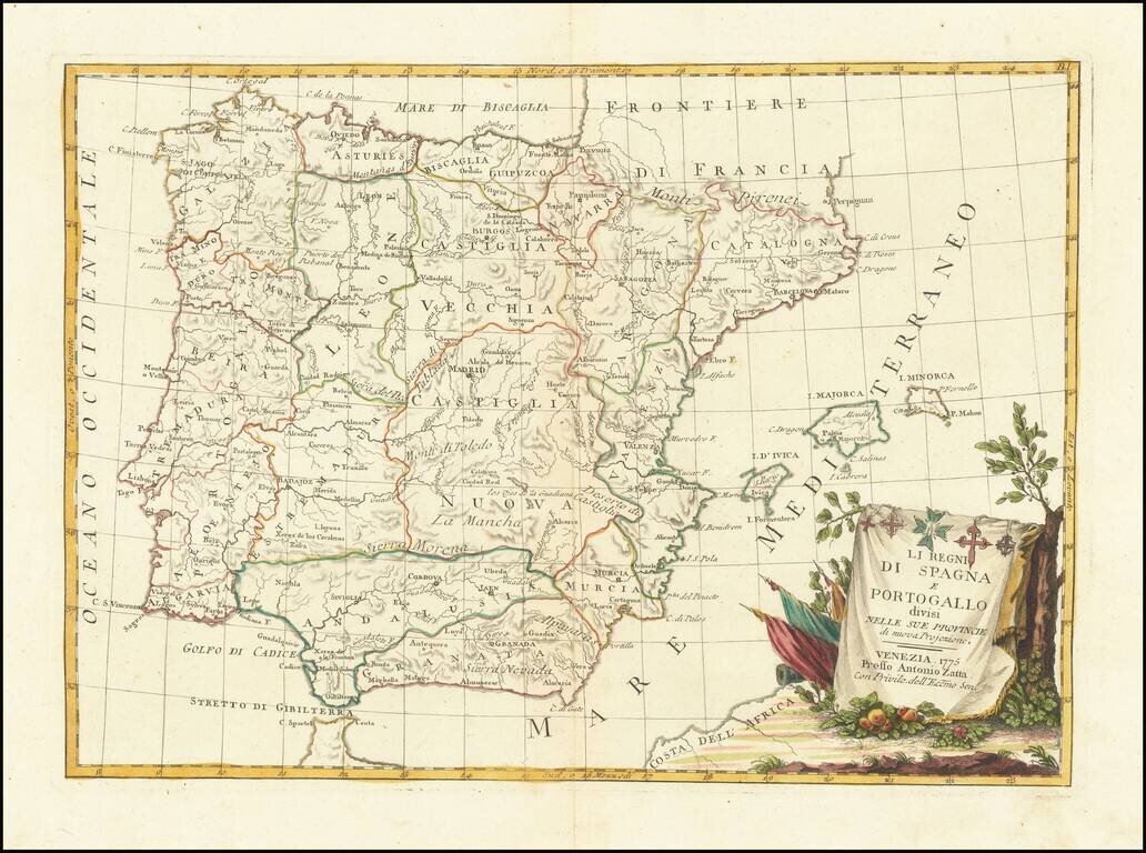
Detailed map of the Iberian Peninsula, published in Venice by Zatta. Very interesting early map, with nice detail. Decorative title cartouche. From Zatta's monumental Altante Novissimo, one of the last great decorative atlases of the 18th Century.
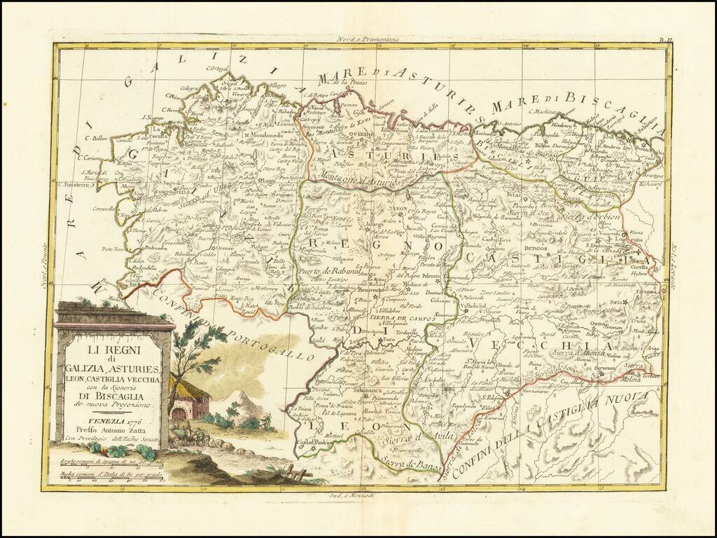
Detailed map of northern Spain, from the Basque Region to Galicia. Very interesting early map, with nice detail. Decorative title cartouche. From Zatta's monumental Altante Novissimo, one of the last great decorative atlases of the 18th Century.
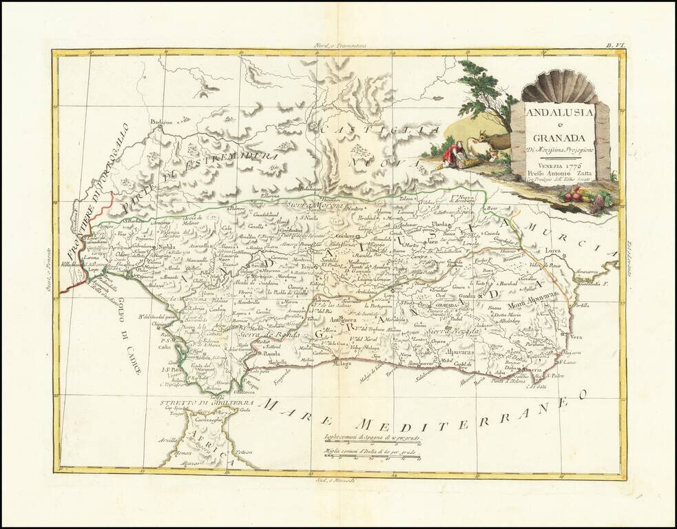
Detailed map of Granada and Andalucia. Very interesting early map, with nice detail. Decorative title cartouche. From Zatta's monumental Altante Novissimo, one of the last great decorative atlases of the 18th Century.
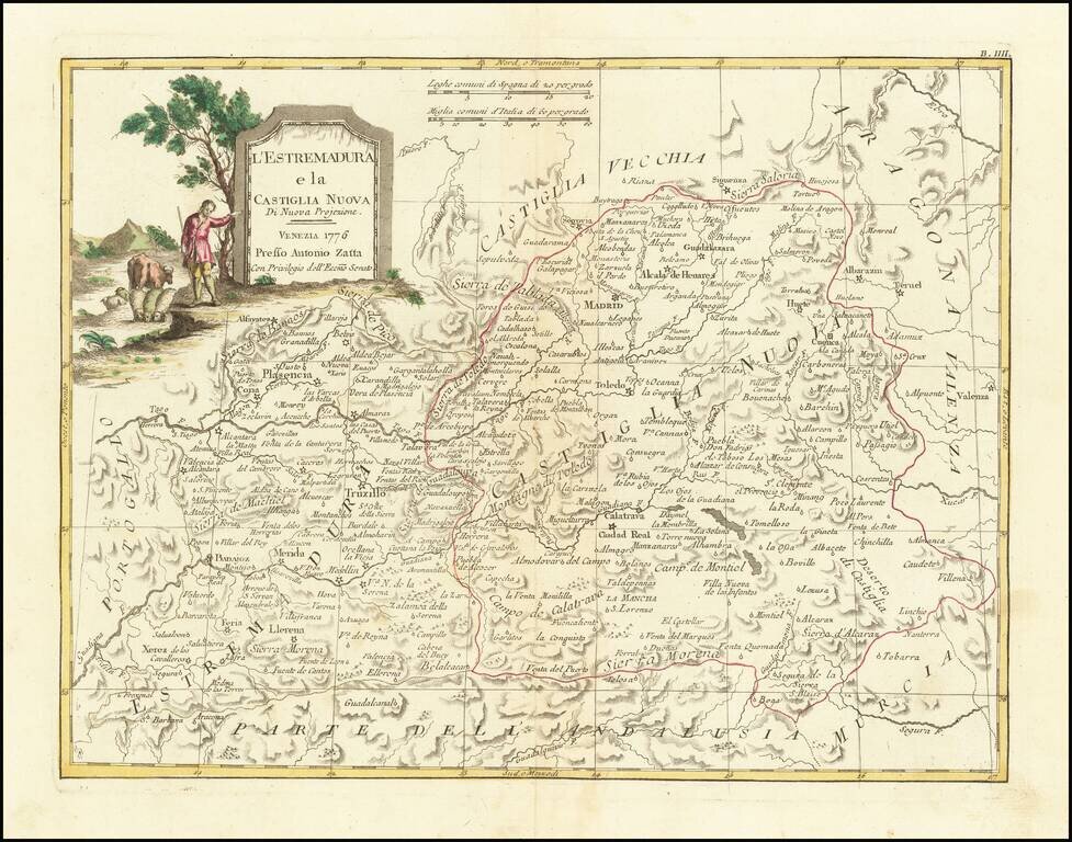
Detailed map of Castille and Extremadura, published by Zatta in Venice. Major Cities include Madrid, Toledo, Ciudad Real, Getafe, Palsencia, Badajoz, Caceres and Merida. Very interesting early map, with nice detail. Decorative title cartouche. From...
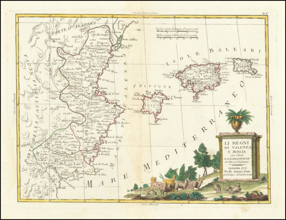
Detailed map of the eastern coastline of Spain, centered on Valencia, Murcia and the Balearic Islands of Ibiza, Minora and Majorca. Very interesting early map, with nice detail. Decorative title cartouche. From Zatta's monumental Altante Novissimo,...
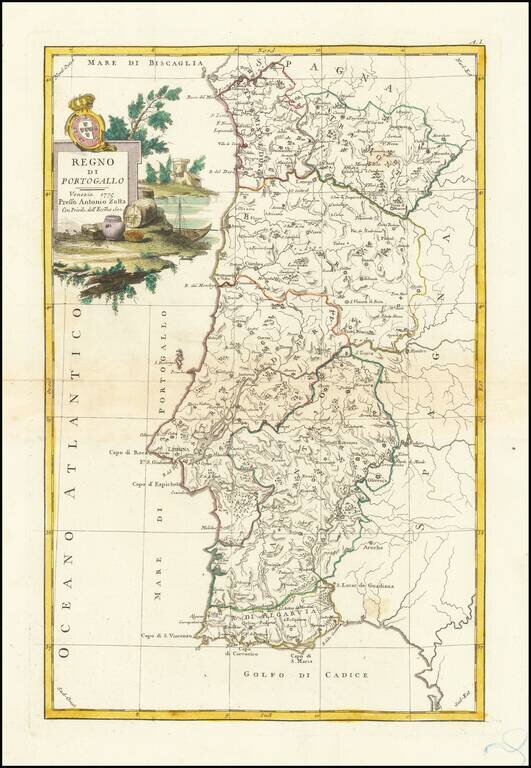
Detailed map of the Kingdom of Portugal, published in Venice. Includes a decorative title cartouche, with coat of arms. From Zatta's monumental Altante Novissimo, one of the last great decorative atlases of the 18th Century.
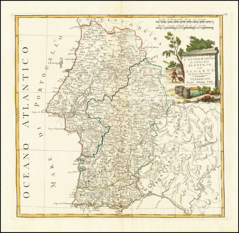
Detailed map of the Southern parts of the Kingdom of Portugal, published in Venice. Includes a decorative title cartouche, with coat of arms. From Zatta's monumental Altante Novissimo, one of the last great decorative atlases of the 18th Century.
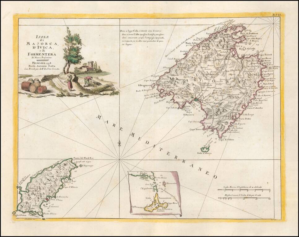
Detailed map of the the Balearic Islands of Ibiza and Majorca. Very interesting early map, with nice detail. Decorative title cartouche. From Zatta's monumental Altante Novissimo, one of the last great decorative atlases of the 18th Century.
![La Tartaria Chinese . . . 1784 [show Corea]](/map/small/44378.jpg)
Decorative map, showing the region from Korea and Tartary to Northern China. Corea is spelled with a "C." Decorative cartouche. The map was issued in Zatta's Atlante Novissimo, a monumental 4 volume work and one of the last great decorative atlases.
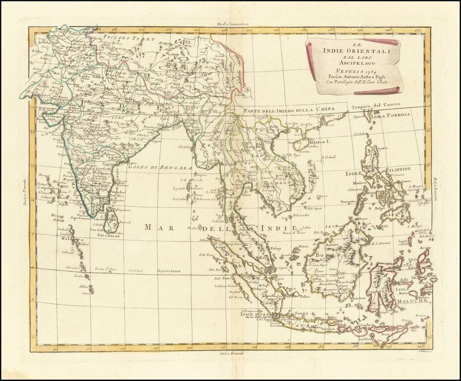
Early edition of Zatta's map of the Philippines, Indian and Southeast Asia. Striking regional map of Southeast Asia, extending from the Philippines and Moluccas to India and the Maldives, and north to Tibet. Decorative scroll title cartouche. This...