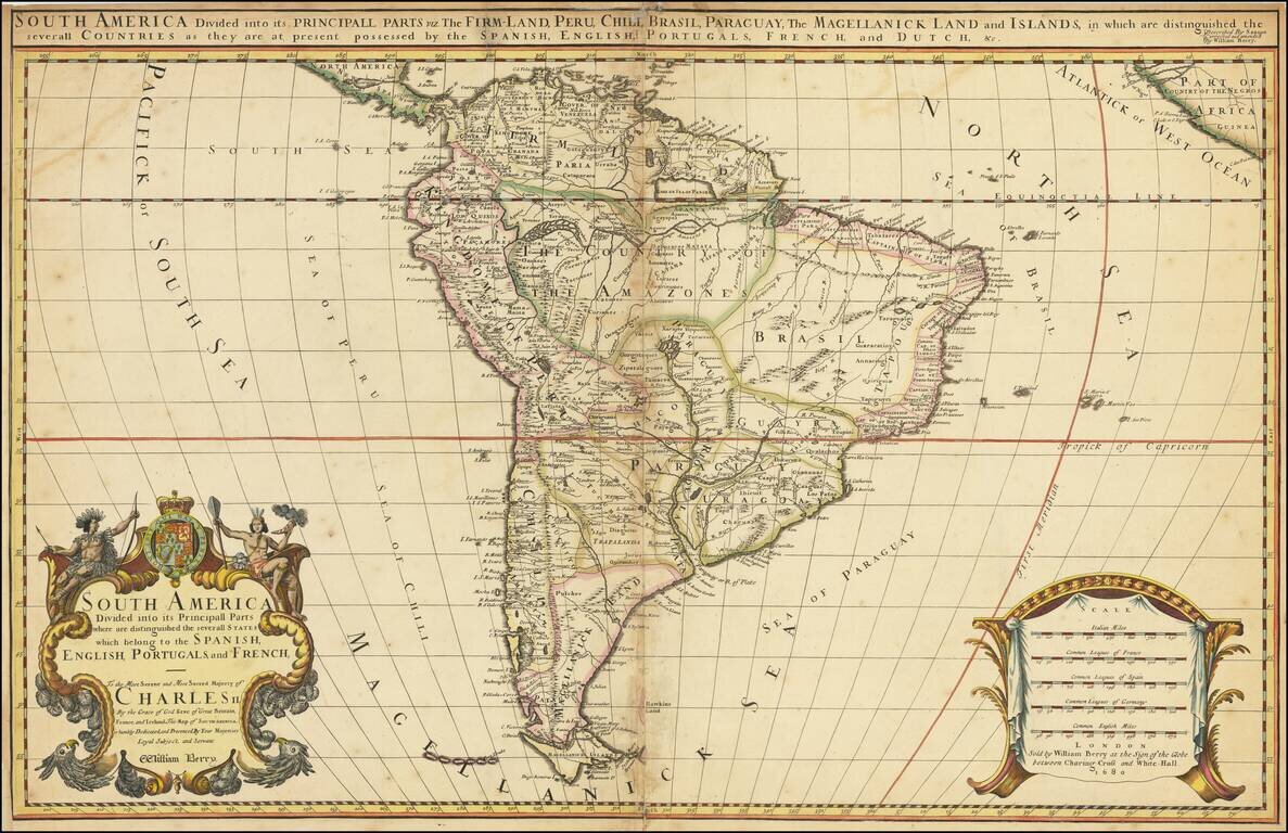
Rare two-sheet antique English map of South America, published by William Berry in London in 1681. William Berry and Robert Morden petitioned the King of England for a license to publish maps for a world atlas in 1678. By 1680, William Berry, then...
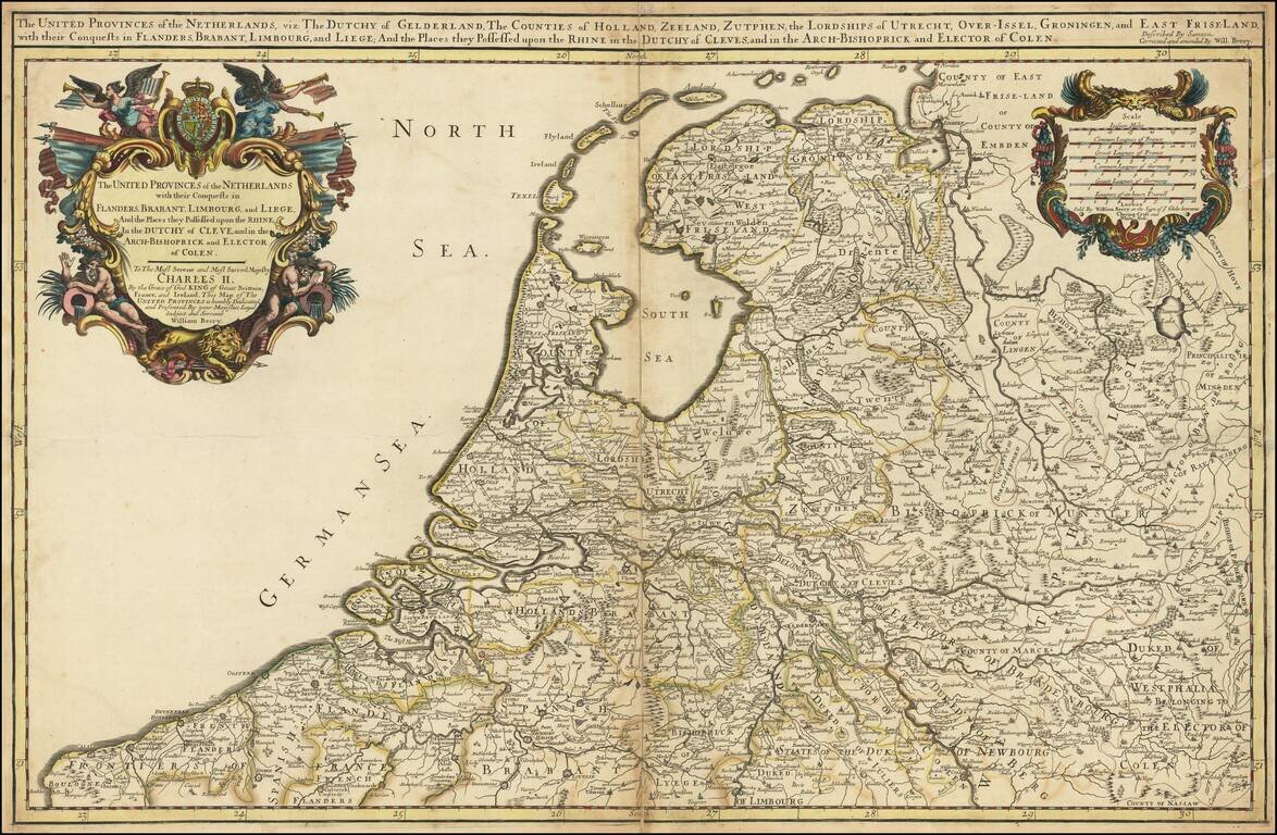
Nice example of William Berry's map of Low Countries, published in London. The map is drawn from Adrien Hubert Jaillot's map of 1674, which has been "corrected and amended" by Berry.
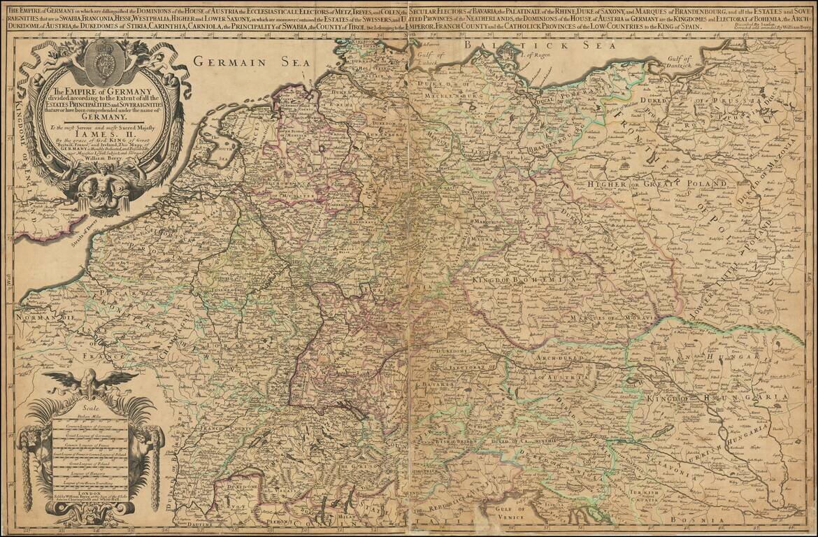
First State of Berry's Rare Map of Germany. Large-format engraved map of Germany, extending to Poland and the Low Countries, by one of London's premier 17th-century mapmakers, William Berry. Many of Berry's maps are dedicated to Charles II, however,...
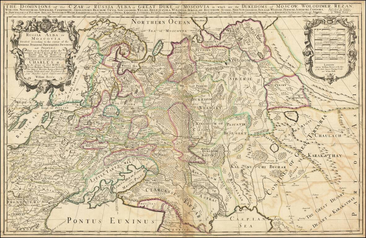
First state. Impressive two-sheet engraved antique map of Russia, published by the 17th century London mapmaker William Berry in 1682. The map covers all of Russia to the Ural Mountains and also depicts a large Kingdom of Poland dominating most of...
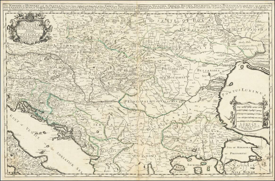
First State, from 1683, the Year of the Siege of Vienna. Rare, large engraved map of southeastern Europe, published by William Berry in London in 1683. The map was published at a pivotal point in the history of the region; in 1683, the Ottoman Empire...
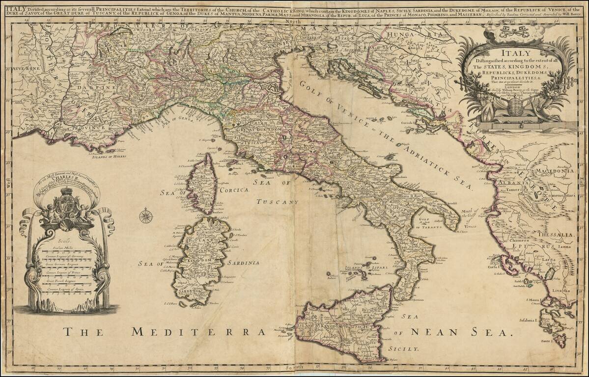
Rare example of William Berry's 2 sheet map of Italy, Corsica, Sardinia, Sicily, and adjoining regions. The map includes a large dedication cartouche to Charles II, King of England. Dated 1682, the map was issued shortly after Charles dissolved the...

Impressive two-sheet engraved antique map of Scandinavia, published by the 17th century London mapmaker William Berry in 1684. The map covers all of Scandinavia, the Baltic Countries, and a large part of northwestern Russia. In 1684, the dominant...
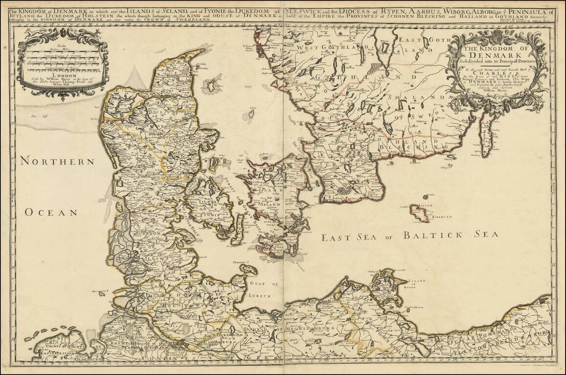
Nice example of William Berry's map of the Kingdom of Denmark, published in London. The map is drawn from Adrien Hubert Jaillot's map of 1674, which has been "corrected and amended" by Berry.