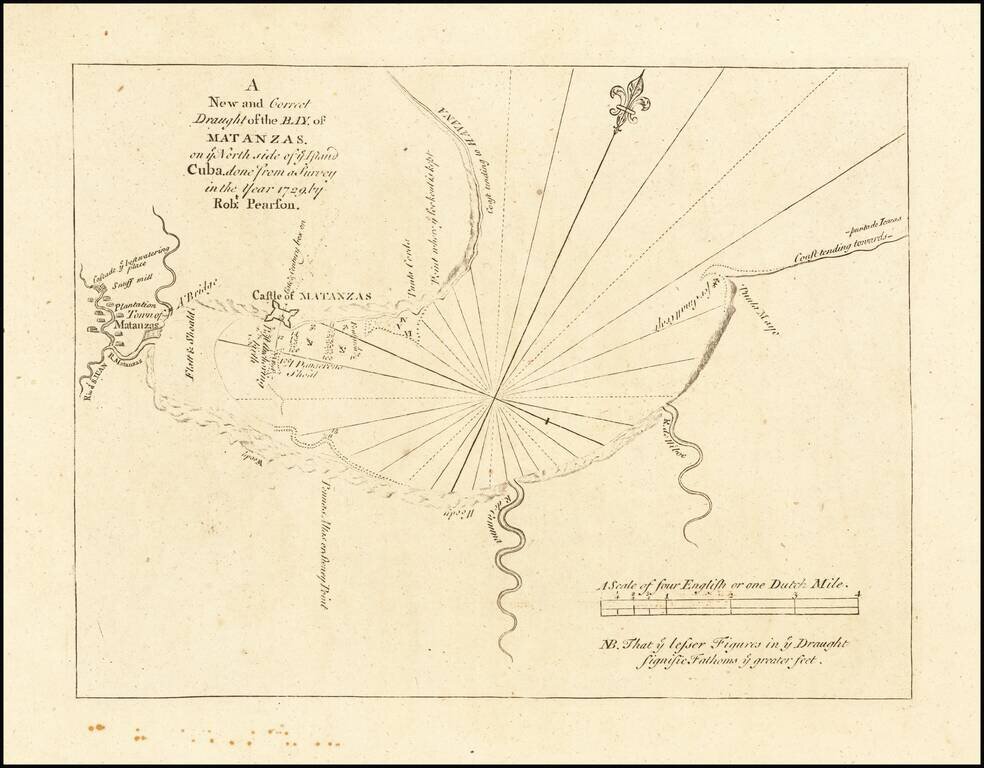
Highly detailed plan of the Bay of Matanzas on the Island of Cuba, from the English Pilot, Fourth Book, published by Mount & Page. This detailed plan includes the location of Plantations Houses, Rivers, a bridge, soundings, anchorages and other...
![[Bermuda]](/map/small/62893.jpg)
Scarce map of Bermuda from the English Pilot, Fourth Book. Shows islands, bays and inlets, forts, navigational hazards, and a "Flemish Wreck." Includes wonderful text in English on the front and back, which includes a description of Bermudas or the...
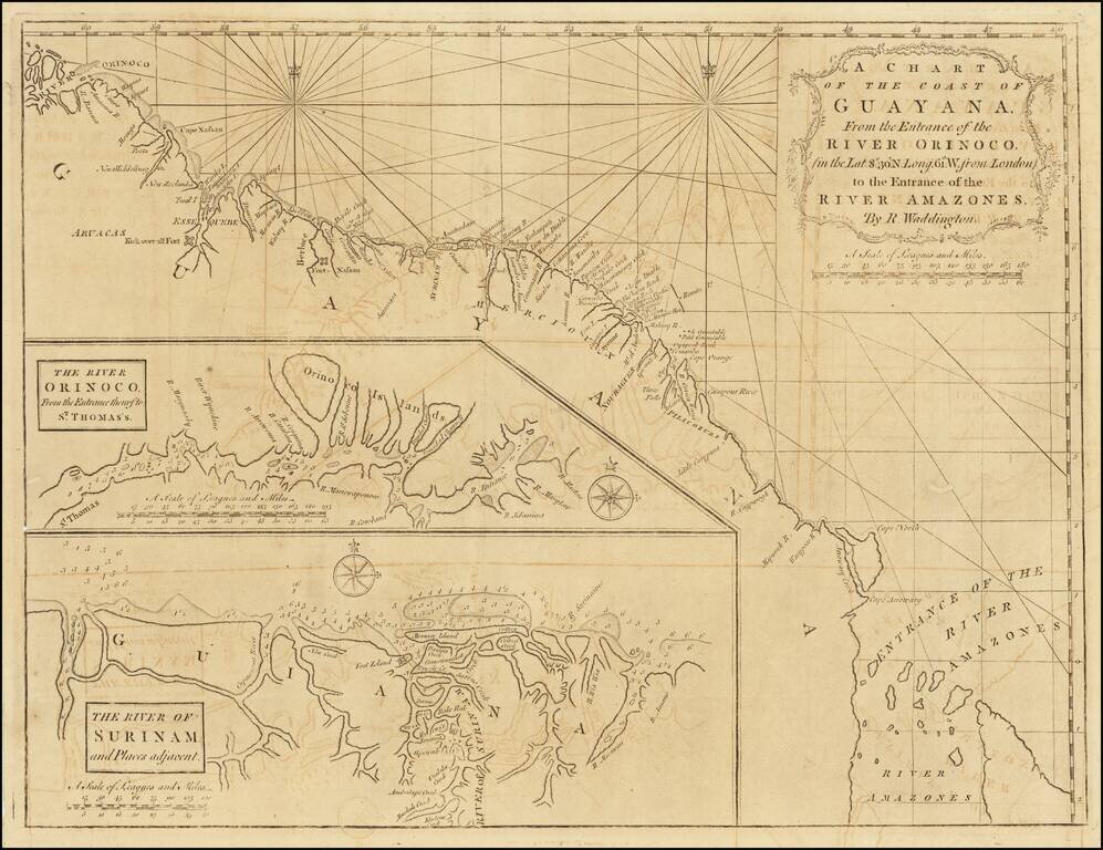
Scarce early English sea chart showing the coast of Guyana, with insets of the River Orinoco, published in London by Mount & Page. The map extends from the entrance thereof to St. Thomas, and the River of Surinam and places adjacent.
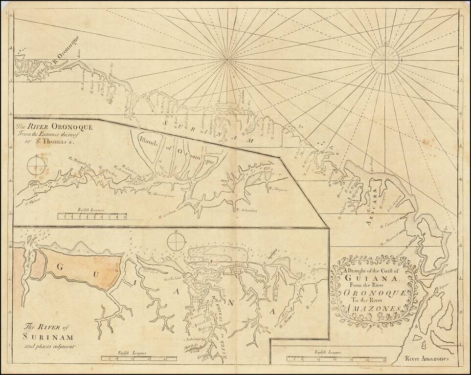
English Sea Chart of The Coast of South America, from the Orinoco River to the Amazon River. Early English sea chart of a portion of the northeastern coast of South America, centered on Guyana, Suriname and French Guiana. The map includes two inset...
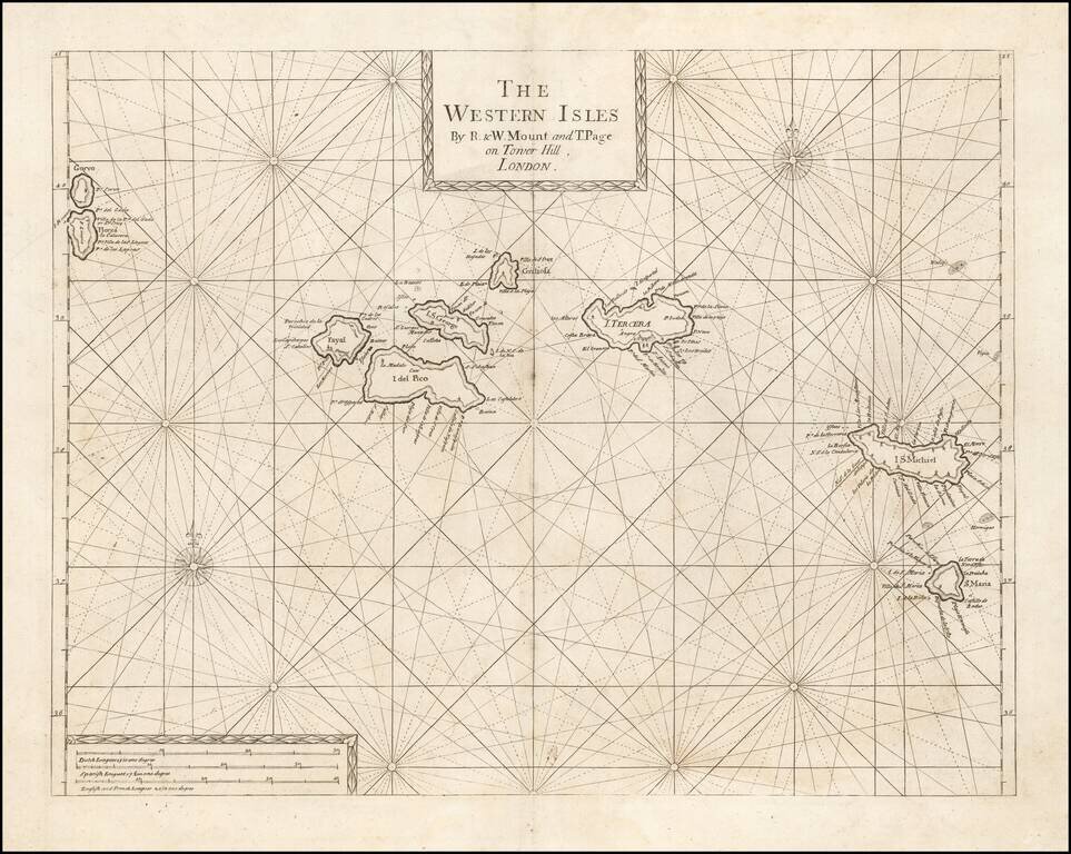
An Early Engish Sea Chart of the Azores Fine early chart of the Azores, which appeared in the English Pilot First Part, Southern Navigation.