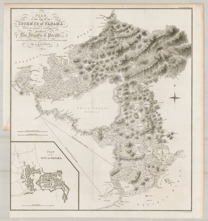
Finely detailed map of a portion of Panama, prepared to illustrate John Augustus Lloyd's article Account of Levellings Carried Across the Isthmus of Panama, presented at the Royal Geographical Society in 1830. This detailed topographical map depicts...
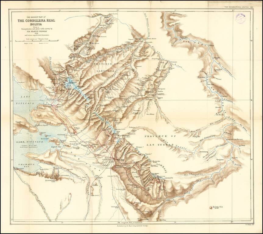
Finely executed map of the area around La Paz and the eastern part of Lake Titicaca, extending north to the Rio Mapiri and Rio Beni regions, published by the Royal Geographical Society. The map illustrates the expedition of William Martin Conway, 1st...
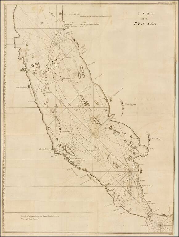
Finely executed map of the southern part of the Red Sea, which was published in A Letter to the Rev. Mr. Maskelyne, Astronomer Royal, F. R. S. Accompanying a New Chart of the Red Sea, with Two Draughts of the Roads of Mocha and Judda, and Several...
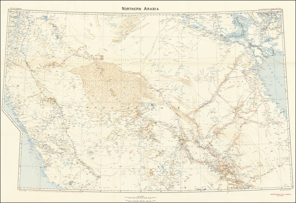
A Map to Illustrate Captain William Shakespear's Last Journey Highly detailed map was produced by the British War Office for the Royal Geographical Society with the permission of the controller of His Majesty’s Stationery Office in March 1922. The...
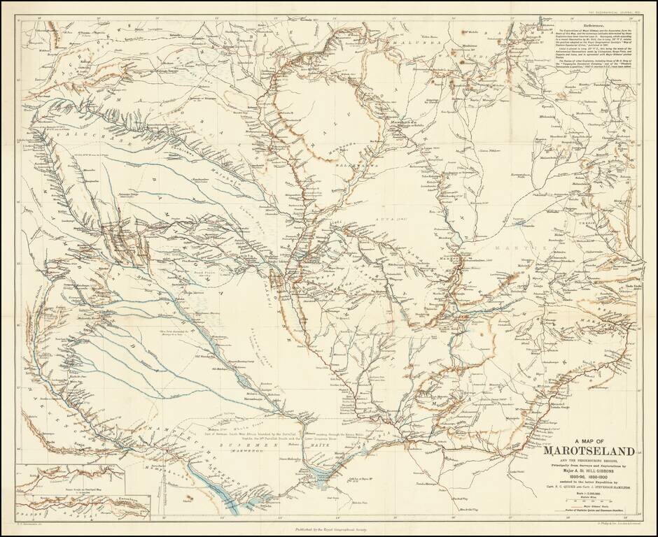
A Scarce Map Following Expeditions Exploring The Zambezi Basin An antique map showing western half of Zambia, collating the results from several expeditions to the region which occurred at the end of the 19th century. The area shown extends into parts...
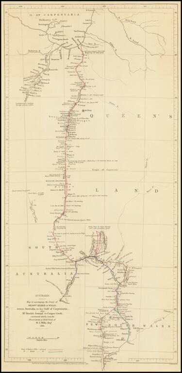
Route Map of the Burke and Wills Expedition Across Australia Detailed map showcasing the route of the Burke and Wills Expedition, which appeared in the Journal of the Royal Geographical Society to accompany an account of the expedition. The map shows...