Joseph Meyer (1796-1856) was a German publisher who released Meyers Konversations-Lexikon, a German-language encyclopedia in print from 1839 to 1984. Meyer was born in Gotha and educated as a merchant in Frankfurt, an important city in the book trade. He traveled in London in 1816 and was back in German in 1820, where he began to invest in textiles and railways. He opened his publishing operation, Bibliographisches Institut, in 1826. His publications each had a serial number, a new innovation at the time. He was best known for his atlases and the Meyers Universum (1833-1861), which featured steel-engravings of the world. The Universum stretched to 17 volumes in 12 languages and was subscribed to by 80,000 people all over Europe. Thanks to his publishing success, Meyer moved the Institut from Gotha to Hildburghausen in 1828. Meyer died in the latter city in 1856.
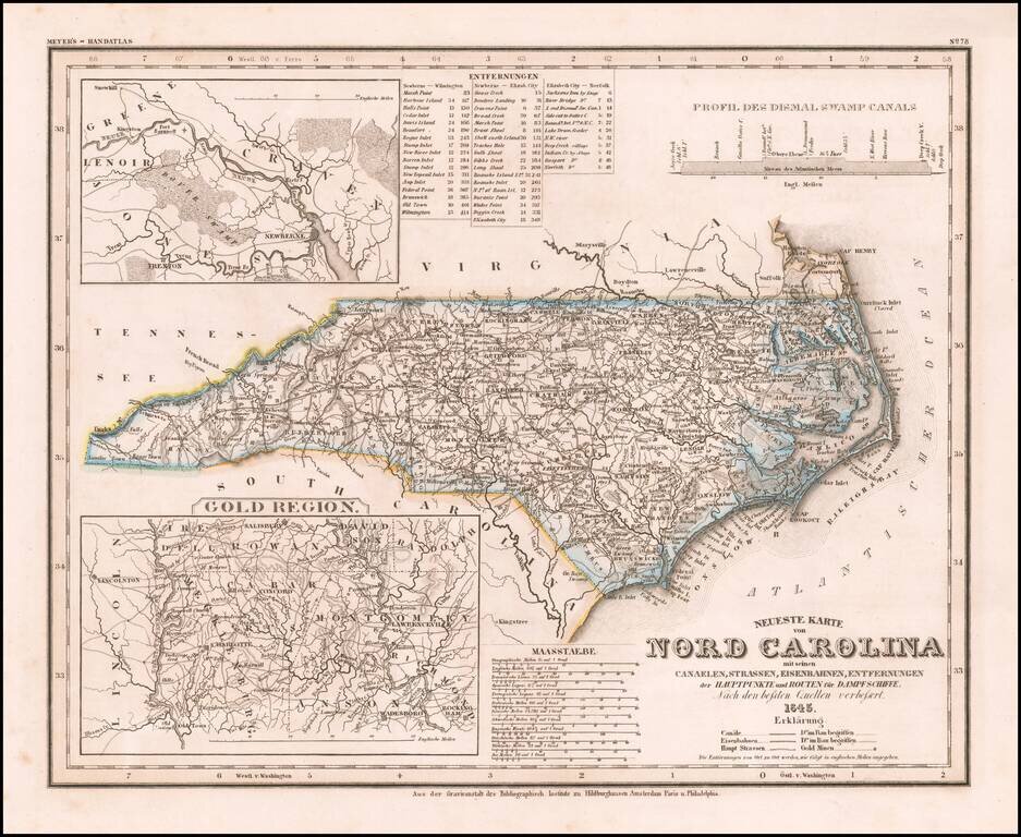
Elegantly engraved & detailed map of North Carolina, based upon Tanner's work in the early 1840s. Shows counties, towns, roads, canals, lakes, etc. Detailed insets of the Gold Region. While often referred to as the "German Mitchell," this is an...
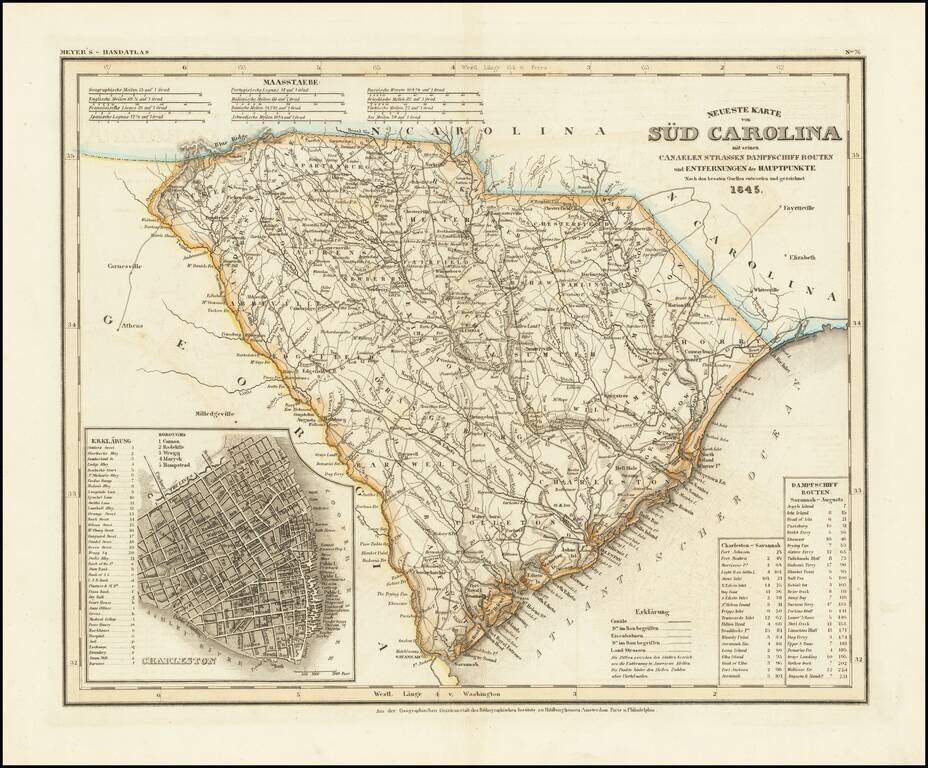
An antique map of South Carolina with German-language description based upon H. S. Tanner's map. The map purports to show the routes, railroads, and distances in the state, though it also locates various other features including rivers, canals, and...

A German Map of the Republic of Texas Detailed map of the Republic of Texas at the start of the Mexican War. The massive stovepipe configuration is shown here, extending to Wyoming in the north, the Rio Grande in the west and the Red River and...
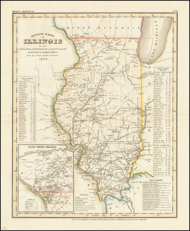
Fine example of this elegantly engraved & detailed map of Illinois, based upon Tanner's work in the early 1840s. Shows counties, towns, roads, rivers, lakes, etc. While often referred to as the German Mitchell, this characterization is unfair, as...
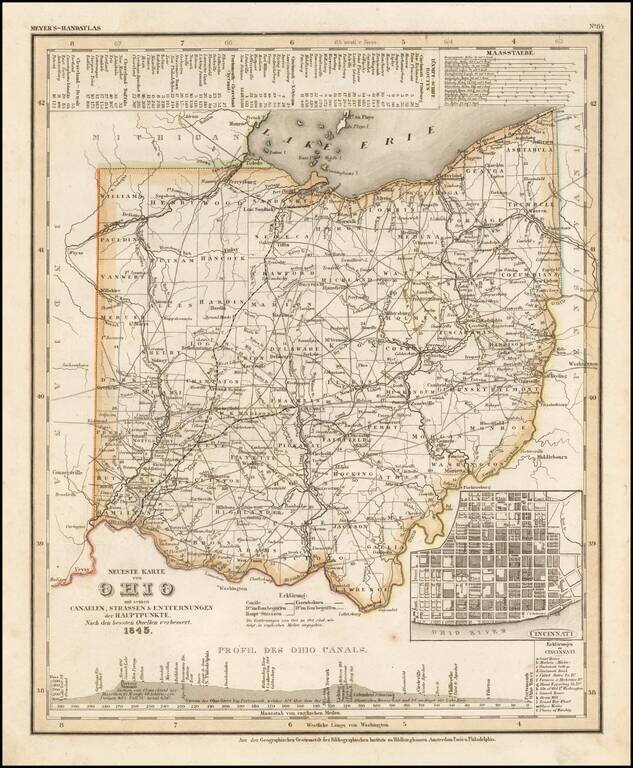
Elegantly engraved and detailed map of Ohio, with an inset map of Cincinnati and profiles of the Ohio Canals, taken based upon Tanner's work in the early 1840s. Shows counties, towns, roads, canals, lakes, etc. While often referred to as the German...
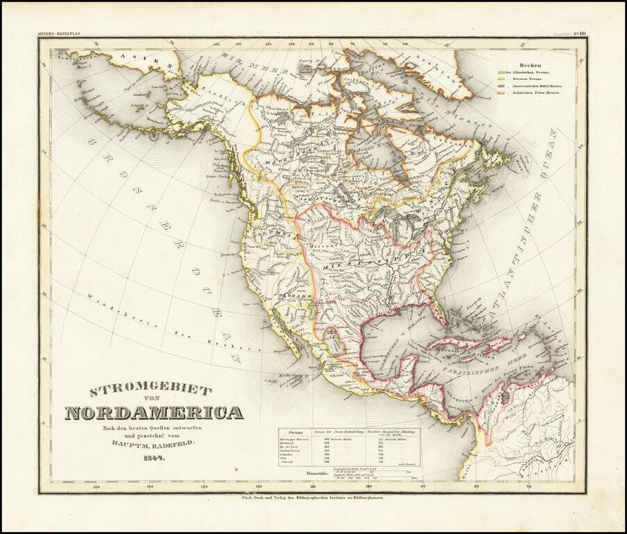
A fascinating early geographical map of North America, showing the various regions drained by major North American Rivers, including Colorado, Columbia, Mississippi, Rio Del Norte, Mackenzie, Saskatchewan, and the St. Lawrence, among others. Very...
Elegantly engraved & detailed map, taken based upon Tanner's work in the early 1840s. Shows counties, towns, roads, mountain ranges, rivers etc. Includes a table of Distances and times for various steamship routes along several rivers.
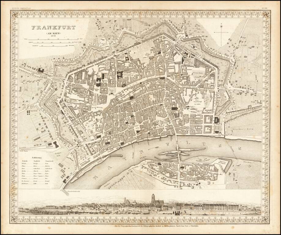
Striking plan of Frankfurt Am Main and Sachsenhausen across the river. Includes a large panoramic view of the city from the river at the bottom.
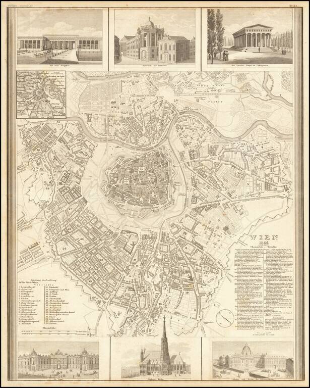
Decorative map of Vienna, published by Joseph Meyer. The map includes 6 large decorative vignettes.
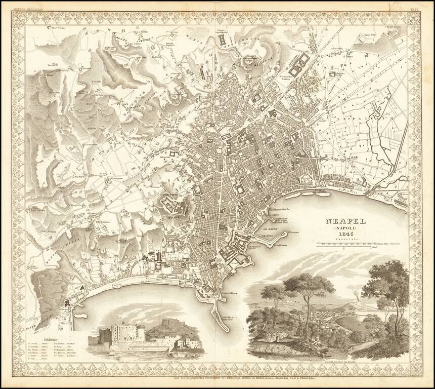
Decorative plan of Naples, published by Meyer. Includes two large vignettes, showing the Castello St. Elmo and a view of Naples and the Harbor from a neighboring hillside, with a volcano erupting in the background.
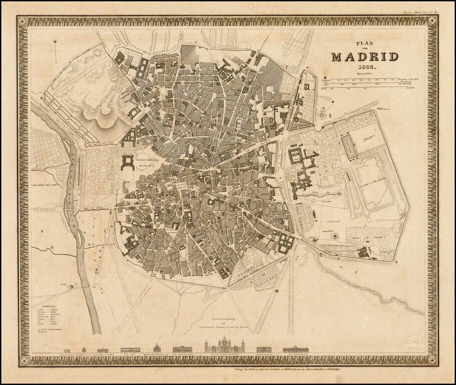
Striking town plan of Madrid, with vignettes showing 9 major churches and buildings.
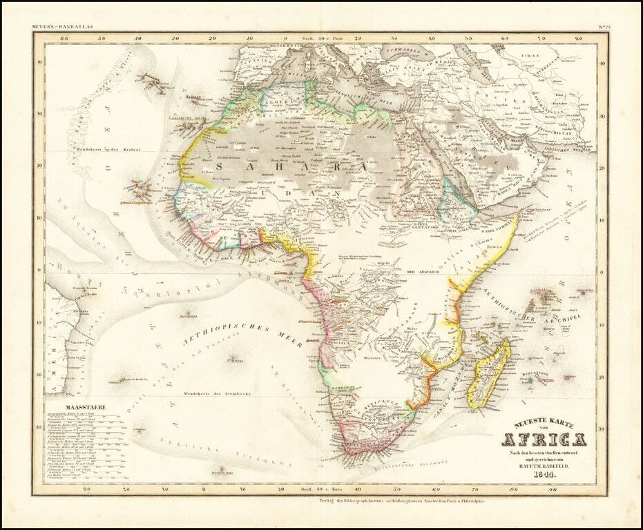
Detailed map of Africa, from Meyer's Hand Atlas. Provides a fine representation of the extent of the known regions of Africa (mostly along the coastlines), with fast expanses of unknown and little known regions.
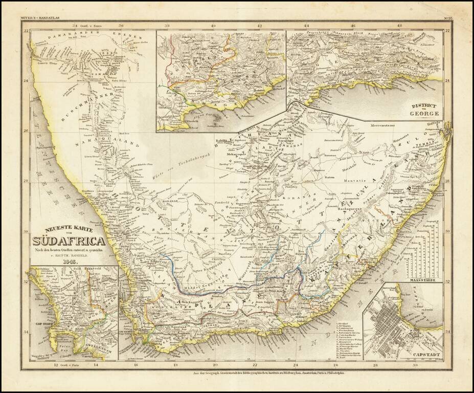
Detailed regional map of South Africa, with 4 inset maps. From Meyer's Hand Atlas. Extremely detailed regional map. A marvelous example of the fine, precise German engraving style of the mid-19th Century.

Scarce map of the South Pole, showing the most recent discoveries and some conjectural regions. Includes annotations with dates of discoveries from 1820 to about 1840 (Charles Wilkes), with some earlier notes regarding Cook's contact with the region...

Finely executed map of the South Polar regions, published in Leipizig. The map is focused on the many explorations of the Antarctic regions up to several discoveries in 1902 and 1903. Very detailed map of Antarctica with insets and numerous tracks of...