Matthias Quad (1557-1613), a map publisher based in Cologne, was trained in the Netherlands by Johannes van Doetecum, who also worked with the De Jodes. Quad used many De Jode maps as a base to which he added additional information and decorations. Quad was best known for his atlases, which were part of the first boom in atlases best characterized by Abraham Ortelius’ Theatrum Orbis Terrarum. In 1592, Quad released an atlas of Europe that had 38 maps. He expanded it in 1594 to 50 maps. In 1600, he expanded the collection of maps further still, this time to 82 maps, and called the atlas, Geographisch Handtbuch. All three were small in size, allowing them to compete as cheaper alternatives to the larger atlases of Ortelius, Mercator, and the De Jodes. Quad released one other atlas, in 1608, with 86 maps, the Fascilus Geographicus.

One of the Earliest Maps to Show and Name the Philippines Rich, dark impression of Matthias Quad's map of Asia. The map shows the entire continent, from the east coast of Africa to the subcontinent to Japan. The land is covered with toponyms; small...
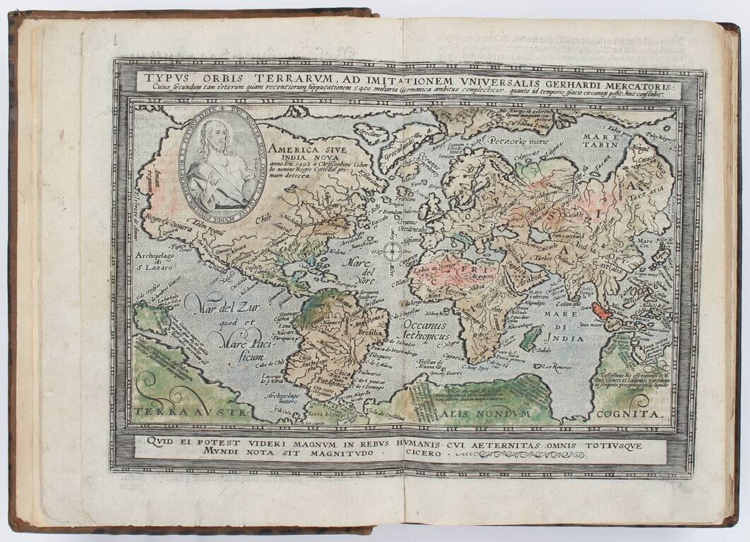
Quad's First Atlas of the Whole World; First Edition with this Title, Early Variant. Small folio (10.75 x 7.75 inches). 20th-century calf antique, spine gilt (very slightly rubbed). Engraved title and 82 double-page engraved maps (3 hand-colored)...
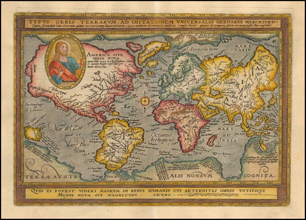
Striking full color example of this fine early map of the World, which first appeared in the third of edition of Quad's Europae totius orbis terrarum, published by Johann Bussemacher. Quad's map derives from Mercator's planispheric map of 1569, with...
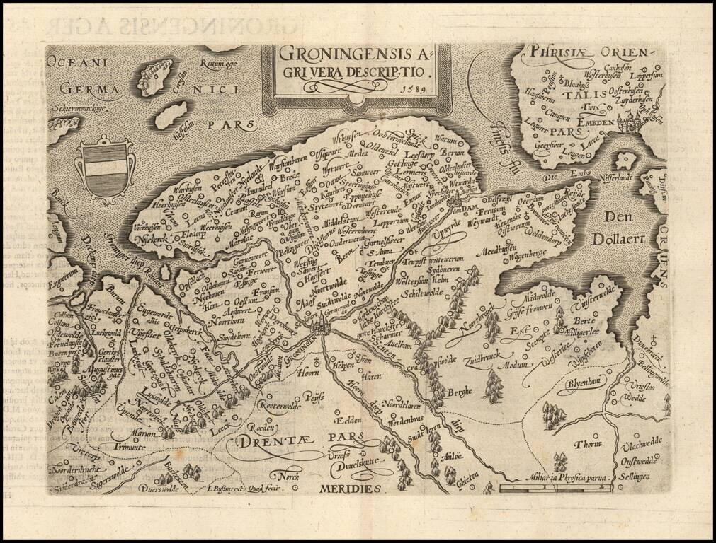
Nice example of this scarce map of Groningen, published in Cologne. The present map was produced by two of the primary Cologne School mapmakers, Johann Bussemacher and Matthias Quad. The Cologne School of cartography, was perhaps the only group of...
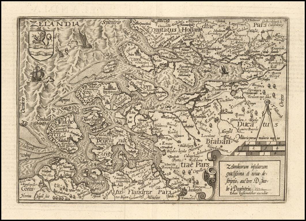
Nice example of this scarce map of Zeland in the Netherlands, published in Cologne. The present map was produced by two of the primary Cologne School mapmakers, Johann Bussemacher and Matthias Quad. The Cologne School of cartography, was perhaps the...
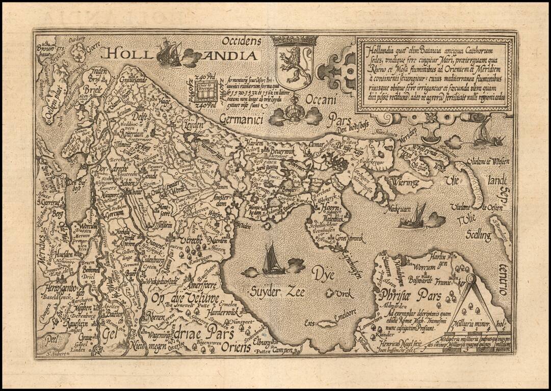
Nice example of this scarce map of Holland, oriented with west at the top, published in Cologne. The map was engraved by Henreich Nagel. The present map was produced by two of the primary Cologne School mapmakers, Johann Bussemacher and Matthias...
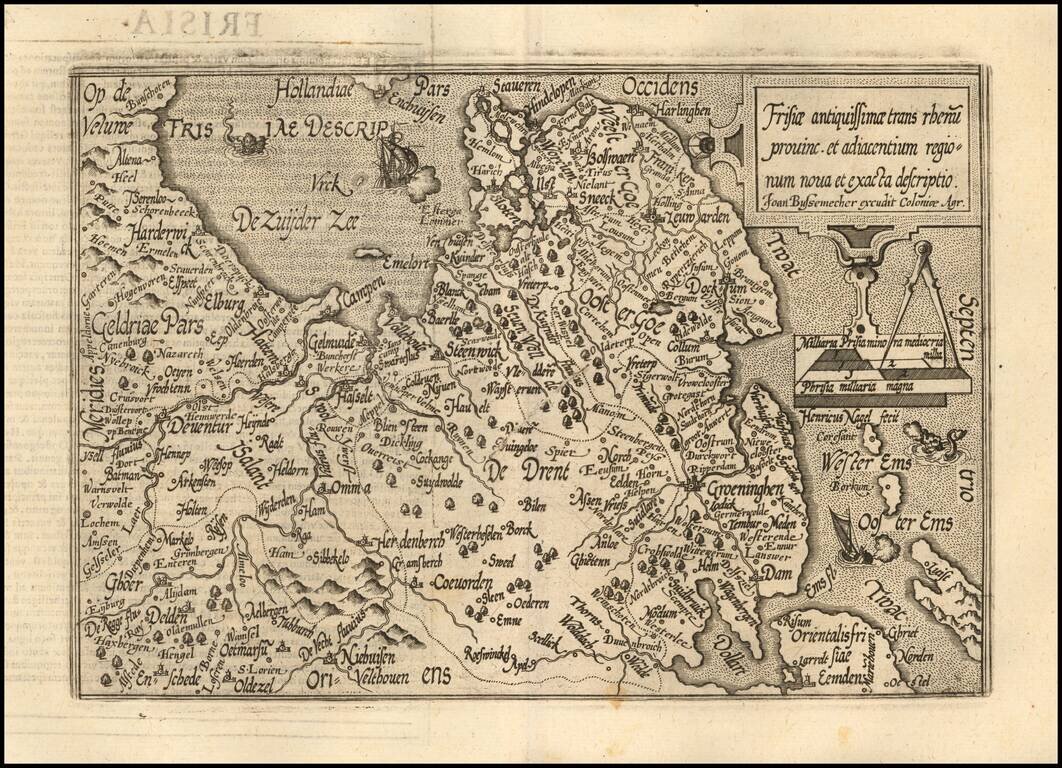
Nice example of this scarce map of Friesland, published in Cologne. The map is oriented with west at the top and extends to Drenth, Groeningen and part of Gelderland The present map was produced by two of the primary Cologne School mapmakers,...
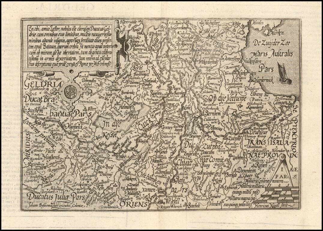
Nice example of this scarce map of Geldria, published in Cologne. The map is oriented with west at the top. The present map was produced by two of the primary Cologne School mapmakers, Johann Bussemacher and Matthias Quad. The Cologne School of...
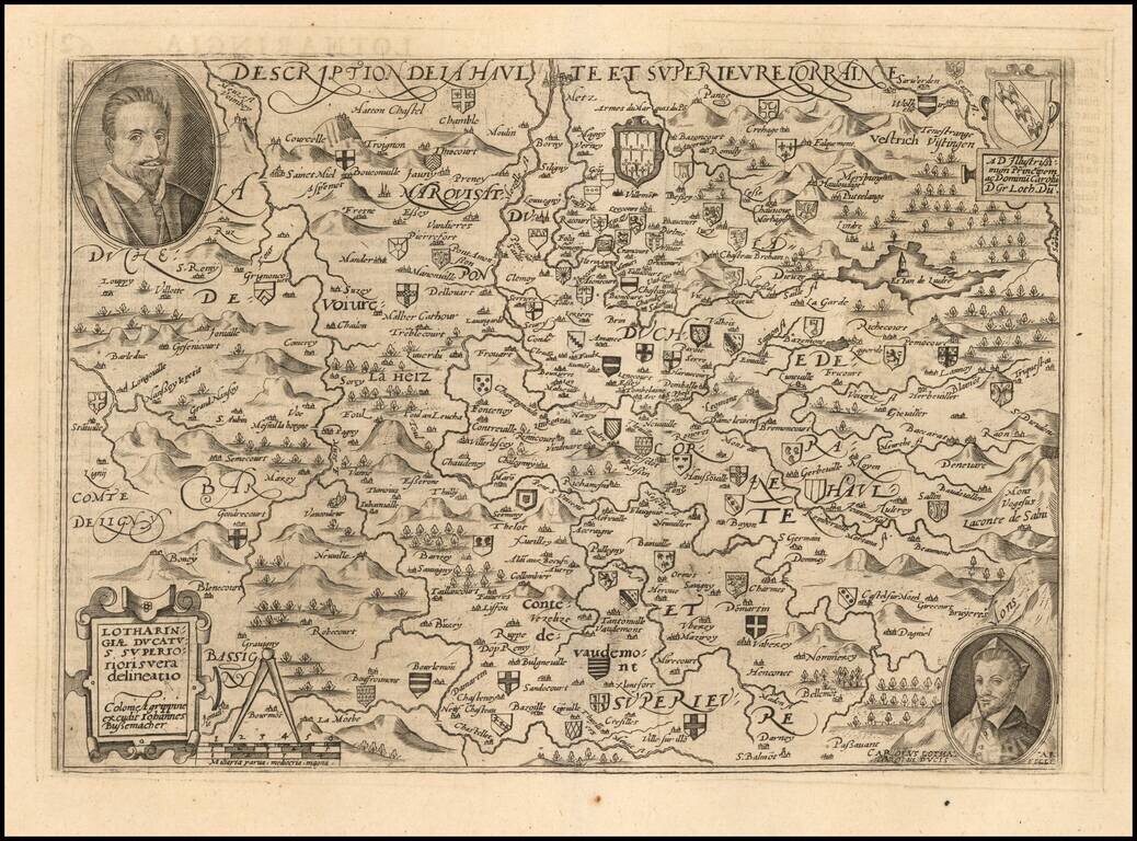
Scarce early map of the Lotharingau Inferioris region of France. Includes two portraits and a number of coats of arms of various towns. Matthaus Quad was a German cartographer based in Cologne. The map was engraved by Johannes Bussemacher and...
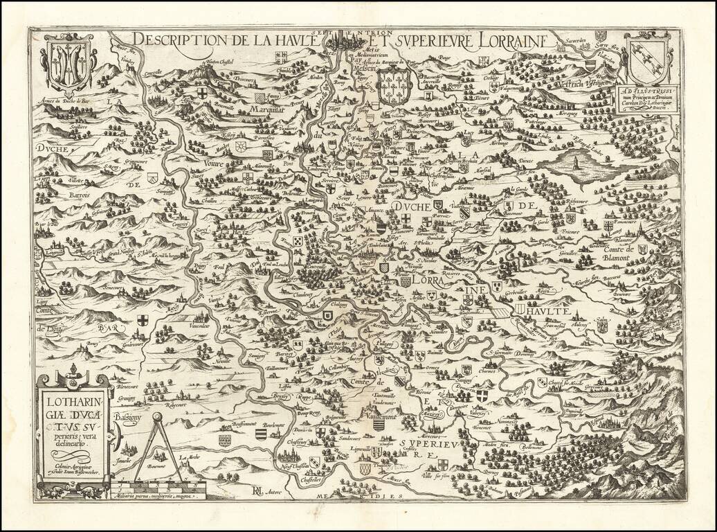
Rare separately published map of the Lorraine region by Johannes Bussemacher of Cologne. The map is centered on the course of the Moselle River and the Meuse (Maas) Rivers, with dozens of smaller coats of arms locating early towns and families. The...
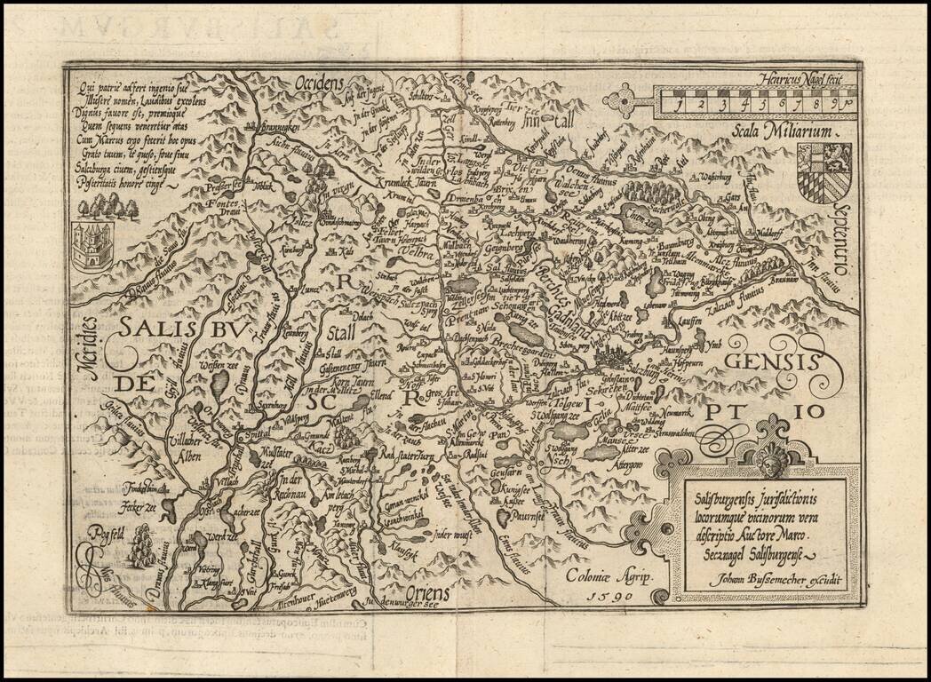
Detailed map of Saltzburg, based upon an earlier map by Markus Setznagel. Setznagel was the son of an official and member of the external council of the city Salzburg, Michael Setznagel. His most important work was the first general map of Salzburg,...
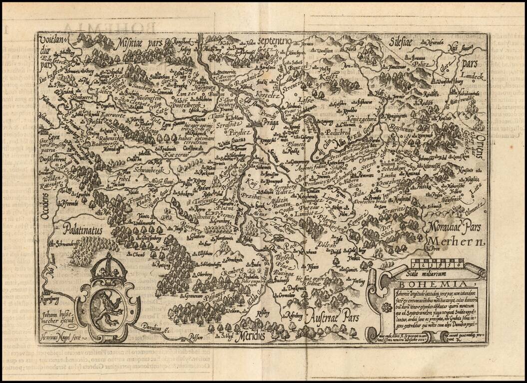
Fine example of Johan Bussemacher's map of Bohemia, engraved by Henricus Nagel. One of the few separate maps of Bohemia published in the 16th Century.
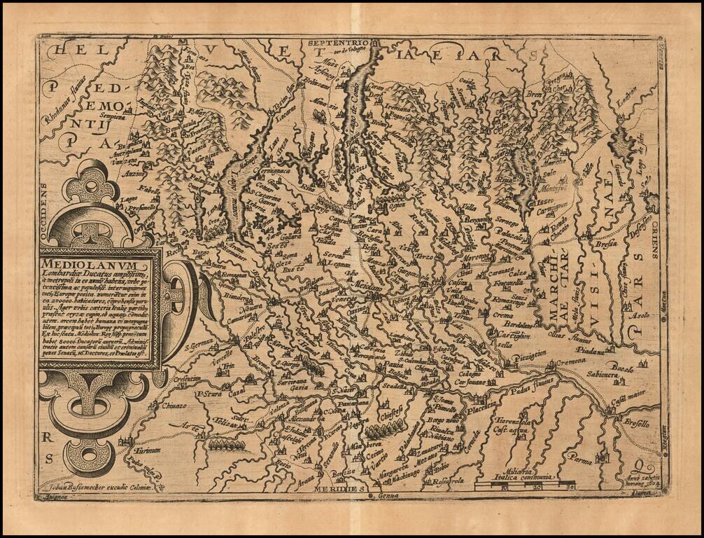
Nice example of Johann Bussemachaer's 1593 double-page engraved map of much of Lombardy, the region around Milan, in northern Italy. The map features Lago Maggiore and Lago di Como.
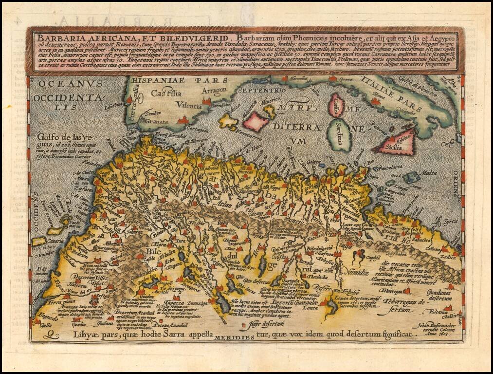
Scarce early map of North Africa and the Mediterranean, engraved by Johann Bussemacher and published by Quad in Cologne.
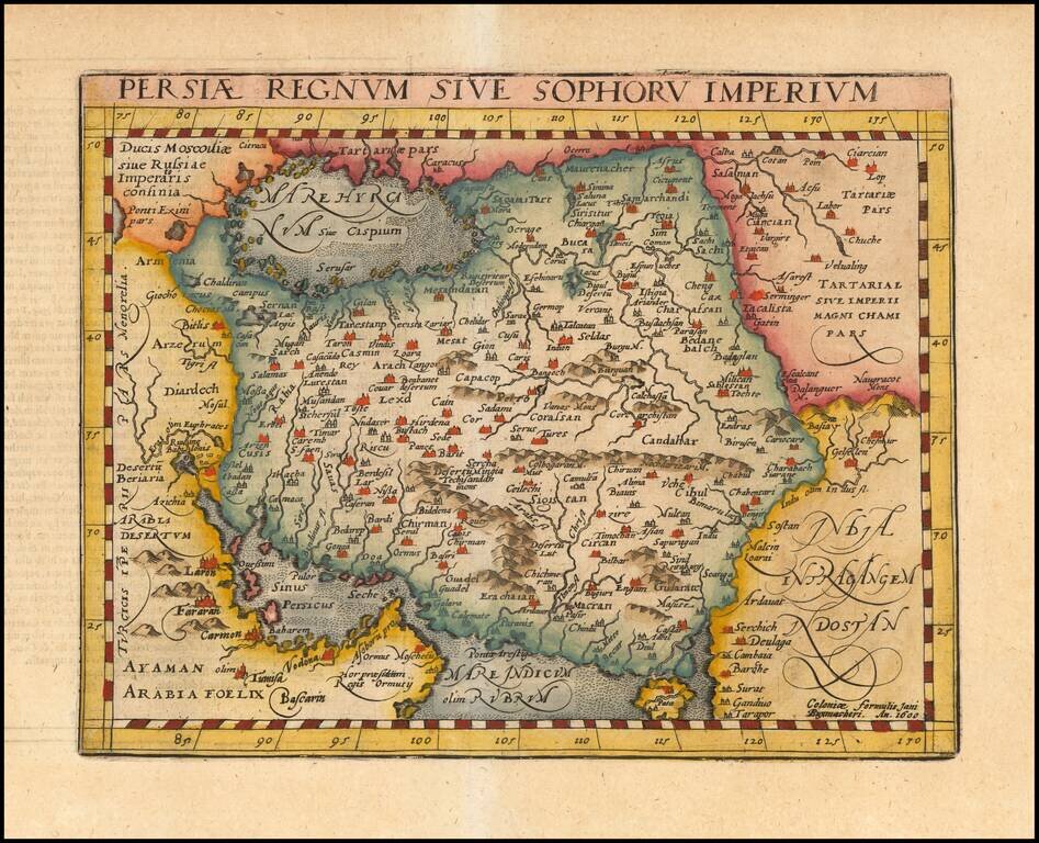
Detailed early map of Persia, including the Caspian Sea, parts of Arabia and Northwestern India, from this scarce 16th Century mapmaker. The map is based upon Gastaldi's modern map of Persia, as copied by Ortelius.
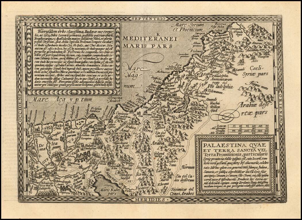
Scarce early map of the Holy Land, engraved in Cologne by Johann Bussemacher for Quad.