Edward Wells was a Church of England clergyman and advocate for education. He published prolifically, including several atlases of the ancient and contemporary world. Wells was the son of a vicar and entered Christ Church, Oxford in late 1686. He graduated BA in 1690, MA in 1693, and worked as a tutor at his college from 1691 to 1702. Then, he entered into a living at Cotesbach, Leicestershire, from where he continued to publish his many works. He attained the degrees of BD and DD in 1704, after he was already at Cotesbach.
From roughly 1698 onward, Wells wrote many sermons, books, and atlases. He focused on catechismal and pastoral works, as well as educational books. For example, some of his first works were mathematics texts for young gentlemen, which included how to use globes and determine latitude and longitude. He also translated classical and Christian texts, sometimes adding geographical annotations.
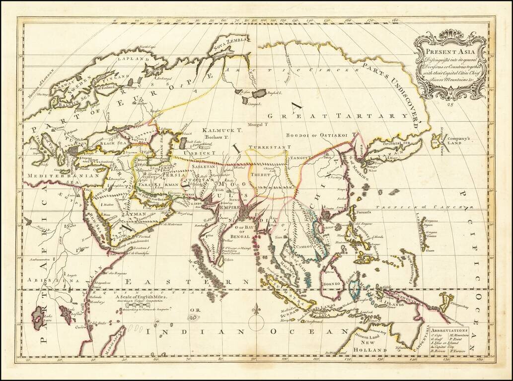
His descriptive geographies were not overly original works, but they were popular in their time. First, he produced a Treatise of Antient and Present Geography in 1701; it went on to four more editions. Next was a Historical Geography of the New Testament (1708), accompanied by a Historical Geography of the Old Testament (1711-12).
![A New Map Shewing all the several Counties, Cities, Towns, and other Places mentioned in the New Testament . . . [shows Cyprus]](/map/small/57664mp2.jpg)
Interesting map of the Eastern Mediterreanean, with smaller inset maps of the Holy Land and the whole of the Mediterreanean. Includes a title cartouche and coat of arms.
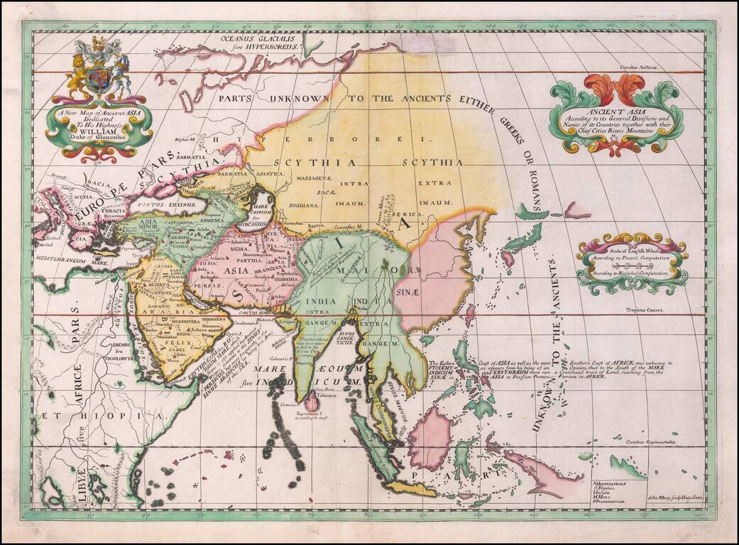
Decorative map of Asia, published in Oxford, circa 1700. The map extends from Saudi Arabia and the Black Sea to Japan, New Guinea and unknown parts which would appear to be the northern Australia coastline. This decorative map was part of a set of 22...
Rare late state of Wells modern map of Asia. This decorative map was part of a set of 22 maps dedicated to William, Duke of Glouchester, who was then an 11 year old student at Oxford.
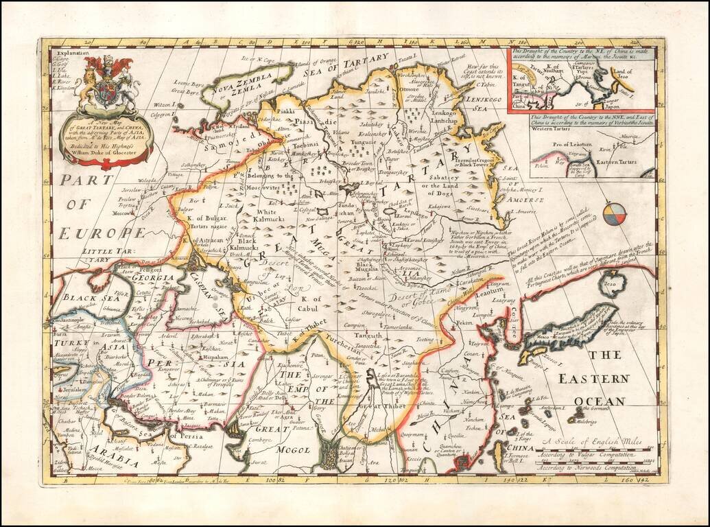
Decorative map of China, Tartary, Japan, Central Asia, etc. at the beginning of the 18th Century. Includes the mythical land bridge to America, the Island of Formosa or Bell Island, and other interesting details. This map was part of an atlas...
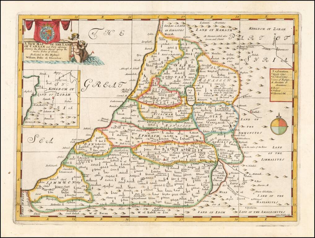
Map of the Holy Land, Published For The Education of A Future King of England. Decorative map of the Holy Land, colored by Tribes. The map was part of an atlas dedicated to the Duke of Glocester, who was then attending school in Oxford. The maps...
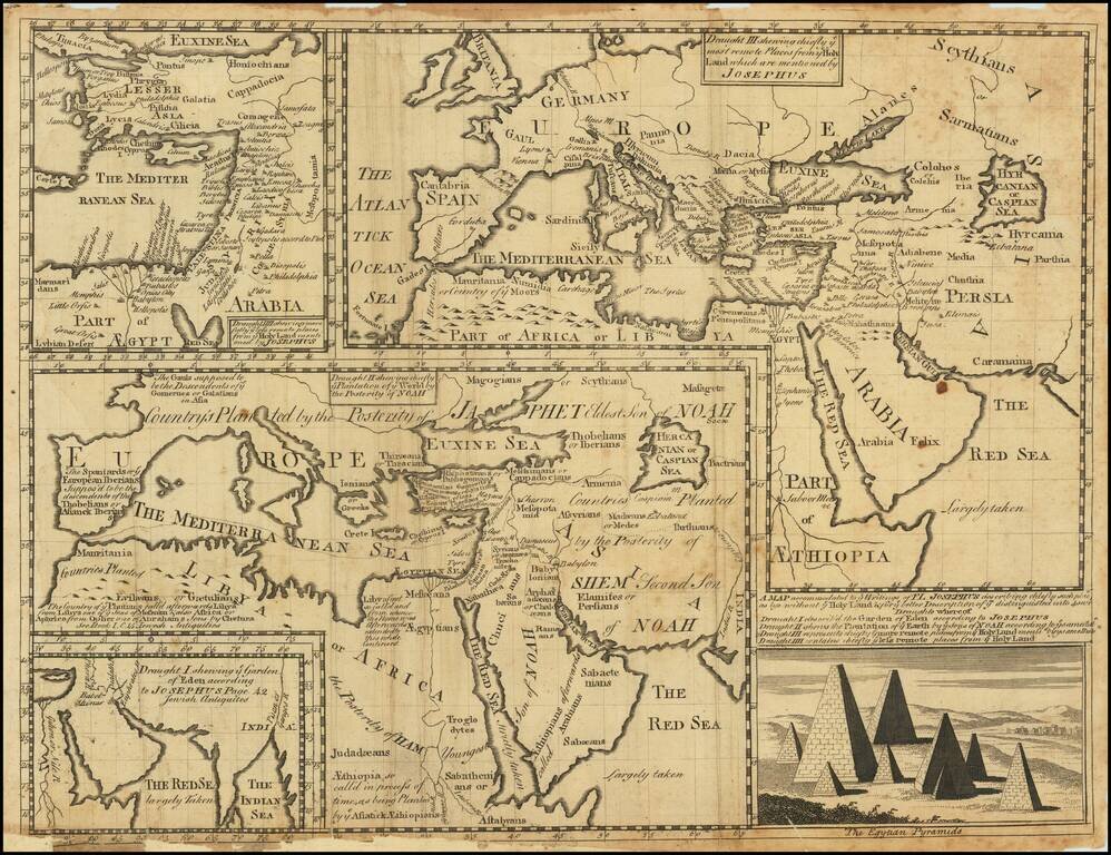
Engraved mapsheet, featuring four maps related to the writings of the Romano-Jewish historian Josephus. The map was issued in Oxford at the beginning of the 18th century. It includes the following sub-maps: Draught I shewing ye Garden of Eden...
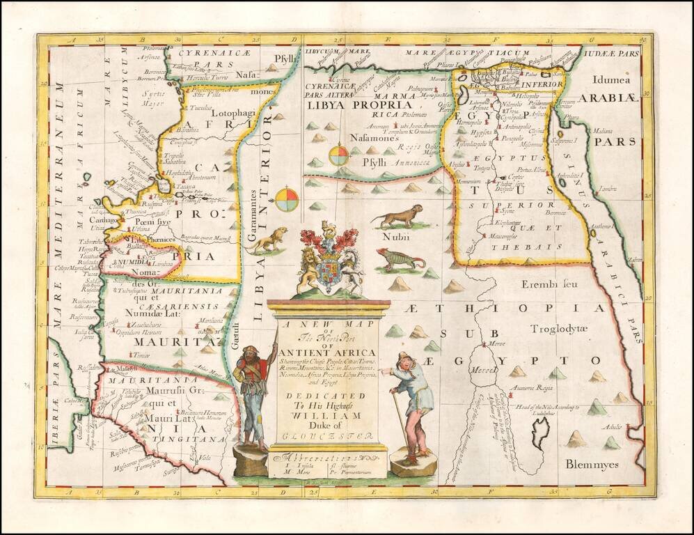
Decorative map of the north part of Ancient Africa. This decorative map was part of a set of 22 maps dedicated to William, Duke of Glouchester, who was then an 11 year old student at Oxford.