Edward Wells was a Church of England clergyman and advocate for education. He published prolifically, including several atlases of the ancient and contemporary world. Wells was the son of a vicar and entered Christ Church, Oxford in late 1686. He graduated BA in 1690, MA in 1693, and worked as a tutor at his college from 1691 to 1702. Then, he entered into a living at Cotesbach, Leicestershire, from where he continued to publish his many works. He attained the degrees of BD and DD in 1704, after he was already at Cotesbach.
From roughly 1698 onward, Wells wrote many sermons, books, and atlases. He focused on catechismal and pastoral works, as well as educational books. For example, some of his first works were mathematics texts for young gentlemen, which included how to use globes and determine latitude and longitude. He also translated classical and Christian texts, sometimes adding geographical annotations.
His descriptive geographies were not overly original works, but they were popular in their time. First, he produced a Treatise of Antient and Present Geography in 1701; it went on to four more editions. Next was a Historical Geography of the New Testament (1708), accompanied by a Historical Geography of the Old Testament (1711-12).

Prepared To Educate A Future King Decorative map of Europe at the beginning of the 18th Century. This map was part of an atlas dedicated to the Duke of Glocester, who was then attending school in Oxford.
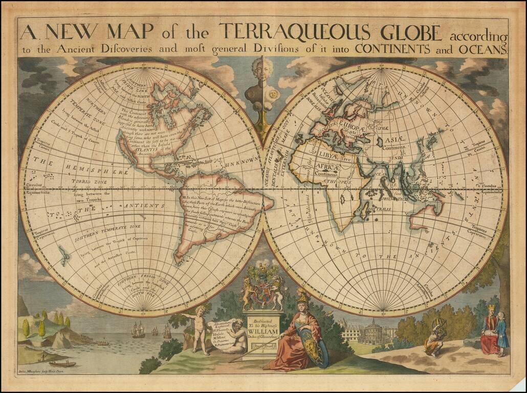
Decorative double hemisphere map of the World, dedicated to William, Duke of Glouchester. This map shows California as an Island, an incomplete New Holland attached to N. Guinea, partial New Zealand Coast line and no Southern Continent. Extensive...
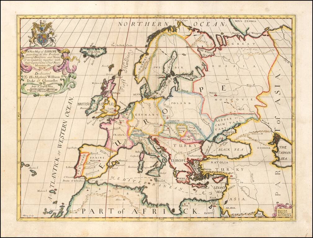
Decorative map of Europe at the beginning of the 18th Century. This map was part of an atlas dedicated to the Duke of Glocester, who was then attending school in Oxford.
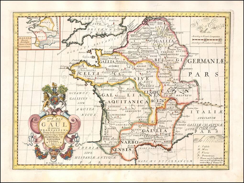
Decorative map of France, as divided by Augustus Ceasar. This decorative map was part of a set of 22 maps dedicated to William, Duke of Glouchester, who was then an 11 year old student at Oxford.
Decorative map of the region centered on Poland and Russia, extending from the Black Sea and the Gulf of Venice to the Baltic Sea. Two title cartouches and decorative coat of arms. This map was part of an atlas dedicated to the Duke of Glocester, who...
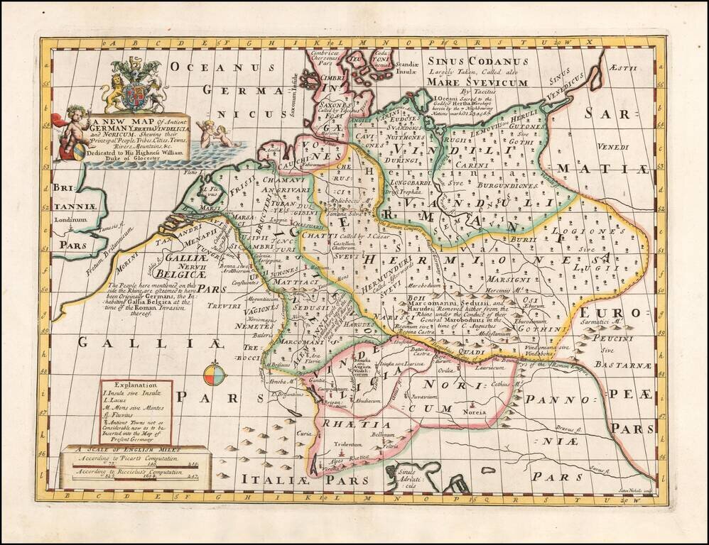
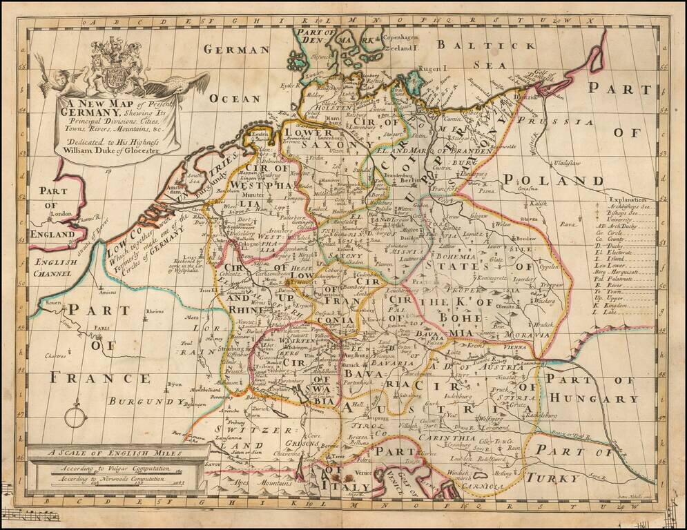
From An Atlas Designed To Educate A Future King of England Decorative map of Ancient Germany. Includes decorative title cartouche and decorative coat of arms. This map was part of an atlas dedicated to the Duke of Glocester, who was then attending...
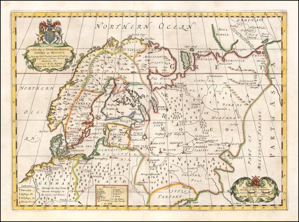
Decorative map of Scandinavia and Russia at the beginning of the 18th Century. This map was part of an atlas dedicated to the Duke of Glocester, who was then attending school in Oxford. English coat of arms and decorative cartouche.
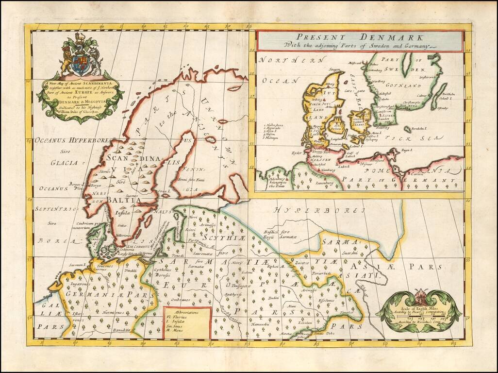
Decorative map of Scandinavia and Northern Europe, with an inset of Denmark and part of Norway and Sweden. Two decorative cartouches. Wells map is 1 of a set of 22 maps dedicated to William, Duke of Glouchester, who at the time of publication of the...
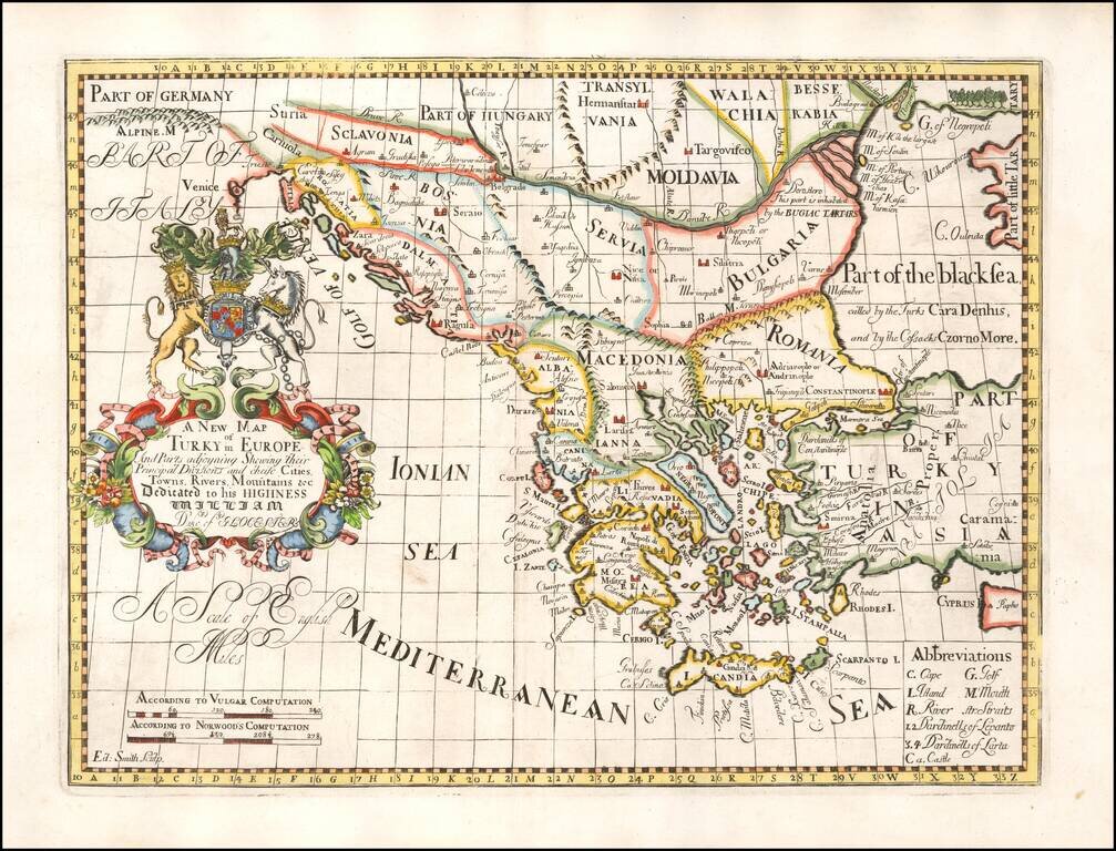
Decorative map of Turkey and the Balkans, colored by regions. This decorative map was part of a set of 22 maps dedicated to William, Duke of Glouchester, who was then an 11 year old student at Oxford.
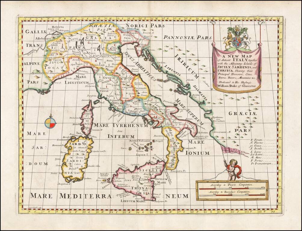
Decorative anicent map of Italy at the beginning of the 18th Century. This map was part of an atlas dedicated to the Duke of Glocester, who was then and 11 year old student attending school in Oxford.
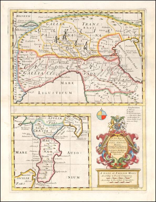
Decorative map of parts of France and Northern Italy and a second map of Southern Italy, with a decorative cartouche. From a special geographical text prepared for William, Duke of Glouchester, during his time at Oxford.
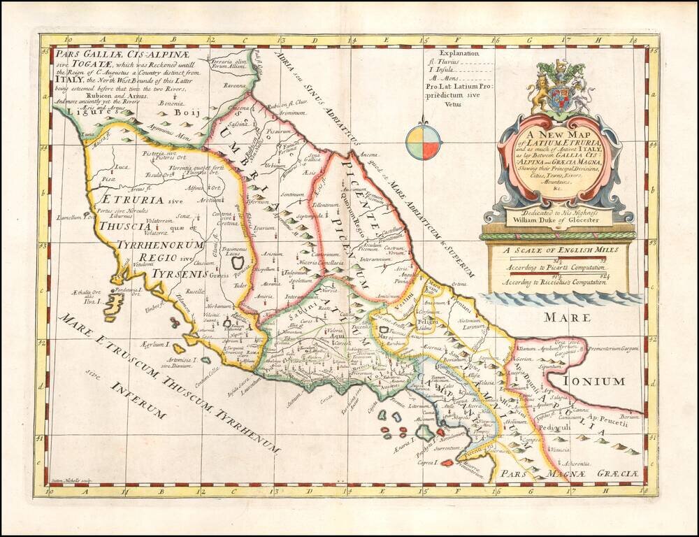
Decorative regional map of the Central and Southen Regions of Italy, as known in ancient times. This decorative map was part of a set of 22 maps dedicated to William, Duke of Glouchester, who was then an 11 year old student at Oxford.
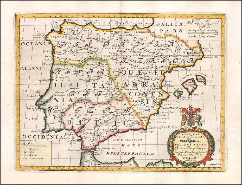
Decorative map of the Iberian Peninsula, colored by regions. This decorative map was part of a set of 22 maps dedicated to William, Duke of Glouchester, who was then an 11 year old student at Oxford.
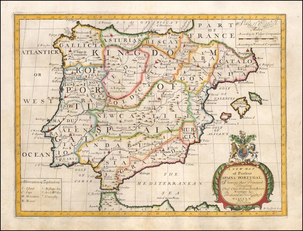
Decorative map of the Iberian Peninsula, colored by regions. This decorative map was part of a set of 22 maps dedicated to William, Duke of Glouchester, who was then an 11 year old student at Oxford.
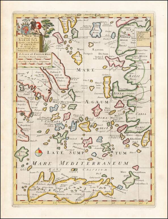
Decorative map of the Aegean Islands. This decorative map was part of a set of 22 maps dedicated to William, Duke of Glouchester, who was then an 11 year old student at Oxford.
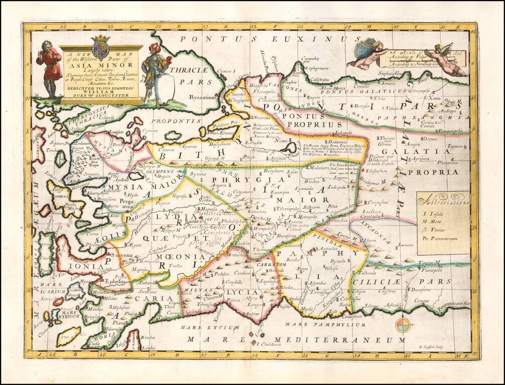
Striking map of Asia Minor and and neighboring Islands. This decorative map was part of a set of 22 maps dedicated to William, Duke of Glouchester, who was then an 11 year old student at Oxford.