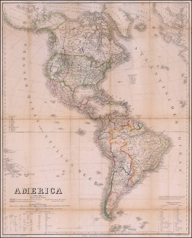
Rare Pocket Map of America, Celebrating World Conferences in Antwerp & Moscow Rare separately published map of America, published by the Weimar Geographische Institut, in conjunction with the International Geographical Conference in Antwerp of...
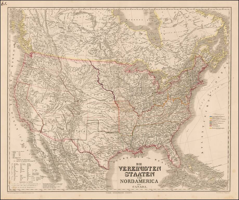
![[Mormon State of Desert] Die Vereinigten Staaten von Nord America nebst Canada . . . 1852](/map/small/69483.jpg)
A Rare Depiction of Deseret Detailed map of the United States, including the Mormon State of Deseret and an alternative name for Utah Territory, which is also shown newly divided from New Mexico Territory, to the south. Kiepert's map depicts "Alta...
![Die Vereinigten Staaten von Nord Amerika (Ostlicher Theil) [New York City Inset]](/map/small/62143.jpg)
Highly detailed map of the eastern part of the United States, with a large inset map of New York City.
Scarce map of the United States, published in Berlin by Heinrich Kiepert. Perhaps the most noteworthy features is the alternative name given for Great Salt Lake City, "New Jerusalem oder Mormonen" (New Jerusalem of the Mormons). The map shows...
![[Mormon State of Deseret] Nord America mit Westindien](/map/small/69513.jpg)
Detailed map of North America, published in Weimar in 1852. The map identifies the newly formed Territories of the western United States. Most notable is the location of the massive Utah oder Deseret Terr. (Utah or Deseret Territory). To the south,...
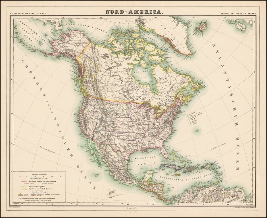
Detailed map of North America, with most of the Western Territories now named and in their proper configurations. The Northwest Passage is well illustrated. The region above British Columbia is Stekeen Colony, named for the Stikine River. Stikine...
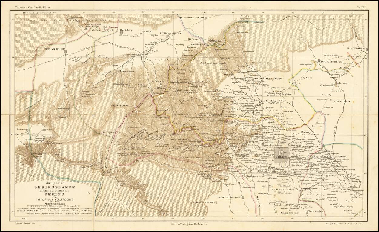
Fine map illustrating the area north and west of Beijing, as explored by Dr. O.F. von Mollendorff. Paul Georg von Mollendorff Paul Georg von Möllendorff (1847 – 1901) was a German linguist and diplomat. Möllendorff is mostly known for his service...
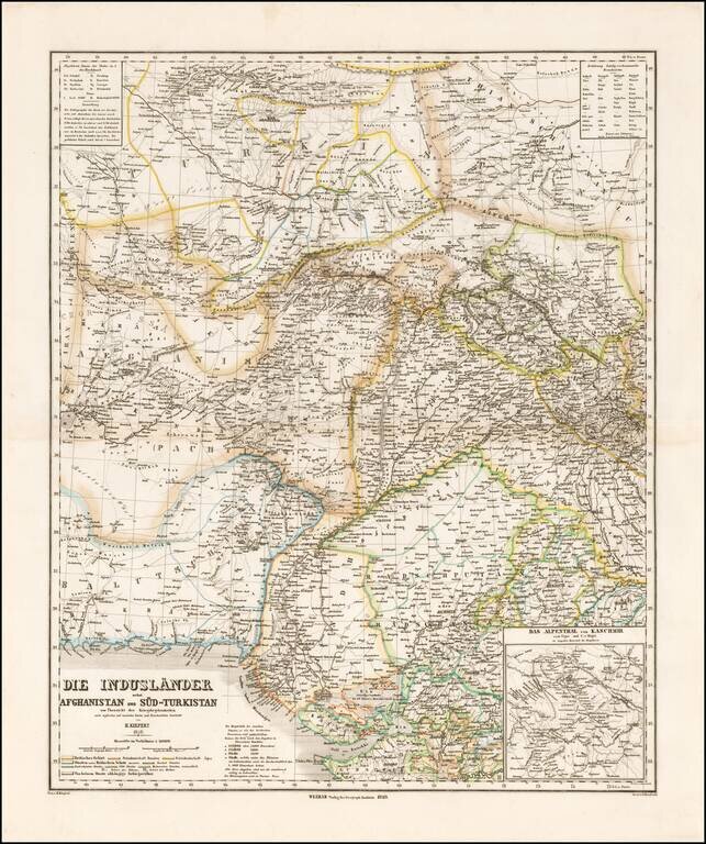
Striking map of Central Asia, published in Weimar by Heinrich Kiepert. The map extends from Afghanistan and Balutschistan in the west to Kaxgar, Jarkand, Delhi and Northwestern India. The map encompasses much of the modern day Pakistan, Afghanistan,...
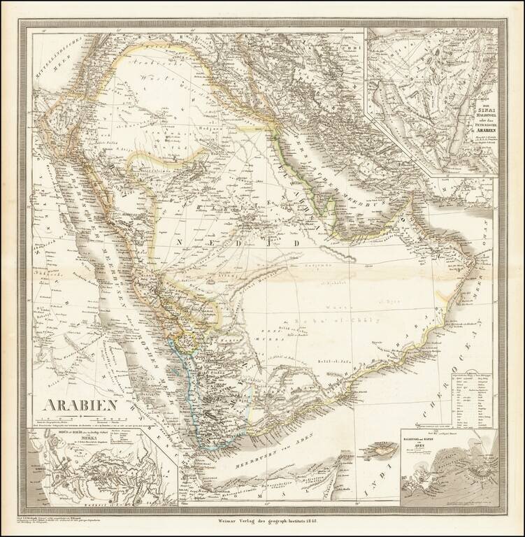
Striking, Detailed Map of the Arabian Peninsula Fine large map of the Arabian Peninsula and its environs, published by German mapmaker Heinrich Kiepert in Weimar. Keipert's map of Arabia is one of the most detailed and accurate maps of the period....
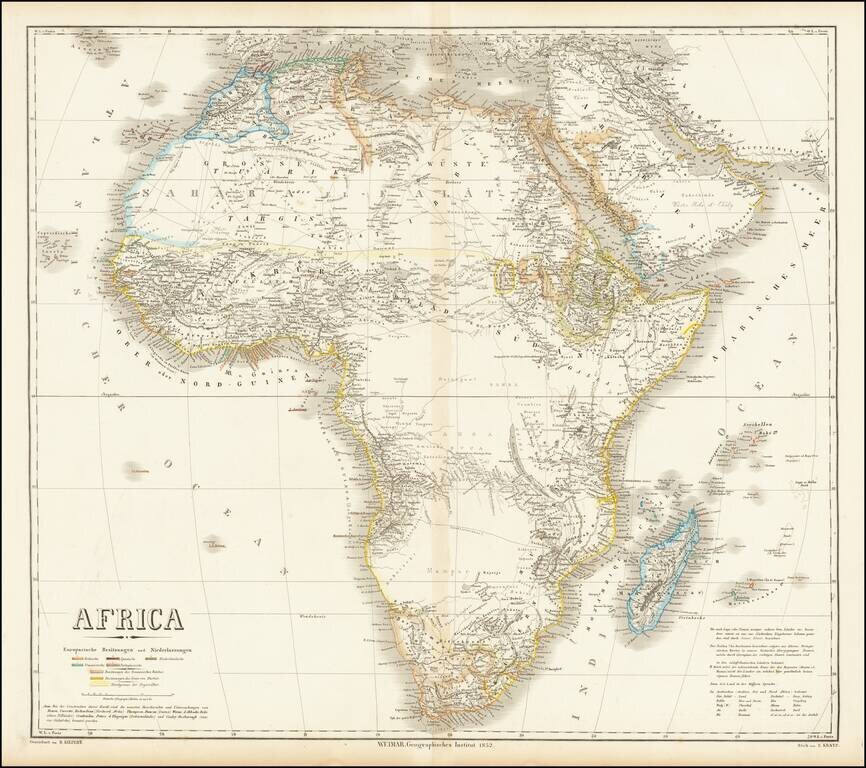
Fine large map of Africa, published by German mapmaker Heinrich Kiepert in Weimar. The map is colored to illustrate the various local and colonial powers (Britain, Spain, Netherlands, France and Portugal). The color coding also locate the...
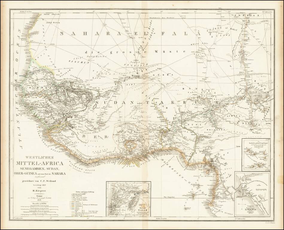
Fine large map of West Africa, published by German mapmaker Heinrich Kiepert in Weimar. Includes several insets, including an inset of the Free Colony of Liberia. Many early trade routes are located in the Sahara.
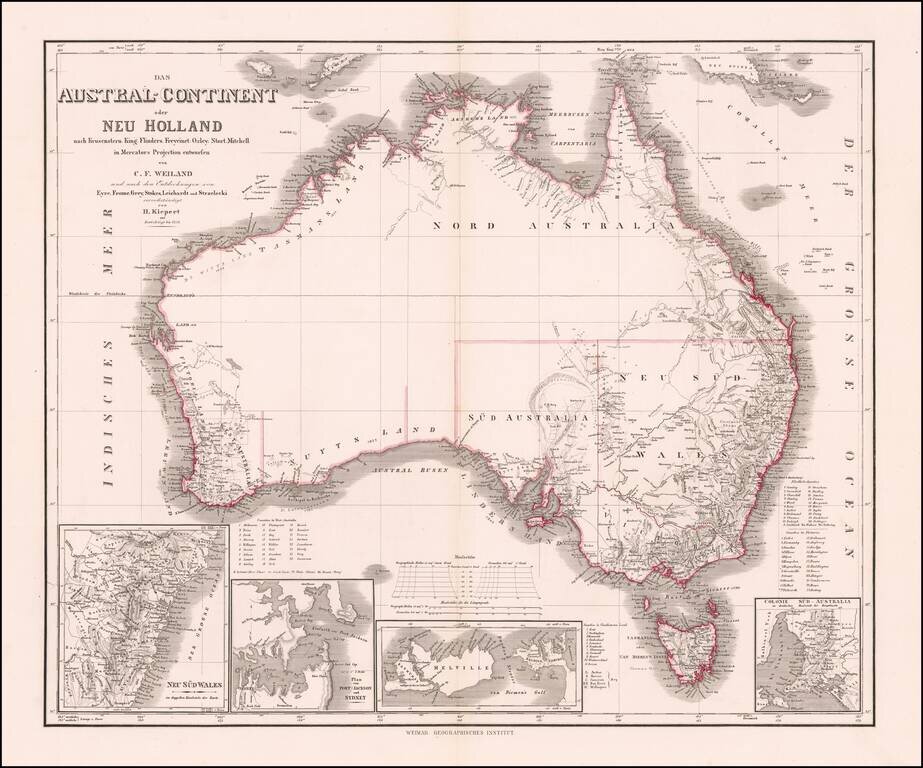
Nice example of Kiepert's fine early map of Australia, incorporating the recent explorations of Eyre, Frome, Grey, Stokes, Leichardt, und Strzeliecki.
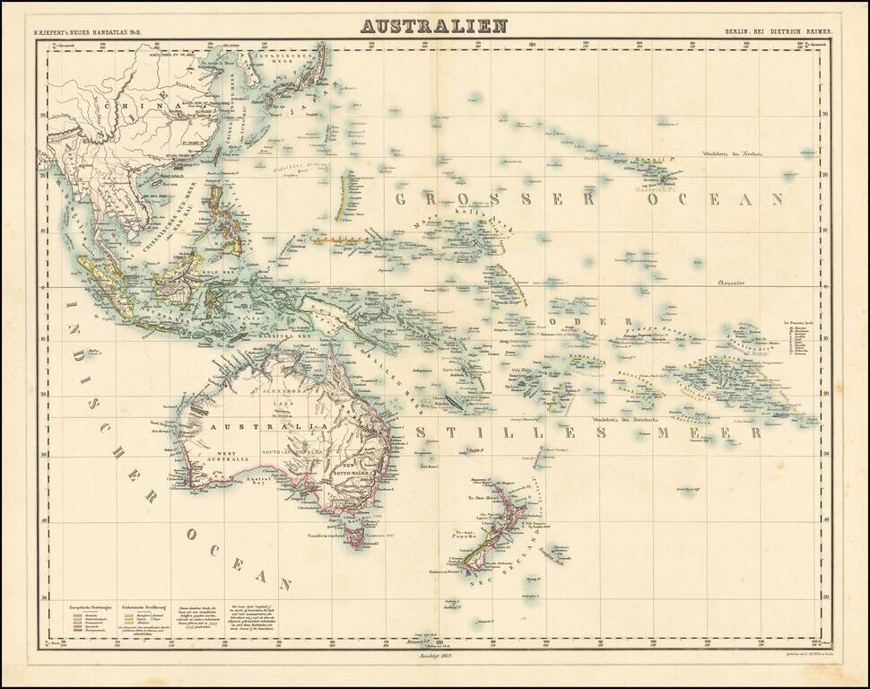
Nice example of Kiepert's fine early map of Australasia, published in 1869. The map extends from the Philippines and the China Sea to New Zealand, Hawaii, the Marquesas and the Society Islands.