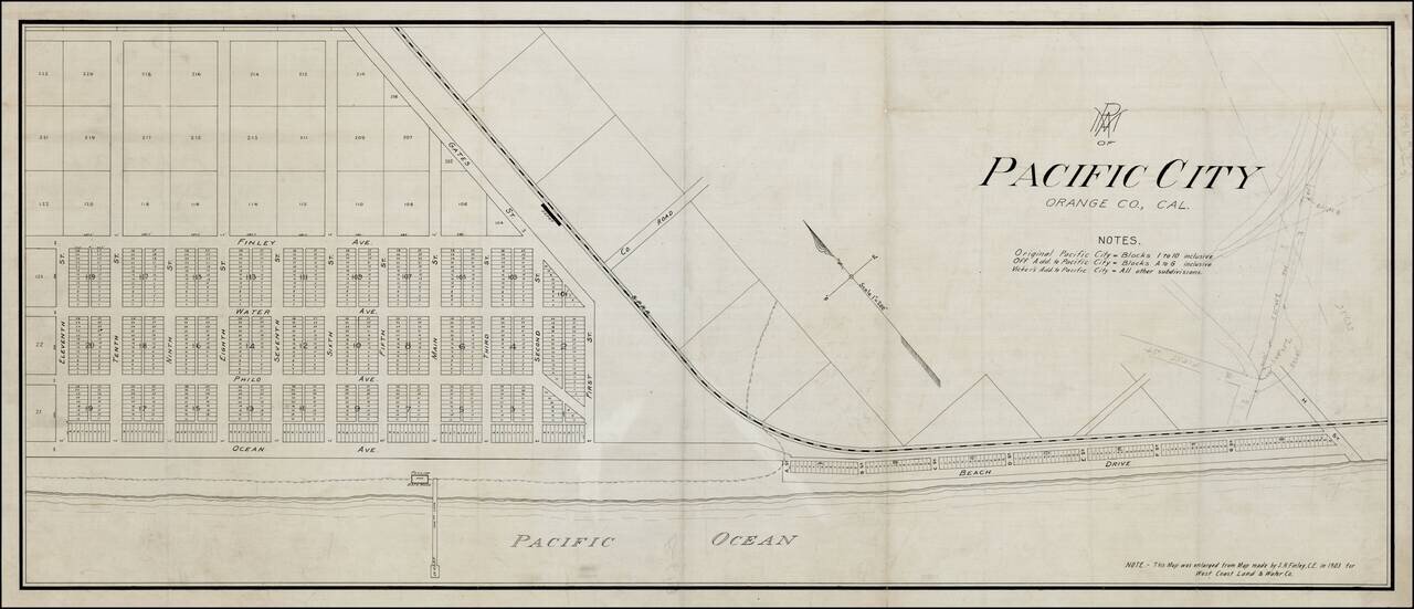
Rare Pacific Electric Railway working map of Pacific City, the first name used for the community which is now Huntington Beach, California, prior to its incorporation in 1909. The map is enlarged from the map made by S.H. Finley, Civil Engineer, in...
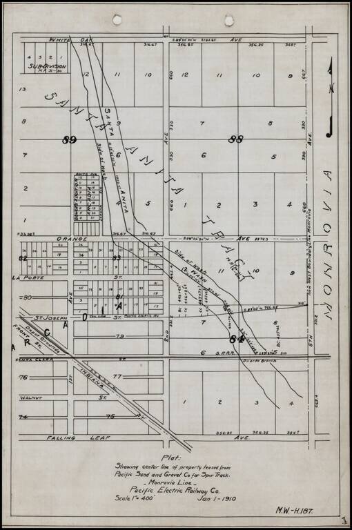
Detailed internal sketch map of the Pacific Electric Railway lines in Arcadia, California. Shows Depot Grounds of the ATS&F, Southern Pacific Railroad's Duarte Branch, a portion of the Santa Anita River and a street plan, centered on 2nd Avenue...
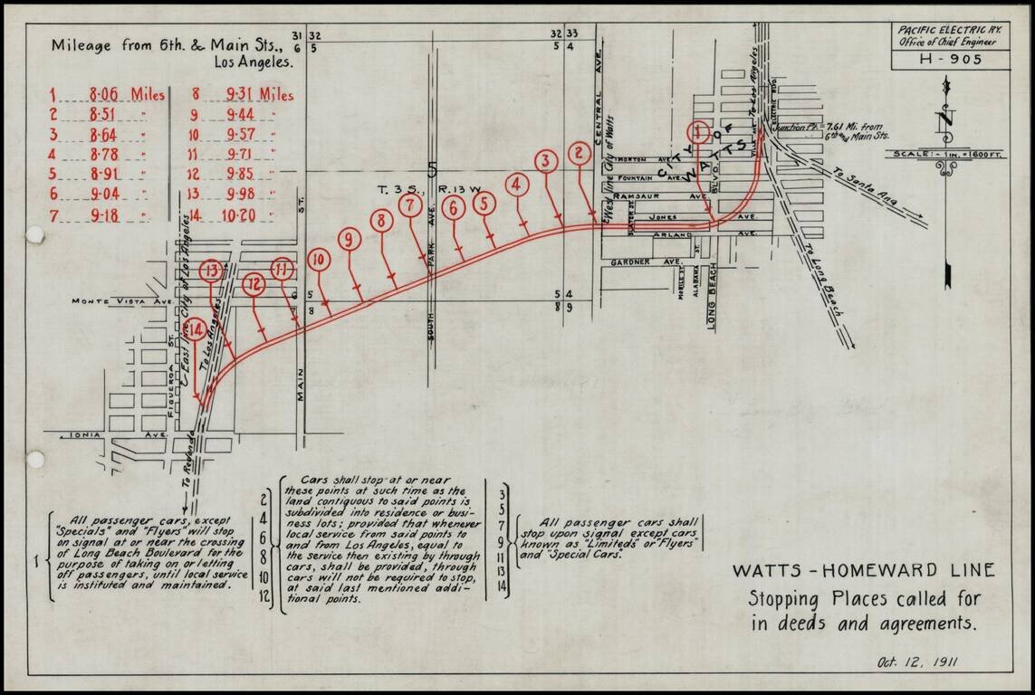
Detailed engineering map showing the various proposed stops on the Pacific Electric Railway line on the Watts-Homeward line, as prepared by the Pacific Electric Railway Company engineers. Includes a lengthy explanation of the various grant and deed...
![[Section of Newport Beach]](/map/small/33577df.jpg)
Detailed map of part of Newport Beach, showing the route of the Pacific Electric Railway from 11th Street to 16th Street, along Ocean Avenue and Central Avenue, showing the water lines on both the Newport Bay and Pacific Ocean sides of the peninsula,...
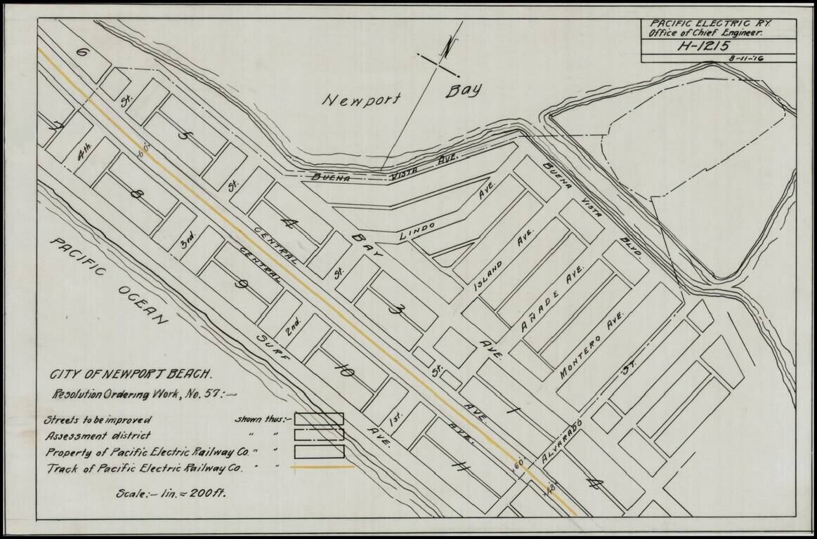
Detailed map of a portion of Newport Beach, bounded by Surf Avenue, Buena Vista Avenue, 4th Street and Alvarado Street. Shows the tracks of the Pacific Electric Railway and other details.