Andreas Cellarius was born in 1596 in Neuhausen and educated in Heidelberg. He emigrated to Holland in the early 17th century, and in 1637 moved to Hoorn, where he became the rector of the Latin School. Cellarius' best-known work is his Harmonia Macrocosmica, first issued in 1660 by Jan Jansson, as a supplement to Jansson's Atlas Novus. The work consists of a series of Celestial Charts begun by Cellarius in 1647 and intended as part of a two-volume treatise on cosmography, which was never issued.
Cellarius' charts are the most sought after of celestial charts, blending the striking imagery of the golden age of Dutch Cartography with contemporary scientific knowledge. The present examples come from the Valk & Schenk edition of Cellarius' atlas, which is unchanged from the 1661 edition. The 1660 and 1661 editions can be distinguished by the inclusion of a plate number in the lower right corner of the 1661 edition. The Valk & Schenk edition can be distinguished by the addition of the printer's name (Valk & Schenk) in the titles of the maps.
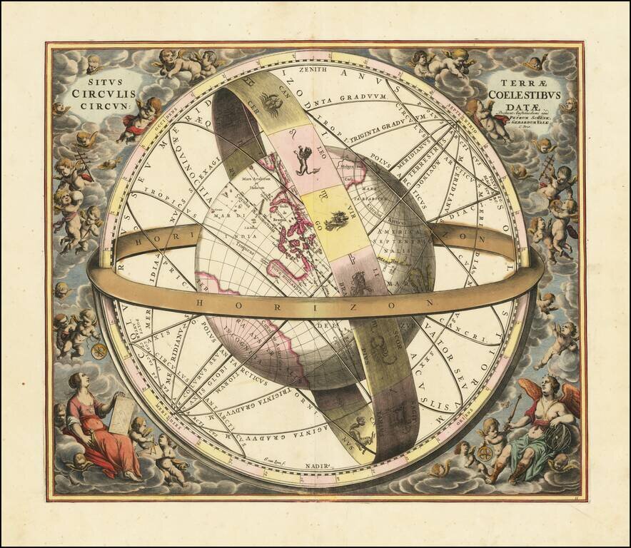
Striking original hand-color celestial chart, showing a Ptolemaic model of the Universe, with the earth in its relation to the plane of the ecliptic, from the 1708 Valk & Schenk edition of Andreas Cellarius' Harmonia Macrocosmica seu Atlas...
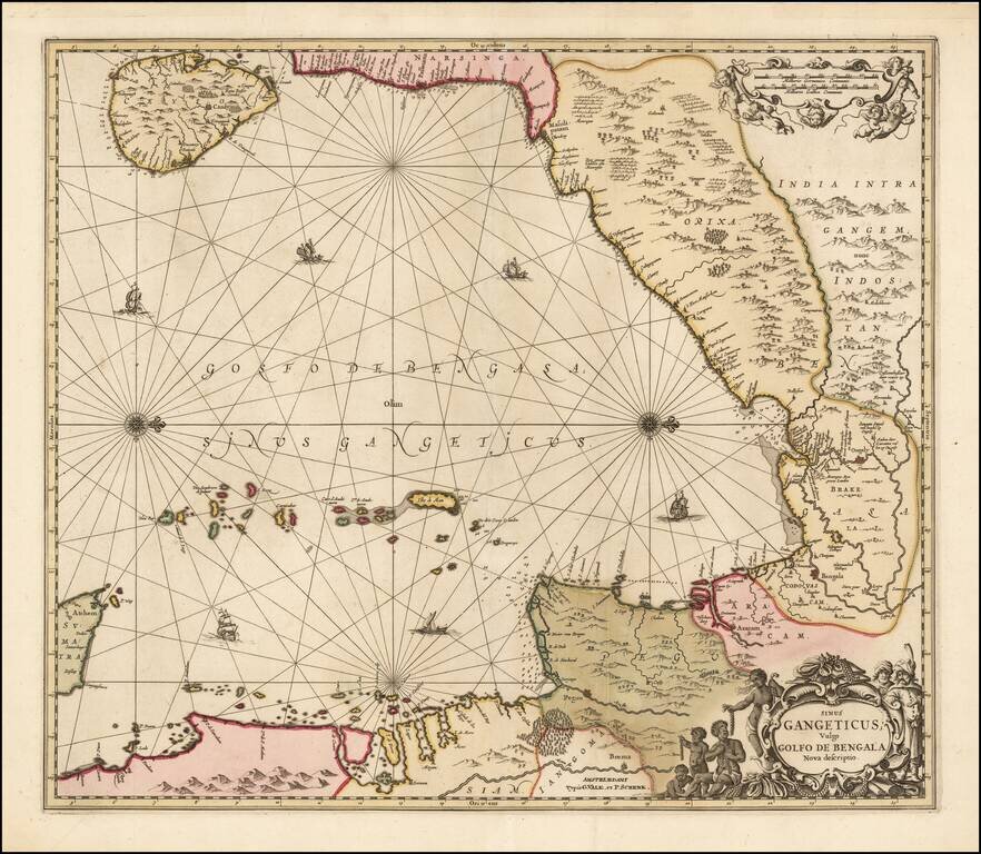
Valk and Schenk's edition of Jansson's engraved map of the Bay of Bengal from Ceylan (Sri Lanka) to Sumatra. This striking large format sea chart was originally published in a Jansson sea atlas. European and Oriental vessels are shown crossing the...
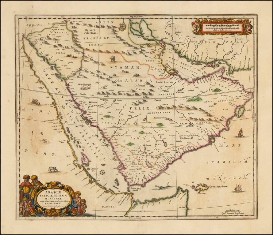
Striking large format map of Arabia and the Red Sea, published by Jansson. The map references the "Mare Elcatif or Sinus Persicus," showing both the Persian and Arab names for the Gulf between Persia and Saudi Arabia. This reflects both the name used...
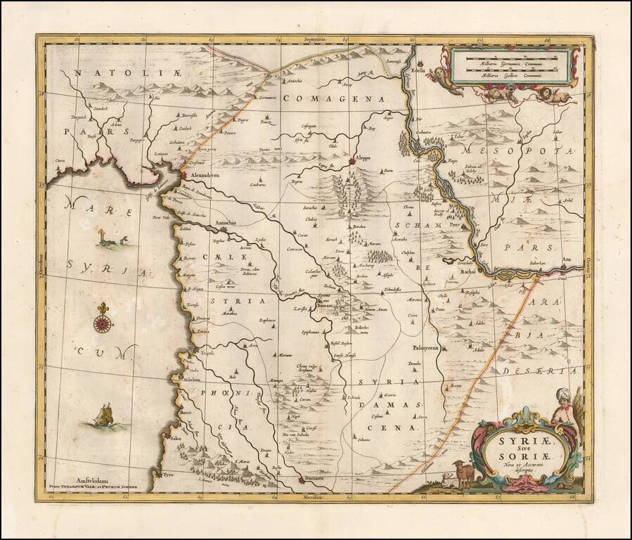
Detailed late 17th Century map of Syria published in Amsterdam. The map extends from Damascus and Sidon in the south, to Edessa, Alexandretta, and Antioch in the north as well as to Aleppo, Palmyrena, Damant, etc. The map also extends from the...