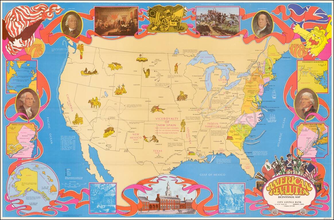
Fine large format map of the United States, featuring vignettes of historical events during the American Revolution and a 1970s style art motif. In addition to Revolutionary War related facts, the map shows information on the California Missions, the...
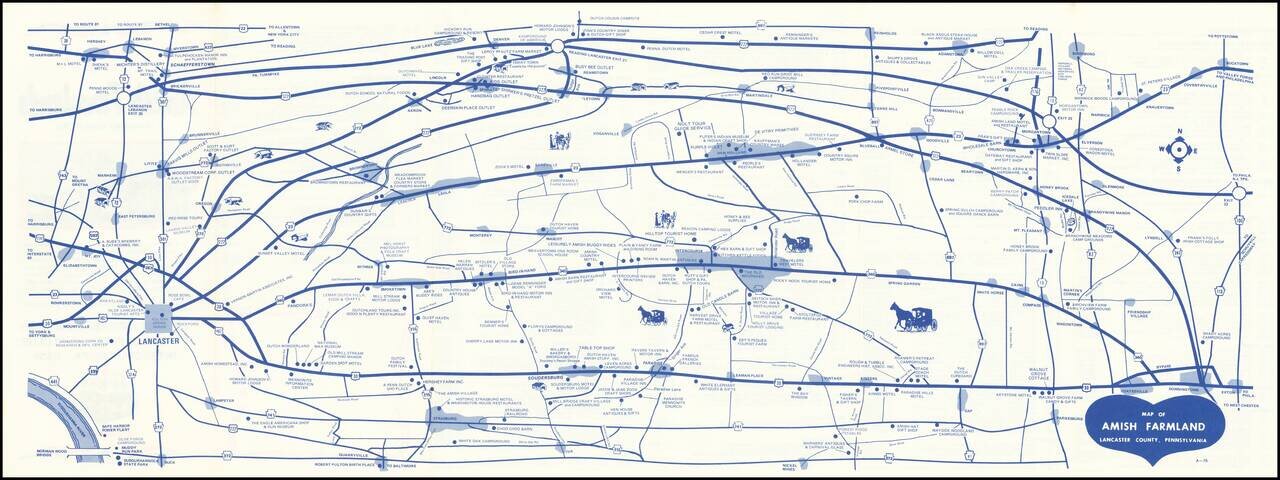
Early edition of this promotional map of the Amish Country. Interesting schematic style road map of the Amish Country, published to promote local businesses by the 340-23 Club. The verso notes that the Free Map of Amish Farmlands, Lancaster County,...
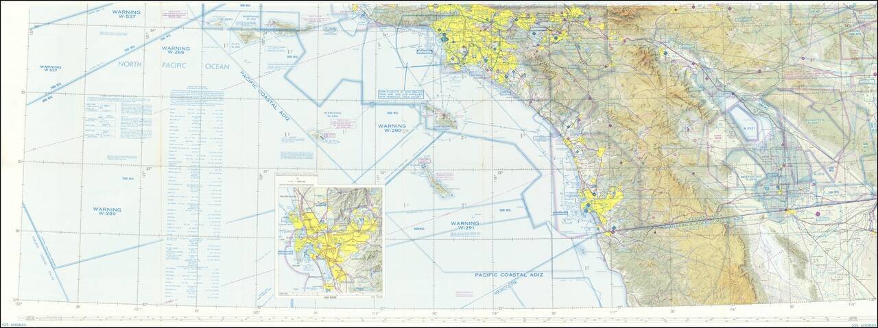
Detailed aeronautical map of Southern California covering the region from south of the Mexican border to the Central Valley. Most of Los Angeles and San Diego (with an inset of San Diego) can be seen on one side, with the other focusing on the region...
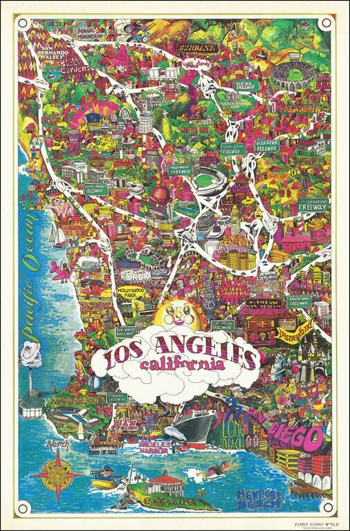
Bright and whimsical pictorial map of Los Angeles, published by Funny Funny World in 1976. The map emphasizes the famous tourist attractions of Southern California, including: Disneyland Queen Mary Marineland Ports of Call Knotts Berry Farm and...
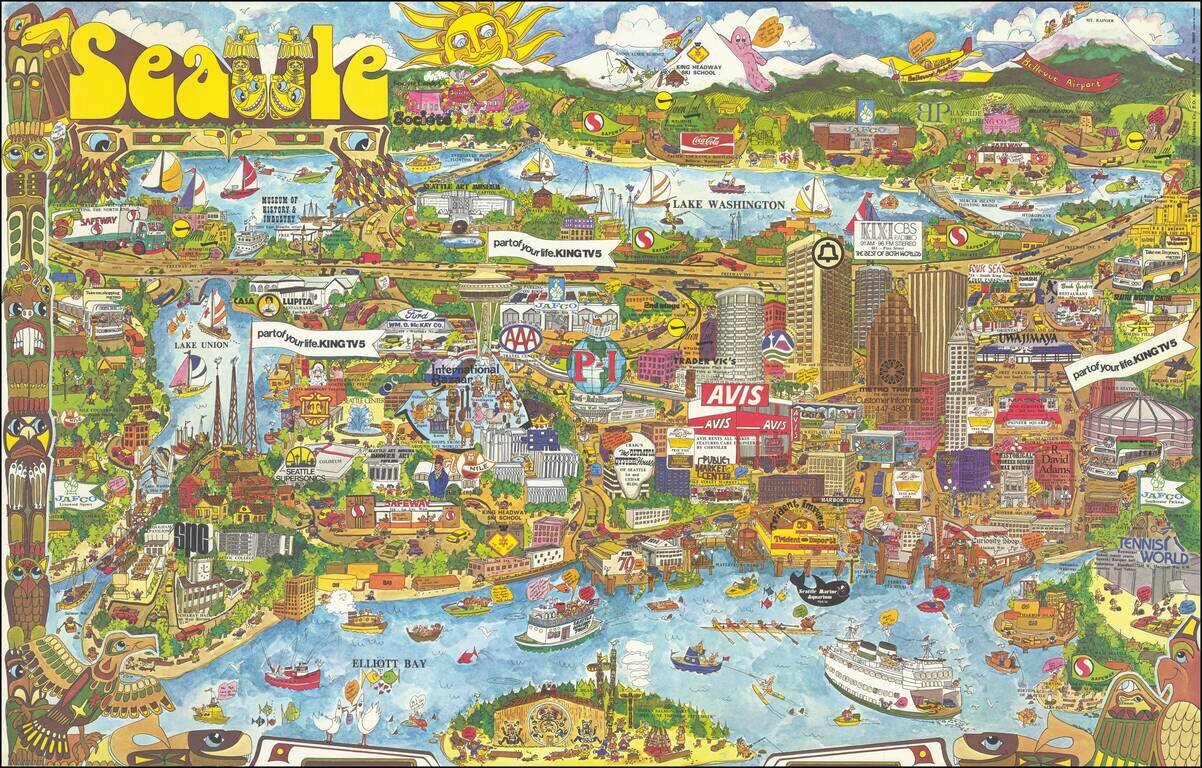
Decorative vintage pictorial map of Seattle, drawn by Roy Bishop and published by Bayside Publishing Company. The map is filled with promotional and advertising graphics, along with landmarks and whimsical images. We locate no other examples of this...
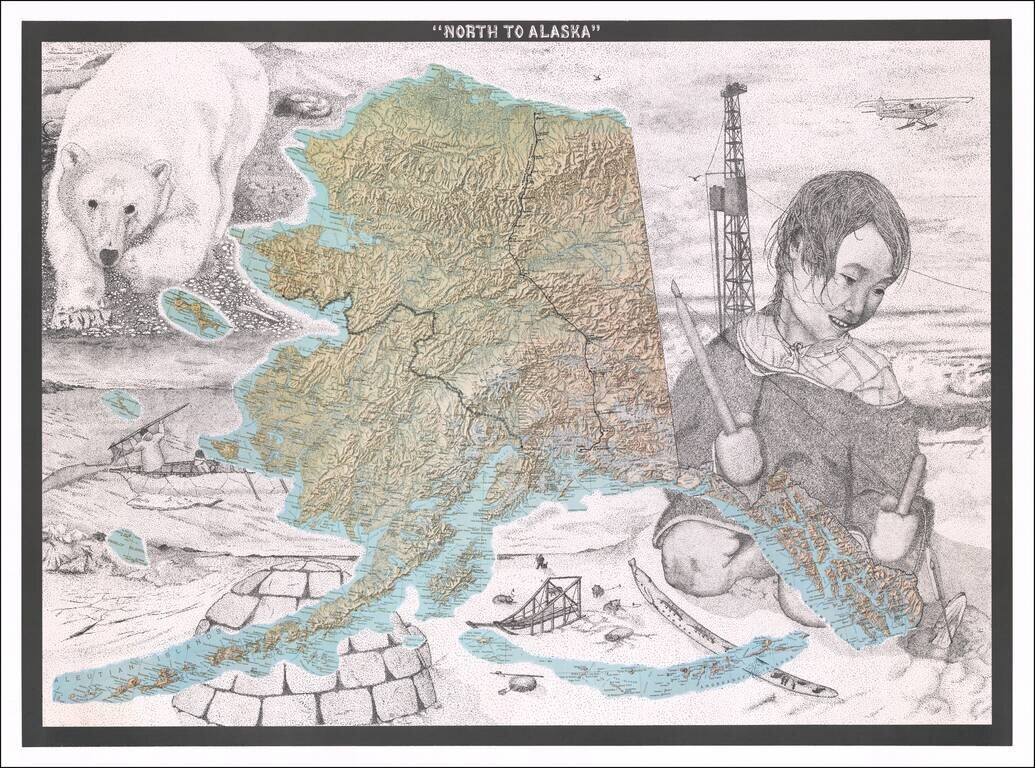
Fine Topographic Poster Map of Alaska with Images of Alaskan Life Detailed map poster depicting the topography of Alaska set amongst stippled drawings showing pictures of Alaska’s snowy landscape and life. This is the first time we have seen the...